| Difficulty | III-V |
| Length | 7 mi |
| Avg Gradient | n/a |
| Reach Info Last Updated | August 21, 2025 |
River Description
la haute rivière Gatineau! ... allons-y!
The Upper Gatineau River flows from the Mercier Dam outflow of Réservoir Baskatong to the Grand-Remous area where Transcanadienne Route 117E crosses the Gatineau River.
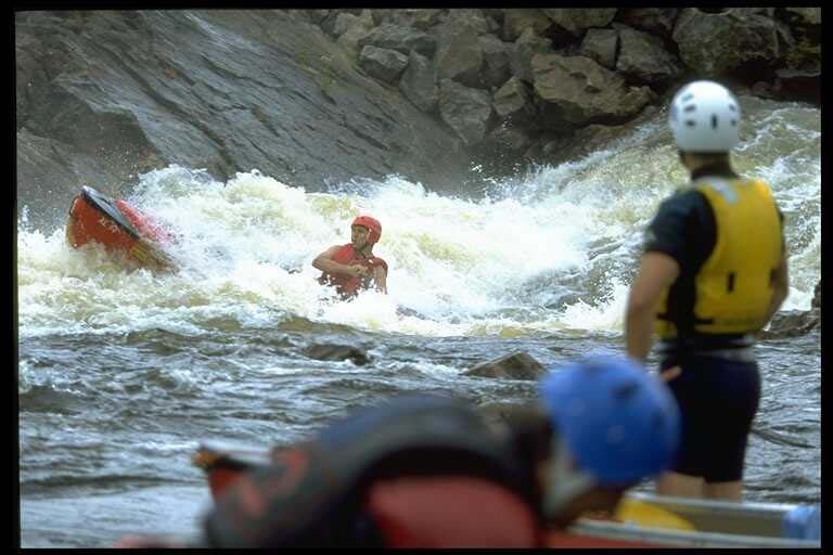
The Upper Gatineau was a well-kept secret and more isolated than the well-known lower section.
Slightly more difficult, however, there are portage trails around all the major rapids and drops.
The likely best place to meet is a restaurant at the take-out found at the intersection of Routes 117 and 105.
Do remember to ask permission to use take-out. (Please be courteus in Canada or we will deny your Tim Hortons order!)
There is an Annual Gatineau Festival, typically August late! Go here for a festival river map of this section.
Note: Mileage measurements and GPS locations of all the rapids are educated guesses. This section has not yet been mapped by a GPS.
Regional Map – Rivers of the Outaouais (Ottawa) Area
Des rivières de la région de outaouais Quebec Région administrative 7
_Map by Ministère du Développement durable, de l'Environnement et des Parcs
Technical info:
Local recommended paddling shops, etc. forthcoming.
Campgrounds:
~Camping at the lower section put-in:<br>Proprietor: Ms. Marguerite Lafrance,193 chemin Godin, Déléage; 819.449.3788. <br></br>Primitive camping along the put-in. No facilities except for outhouse. Restaurants, stores and more are nearby in Maniwaki. <br></br>River access: 3$ per person -Camping: 15$ per tent per night.<br></br>Reservations not necessa
River Features
Put In
Access PointDistance: 0 mi
Chute du Grand Remous (Grand Eddy Falls /or/ Great Funnel Falls)
Access PointDistance: 4.5 mi
