Payette, S. Fork
4 - Deer Creek Ramp to Banks(Staircase)
| Difficulty | IV |
| Length | 4.8 mi |
| Avg Gradient | n/a |
| Permit | No permit needed, but user fees are required at the put in and take out facilities. A season pass can be obtained at the Banks store and Cafe for $20. EDIT: A season parking pass for the payette river system must be purchased online, the pass is tied to the vehicle's license plate, so they can't be transfered between vehicles. Day pass still works the same; bring dollar bills to use this. |
| Gauge | South Fork Payette @ Banks |
| Flow Rate as of 1 hour | 1470 cfsmedium runnable |
| Reach Info Last Updated | June 18, 2026 |
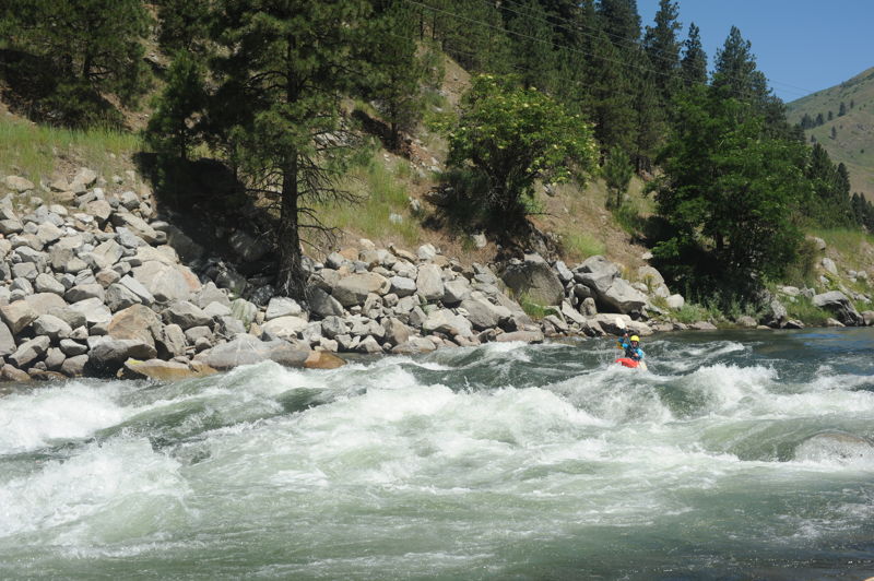
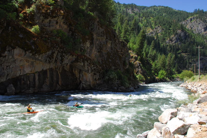
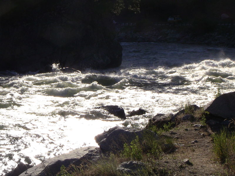
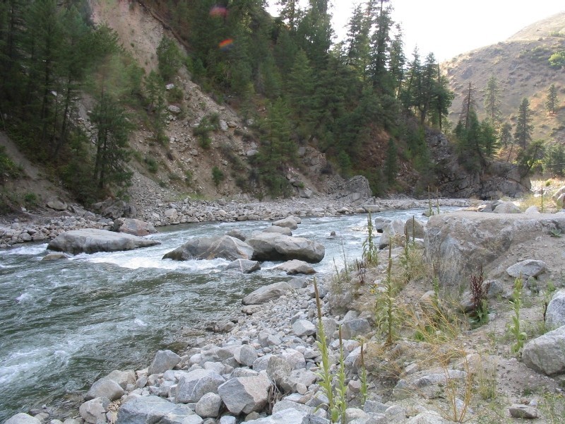
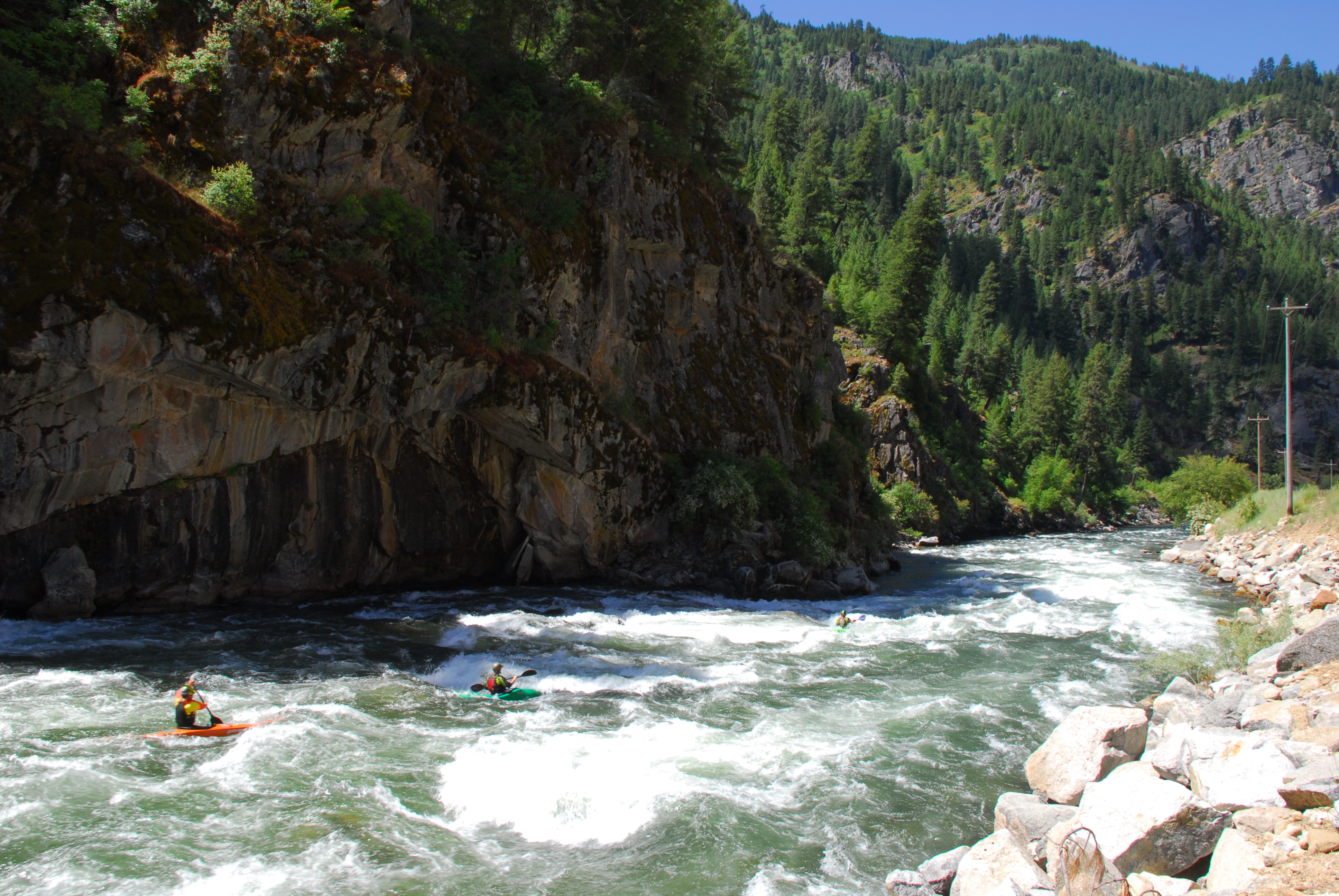
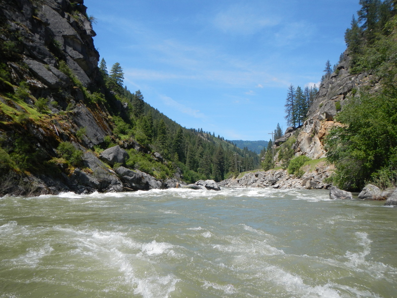
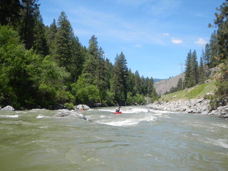
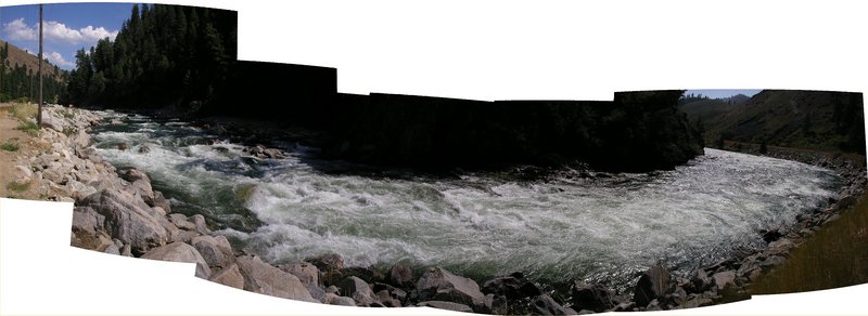
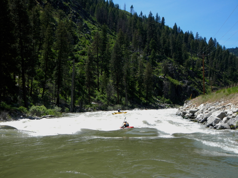
Character: There are several rapids along this stretch with Bronco Billy (Class III+, with a road pullout that is used for a nearby hot springs), Staircase (Class IV), and Slalom (Class IV-) being the standouts. Rapids are described in more detail below. The Banks-Lowman Road is next to the river through this canyon making it easy to scout the entire run.
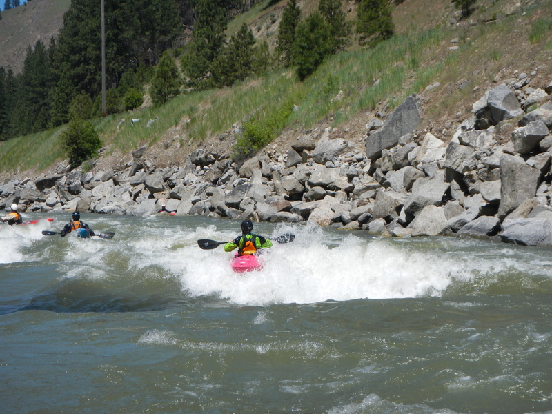
Staircase Run can have significant swings in character, at high flows this turns into a fast big-water river with giant waves and holes. Cleaning up a swimmer would be problematic in the 'mellowest' parts. At low flows, this run gets very 'creeky,' with lots of slipping between rocks and little ledge drops. Be ready to bounce off rocks if you flip over your kayak. Perfect flow for a paddler looking to break into Class IV for the first time would be about 1200 to 2000 cfs.
Another possible hazard to be aware of is jet skis and jet boats. Jet boating is increasingly popular at higher flows. Jet boat operators report that they can navigate the entire Staircase run above 5000 cfs, and at higher flows they can even get up past Little Falls on the Canyon run. Jet skis have also been up as far as Little Falls.
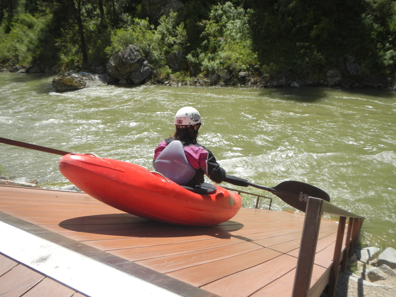
The typical access point is Deer Creek Ramp, at mile 4.5 on the Banks-Lowman Road. At most flows the Deer Creek ramp is a super fun seal launch. At low flows there are exposed rocks at the bottom that can break your boat, if you can see them, then likely the flow is too low to use the ramp. If the ramp needs to be bypassed, there are stairs that can be used to climb down to the water with some flatish rocks to launch from.
A few years back, a warning sign was posted by the Forest Service calling the rapid with the huge log in it 'Dogleg.' The sign is long gone, but the name remains. A large midstream boulder towards river left separates the river into a river left slot and a wide open line down the right. More often than not, there are logs jammed into the river left slot; forming strainers. So when in doubt, go right. This rapid is visible from the road when looking upriver.
At low flows (800ish), this turns into one of the most interesting features on the run. The river right channel turns into a series of little drops and sharp turns. Lots of shooting green tongues between rocks.
Bronco Billy is a long class III wave train that is run down the middle.
Excellent green wave at 2000-2500cfs, still decent at other levels. At flows that are too low for this feature to surf, there is an alternate large wave that forms just upstream between the large rock and river left channel.
More of a III- than a III, but still fun. You can start right of center and boat scout this one. At the bottom there is a large eddy on river left where paddlers like to stop and surf. At higher flows the waves get giant and fast.
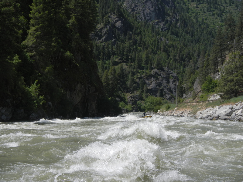
Staircase is a challenging rapid with a very long swim if things go wrong. There are multiple different lines that can be scouted from a large pull-out at mile 2.3 along the Banks-Lowman Road. From the top of the rapid to the run out is about 1/3 of a mile.
While bank scouting Staircase, take note of the large entrance rock left of center, which is called Whale rock. There is another round boulder right-of-center that forms an eddy in the middle of the rapid called the 'Duck Pond,' most kayakers try to catch this eddy on the way down. A good line can generally be found down the middle between Whale rock and the Duck-Pond-Boulder. Entering the rapid just to the left of the Duck-Pond-Boulder and going down the center will position you the best for both catching the Duck Pond and missing the upcoming holes. 50 yards below Duck Pond, is a sweeping bend to the river, called Carnage Corner, right before this bend is a big hit with holes and/or waves depending on the flow. Holes here are not super retentive, but if it can get sticky if you founder in sideways or upside down, so this is a common spot for boaters to swim. At low flows (800ish and down) Carnage Corner can form rocky ledges that are a good idea to scout from the bank. Below Carnage Corner the river flatens out for a ways, but the water is still fast and churny so it's still near impossible to clean up a swimmer. There is one last class fun wave-hit/drop at the bottom before the river mellows.
There are other lines to the left of Whale Rock that are common for kayakers to take. However, below Whale Rock's eddy there are some rocks that can be dangerous. They like to catch wood, many rafts have wrapped on a rock left-of-center, and there is also a sieve rock on river left that is known to have drowned a raft guide years ago.
This easy class II means Slalom is coming up next.
At higher flows this can turn into a fun drop with a big hit. At lower flows beware of rocks hiding in the froth at the bottom; left of center. At super high flows (5000ish and up) those rocks form the 'Turbo Wave.' Bring a fast boat to catch it.
Slalom is a long rapid with a couple holes to avoid. Start right but immediately begin working left as the biggest hole in the drop known as “See More” is near the start of the rapid on river right. Once you have passed the first big hole work back right to avoid a hole on the left. One final hole is near the bottom right. This rapid is more of a class IV- than a class IV, but it is a challenging rapid with unpleasant consequences if you end up in one of the holes. At lower flows these holes are pretty small, easy to punch if you have some rocker to your kayak.
Towards the end of the rapid on river left is a pair of large rocks known locally as the Dolly Parton's. These are fun to eddy out behind. At high flows, Dolly's go from eddy to dark death hole. Directly below Dolly's on full river left is a fun optional boof. Its a green water ledge with a hole at the bottom that isn't very retentive. Paddlers like to gather in the following the eddy to gather stragglers and watch their boofs. After this there is one more feature on this rapid then it is flat water all the way to the confuluence.
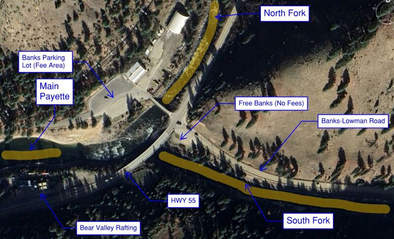
From Boise drive north on State Highway 55 about 32 miles to Banks which is at the confluence of the North and South Fork Payette (Highway 55 mile 78.8). Access is on river right. This is a sand bar with a large eddy. The main parking area has boat trailer access, toilets, and changing rooms. Banks can get very busy in the summer months, since it is also the put in for the Upper Main Payette.
Dec 11, 2025
Free Banks is not longer free, it is imprisoned behind metal highway guardrails and unable to provide the community with it's services.
Last year the Idaho DOT installed a stoplight in Banks and for some reason this project included the demise of Free Banks. one star :(
Jul 2, 2020
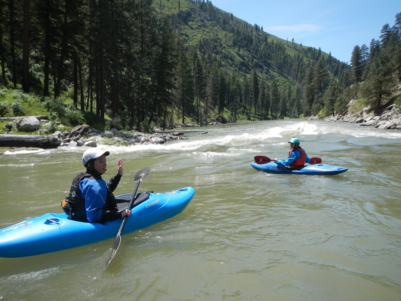
Omar Jepperson, James Girton, Leanna Girton, Web Peirce, Cyn Taylor, and Tom O'Keefe on a run down Staircase.