Potlatch
2. Little Boulder Campground to Cedar Creek
| Difficulty | IV-V |
| Length | 16 mi |
| Avg Gradient | n/a |
| Gauge | Potlatch River Bel Little Potlatch Cr Nr Spalding |
| Flow Rate as of 42 minutes | 11 cfsbelow recommended |
| Reach Info Last Updated | June 9, 2023 |
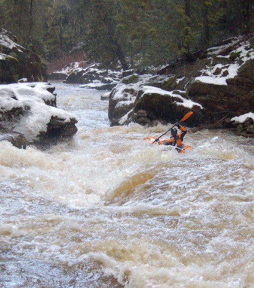
The Potlatch Canyon run is the most reliable and easily accessible creek to anyone living or traveling through the Moscow/Pullman area known as the Palouse. Its typical run-off season starts in late February/early March and can run through April. A combination of warm days and rain-on-snow can occasionally bump this creek up to runnable flows in December and January for a day or two (or more!). In the winter and early in the run-off season, expect very cold water, snow and ice on the banks, and keep an eye out for huge ice chunks built up on mid-stream rocks. Ice dams can block the entire river in some places during the winter.
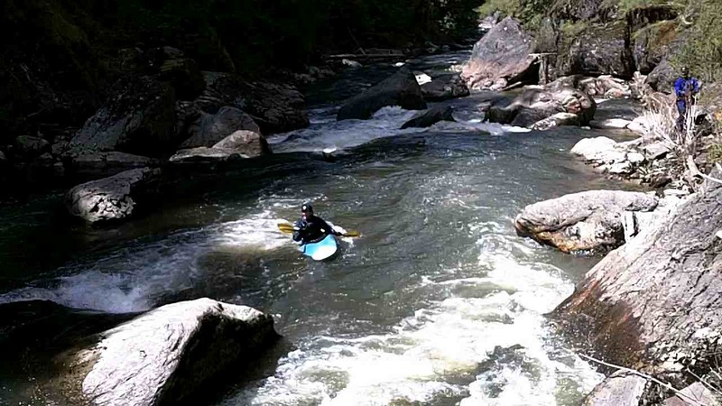
From the put-in, the river drops away from the access road and into a basalt canyon. You'll have a couple miles to warm up in fast-moving class 2 and 3. In this warm-up stretch, there is one short but quality rapid that comes after a sharp left turn in the river. There are small eddys on either side above the drop. Two offset boulders create three routes: the left and right are a bit rocky but fairly straightforward. The center route is a diagonal slot between the boulders. Boaters who experience trouble with this rapid would be best off hiking out at this point, on river left. The road that passes the put-in is a short hike straight uphill. Turn left at the road and head back to the put-in car.
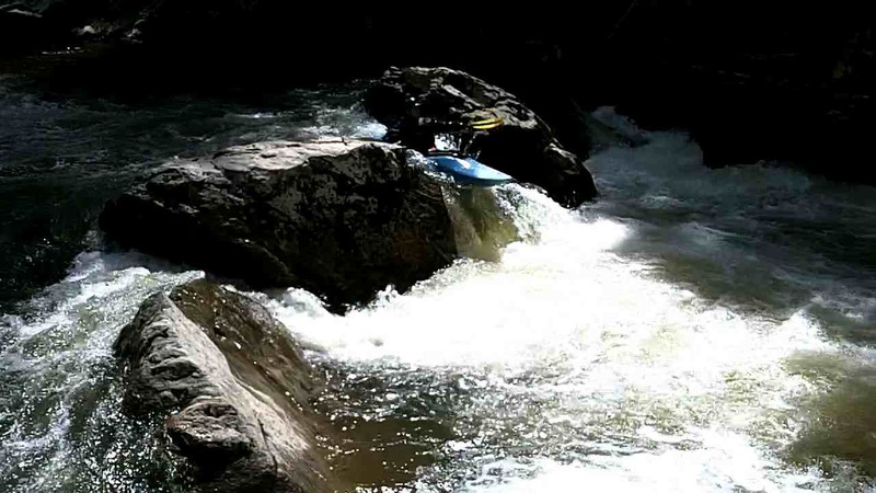
After another mile or so, the gradient picks up and you may feel yourself pushed along a bit quicker. You'll also notice that the rock structure is primarily granite now. Keep your eyes open for a large tributary spilling in on river right. The first and most critical rapid of the canyon is around the next bend to the right: Coleman Falls. It's not a waterfall in the traditional sense. There are eddys above the horizon on river right for scouting and portaging. The rapid consists of two parts. At the top, you'll punch through a small hole, and then have three options, right, center and left. Center is a small 4' pour-over, and is probab
...May 20, 2018
The upper and lower recommended flows of 1000-8000 (cfs) listed as the range for this section are misleading, and maybe even dangerously so. In fact, my preference is for flows under 1,000 cfs.
Here are a few of the levels we have run this section:
(gage at put-in, cfs at Spaulding): (2.4, 325), (2.9, 350); (3.1, 370); (3.15, 500), (3.3, 470), (3.3, 640), (3.55, 750); (3.7, 800); (3.725, 944); (3.8, 700); (3.8, 1200); (4.0, 1750).
Some may prefer higher levels than these, but even the lower levels in this range are delightful, though tight and ledgy in (many) spots. When it gets below about 2.8 expect a lot of bumper boating at the beginning and the end and where the riverbed is wide.
Apr 14, 2016
Riverwide logs in Coleman Falls, 10 April 2016. 3.32 ft, 470 cfs.
Apr 13, 2016
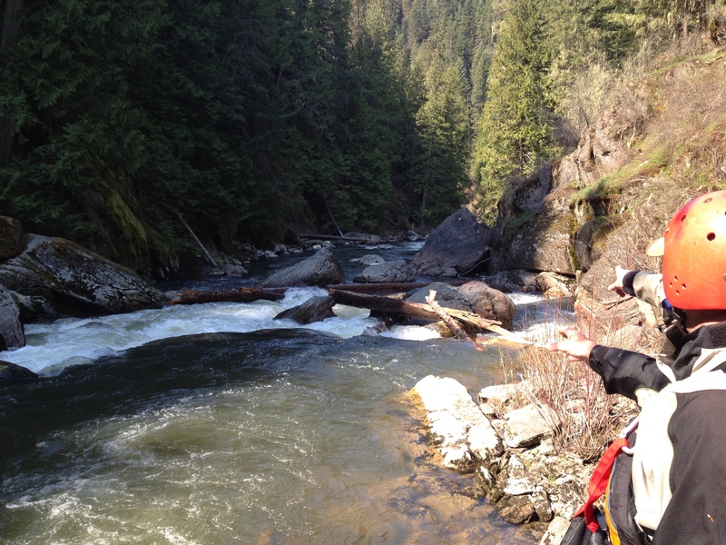
Big logs in Coleman falls main drop, river-wide. River left is blocked completely, and the river-right sneak is much dicier due to a log just below the drop.
May 11, 2014
370 cfs (USGS) and 3'1'' in the put-in gage
May 11, 2014
370 cfs (USGS), 3'1'' (put-in gage)
May 11, 2014
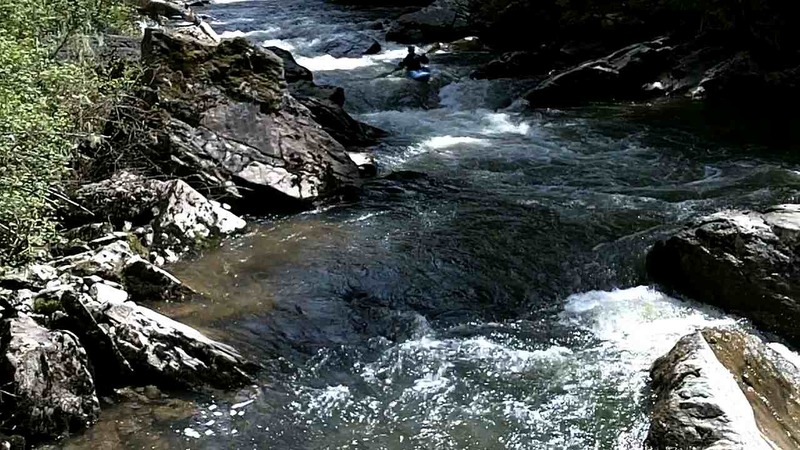
The Potlatch Canyon at 370 cfs on the USGS gage and 3'1'' on the Boulder gage is a great level. The drops are distinct, lots of eddies, lots of recovery time (relative to high water), and it is not too boney. The AW currently says that below 1000 cfs is too low, but this is not the case at all.
May 10, 2014
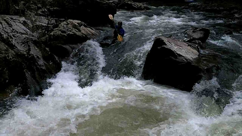
370 cfs (USGS) and 3'1'' at the put-in gage. This fun drop is usually log-infested, but was clean May 2014.
May 10, 2014
370 cfs (USGS), 3'1'' (put-in gage)
May 10, 2014
370 cfs (USGS), 3'1'' (put-in gage). Looking down toward Lower Coleman
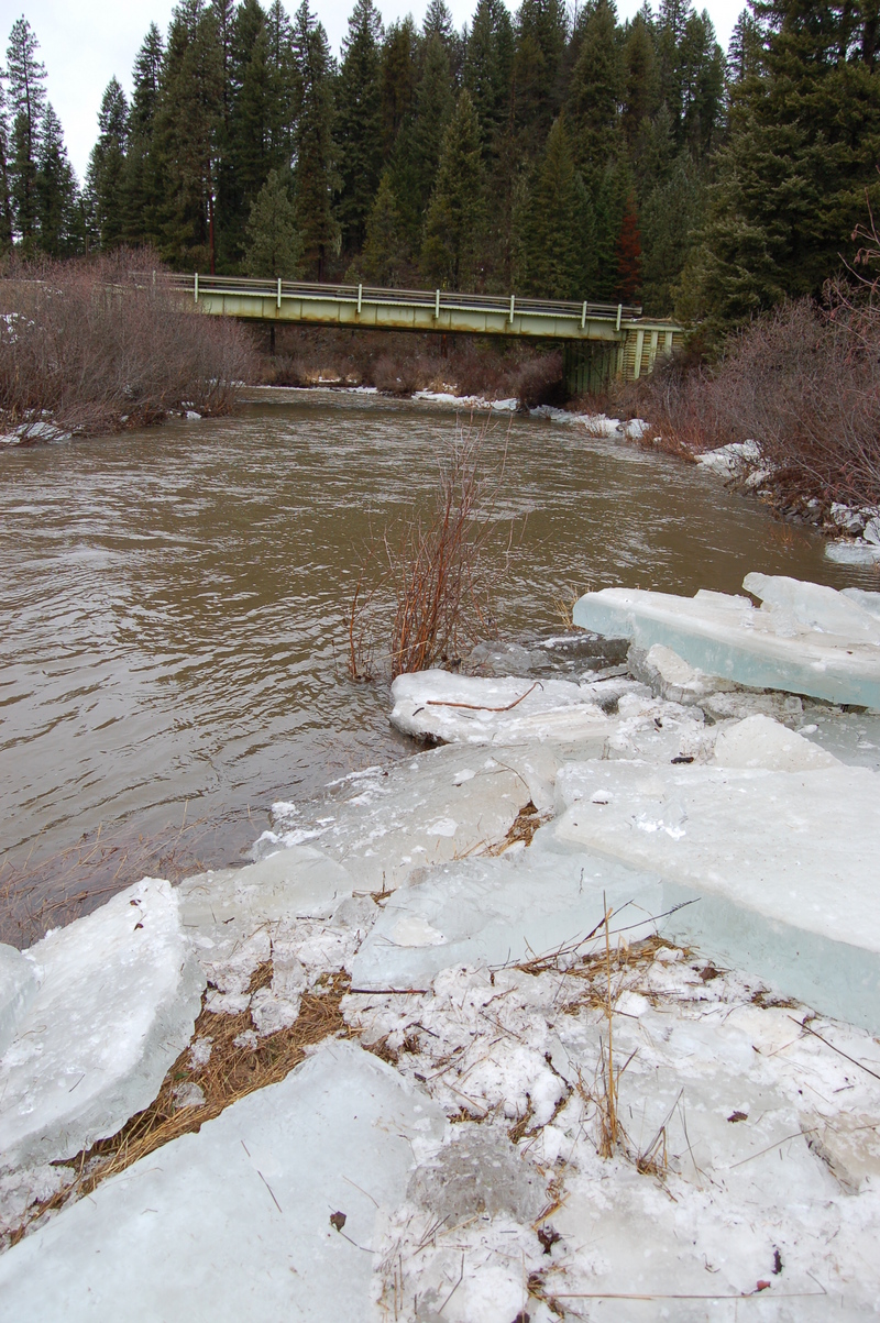
Dec 29, 2005
These huge ice sheets littered the banks, made rapid features, redirected the river channel, and even dammed the whole river at one point. The ice was about 1 foot thick!