Salmon
4 - E. Fork of Salmon to Town of North Fork

| Difficulty | II |
| Length | 110 mi |
| Avg Gradient | n/a |
| Gauge | Salmon River at Salmon Id |
| Flow Rate as of 1 hour | 1410 cfsrunnable |
| Reach Info Last Updated | June 18, 2026 |
In his book America's Great River Journeys, Tim Palmer describes the reach from below Sunbeam Dam to Corn Creek as 'a medley of mostly class II and some class III whitewater with captivating views, cottonwood forests, and roads that share the valley and canyon corridors bud intrude little on the overall atmosphere.'
Jul 6, 2022
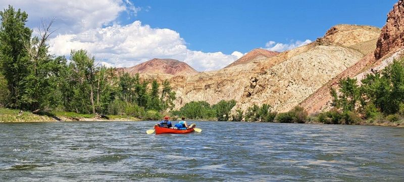
A group of seven floated this section in late June/ early July of 2022. There were two tandem canoes, two single kayaks, and one ducky. We stayed on the river for five nights, covering about 20 miles per day. We had the option of camping at the BLM campgrounds but opted to find our own campsites away from the road. It was nice having the ability to stop at the boat launches and use the facilities. There are a few caution areas for open boats; there is about a mile-long section of class II rapids on day one that will swamp an overloaded canoe. The more difficult part of this section is that there is a diversion dam about half way through the run. You could face some real difficulty if you take the diversion, Stay Left. On day three, somewhere between Buck Lake Creek and Twelvemile Creek we hit a class III rapid that was not on any map we had studied. The river takes a left turn and all the water is pushed up into huge waves on river right. We figured there would be a 'chicken run' to river left but a hole awaits those who try to stay left, once an open boat hits the hole, it fills up and pushes you into the wave train on the right. There is very little recovery on river right once you start swimming. Overall, this is a great float with wildlife and million dollar views around every corner. The one drawback is the ever present route 93 right next to the river.
Jun 7, 2020
Ran this over the first June weekend in 2020. East fork to Shoup Bridge was 80 miles. Probably another ~20 to North Fork making this run more like 100 miles not, 70 as noted above. Fun splashy water at 3000 CFS on the blw Yankee fork gage and we covered 35 miles a day pretty leisurely. A few easy class III at this level with one big watch out a few miles below Elk bend where the river is choked with house size boulders and a series of logs 1/2 way across river.