Salmon, E. Fork of S. Fork
2 - Johnson Creek to S.F.Salmon River(Lower EFSF)
| Difficulty | III-V |
| Length | 15 mi |
| Avg Gradient | 75 fpm |
| Gauge | Johnson Creek at Yellow Pine Id |
| Flow Rate as of 1 hour | 161 cfsbelow recommended |
| Reach Info Last Updated | March 8, 2021 |
This run is more difficult at the top and gradually gets easier, making it suitable for a variety of skills and water levels. It starts out class V (IV at low levels) and ends as class III (II+ at low levels).
Approximately 3 miles downstream of the confluence of Johnson Creek with the East Fork South Fork Salmon, the action begins with two long class V rapids called Flight Simulator. The first is near the road (visible 3.2 miles downstream from Yellow Pine or 0.6 mile upstream from the Sheep Creek Trailhead) and starts out easy and gets harder. The second is far down in the canyon and is hard to see from the road. In fact it is just plain hard. The standard class IV put-in is just above Caton Creek at Sheep Creek Trailhead. The road is nearby for the rest of the run and roadside scouting is easy. The river is active and some of the drops can be IV+ with enough water in them. Four miles below Caton Creek, after six miles of class IV, Deadman Campground makes a good take-out, put-in, lunch spot. The next five miles to the take-out are gradually easier class III, but you may chose to portage once or twice. You can continue down the South Fork Salmon to the end of the road for another four miles of class II if you like.
Logistics: Set your navigation to Yellow Pine and determine what option is best to get there. You can come down Johnson Creek and approach the run from the upstream end. More commonly paddlers will come in on the Warm Lake Road and South Fork Salmon Road from Cascade (50 miles of paved roads) or the Lick Creek Road from McCall (35 mile dirt road) to approach the run from the downstream end. This option allows you to scout the entire run by driving the shuttle road on river right that offers a multitude of access points and easy road scouting.
To get to the take-out: From the South Fork Salmon Road (paved) go up the gravel road toward Yellow Pine less than a half mile, cross the bridge and park.
Intermediate put-ins: Deadman, C
...
Grant Amaral describes how this rapid got its name when scouting one morning with Tony Brennan as they kept looking to the sky for the jet plane they were hearing. They soon realized the sound was coming from the river. This rapid has a challenging line and some big holes that even skilled paddlers have trouble avoiding. Proceed with caution and bring a strong crew.
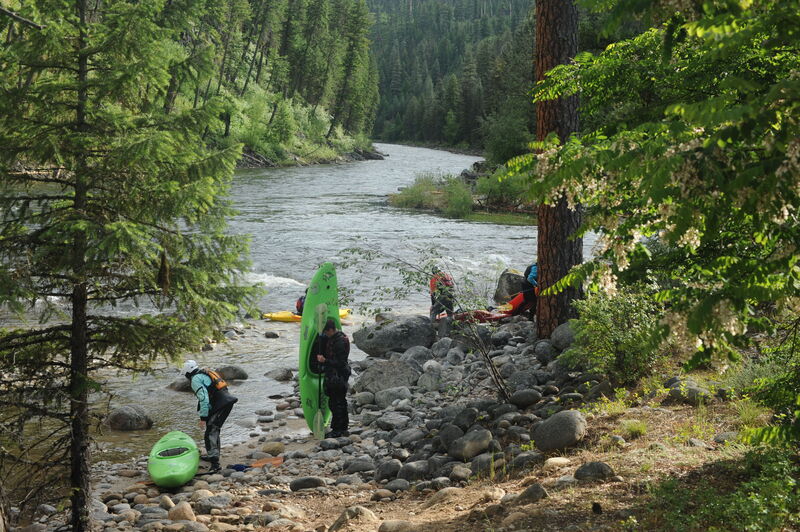
A standard put-in downstream of Flight Simulator
Another alternate put-in downstream of Flight Simulator.
An intermediate put-in with convenient parking and river access for those who do not want to run the bigger drops upstream. This small campground has a couple of sites for those spending a couple days in the drainage.
Jun 28, 2020
Sheep Creek Trailhead to South Fork Salmon.
Apr 27, 2016
Ugly, barely submerged log blocking usual Rt Center channel in ExLax rapid, 3 miles below Castel (?) Creek, below flight simulator. Will take you under the log. Hard to see log, pinned with about 15' extending out from pyramid rock in center of rapid. Left channel open as of 4/17/16.
Jan 1, 1900
EFSF Salmon (Reach 615) . . . Upper EFSF Salomn (Reach 616) . . . Johnson Creek (Reach 562)
There are four ways to get to Yellow Pine (counting the airport), but the easiest is from the town of Cascade on Idaho State 55. Just north of town turn east toward Warm Lake. Go about 23 miles and turn left toward Krassel RS. Go down the South Fork Salmon 30 miles. When the road turns to gravel turn right and go 14.5 miles up the East Fork of the South Fork to the intersection of Yellow Pine Ave, Stibnite Road and Johnson Creek Road.
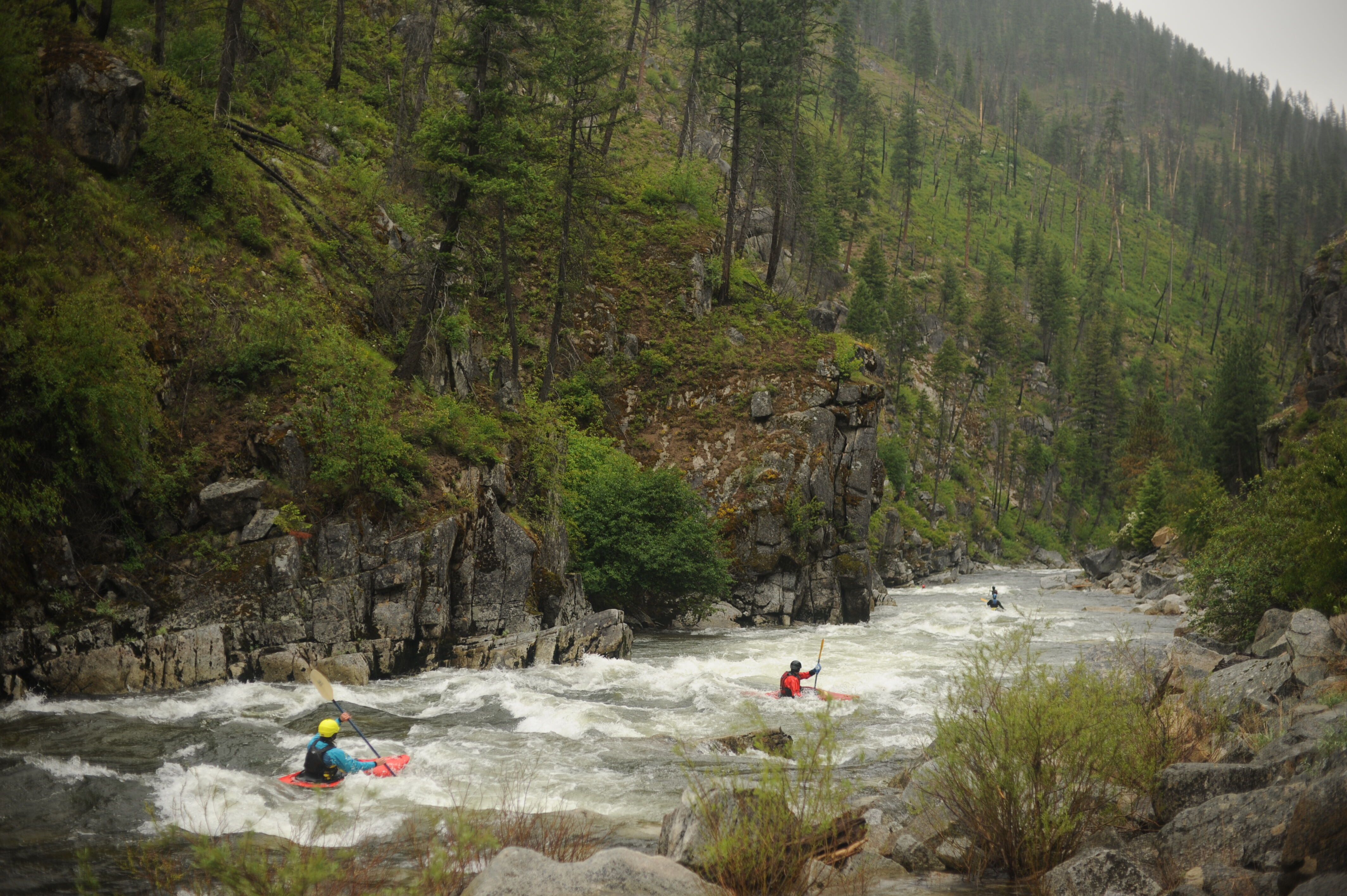
The road can be seen just above these boaters. It is usually closer, but does not intrude.
This is a good lunch spot. It has plenty of parking, but skimpy camping. Sit in the ladies toidy with the door open and look accross the river to see Osprey nesting.
Even the easy stuff is a lot of fun.
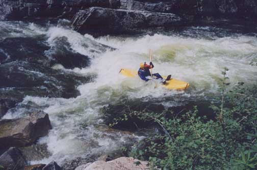
Burried in the first drop below Caton Creek.