Tahquamenon
Upper Falls to Lower Falls (4.1 miles)

| Difficulty | IV-V |
| Length | 4.2 mi |
| Avg Gradient | 20 fpm |
| Gauge | Tahquamenon River Near Paradise, Mi |
| Flow Rate as of 56 minutes | 588 cfslow runnable |
| Reach Info Last Updated | March 29, 2026 |
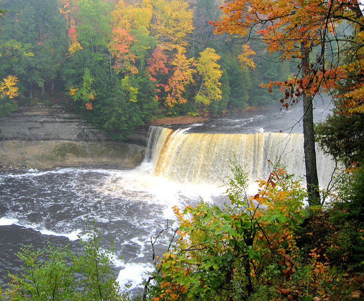
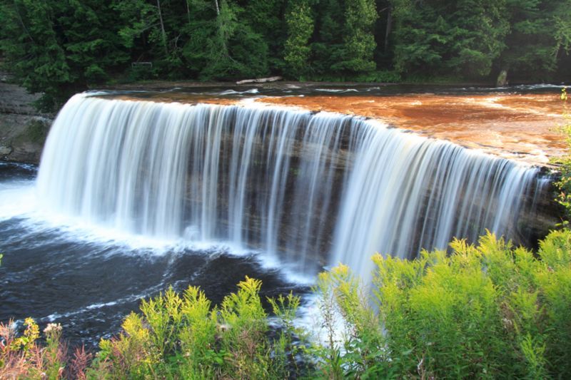
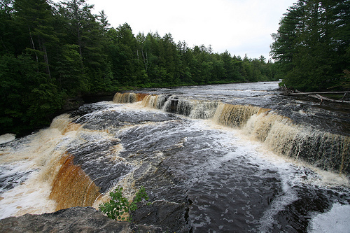
Billed as ' the second largest falls east of the Mississippi' (behind Niagara, of course), and ' third most voluminous vertical waterfall east of the Mississippi River, after Niagara Falls and Cohoes Falls, both in New York State', Tahquamenon Falls State Park hosts two areas of falls in what is otherwise a flatwater river. This seldom gets run because it lies 'in the middle of nowhere' (a long way from most of the great U.P. whitewater).
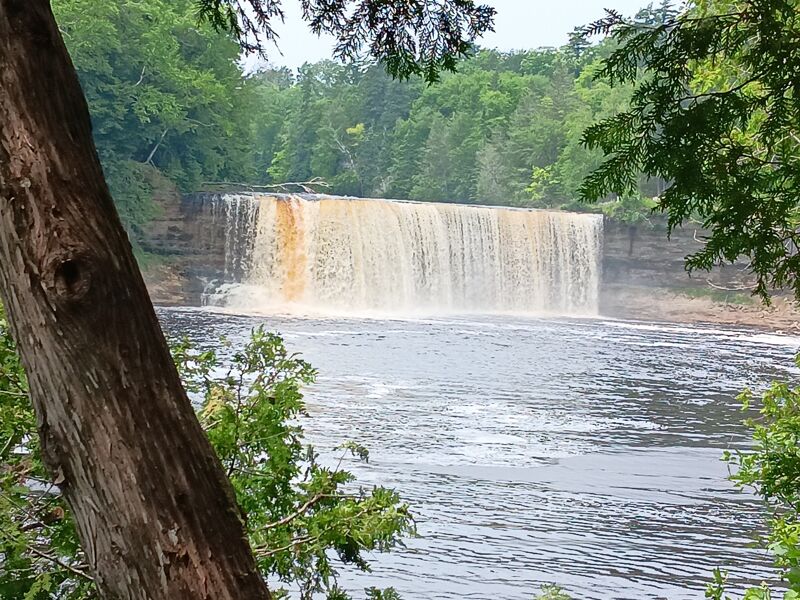
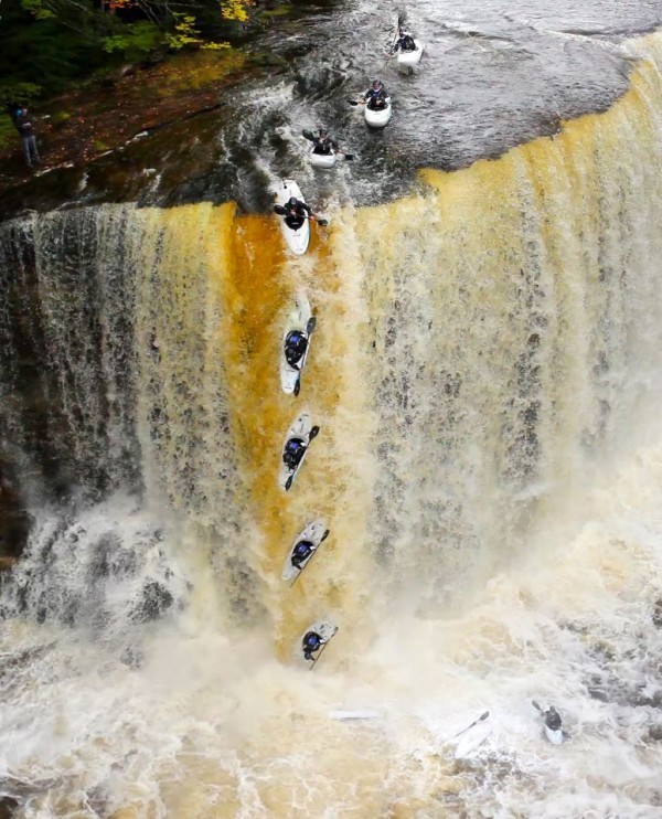
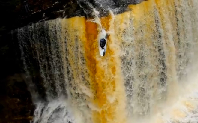
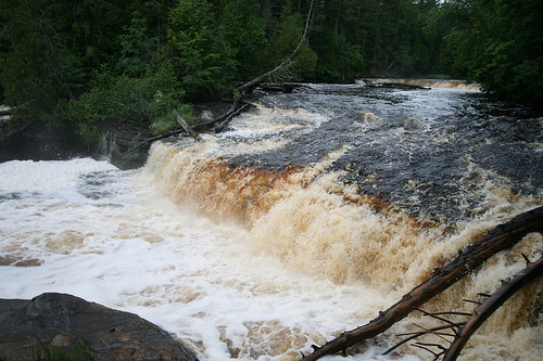
Upper Falls is a wide, sheer-vertical drop (in the neighborhood of 50 feet tall and 200 feet wide) which has been run by a few 'big cajones' boaters. (Most mere-mortal boaters will be content to enjoy the view of this impressive falls, and will boat only the lower falls.) Click for a video (queued to 0:25 to skip some of the float in) of Marcelo Galizio running the falls on 2018.12.30: Marcelo Galizio runs the falls
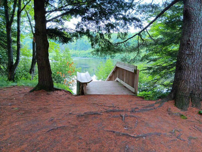
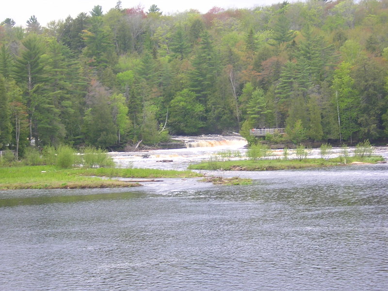
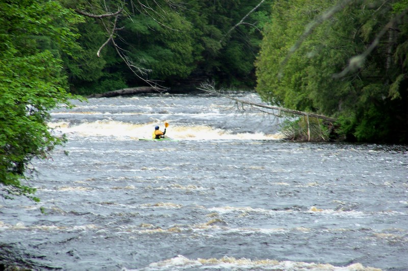
Lower Falls occurs 3.6 flatwater miles downstream. You can put-in below the Upper Falls and paddle down to the Lower or just park-and-play at the Lower. An island splits the river at the Lower, so routes are possible on both sides. From the Lower parking lot picnic area, carry your boat the short distance to the steps down to the water and paddle over to the island. As of May, 2022, there is a handicapped accessible pedestrian bridge to the island, but this would be a long hike to carry your boat. After paddling to the island, hike your boat up to hit either channel.
Just upstream of the island there is a river wide, shallow ledge that does have a few small play waves on river left. This is also the deepest water to run the ledge. You could paddle to shore and portage 50' to get above the ledge, then paddle down.
River-right around the island are two ledge drops of about 6 to 8 feet which land hard on bedrock, one right after the other. Flows wil
...
Fifty foot falls. If you dare, run river right on the toungue at the point.

(Via GoogleMaps aerial view) There appears to be a minor ledge/wave/shoals here, which may (at some flows) create minor entertainment (play).
The Lower Falls Sequence begins with a couple of small ledge/waves, and builds nicely as you proceed down from here.
This is a river-wide shallow ledge, just upstream from the main island of the lower falls. It can probably be run anywhere, if you don't mind sliding over the rocks. River left, near shore, provides the best chute.
Just above the island on the lower falls is a river wide ledge. On river left, there is a playspot just below the ledge. Not much, but it's something.
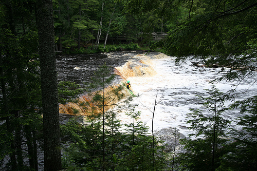
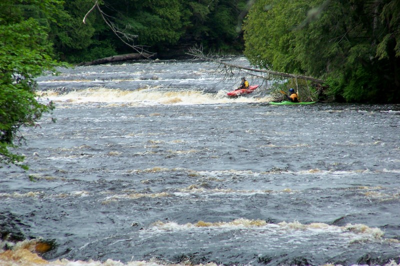
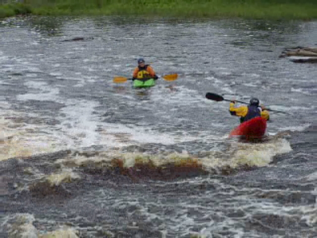
River left of big island, the first drop is a 6' to 8' ledge. This can be run in more than one location. The photo and video shows probably the best route over a point that is right of center. In the video, the second paddler (Tom) tried it a little too far right and got caught in the backwash. It wasn't too difficult to get him to the island to bail out. It's fairly shallow and not a strong current before the next drop.
River left of big island, the second drop is another 6' to 8' ledge. A small island that splits the river again, and you can run on either side of the island, but the river-right side is a bit bony. The photo and video show the river-left side. There is really only one route which is on the right side, maybe 10' out from the island. Too far left and you'll run into the rock outcrop that the viewing platform is built on. The river really narrows here and there is kind of a tongue on the river right (you can see the smooth water in the photo). No boof is needed here as the water just washes you right through.
Below the viewing platform are a few small ledges and some rock garden.
River right of big island is a double drop consisting of two 6' ledges. (This isn't really at 4.2 miles, but after you run river left, you can take-out at the end of the island, portage back to the other end, and run river right.) Flow needs to be over 1,000 cfs to run this -- at flows lower than that, it is just too shallow (you'll 'grunge out' on the approach, and land hard -- boat/body abuse).
Jul 15, 2025
The park has moved and improved the access point below the falls. The did this for folks that put-in here to go down the river, but it work well for those of us going up the river to run the lower falls.
Aug 24, 2018
Curious what makes it a 5.3? Looks like a clean approach with landmarks into a rolling lip into a large pool.
Doug: Not sure where Matt Jackson got the 5.3 rating. I haven't run the falls, but his description is correct, though at lower flows it is shallow above the drop. I think there would be a chance of turning if you weren't in the deepest water.