Salmon, Middle Fork
2 - Boundary Creek (Dagger Falls) to Salmon River (Cache Bar)(Middle Fork Salmon)
Jul 7, 2026
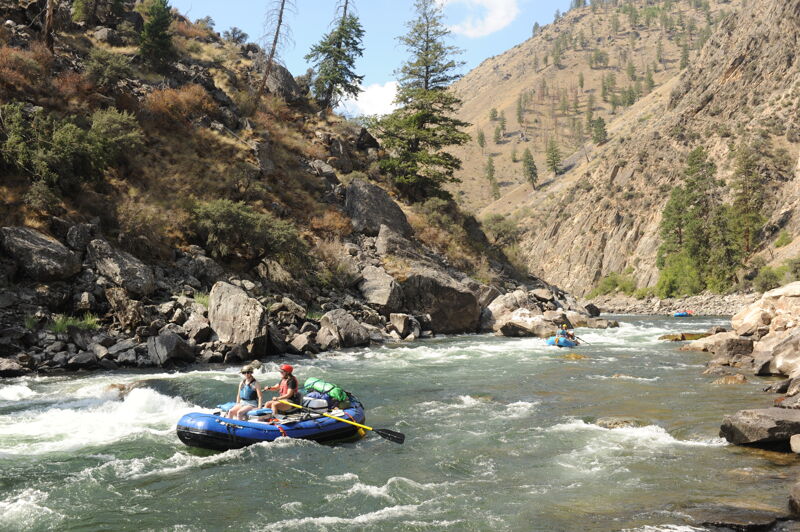
American Whitewater hosted its inaugural Middle Fork Salmon River trip at the start of July 2026, with 21 participants in rafts, kayaks, and IKs supported by ARTA and Phil DeRiemer (kayaks). We had ideal flows, good weather, and a great time.
Jul 27, 2025
Stage was 1.83' corresponding to 750 cfs at Middle Fork Lodge on put-in day. The river was low and very technical at the top. We were able to get the rafts down with a couple of mishaps along the way including a badly pinned raft at Hells Half Mile, but all the boats and gear made it down safely. Several of our rafts were lightly loaded with additional gear and food flown in to Indian Creek which was very affordable when split among the group.
We were on the river for seven days and six nights. Our camps and approximate mileage from put-in were as follows: Elkhorn Bar 8.2, Big Snag 19.1, Upper Jackass Flat 37.3, Lower Grouse 56.5, Driftwood Flat 72.1, Cradle Creek 88.6. This gave us a little more time to deal with the low water at the top with longer mileage days after passing Indian Creek. We had plenty of water after Indian Creek although there were technical rapids to navigate and places to get stuck.
Aug 28, 2022
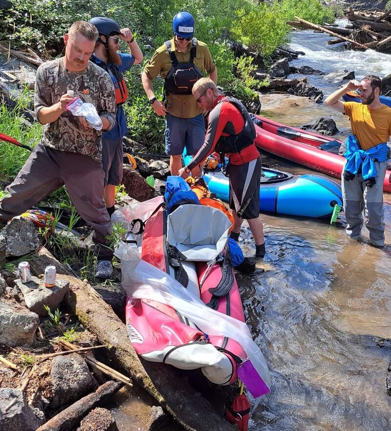
Putting out this report on the status of the log jams on the upper Middle Fork Salmon for those who may be launching soon. I was in a group 7 in inflatable kayaks who paddled from Boundary Creek to Indian Creek. The ranger at Boundary said we were the first to launch there since the blowouts. After some log-clearing we were able to paddle everything easily. A small raft would be challenging to get through some jams, but portages would not be horrible. Here are the debris flows and log jams.
Lincoln Creek deposited some debris on river right, but there is an easy passage on river left.
Ramshorn rapid has two substantial log jams. There were nearly clear passages through both on river right. We cleared some logs from both to make them passable. The first is a simple tongue with no obstructions in the water, but you have to dodge a shoulder-height log on the left. 50 yards of shallow rocky water brings you to the second. Moderate current flows into and through the jam and could be dangerous to a swimmer, but it’s simple to get to river right. A head-height log extends over the second chute. Easy to duck under in a kayak. One of our IK’s brushed up against a plank from destroyed pack bridge and tore an 8 inch rip in his boat…instant pop and swim. We removed the plank. Be wary of other debris from the bridge.
Spike creek debris completely blocks river left and has a river-wide log on river right. Simple to drag over in any craft.
Velvet Falls had a river-wide log jam that now has a single chute through the center over an 4-5 ft drop into a weakly recirculating hole. Although the chute itself is wide enough for a small raft, there are shoulder-height logs on both sides limiting the gap to about 6 ft. The log on the right has a lot of water moving under and could pose a pin potential. It’s not hard to hit the line in a kayak. Portaging a small raft looks possible but not pleasant on river left.
A smaller blowout about a mile after Velvet put a lot of debris in the river for the next mile, but not block passage.
No other obstructions past Velvet. Have fun and be safe.
Aug 14, 2022
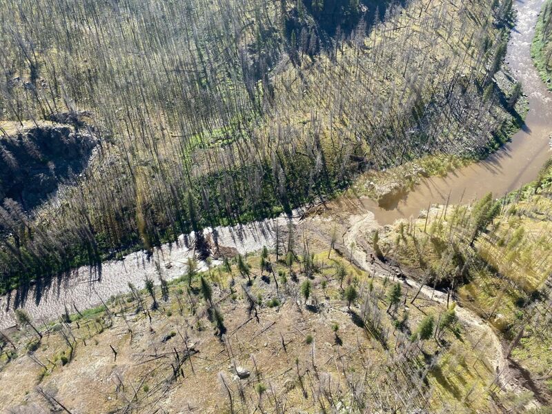
A debris flow from Rams Horn Creek has entirely obstructed the Middle Fork of the Salmon River (MRSR) four (4) miles downstream of Boundary Creek Boat Launch.
Downstream of the debris flow, other log jams have fully obstructed the MFSR.
The debris flow has displaced the Ramshorn Pack Bridge that spanned Ramshorn Creek on the Middle Fork Trail (#4001). The bridge or pieces of the bridge are in the MFSR, location unknown.
Agency officials are STRONGLY encouraging people to launch from the Indian Creek Launch Site or another access point further downstream of Indian Creek for the foreseeable future.
Beginning Wednesday, 8/17, people can launch from Boundary Creek. However, Forest Officials are strongly discouraging launching from Boundary Creek or any point upstream of the Indian Creek Launch Site.
Launching from Boundary Creek will likely result in several portages of significant distance. Boaters may encounter frequent obstructions with little to no time to react before encountering them.
The Forest will continue to monitor the debris flow and any associated log jams.
When floating the MFSR, always be prepared for debris in the river, including logs and other river obstructions. In the post-fire environment that makes up much of the Middle Fork River corridor, falling trees, rolling rocks, and other hazards may be encountered at any time.
As there is access to the river, Forest Officials are not offering rollovers for launches next season.
Forest Officials are allowing late cancellations, up to three days prior to your planned launch, without penalty.
While the Forest continues to assess the situation, there are no immediate plans to try to remove the debris flow and associated obstructions.
🚣The Middle Fork of the Salmon River is located in the Frank Church – River of No Return Wilderness. Wilderness is managed to allow natural ecological processes, such as this debris flow and log jams, to take place.
🚣Endangered Chinook Salmon are actively spawning in the Middle Fork and its tributaries
🚣A preliminary assessment determined that the use of explosives was not likely to be successful in removing the obstructions
The most up to date information can be found by calling 208-756-5587
Jul 8, 2022
It was 3.85 at boundry. We thought this would be a great level to bring big cats and have a great time and we did. However, we also ripped our 3 cat boats that were each 17 feet long. The round boats had no rips or tears. My point in mentiioning this is that you need to bring your repair kit at this level and it should include tear aid for quick fixes on the river and sta bond for real repairs at camp with MEK and plenty of patch material. One boat ripped a 18 inch hole in the boat. Believe or not tear aid got it to camp where we could do real repair. You should also air your boats down. The professional guides said essentially the same thing to us with all the recent rock fall and the sharp rocks in the river.
At this level with any boat 16 feet and up Velvet is nothing. Just plow through it if you like or move to the left, it just does not matter. The left sneak route is easy at this level but you don't need it in a big boat.
Also most of the class IV rapids are not bad and should be class III at these flows. The only rapid that gave us problems was Devils tooth and that was because you can't see the giant hole hiding in plain site and you can be like our 13 foot boat which was ejected up clean into the air befor landing upside down. It was amazing what that hole did to a 13 foot fully loaded boat.
The hardest rapid is Redside by far and at these water levels the left line in by far the easiest. I only needed two mild strokes to miss the big rock in the middle of the current. We watched commercial and private groups at this level the the center and far right lines nearly wiped our alot of boaters. Lots of lucky people at these levels.
Weber at 3.8 was nothing but a simple wave train down the middle. Speaking of over rated rapids Cramer creek is no IV at these levels. Run it straight down the middle. Just grins. There is a large hole on the bottom far right and rocks on the far left but nothing in the middle of the river. My boys saw this rapid and decided to swim it and it was super fun to swim.
If you have people who want to kayak that don't have a lot of experience start them at Indian Spring air strip. The 30 miles of whitewater below this is super fun and this is where commercial companies allow guest to kayak.
Tappan falls line in the far right and it easy if you hit the line, if not flipping or pinning on a rock is possible.
Now both Loon Creek and Flying B have a little store with ice cream and hard goods. I am told both will do lunch for you if you make plans ahead of time.
Big snag camp has a small beach but if you miss it there is a large cobble bar after it at these flow.
Finally, the petroglyphs and the Veil cave and hot springs were all great. Don't miss the petroglyph of the really well endowed man! I am not going to tell you which one it is.
We camped at Elk Bar, Old Snag, Johnny Walker, State Land Right. All were good.
Sep 29, 2020
We enjoyed a 6 night and 7 day trip on the Middle Fork Salmon the first week of October. Discharge at Middle Fork Lodge USGS gage was 620 cfs and slowly dropping to 580 cfs (1.64 to 1.58 on the staff gage). We launched at Boundary with very lightly loaded rafts and kayakers carrying personal gear in their boats. We picked up coolers and additional supplies on day 2 at Indian Creek that we had flown in. The lightly loaded 16' raft did very well and we had few issues. The fishing was very good.
We had good weather with pleasant fall days and cool nights. We had frozen water bottles at Boundary when we woke up but night-time temperatures stayed above freezing as we made our way downstream.
Camps were as follows:
9/28 Boundary Launch, mile 0
9/29 Sheepeater Hot Spring, mile 13.3 (13 mile day)
9/30 arrived at Indian Creek for gear pick up at 3pm; Pungo Creek, mile 28.0 (15 mile day)
10/1 Whitie Cox, mile 46.4 (18 mile day)
10/2 Pool, mile 61.4 (15 mile day)
10/3 Driftwood Flat, mile 71.3 (10 mile day)
10/4 Cradle Creek, mile 87.8 (17 mile day)
10/5 take-out and drive home, mile 98.3 (11 mile day)
Jul 10, 2018
We enjoy a 6-night 7-day trip on the the Middle Fork Salmon. Our rig day was July 9th and we launched the morning of July 10th. Flow was 1400 cfs at Middle Fork Lodge at the start of the trip slowly dropping to 1250 cfs by the end of the trip with slight diurnal fluctuation (corresponding to about 2.4 to 2.3 on the staff gage). We had fully-loaded rafts from the top and got stuck a few times but made it down.
Our camps were as follows:
7/9 Boundary Launch, mile 0
7/10 Big Bend, mile 6.7 (7 mile day)
7/11 Pungo Creek, mile 28.0 (21 mile day)
7/12 Cow Creek [hiked to Loon Creek Hot Spring], mile 50.3 (22 mile day)
7/13 Camas Creek, mile 60.0 (10 mile day)
7/14 Fly, mile 75.0 (15 mile day)
7/15 Solitude, mile 92.2 (17 mile day)
7/16 take-out and drive home, mile 98.3 (6 mile day)
Jun 18, 2017
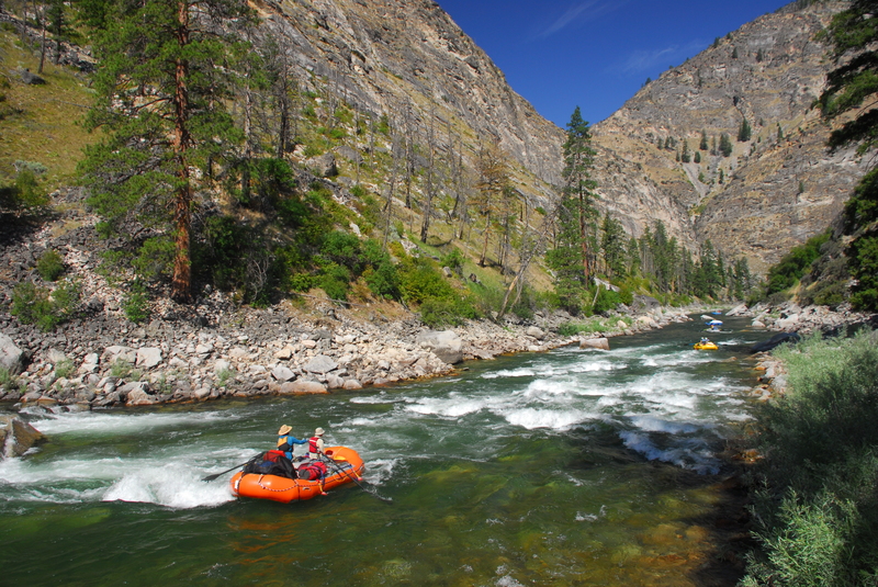
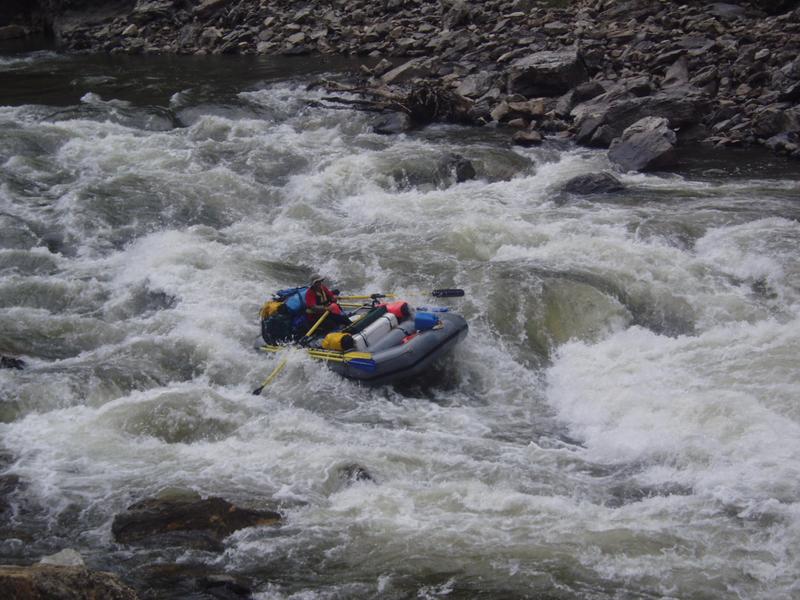
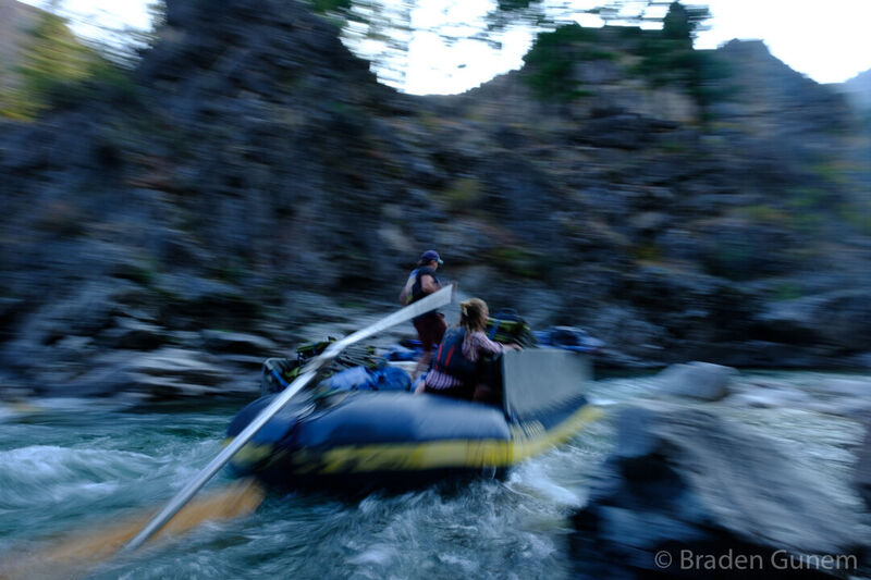
Raft going by Murph's Hole at 6.5 feet
Jan 5, 2012
new online whitewater guide for idaho and montana area paddling - check it out!
www.montanaeddyhop.blogspot.com
Jun 19, 2009
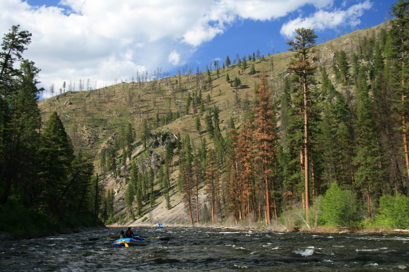
Random river shot.....
Jun 17, 2009
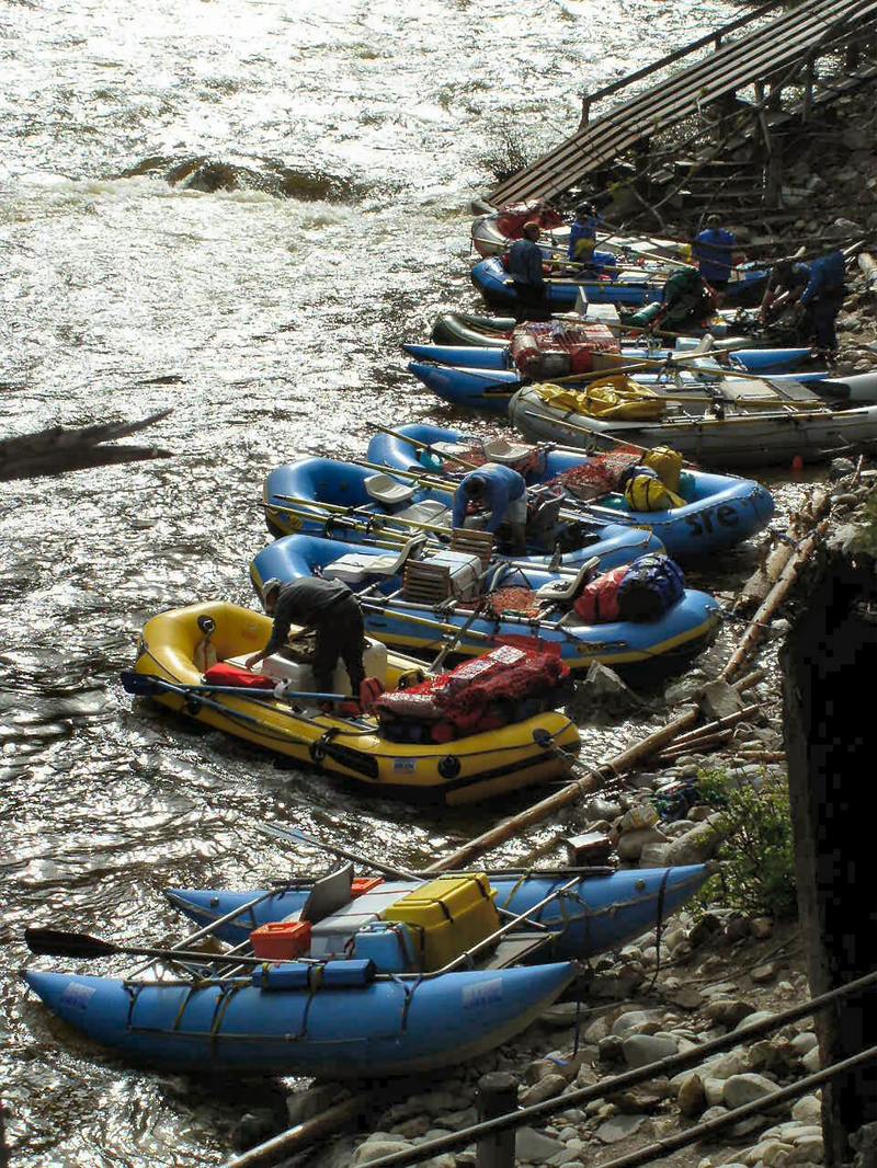
Boat ramp at Boundary Creek. My favorite put-in of all time!
Jun 16, 2007
This is actually on the Main right before the takeout.
Jul 20, 2006
New Gudebook out June 20, 2006 by
-Matt Leidecker-
Matt Leidecker Photography
P.O. Box 3834
Ketchum, ID 83340
208-720-4712
Easily the new standard for guidebooks.
Jul 15, 2005
Morresa runs the small tongue through the center right side of Tappen Falls.
Karen punching through the hole after taking the center tongue through the falls.
Martin eddies out bottom left after running the third drop of Tappen Falls.
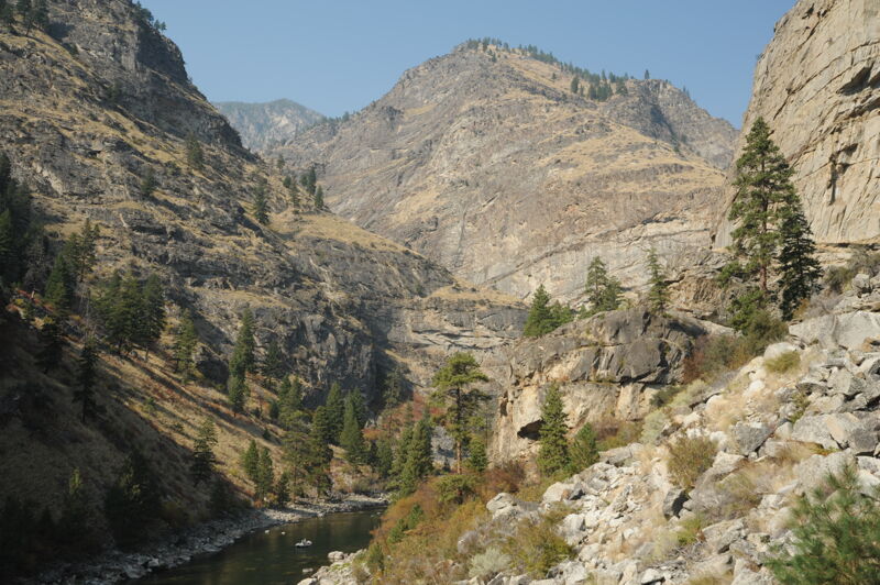
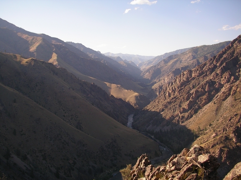
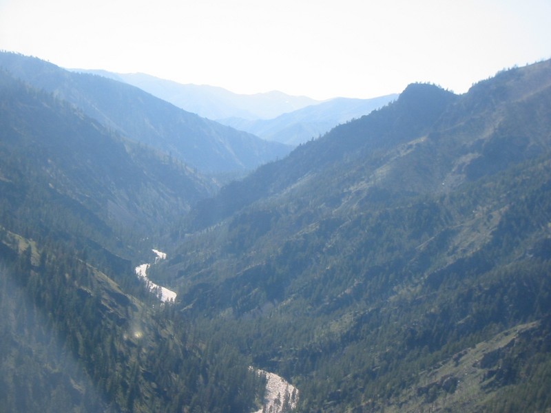
Another stunning view on the Middle Fork of the Salmon. Looking downstream into Impassable Canyon from the top of the Little Pine campground area.
Jul 15, 2005
Karen runs the left tongue at Velvet Falls
Jul 15, 2005
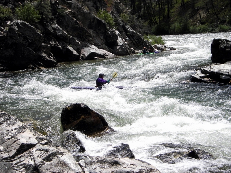
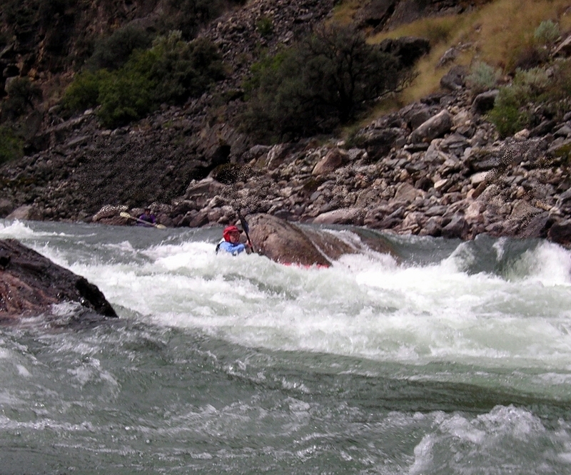
Karen zig zags from eddy to eddy in Pistol Creek Rapid. Watch out for the pinning rocks bottom right.
Jul 15, 2005
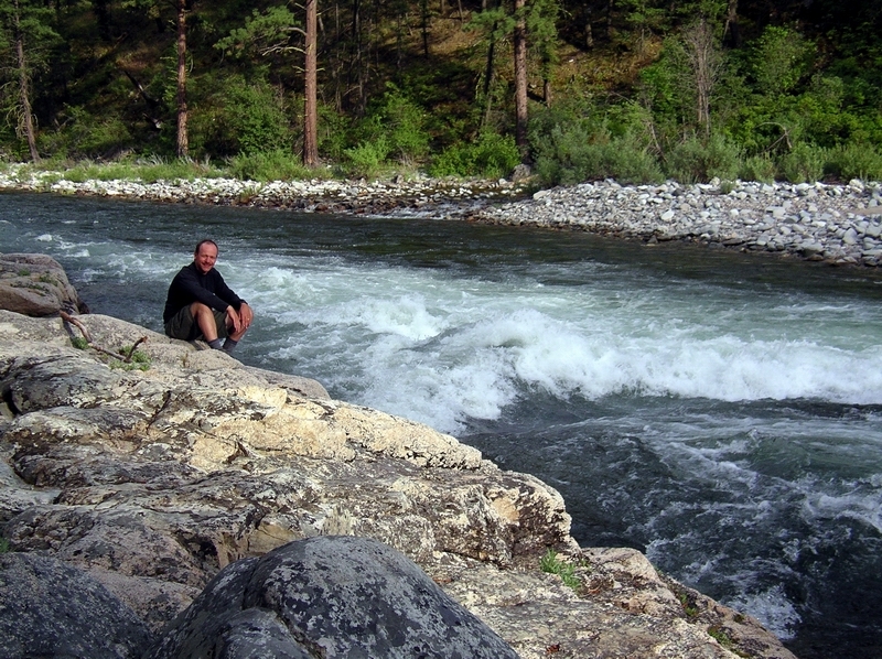
This was one of many 'sweet', big, surf waves we found daily on our Middle Fork trip at this level. Every section of the river had good waves to be found. Very exhausting!
Paul surfs the very nice wave at the end of the Marble Creek camping area.
Jun 30, 2005
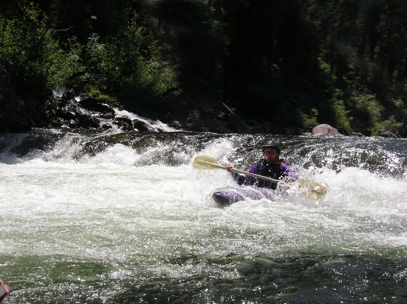
Morresa runs Cliffside? Rapid (the rapid above Rubber Rapid).
Aug 24, 2004
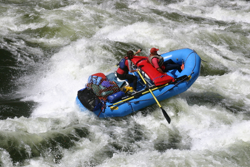
This is the new rapid on the Main Salmon just obove the MF take-out. This is a 15 foot raft taking the right line. The line is to graze the hole/pour-over just to the left of the raft and to miss a rock on the right just out of the picture.
Jun 17, 2004
waypoints
44.531800, -115.294367, 0.0M, Boundary Creek, RL
44.624550, -115.198500, 10.7M, Scout Camp, RL
44.783900, -114.856233, 46.2M, Whitey Cox Grave, RR
45.032400, -114.724000, 72.9M, Wilson Creek, RR
44.891583, -114.722533, 59.9M, Camas Creek, RR
44.956683, -114.734633, 66.8M, Flying 'B' Ranch, RL
45.211017, -114.684117, 87.9M, Parrot Cabin, RL
45.318583, -114.636583, 99.7M, Cache Bar, RR
May 15, 2004
True Whitewater Heroes!
May 15, 2003
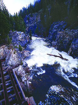
8.5!!!!!
Note the giant logs floating around. They were also on the river with us, at least the 45 minutes and 10 or so miles we spent on the river each day.
Jan 1, 1900
Jan 1, 1900
A sweep boat runs through Pistol Creek.