Salmon, S. Fork
1 - Goat Creek to footbridge at Poverty Flats Campground(Goat Creek Run)
| Difficulty | IV-V |
| Length | 6.7 mi |
| Avg Gradient | n/a |
| Gauge | Sf Salmon River Nr Krassel Ranger Station Id |
| Flow Rate as of 41 minutes | 2.25 ftbelow recommended |
| Reach Info Last Updated | July 10, 2020 |
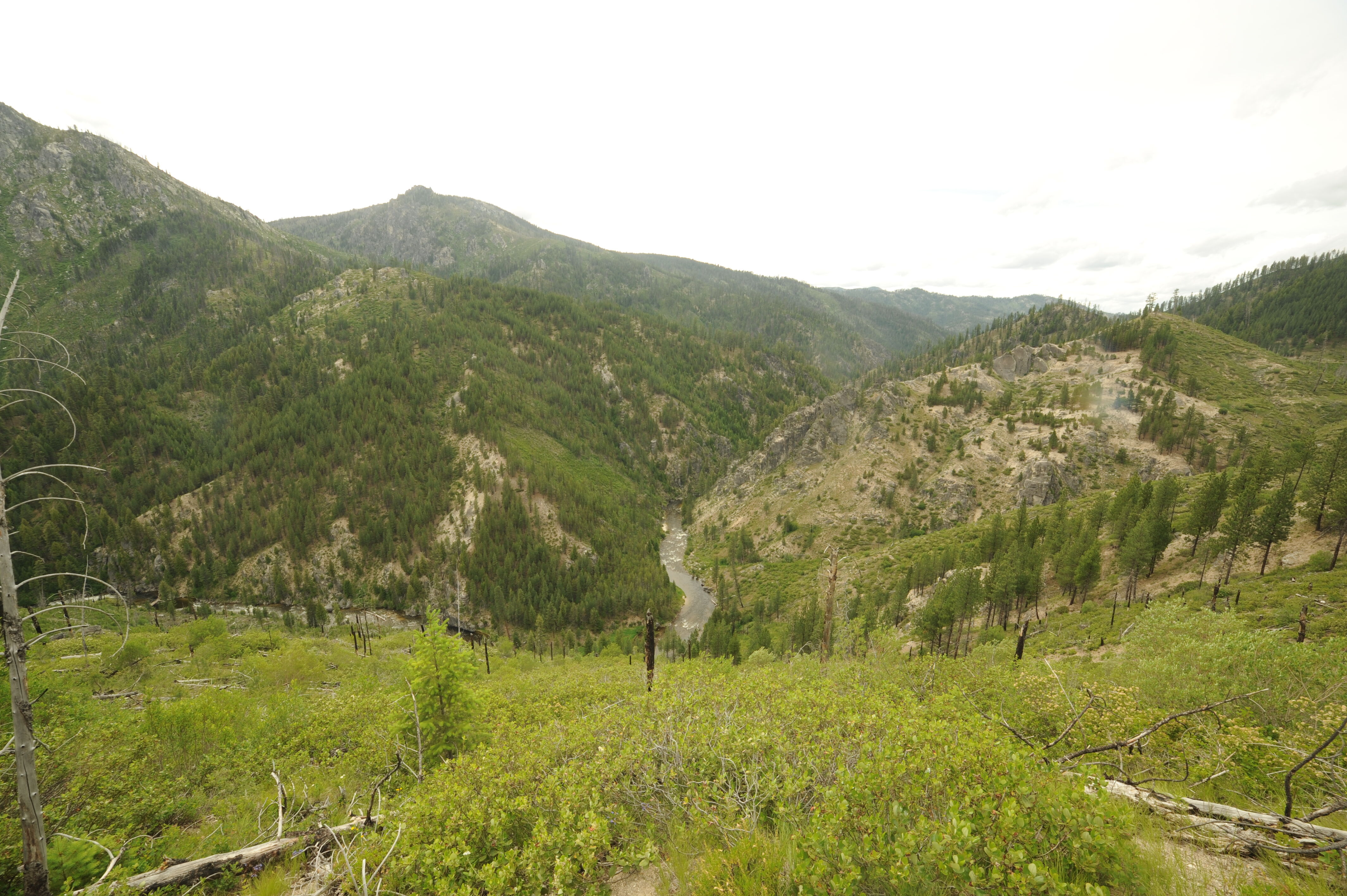
This is the classic day run on the South Fork Salmon with several class IV rapids and at least one class V, Double Drop, at medium flows. The road climbs away from the river at Goat Creek and does not return until the take-out at Poverty Flat Campground. The Poverty Flat overlook along the shuttle route offers a distant view of the river far below.
This section is closed to paddling during April, May, August, and September in an effort to reduce disturbance of spawning salmon. Review the rules here.
Logistics: To reach the South Fork Salmon, turn east on Warm Lake Road (FR 579) in Cascade at Highway 55 mile 116.1. It's 24 miles up this road to the turn for the South Fork Road (FR 474) at Warm Lake Road mile 55.9 (on the way you will pass a Trail Creek Hot Spring at Warm Lake Road 60.5, 0.1 mile up the hill west of the FR 409 junction). The South Fork Road (FR 474) parallels the river on river right.
The put-in is at South Fork Road mile 7.9 where Goat Creek passes under the road through a large culvert. A small pull-out provides parking for a shuttle rig and it's a bit of a scramble down to the river. From this point the road immediately climbs away from the river and at mile 9.6 you can stop at the Poverty Flat overlook for a view into the canyon below. Continuing on to mile 13.6 is the Poverty Flat Campground where the road returns to the river. The road comes close to the river at mile 14.0 providing several options for easy access if you don't want to drive into the campground. You can also paddle down to Tea Pot Hot Spring at mile 15.3 although the springs will be inundated at higher flows.
Both Warm Lake Road and South Fork Salmon Road are paved. An alternate access is to come in from McCall over the Lick Creek road and access the run from the downstream end. The Lick Creek Road is not paved and may be snowed in early in the season.
May 18, 2015
Ran this at low water in 2013 and it was still clean below the log jam. Portage the enormous log jam on river left. Would love to catch with little more water - it's a great run.
May 27, 2002
Forum:BoaterTalk
Date: May 27 2002, 04:57
From: glawley
Ran the Goat Creek section on the South Salmon today for the first time this season. Have not heard of anyone else doing it yet this season and so we were unprepared for the massive avalanche destruction at about the one mile mark. Anyone that has done this run will be familiar with the spot where the big avalanche path comes into the river left side of the canyon. It came out huge this year and the scope of the destruction is impressive to say the least. Fortunately, the bulk of the hundreds of trees that were blown into the river have all collected in a huge raft just at the downstream end of the pool below the slide path. After we portaged this mess we were very relieved to find that the rest of the run was clean as far as any more river-wide logs were concerned. However, this situation could change dramatically if the big jam breaks loose. Anyone attempting this run should proceed with utmost caution and beware that the entire section from the slide path downstream to Double Drop could become unrunnable if a bunch of logs shifted around. Even with the log threat we had a great run today and as always this run is in my opinion one of the very best in Idaho.