Salmon, S. Fork
2 - Poverty Flats Campground to East Fork of South Fork
| Difficulty | II-III+(V) |
| Length | 20 mi |
| Avg Gradient | n/a |
| Gauge | Sf Salmon River Nr Krassel Ranger Station Id |
| Flow Rate as of 1 hour | 248 cfsrunnable |
| Reach Info Last Updated | March 8, 2021 |
The river is class II from the pack bridge at Poverty Flats Campground 1.5 miles down to the
Teapot Hot Springs. Another mile or so below the hot springs is a
short canyon where the river cannot be seen from the road. This can be class
IV-V at very high water.
The river returns to the road downstream of Reed Ranch and Camp Creek and is class
II-III for about 11.5 miles to the Secesh confluence. This whole segment can be easily scouted from the road. The class III whitewater is at the top and bottom of this segment and those looking for class II can paddle from the Buckhorn Creek bridge down to the Krassel Work Center.
This section is closed to paddling during April, May, August, and September in an effort to reduce disturbance of spawning salmon. Review the rules here. Paddlers should also be aware of wood as trees in this segment can extend across the entire channel width.
Logistics: To reach the South Fork Salmon, turn east on Warm Lake Road (FR 579) in Cascade at Highway 55 mile 116.1. It's 24 miles up this road to the turn for the South Fork Road (FR 474) at Warm Lake Road mile 55.9 (on the way you will pass Trail Creek Hot Spring at Warm Lake Road 60.5, 0.1 mile up the hill west of the FR 409 junction). The South Fork Road (FR 474) parallels the river on river right and climbs high above the river along the Goat Creek section before descending down to river level at Poverty Flat Campground located at mile 13.6 on the South Fork Road. The entire road is paved.
The following points along the South Fork Road, ordered from upstream to downstream, can be used to access different segments of this reach:
13.6 Poverty Flat Campground
14.0 dispersed access sites
15.3 Tea Pot Hot Spring (steep trail to river), class IV/V rapids downstream where river is away from the road
16.5 Four Mile Trailhead (away from the river
...Jun 27, 2020
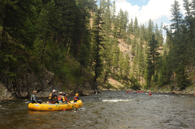
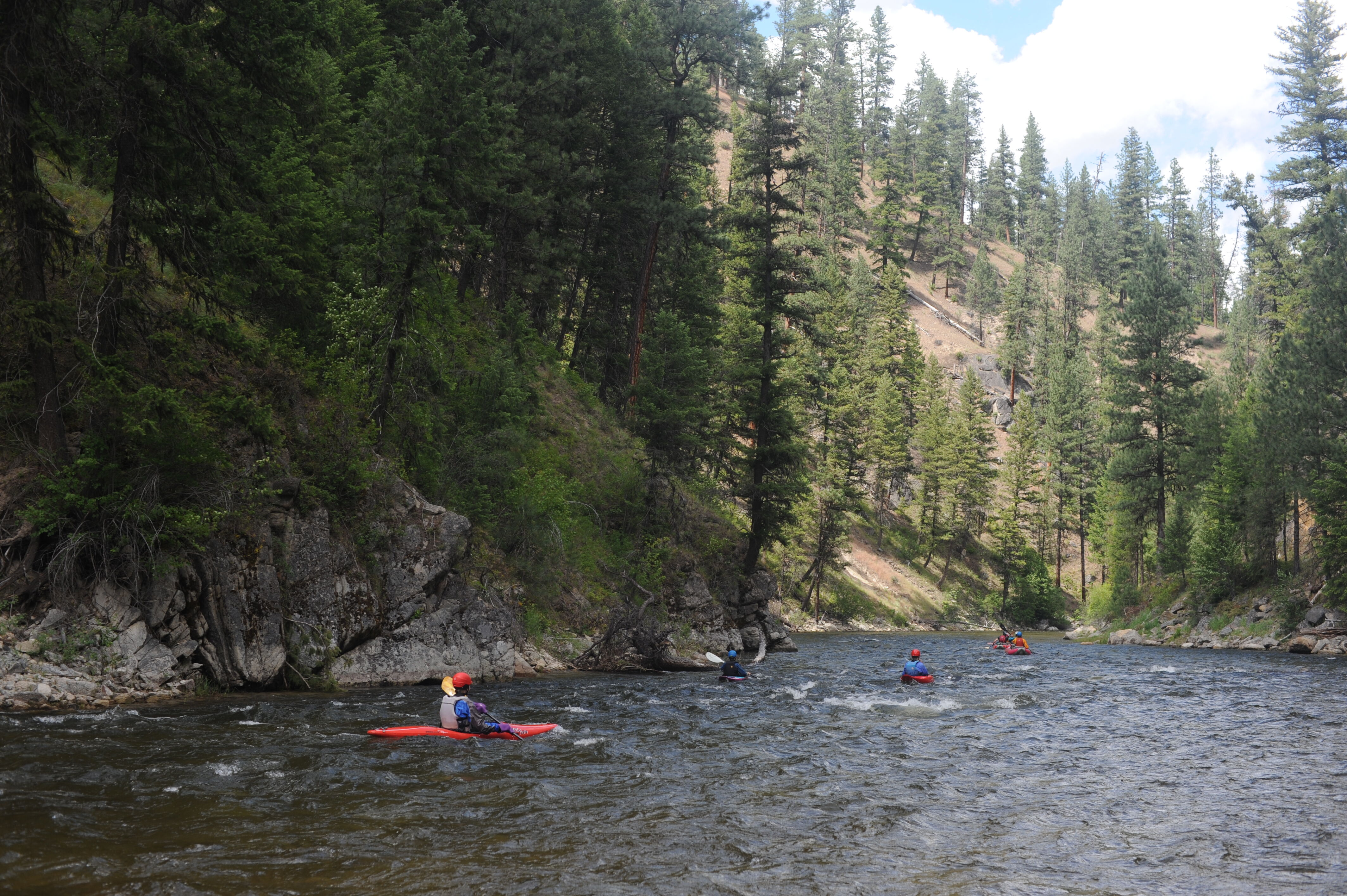
We ran from the Buckhorn Creek Bridge down to the Krassel Work Center and enjoyed roadside class II whitewater with the kids. It was a short run but fun. On a subsequent day, some in our group ran from the Buckhorn Creek Bridge down to the Secesh to enjoy the class III that comes at the end. We encountered one piece of wood that was nearly river wide and a couple more pieces that were in play and extended across a good portion of the channel.