Salmon, S. Fork
3 - Secesh Confluence with South Fork to Salmon River(South Fork Salmon)
Summary
Following the pioneering descent in 1971, Cal Giddings reported in the American Whitewater journal that “we feel we have uncovered a superb wilderness kayaking river.” The South Fork has stood the test of time as a great 2-3 day self-support trip in central Idaho. The put in is at the confluence where the Secesh River joins the South Fork Salmon River and the road ends. The trip can be combined with runs on the South Fork Salmon River, East Fork South Fork Salmon River, or Secesh River that all have access points along the forest road network in the basin.
This is a challenging, remote wilderness run. It is strongly advised to not attempt this unless you know exactly what you're doing.
A permit is required for the float out on the Main Salmon, but there is presently no lottery. You cannot camp on the Main Salmon part of the run. Get your permit before heading from McCall from the Paytte Forest office, with more info here.
Overall Description
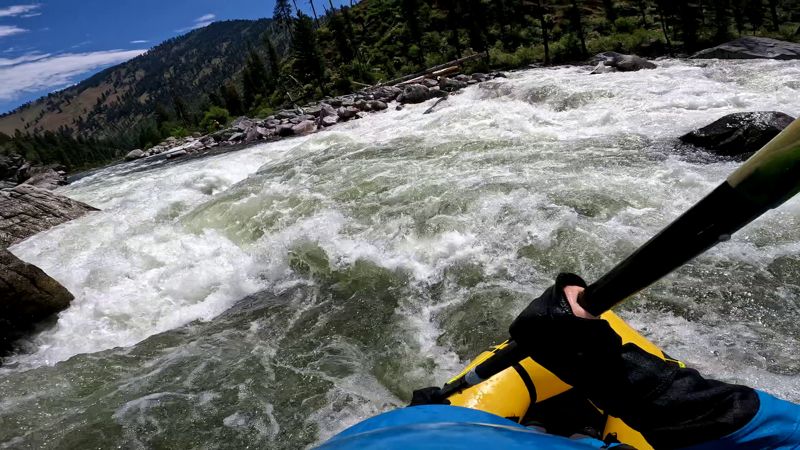
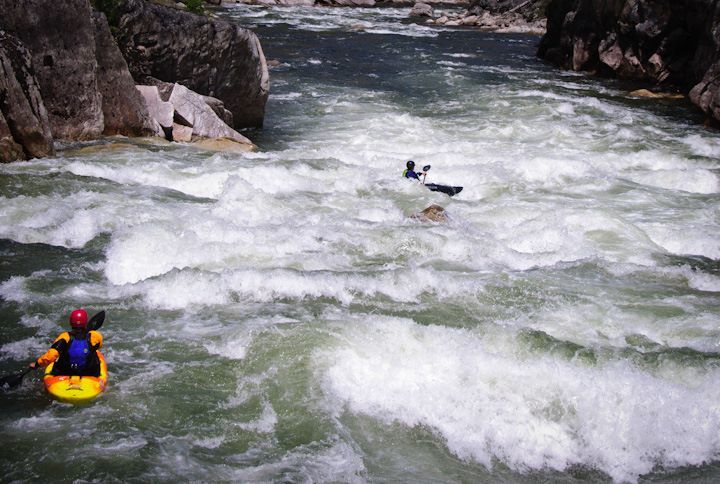
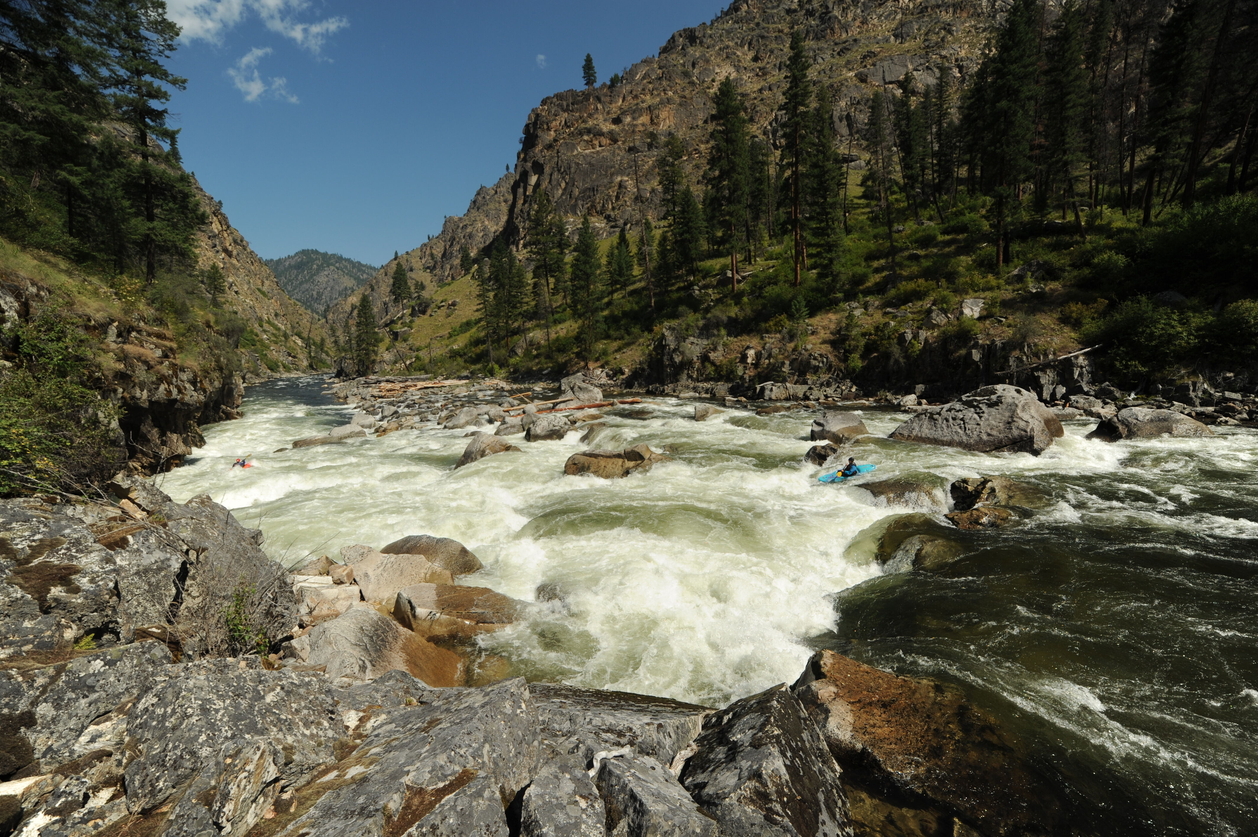
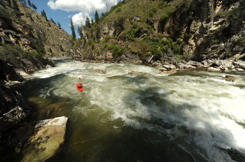
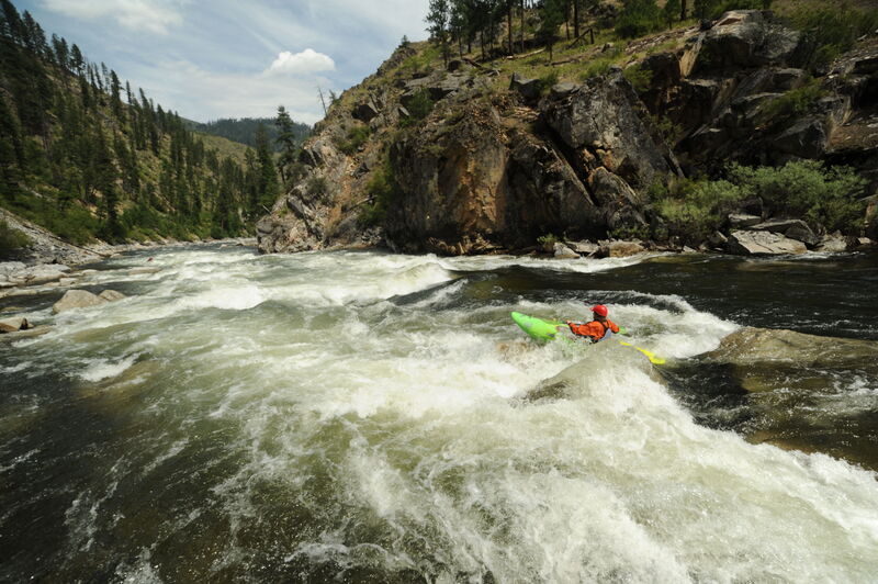
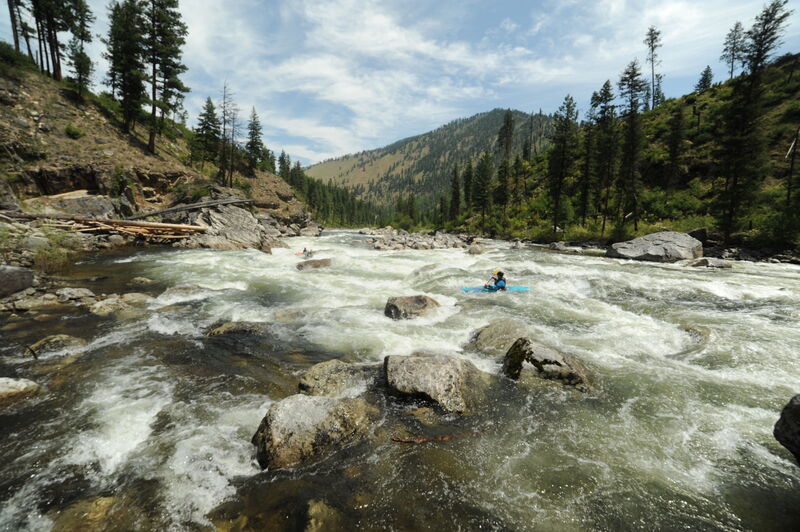
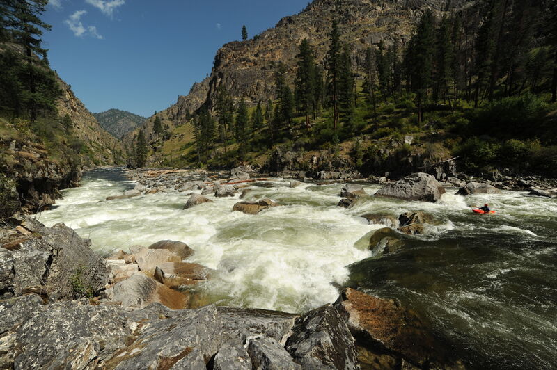
The river changes with flow. During spring snowmelt the South Fork dishes out some of the biggest water around and is a committing Class V expedition. Expect huge waves and holes, many of which are unavoidable, stacked throughout the run. Medium flows provide an experience somewhere in the middle, with several spots that still readily push into Class IV+ or more. Due to the remoteness, it is not a place for someone who swims or misses lines on any regular basis. It is remote and rescue extremely difficult.
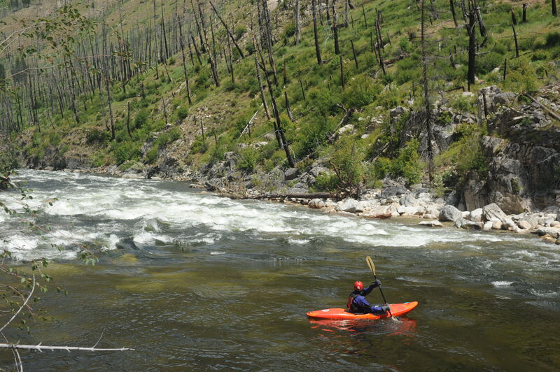
Rafting descents of the South Fork are challenging and relatively rare although catarafts are an increasingly common sight. The river is largely the domain of self-support kayakers.
One Boise boater has opined, 'My two cents: you gotta feel super good on the SF Payette - sti
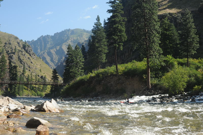
...The put-in is on river left just downstream of the Secesh confluene with the South Fork Salmon River.
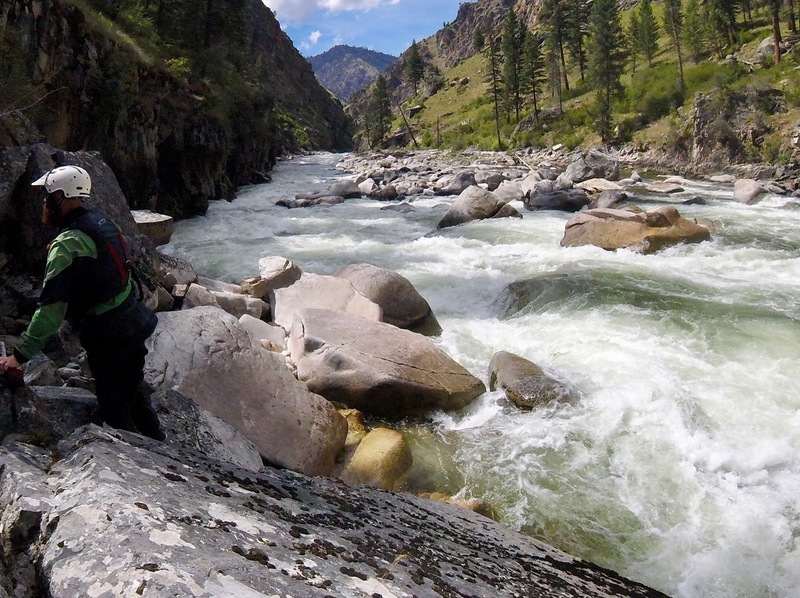
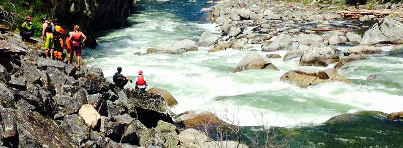
Devil Creek Rapid is the first big test on the South Fork Salmon. River left provides a good vantage point for the scout. Depending on flows, there are options for the line. A large hole awaits on the bottom left that is best avoided. A portage on the right is possible if you have eddied out far enough upstream to get across.
Surprise is a fun class IV+ that marks the pending approach of Elk Creek rapid.
Elk Creek Rapid, at one time known as Teetering Log before the log was washed away in 1982, has a cliff along river left with a steep drop at its base.
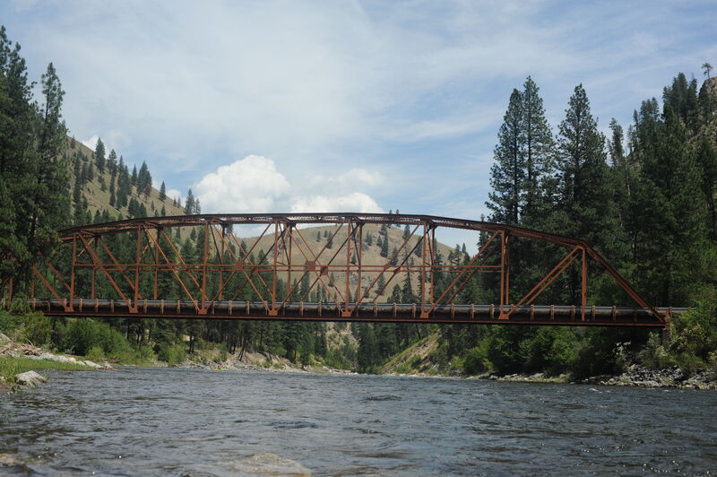
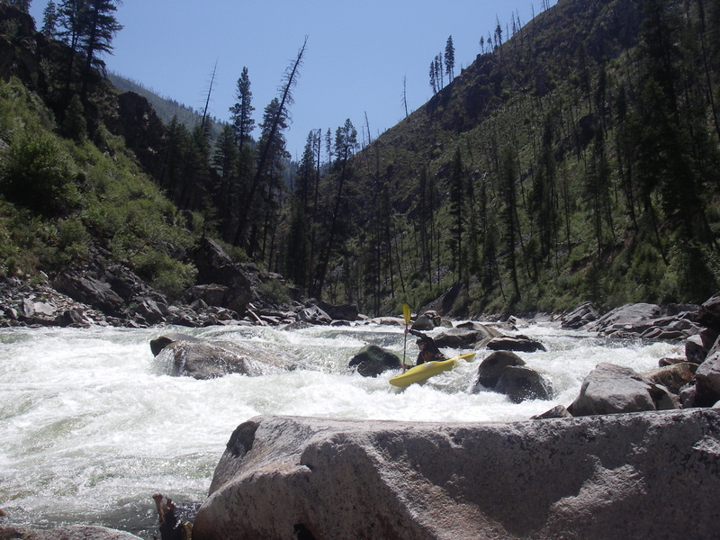
The bridge marks the approximate halfway point for the trip. Road access and cabins along river left extend for the next half dozen miles down to Smith Creek.
The South Fork Salmon Trail (#122) crossing marks the start of bigger drops at the end of the run. For the next 6 miles the river drops 400 feet and dishes up some incredible whitewater.
The biggest rapid on the run and the final test is Fall Creek Rapid. The drop is recognized by bigger midstream boulders (exposed at medium flows). The drop is easiest to scout on the left but the portage is on the right.
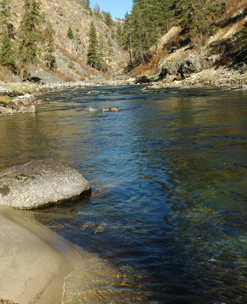
The standard take-out, unless you are flying out, is at Vinegar Creek Access on the Main Salmon which requires a 20 mile paddle out on the Main Salmon on the last day of your trip. You can also take out at Carey Creek Access which is just downsteram of Vinegar Creek Access.
Jul 8, 2022
We put on the morning of July 8th, running the final mile and a half of the Secesh River down to the confluence, before starting down the South Fork Salmon. We had 2 packrafts and 2 kayaks in our group. The Krassel Gauge was at 3.2 when we launched, falling to 3.1 over the trip. We spent 2 nights on the river, and our 3rd day was spend paddling the Main Salmon out to Carey Creek Boat Ramp.
The level was a good level for our mixed group. Still plenty of water for the kayakers to be happy, but not so pushy the packrafts couldn't hit their lines. We saw 3 other groups on our trip, 2 groups of Catarafts, and another group of kayakers, plus one solo kayaker that we saw come through during our scout of Elk Creek Rapid.
Oct 5, 2020
I ran this at 1.65 ft a month ago. I went by the info on here that it is in down to 1 ft and was expecting class 3+ as indicated on here. Not the case. I would really recommend updating this info, as I could see it getting people in over their heads or on a portage fest they weren't expecting. Lots of scraping over rocks and one portage due to more sieves than water in the rapid. Lots of sieves in general. Still fun as always, but I wish there was more accurate info on here. 2 ft is probably my personal low end cut off.