Sheep Creek (Bruneau trib)
Simplot Ranch Bridge to Bruneau River
| Difficulty | II-V+ |
| Length | 31 mi |
| Avg Gradient | n/a |
| Permit | No BLM permit required but regulations apply. On the way to the put-in you will pass an invasive species watercraft inspection station and they expect you to stop and may chase you down with lights flashing if you do not. Idaho invasive species pass advised. |
| Gauge | Bruneau Rv at Rowland, Nv |
| Flow Rate as of 11 minutes | 3 cfs |
| Reach Info Last Updated | May 25, 2016 |
Sheep Creek (class II-VI) is rarely run because adquate flows are hard to catch, much of the run is obstructed by a willow thicket, and the canyon is extremely remote. With that said, for adventurous paddlers, it is a bucket list item not to be missed. This run is best suited for hard shell kayaks because at least 20 miles of the run involves stuffing your boat through thickets of willows growing in the streambed. A wider or softer boat would insure that you would be stuck that much more.
From a launch at the last road bridge there is an hour of moving water through willows. After the stone cabin on the right marked as James Place on GPS maps (nice camp), the gradient begins to pick up with small rapids in the willows. At mile 7 there is a sharp left bend marking the first class IV which is a narrow chute through the willows, from which you must move left in order to avoid the rocks bottom right. More class III's in the willows follow.
Around mile 9 Mary's Creek enters from the left, but you will not see it for the willows. This has been run (see the 1999 May-June issue of the AW Journal). To my knowledge no one has run it since then. There are many enjoyable open sections interspersed with willows for the next 10 miles.
There are many small camps, the best starting at mile ~12 on the right. One more class IV in the willows is split into two channels, and the right one ends under the cliff in the rocks. It is possible at lower flows to run the right channel and cut to the left one before the cliff. A class III drop follows.
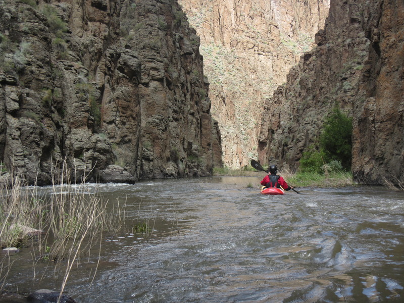
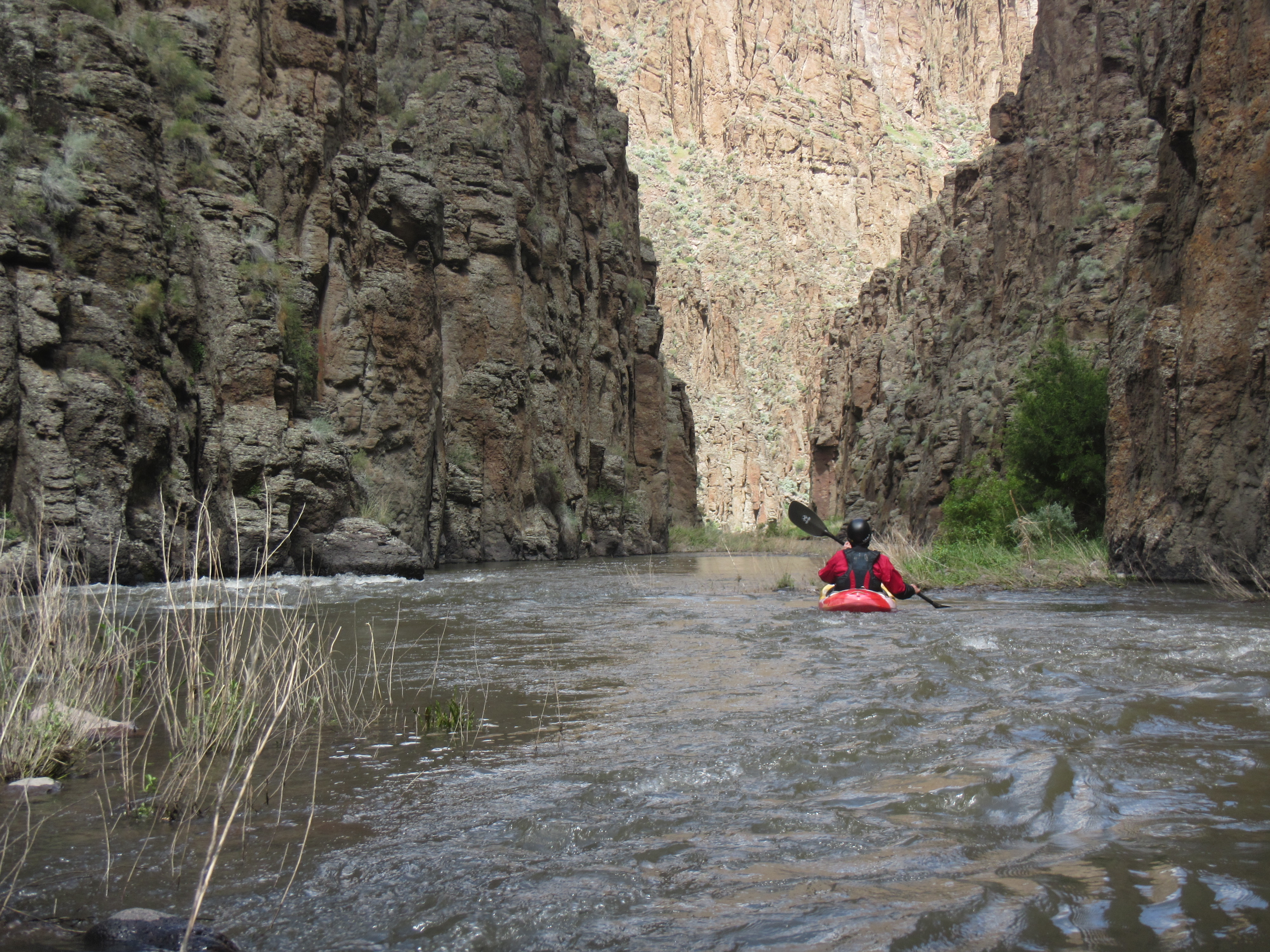
The willows wax and wane until mile 17 or so, when the canyon narrows. At mile 20 an obvious horizon line will be the class V rapid called Gushy, aka the Slide. Scout and portage left. A left side line opens up at higher flows, the right side may go at lower flows. One of the largest camps is 1/4 mile downstream around the bend on the right.
About a mile downstream a long class III occurs in a narr
...
After a sharp left bend, a narrow channel accelerates downstream on the right and dumps into a rockpile and willows. Move left from that channel when possible.
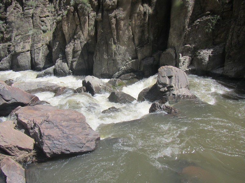
Congested class V drop. May be runnable on the right at low flows, or on the left at high flows.

Congested boulder pile and sieve, eddy right to scout or portage. Follows left bend.
There's lots of lovely class II and III out there
This is a long series of class III and IV drops on the Bruneau. Read and run for skilled paddlers, rescue would be difficult if skills didn't suffice.
Apr 16, 2017
I ran Marys Creek with three others in 2005. To my knowledge, this was the third and last descent. Over all, the willows were as bad if not worse than Sheep Creek. They were so thick and sturdy in one area that it was literally impassable, necessitating a portage. And I'm sure, like the other runs out there (Clover, Shp, EF, WF), this stream bed has seen substantial growth since.
As far as the run itself, the canyon looks much like Sheep above the confluence. The gradient is steeper and sustained though giving it the potential to have some of the best whitewater in the basin. All runnable. However, besides the willows, it would take an unusually high runoff event to provide enough flow to realize its potential. What looks to be more than enough water at the put-in proves low and terribly boat abusive downstream. Not recommended.
May 23, 2016
May 17-19, 2016, three of us Portlanders completed the run starting from the 4780 Simplot Ranch Bridge, South East of Grasmere, making the section of Sheep Creek ~31 miles in length. The Mary's creek confluence is ~10 miles downstream from where we launched. The first 18 miles of the run is willow-choked. We quickly learned how big of a willow patch we could just bust through. James' place (on GPS) is about 1 hour downstream from the launch and would make a good first camp.
The first class IV rapid is at mile 7 after a left bend. There are numerous class III and a few class IV rapids that are in the willows, meaning that they are claustrophobic and difficult to scout.
When the canyon walls get vertical and the channel is deeper, the willows abate. There is a class V named Slide or Gushy at mile 20, easy to recognize, portage left. This rapid is more runnable at higher flows. There's a camp on river right around the next right bend from here.
A couple miles downstream are a III and two IV's in the narrow gorge. Then the canyon opens up and the willows return. In the next gorge section at around mile 26 there is another class V-VI called Redwall, which comes after a left bend and where there is a sheer wall on the left. Portage on the rock pile on the right. The last eddy above the drop is small but if you are gutsy enough to go there the portage is short. It is possible to portage from the next eddy up which is larger and does not require a ferry above a class VI.
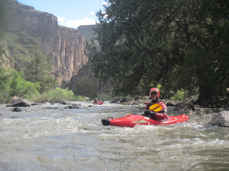
There is one more complex class IV below this point and lots of II and III before the confluence with the Bruneau. The Bruneau moves fast and we were able to paddle the 30 miles to the takeout at 1800cfs in under 5 hours. Fivemile rapid on the Bruneau is truly read and run for a class IV paddler who is comfortable in big water; very fun.
There are many small camp sites scattered throughout the run, but very few large sites. I would not attempt this run with a group larger than 4 boats, and I would not recommend bringing a raft because of the willows.
FLOWS
There is no gauge on Sheep Creek however you can estimate the flow by calculations. Subtract the West fork (Bruneau at Rowland NV) and 2x the Jarbidge flow (because the gauge is on one of two forks) from the Bruneau at Hotsprings flow. The remainder is ~60% Sheep creek and 40% East fork aka Clover Creek. Six hundred is a reasonable flow on Sheep. Sheep Creek and the EFB both run off earlier than the Jarbidge because they are lower elevation. Locals say that you can also run Sheep Creek on rainfall if the Bruneau is over 2500 on rain only.