Snake

I) Hells Canyon Dam to Pittsburg Landing(Hells Canyon)

Reach banner

River Description

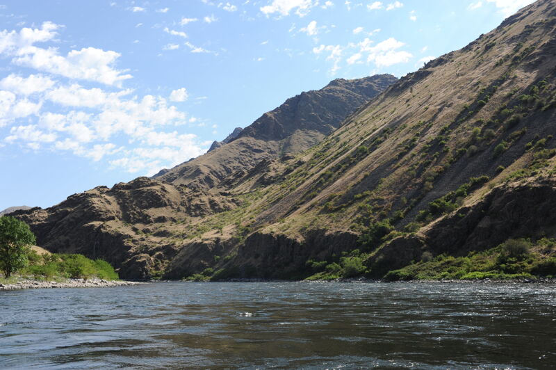
Hells Canyon is a jewel of the Snake River protected in 1975 when the Hells Canyon National Recreation Area was established to stop the construction of new, destructive dams that would have flooded the canyon. At the same time, the river was designated as a Wild and Scenic River, with 32.3 miles from the dam, downstream, classified as a wild river. Another 34 miles below that is classified as scenic. This historic conservation victory was realized shortly after construction of the Hells Canyon Dam complex upstream of the put-in that was completed between 1959 and 1967 and blocks upstream migration for salmon and steelhead and other species. In addition to burying great whitewater beneath the stagnant waters of the reservoirs, these dams eliminated great fall chinnook runs upstream to Shoshone Falls, and into tributary streams like the Boise, Payette, Malheur and Owyhee. The impacts of the upstream dams on the river are evident by the lack of beaches and heavily armored banks characteristic of a sediment-starved river.

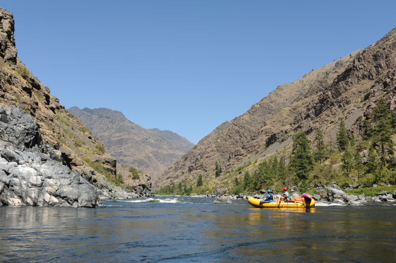
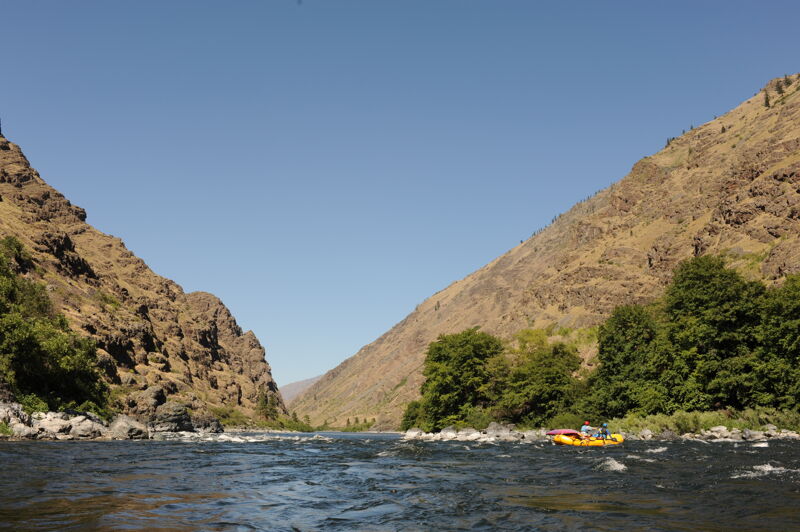
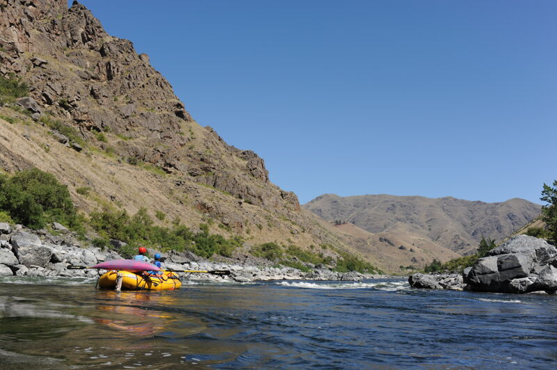
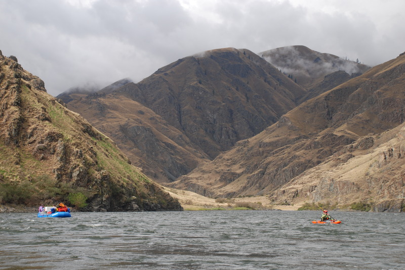
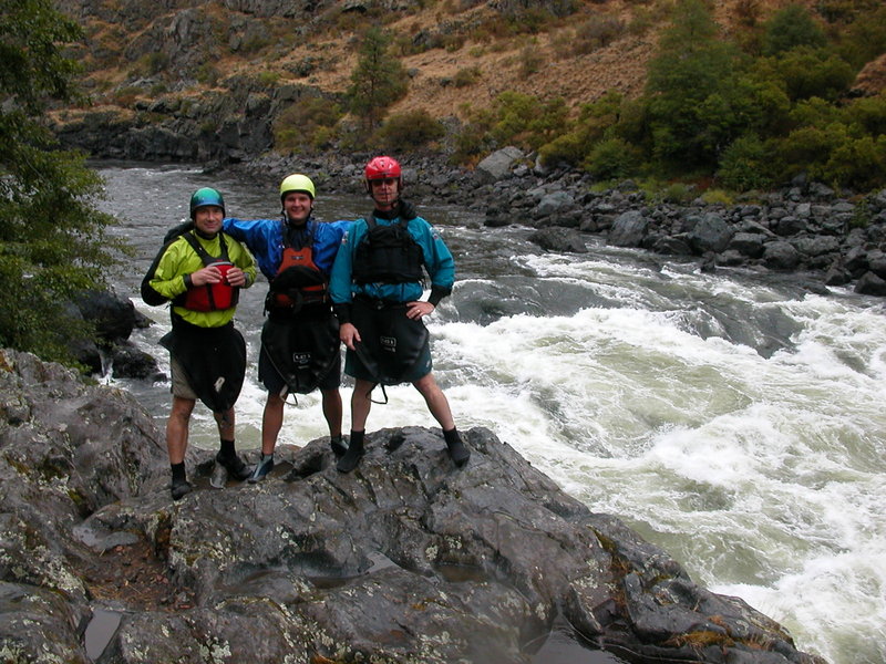
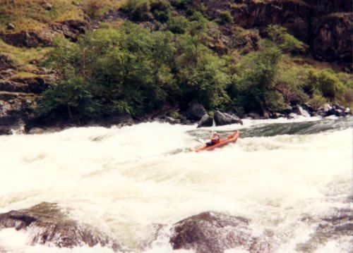
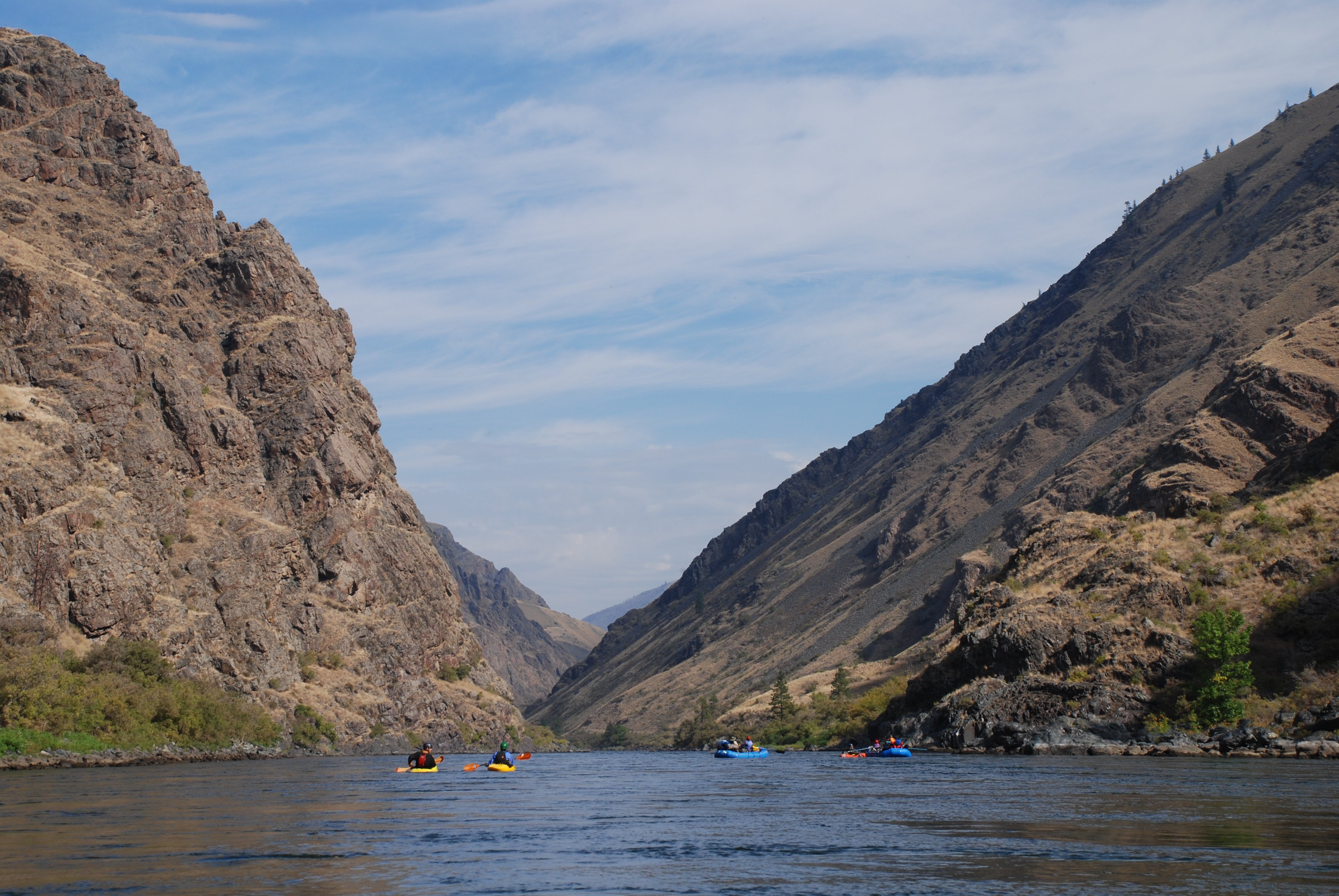
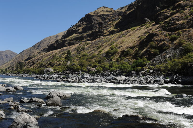
Hells Canyon is the nation's deepest river canyon averaging 5,500 feet below the rim for some 75 miles, and reaching depths of more than 8,000 feet below the Seven Devils Mountains on the Idaho side of the river. The result is a very scenic 3-4 day trip with a number of class II-III rapids and two class IVs. The Wild and Scenic Snake River Boater's Guide is available from the US Forest Service, giving detailed information on campsites, rapids, and regulations. A lottery permit season runs from late May to early-mid September. Before and after the lottery season, only a self issue permit is required and can be obtained for free at the launch site.

In addition to the whitewater and scenery the river has a rich human history. The Canyon is ancestral home of the Nez Perce people, and other tribes of the region were in and out of the canyon as well. White settlement occurred in the late 1800’s and early 1900s--sheep and cattle ranchers and pr

...

River Features

Hells Canyon Dam Put In

Distance: 0.01 mi
Hells Canyon Dam Put In

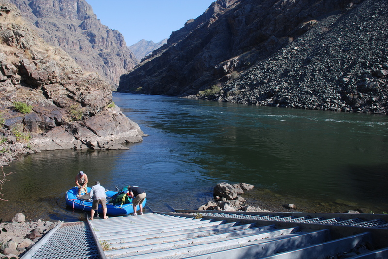
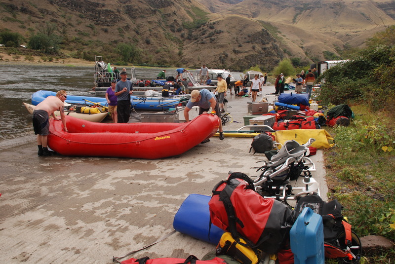
Access is at a ramp on river left just downstream of the dam. Trailers should go to the ramp just upstream of the raft slide (pictured) to unload pre-rigged boats and jet boats. Raft slide is great for those needing time to inflate and rig.

Cliff Mountain Rapids

Class: IIDistance: 0.26 mi
Rapid
Cliff Mountain Rapids

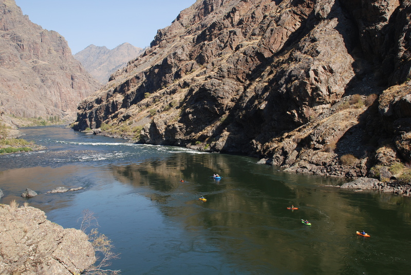
Easy rapid visible from the put-in. Located at USGS River Mile 246.7.

Rocky Point Rapids

Class: IIDistance: 3.06 mi
Rapid
Rocky Point Rapids

Located at USGS River Mile 243.7.

Wild Sheep Rapids

Class: IVDistance: 5.53 mi
Hazard
Wild Sheep Rapids

One of the big drops. It can be scouted from river left. Located at USGS River Mile 241.2.

Granite Rapids

Class: IVDistance: 7.72 mi
Rapid
Granite Rapids

One of the big rapids. Located at USGS River Mile 239.2.  Scout on river right just below Lower Granite Camp. Worth a look, especially over 19,000 cfs.

Three Creek Rapids

Class: II+Distance: 8.73 mi
Rapid
Three Creek Rapids

Located at USGS River Mile 238.2.

Upper Bernard Creek Rapids

Class: II+Distance: 11.71 mi
Rapid
Upper Bernard Creek Rapids

Located at USGS River Mile 235.2.

Lower Bernard Creek Rapids

Class: III+Distance: 11.98 mi
Lower Bernard Creek Rapids

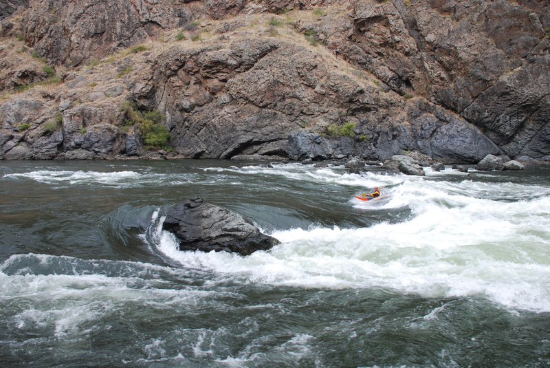
Great surfing for the kayakers. Located at USGS River Mile 235.

Waterspout Rapids

Class: III+Distance: 13.18 mi
Rapid
Waterspout Rapids

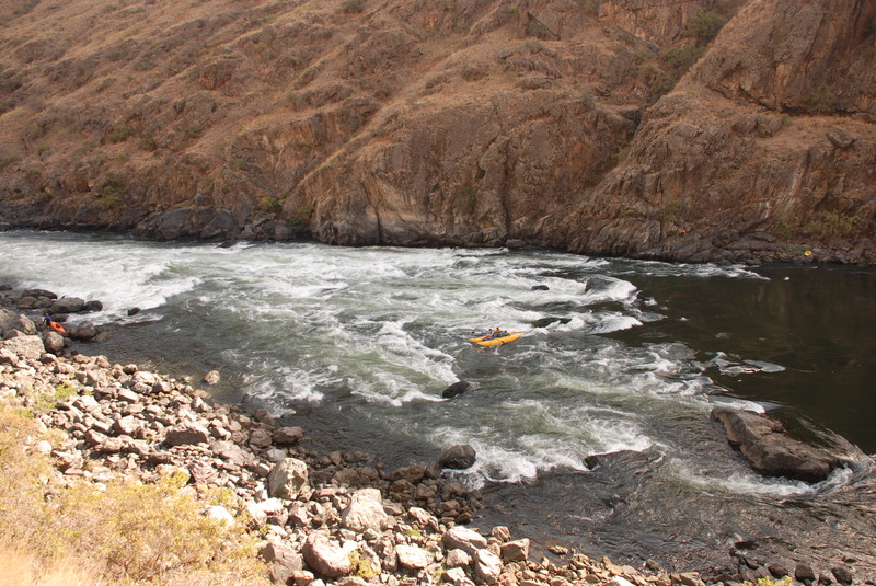
Look out for the big sleeper hole on the lower left; at low water Waterspout is run from center left and then driving hard right before you get to the bottom. Above 14,000 cfs options abound, scout for optimum fun. Scout from the trail on river right but beware of the rattlesnakes and poison ivy. Located at USGS River Mile 233.7.

Bills Creek Rapids

Class: II+Distance: 13.82 mi
Rapid
Bills Creek Rapids

Located at USGS River Mile 233.2.

Sluice Creek Rapids

Class: IIDistance: 15.17 mi
Rapid
Sluice Creek Rapids

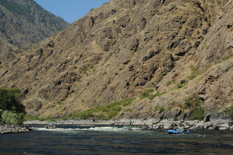
Located at USGS River Mile 231.7.  Clear wavetrain down the right. Great practice for Rush Creek just around the next bend.

Rush Creek Rapids

Class: III+Distance: 15.57 mi
Rapid
Rush Creek Rapids

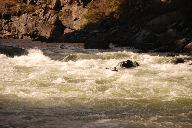
Similar character to Sluice Creek but with steeper gradient and a mid-river boulder at the top in the center that can form a boat-sized hydraulic behind the horizon line. Clear wavetrain down the right and a spicy option left of the boulder. Located at USGS River Mile 231.4.

Sheep Creek Rapids

Class: II+Distance: 17.34 mi
Rapid
Sheep Creek Rapids

Located at USGS River Mile 229.6.

Middle Kirby Rapids

Class: II+Distance: 28.16 mi
Rapid
Middle Kirby Rapids

Located at USGS River Mile 218.9.

Pittsburg Landing Take Out

Distance: 32.18 mi
Take Out
Pittsburg Landing Take Out

Take out on river right.


We picked up a cancellation permit for a quick three-day mid-week trip with just the boys and I. We came in late on Monday evening and Scotty's Outdoor Supply allowed us to park our van for the evening. It's the last stop for gas, ice, invasive species stickers and basic supplies. It's also where you make final arrangements and leave a key for the shuttle. We got up Tuesday monring and after settling up shuttle payment we drove the approximately half hour down to the put-in.

We got to the put-in below the dam around 9am, took our time rigging and were off by noon. We were on the water until about 4pm or so that included a break for lunch. We scouted Wild Sheep running the left line and Granite running the right to center line with no issues. Flow was about 10,000 cfs when we launched rising to 14,000 cfs by the time we got to camp. We found camp at Bernard Creek where we had a small patch of sand down on the beach that served as a camp. The flow continued to rise to about 16,000 through dinner before stabilizing.

When we got up on day two the water was down to about 8500 cfs and our raft was high and dry. We had it lightly loaded so it was no problem carrying it down to the shoreline. We were on the water by 10am. We were soon at Waterspout and did a quick scout at 8500 cfs from river left. The line entering center and then cutting hard right across the side curler to avoid the whole at the bottom worked fine. We continued down to Pine Bar for lunch and also made a stop at Kirkwood Ranch. We found camp by 4pm at Russell Bar which had a very rocky shoreline. The flow continued to rise throughout the day eventually peaking at 19,000 cfs by the time we were settled in at camp.

We once again awoke to a raft that was high and dry with morning flow at 8600 cfs. We were on the water from about 9:00 to 10:30, with the flow remaining lower, before reaching our take-out at Pittsburg Landing. We were the only group taking out on a Thursday morning although we encountered a couple of jet boats launching. We were all packed and on our way by about noon.

Our trip flows ranged from 12,000-20,000 cfs.  We scouted Wild Sheep, Granite and Waterspout. We launched around 2pm and got to Wild Sheep as waters were rising. Good fun there. But remember to bring Technu for all the poison ivy.

We got to Granite late in the afternoon and the rapid was juicing close to 20,000 cfs due to the dam release. Some flip potential at that level. The next morning we ran Granite in the 14,000-15,000 cfs range and it was a ton of fun.

Waterspout was also a blast.  Everything else was straight forward read and run; Rush creek has potential for a rowdy swim if you are not careful.

Jet boats are a huge impact, be prepared. Many do not abide by the river ettiquete, praise those who do.

Early October trip with staff and friends of Idaho Rivers United and American Whitewater. We spent 3 day and two nights on the river on a trip from Hells Canyon Dam down to Pittsburg Landing.

MH
Mike Harmon

Sep 23, 2005


Granite rapid on the snake river hells canyon stretch. Water was low, waves were still big!

WR
Will Reeves

Jun 15, 1995


Brian did this tailstand on purpose.

RB
Ratt Boy

Jan 1, 1900


Copyright Randy Clark.

Randy says: 'The smooth green water behind the boat is the top of the 'Green Room.' It is literally a room-sized hole with green walls. Few boats get through the Green Room without flipping and most boaters avoid it.'

WR
Will Reeves

Jan 1, 1900


Sheep Creek is a tiny tributary that flows into the Snake. Boaters can carry up and run parts of the creek down to the Snake River.