Snake
J) Pittsburg Landing (or Salmon) to Heller Bar
| Difficulty | II |
| Length | 47.4 mi |
| Avg Gradient | n/a |
| Permit | Scenic River Reservations – from Pittsburg Landing and Dug Bar – are required for the issuance of a trip permit on Fridays, Saturdays, Sundays and Holidays during the primary season. These reservations are not made through recreation.gov and must be reserved by calling the Clarkston Forest Service office at 509-758-0616. The permit will be mailed to you along with boat tags. Scenic River launches Monday through Thursday (except Holidays) do not require an advance reservation and can be self issued. Self-issue permits must be completed at a permit station at Pittsburg Landing or Dug bar. |
| Gauge | Snake River at Hells Canyon Dam Id-or State Line |
| Flow Rate as of 518 days | 21900 cfsstale data |
| Reach Info Last Updated | March 17, 2023 |
The Lower Salmon is a very special place, located downstream of the iconic whitewater town of Riggins, Idaho. Paddlers typically take 4 days to traverse the canyon, which is a prime example of the Canyon Grassland ecosystem. While most similar rivers are protected as Wilderness or Wild and Scenic [...]Read More
Encompassing 250,000 square miles, the Pacific Northwest’s Columbia and Snake River system represents a vast network of rivers that have served as the foundation for transportation and commerce in the region for many centuries. Before dams were constructed on these rivers, up to 16 million wild salmon returned to [...]Read More
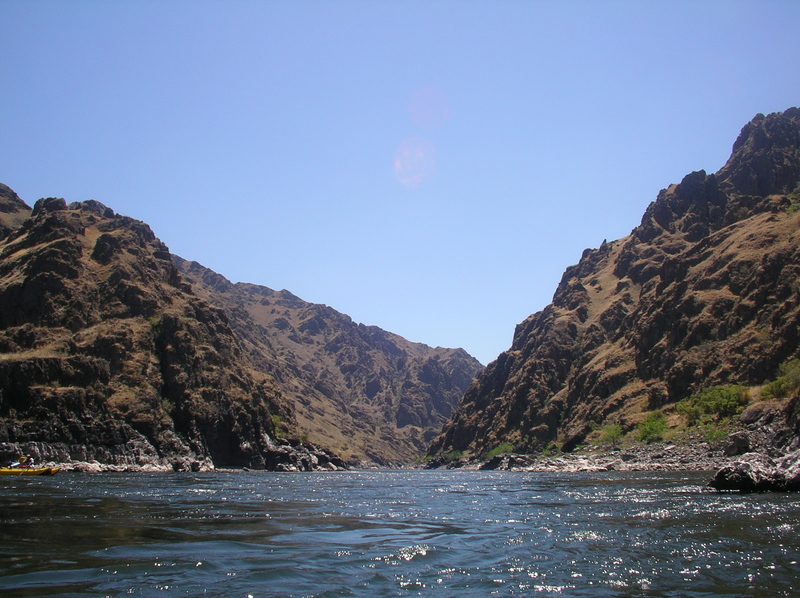
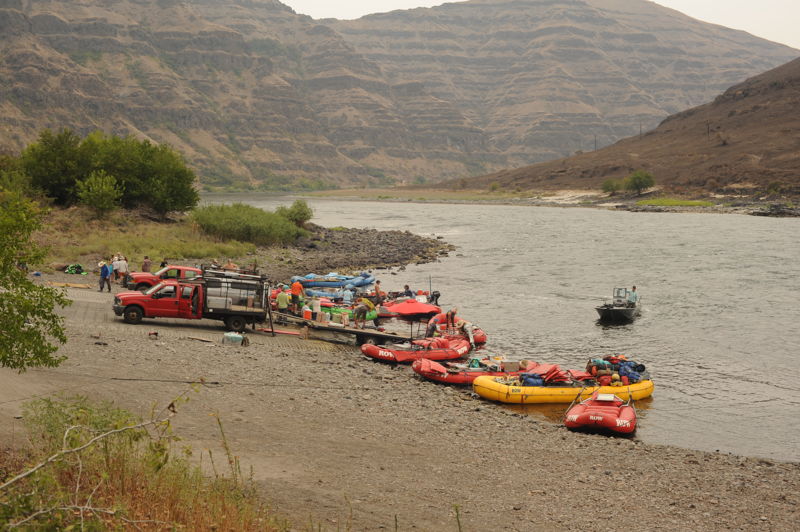
This is the last section of the Snake regularly used by whitewater boaters. Those who boat this section will be either heading downstream from Pittsburgh Landing which is the traditional take-out for Hell's Canyon trips or coming from the Salmon River where it joins the Snake.
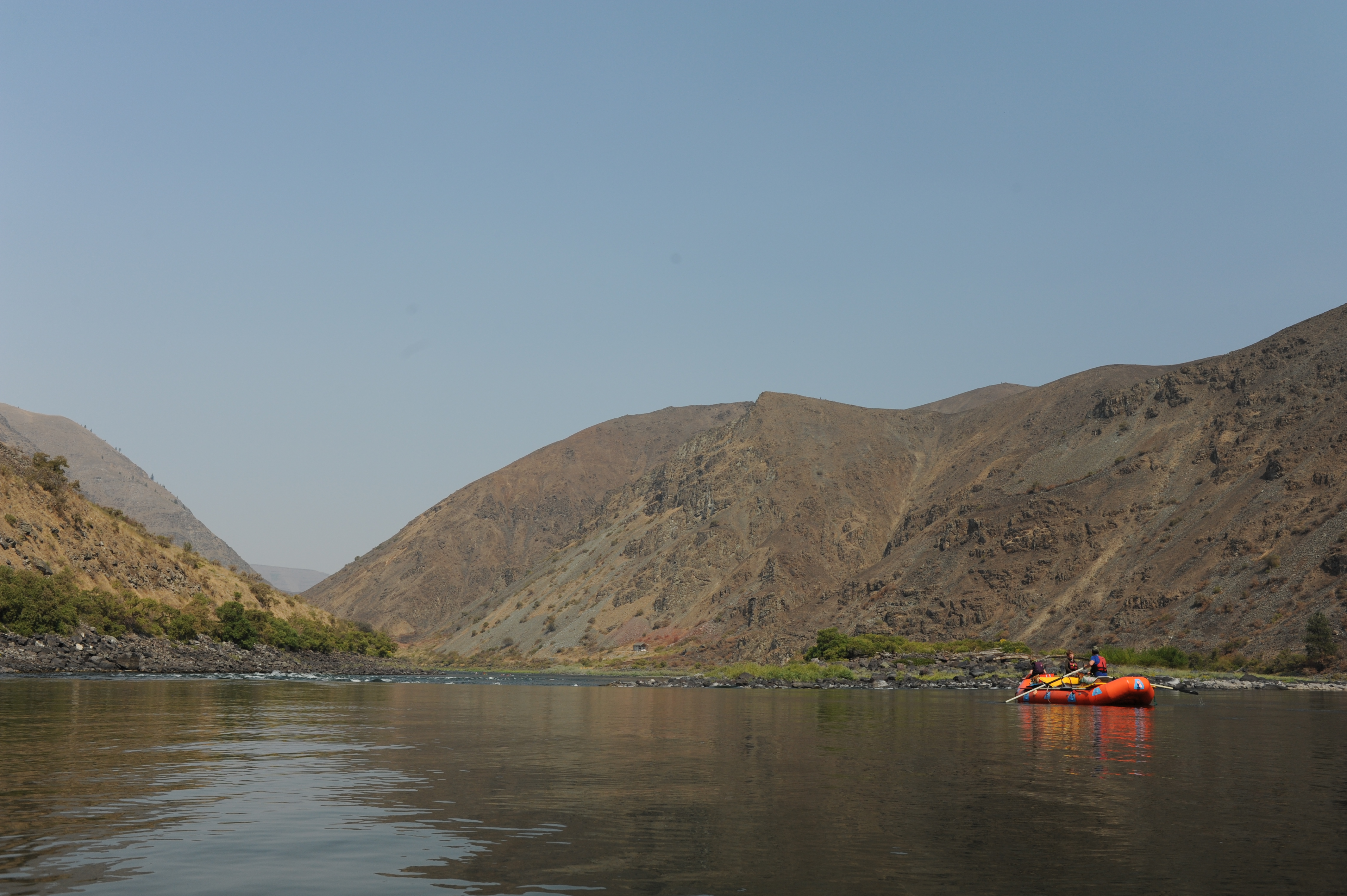
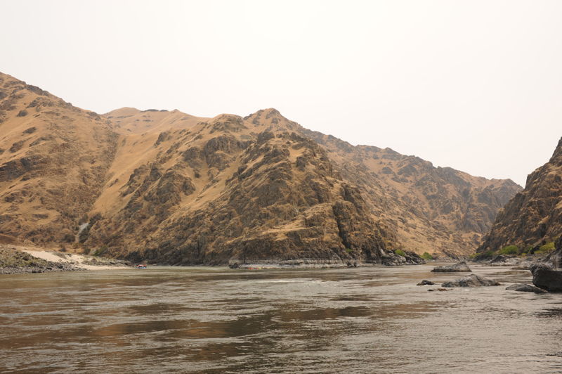
This lower section of Hell's Canyon has some beautiful scenery and great beach camping especially downstream of the Salmon River confluence. You will be sharing the river with jet boats which during the peak of the summer season will always be in sight and particulary on weekends. There are several fun bigwater class II rapids with a couple featuring some great wave trains. There are also some long flat stretches that can be a lot of work in late summer when flows drop and especially if an up canyon wind impedes your progress.
Logistics
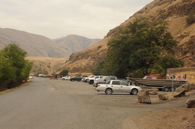
You have a couple different options for this trip. You can start from Pittsburg Landing on the Snake River located at river mile 215.0 (or if you are on Hell's Canyon trip just continue on downstream). This trip is also done as an extension of a Lower Salmon trip since there is no road access where the Salmon joins the Snake at river mile 188.2. Although there are a couple private ranch roads, the next public access to the Snake is just downstream of the confluence with the Grande Ronde on river left at river mile 168.7. This is the public boat launch at Heller Bar which also has overnight parking and requires a Washington State Discover Pass.
Groups who began their trip on the Salmon River join the Snake River at the confluence. This site has an interesting and important conservation history. In the 1960s Washington Public Power had plans to build a dam directly downstream of the confluence at the Nez Perce Site. Pacific Northwest Power had a competing application for the High Mountain Sheep Site, a mile upstream from the confluence. The Department of Interior had their own plans for a federal project. On June 5, 1967, the U.S. Supreme Court issued its landmark decision in Udall v. Federal Power Commission, which temporarily prevented construction of a dam and stipulated that hydroelectric projects under the Federal Water Power Act, must consider the 'public interest' in their decisions. The decision represnted a turning point in the interpretation of the Federal Power Act to consider environmental consequences of proposed hydropower development. The decision also resulted in delay that gave groups time to advocate for the conservation of Hells Canyon through a prohibition on additional hydropower development with the establishment of the Hells Canyon National Recreation Area in 1975; this legislation included designation of the Wild and Scenic Snake River.
Take-out on river left administed by Washington Department of Fish and Wildlife (requiring a Washington State Discover Pass) that serves trips coming down the Snake, Salmon, and Grande Ronde.
Jul 8, 2022
Snake River segment of a trip that began on the Salmon River. We paddled onto the Snake at about 2pm in the afternoon and made it a couple hours downstream to a nice beach camp. We were up the next morning and on the water by 9am. We were at Heller Bar by 2pm. It required some work to row the flats but we had no wind.
Jul 23, 2005
Retreat with the Hydropower Reform Coalition that included a night on the Snake River as a continuation of a Lower Salmon trip that ended at Heller Bar.