Merced
7) Merced Falls to Snelling Diversion Dam

| Difficulty | I |
| Length | 3.5 mi |
| Avg Gradient | 2 fpm |
| Gauge | Merced River Below Merced Falls |
| Flow Rate as of 20 days | 1930 cfsstale data |
| Reach Info Last Updated | June 8, 2022 |
This is a very pretty section that has dependable irrigation flows through the summer. It is mostly flat water paddling, but there is steady current for the first half of the trip. There are two small riffles early on, then one nice class 1 rapid near the halfway point. The last one third to one half of the trip is on the slow water impounded by the Snelling diversion dam.
Highlights of the trip are the interesting scenery and frequent sightings of osprey, herons, egrets and various waterfowl.
The total on water distance of the trip from Hornitos road to Snelling Diversion dam (Crocker Huffman dam) is about 3.4 miles. A portage around the left side of Merced Falls dam is about 1/10 of a mile.
Put in:
Launch at large turnout next to the Hornitos Road bridge, on the north side of Merced Falls forebay. Paddle down and across the lake to the left side of the Merced Falls dam. Do an easy but fairly long portage around the end of the dam and back to the right side where the river emerges from the small powerhouse.
Take out:
As you approach Snelling diversion dam, (officially called the Crocker-Hoffman Diversion Dam), stay to the far right, especially at higher flows. Take out on the bank to the right of the dam and carry a couple hundred yards to the Crocker-Hoffman Dam fishing access parking area. Alternatively, portage the dam with some difficulty and take out a few hundred yards downstream where the highway comes close to the river.
Other Information Sources:
Merced River Hatchery can be open to the public, weekdays from 8 AM to 5 PM. They raise salmon and steelhead. However, the drive in is a couple miles of rough gravel road without direction signs. The fish pens are locked up and there may not be anyone there unless you call ahead. It is easier to paddle across the river from the take-out, especia
...
This large parking area provides flat water boating access as well as fishing access near the base of McSwain Dam. Follow the road on the north side of Merced Falls Reservoir, but turn right to the access just before the McSwain Recreation Area entrance.
The junction of Hornitos road and McClure road has a large area for parking. There is a primitive boat ramp on the east side of the road.
The portage can start pretty close to the edge of the dam. There is a flattish spot in the reeds, just upstream of a fence guarding the dam. Carry over the levee, then down a steep bank. Follow vehicle path along the base of the dam to an easy put in.
Below here the river is wide and mostly flat, but usually with steady current. At high summer flows there are two riffles in this first half of the run. At low flows a couple more small riffles are revealed.
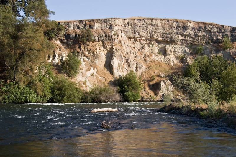
The rapid starts by dropping down to the left towards the cliff. The cliff pushes the flow sharply back around to the right. A few boulders along the bank increase the interestingness. Novice kayakers or canoers without any boat control at all, could easily tip here. Those with even modest experience should find this an enjoyable change from the flatwater.
Kayakers with small playboats may find some play action in the eddylines and in the rapid itself.
This rapid is easily scouted on river right.
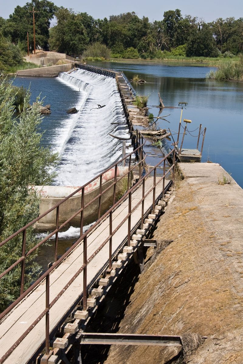
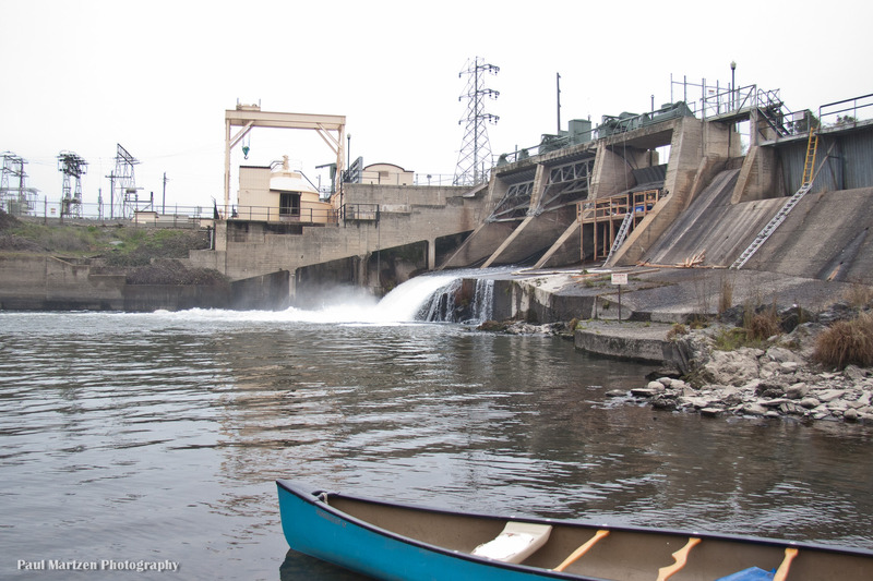
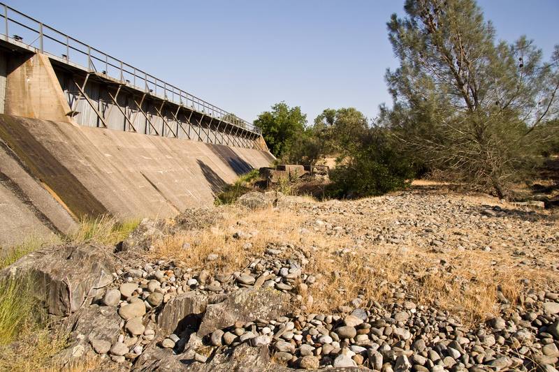
This long low dam is visible from above as a wide horizon line across the reservoir. Paddle over to the far river right to take out or portage. From the dam to a parking area is about 1/4 mile of walking.
To portage, either
Go over the berm and bushwack to the river.
Lower boats down the face of the dam.
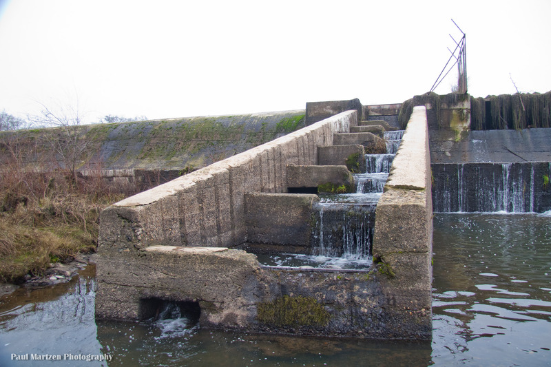
Walk down the walls of the fish ladder, visible as a low angle ramp.
Typically very little water is released over the dam into the river. Most of the water in this reach is diverted into the Merced Main Canal, just upstream on river left.
Jul 23, 2008
The put in that we used is next to the Hornitos Road bridge, on the north side. There is a big turnout for parking. Most of the bank is very steep, but there were a couple spots low enough for easy launching of our canoe. There is a boat ramp down to the water on the east side (upstream side) of Hornitos Road, but somehow we missed it on this day.
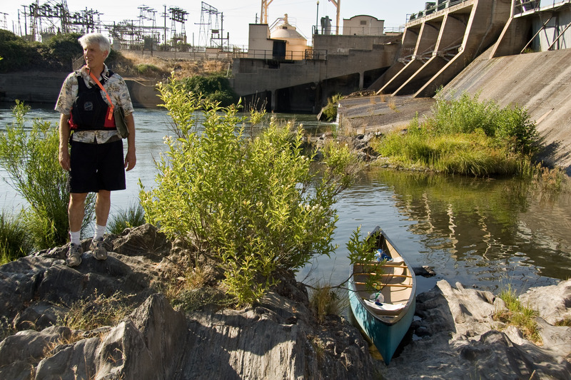
The McSwain powerhouse dumps into the upper end of this small reservoir, so there may be playboating potential near that outflow.
Jul 18, 2008
Looking north across the top of the Crocker-Huffman diversion dam. A cat walk extends all the way across the dam. You can take out on river right (the far side in this photo) and walk 1/4 mile to a fishing access parking lot. One can also portage on the river right side also. The long ramp visible on the other side of the dam is an old fish ladder. The walls are 12 inches wide and can be walked down. Otherwise lower boats down the dam face, or carry over the berm and bushwack to the river.