| Difficulty | II |
| Length | 40.4 mi |
| Avg Gradient | n/a |
| Reach Info Last Updated | December 4, 2010 |
River Description
This reach, also known as the 'South Fork' by locals, flows through a secluded canyon downstream of Palisades Reservoir.
River Features
Put In
Access PointDistance: 0 mi
Take Out
Access PointDistance: 43 mi
Trip Reports
Log in to add a reportTC
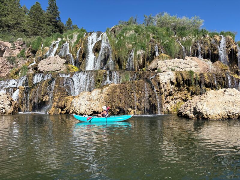
Fall Creek Falls - Tyler Clark
Jun 16, 2026
We were in the area running Alpine Canyon on the Snake. This was a change of pace on our last day, some stress free flat water with a view. We did a very short stretch of this section of river (1.7 miles) to be able to get the full view of Fall Creek Falls. I would suggest it if you are in the area and have a couple of hours. We put in 0.3 miles above the falls off of Snake River Road and took out 1.4 miles down river from the falls at Spring Creek Boat Landing right before the highway bridge.