St. Joe
5. Skookum Canyon: Turner Creek to Packsaddle(Skookum Canyon)
| Difficulty | III+ |
| Length | 4.6 mi |
| Avg Gradient | n/a |
| Gauge | St Joe River at Calder, Id |
| Flow Rate as of 41 minutes | 844 cfsrunnable |
| Reach Info Last Updated | March 2, 2023 |
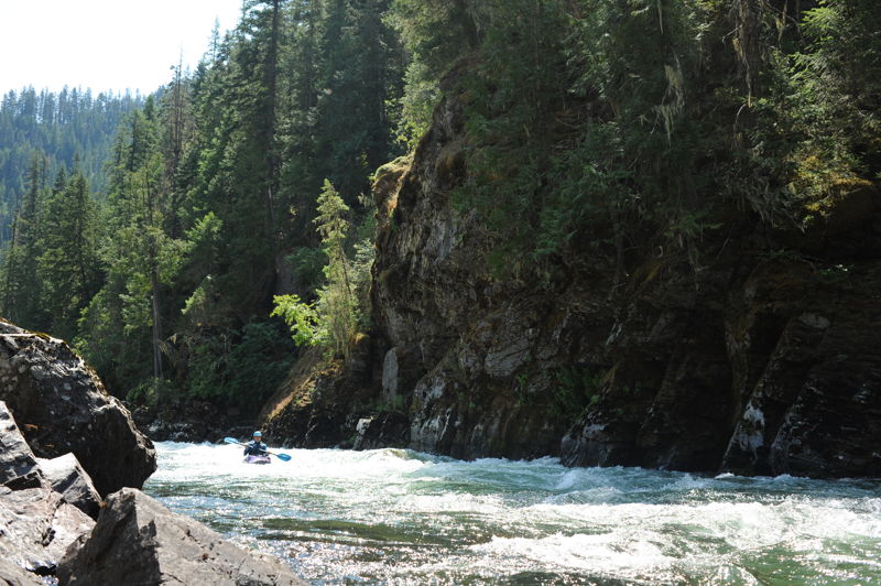
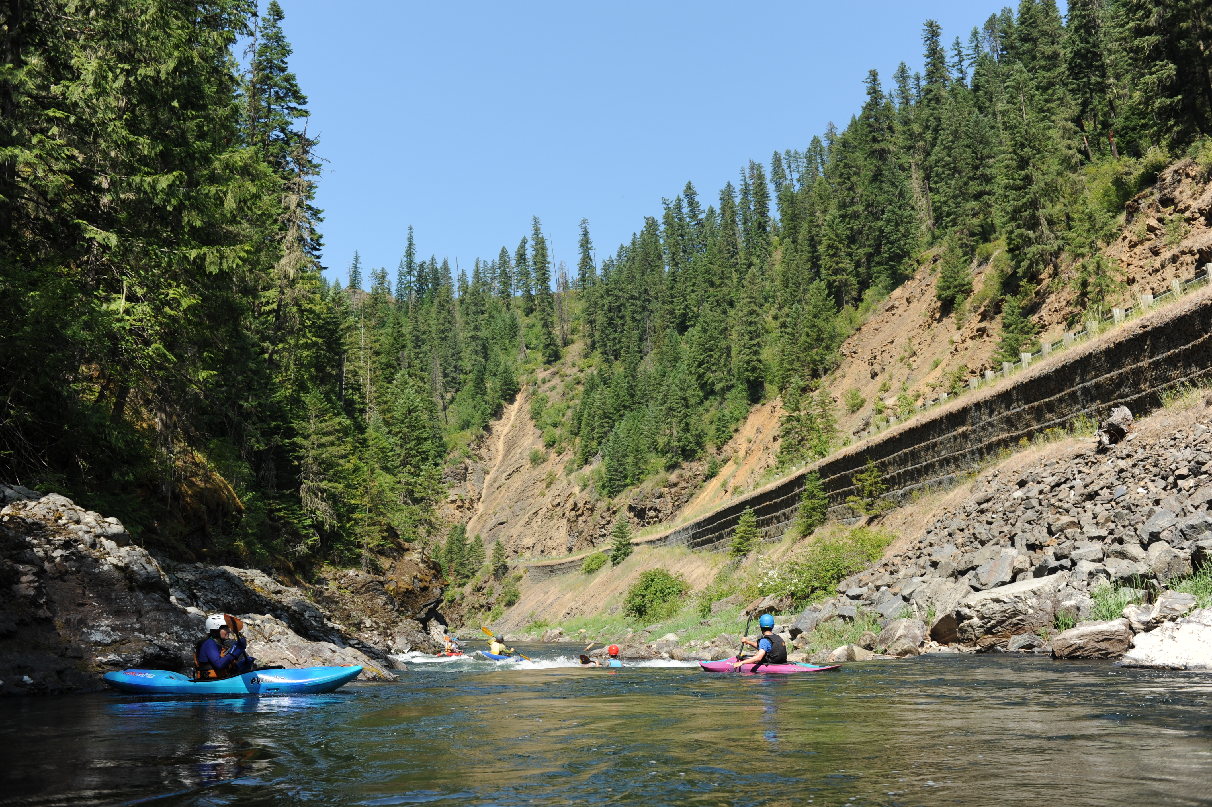
The run begins from Bird Creek Boat Launch or Turner Flat Campground and the first two miles are relatively flat with occassional riffles. Once you reach the obvious horizon line marking the entrance to Skookum Canyon the action begins. The two most significant drops are at the start but the action continues for the next mile down to Sisters Creek, an intriguing tributary that enters from river left and a side canyon that invites exploration. While this run is short, it is a fun hour long adventure when you are looking for a quick hit with easy logistics. Highway 50, a paved two-lane road parallels the entire run although the guardrail partially obscures the view into Skookum Canyon. At low flows this river becomes more class II.
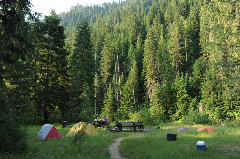
The Turner Flat Campground (Highway 50 mile 55.9) features 10 camp units, 1 group camping area to accommodate up to 15 people, potable water (June-October), and vault toilets. Sites 2, 3, and 4 are interconnected and include the group camping area with a field that has a few tent sites for a group. The rest of the campsites are in the forest. River access for rafts or kayaks is easy here. If the campground is full, kayakers can access the river near the upstream exit of the campground at the Trail 17 bridge (Highway 50 mile 56.4).
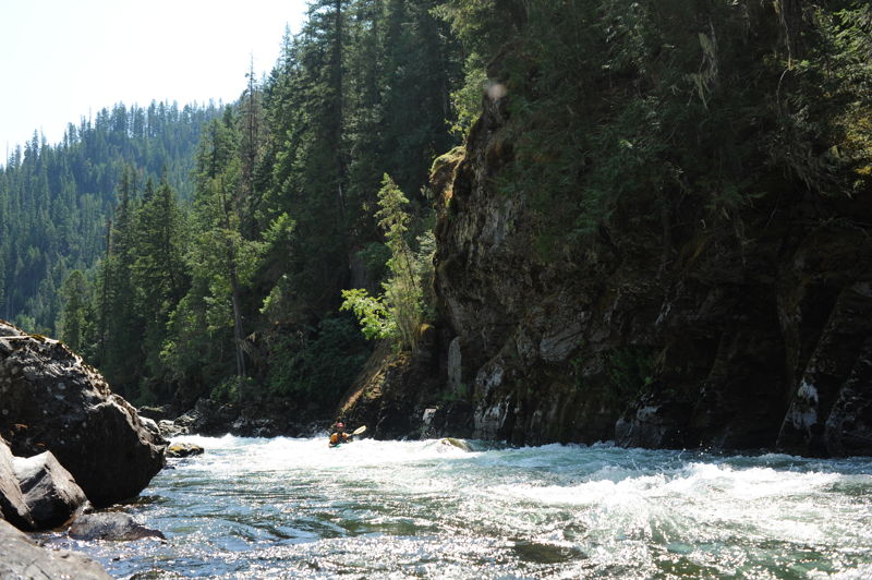
The entrance to Skookum Canyon is marked by an obvious horizon line (visible from Highway 50 mile 53.6). The most significant drops come at the start and then the action gradually tapers off over the next mile.
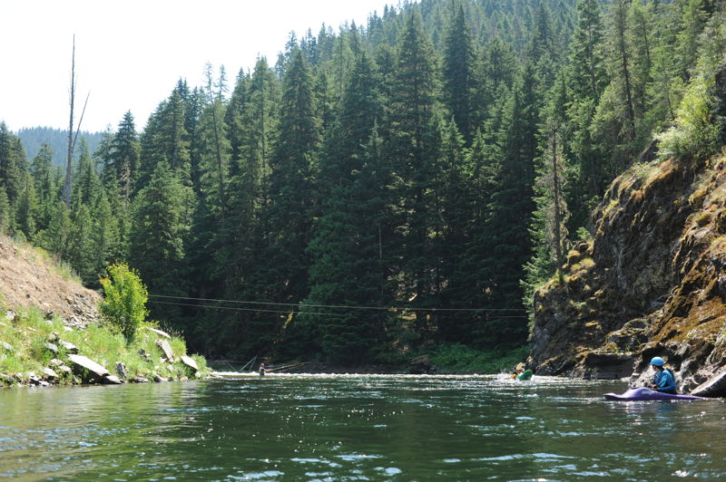
The end of the whitewater is marked by a cableway that crosses the river. A pull out here at Highway 50 mile 52.5 serves as an alternate take-out for kayakers who don't want to paddle the remaining flatwater down to the campground. It does require a short climb up the bank to the highway.
Located at Highway 50 Mile 51.4. This Forest Service campground offers two camp sites, a vault toilet, drinking water (June- October), and a dedicated boat launch area immediately downstream of the first campsite. Parking is available on a pullout along the highway at the upstream exit of the camgpround near the toilet.
Jun 30, 2022
After spending most of our day on the North Fork, we decided to hit up Skookum Canyon in the evening as it was close to the area we were planning to camp. We put in slightly below the marked put in and we took out slightly below the marked takeout, it didn't seem to change the run much. We worked our way through the flatwater and soon came to the first and only real sequence of rapids on the run. The rapids themselves were straightforward class III wave trains with a couple decent holes and ledges to boof around the sides. There were two or three rapids that boasted a class III rating before tapering off to class II busywater for the next half mile or so. The creek mentioned at the end of the rapids did invite exploration however we were on the wrong side of the river by the time we had noticed the canyon passing by. After another good stretch of flatwater we passed the standard pullout and finished the run shortly downstream. At the flows we ran we would not consider this run to be much of a class III but it was still a nice adventure.
Jul 2, 2021
We stayed at Turner Flat Campground and did this run twice as an evening run on 6/29 at 1250 cfs and a morning run on 7/2 1100 cfs. Flows were great for a class III experience through a mile of whitewater in Skookum Canyon that we enjoyed with our kids. We pulled out at Sisters Creek and hiked up the side canyon a few hundred yards.