Stanislaus
Camp Nine to Parrot's Ferry
| Difficulty | III |
| Length | 9.3 mi |
| Avg Gradient | 31 fpm |
| Permit | No permits are needed for this section. |
| Gauge | Stanislaus at Camp Nine |
| Flow Rate as of 1 hour | 633 cfsbelow recommended |
| Reach Info Last Updated | July 21, 2014 |
The fight to stop the construction of New Melones Dam and to save this section of the Stanislaus failed, but it did lead to the founding of Friends of the River and a strong river conservation movement in California.
When the reservoir drops low enough to reveal parts of this river, it is worth paddling again to experience the beauty that is still there and to contemplate what it was once like. Monitor the reservoir levels at New Melones on the CDEC website. Compare the reservoir elevation with the elevation markers on the map tab, to get an idea of how much river you can paddle at that level.
Put in: Elevation at the powerhouse is about 1080 feet. There is plenty of parking at the end of the road near the new powerhouse, however access to the river in this area could be difficult for rafters. There are use trails that provide reasonable access for kayakers. There is an old railing system for sliding rafts down to the water next to the remains of the old Camp Nine bridge. This is about 1 mile downstream of the end of the road and there are several rapids in between.
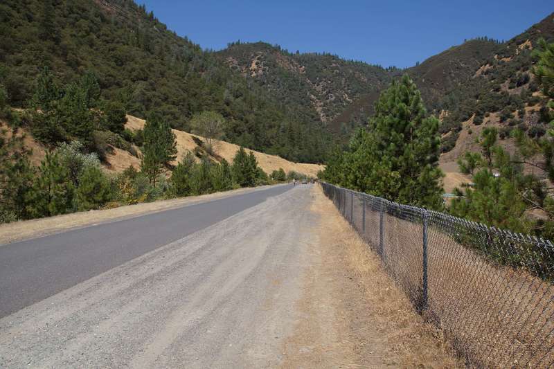
The Camp Nine road is a one lane, paved, heavily patched, twisty road that is not county maintained. Allow extra time for this drive. The junction with Parrot's Ferry road is not well marked.
Take out: The old Parrot's Ferry Bridge is just above 800 feet elevation. However, this road is gated at the top, so it is about 3/4 of a mile to hike up from the reservoir to the highway. There is space for quite a few cars near the gate at the junction of the old road with the new road. The old road down to the old bridge is reported to be in very poor condition due to lake wave action. The chief park ranger at New Melones wrote, 'Paddlers may hand carry boats and equipment from Parrotts Ferry up to the road, but the access gate will not be open to vehicular traffic this se
...
Just before the gate to the Stanislaus powerhouse, there is a fenced area with lots of parking. There is also a building with pit toilets nearby.
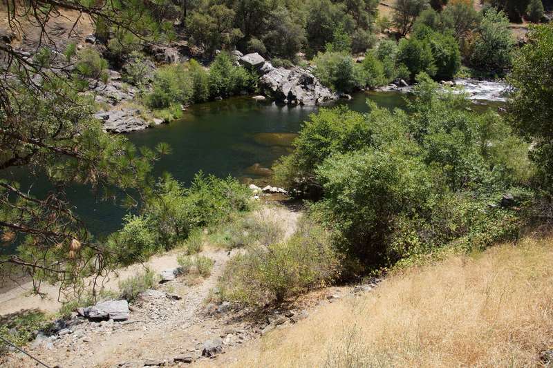
Steep use trails lead down to a nice beach. Looks like the easiest put in spot at this time. There is one rapid just upstream.
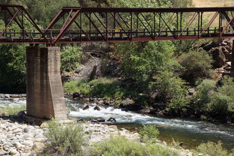
An old rusted pedestrian bridge crosses the river. A nice looking rapid runs underneath.

Compare this marker with reservoir elevation to estimate how much river is exposed. When the reservoir is this high, storage is 1,867,000 acre feet.
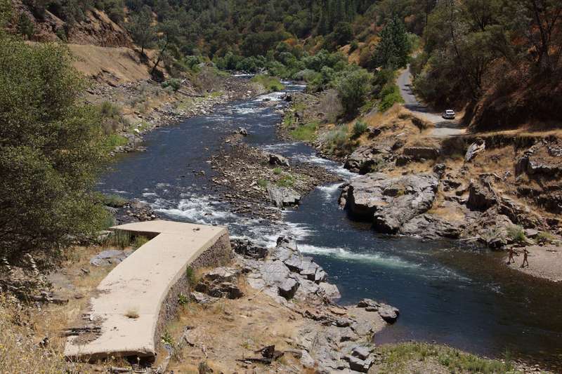
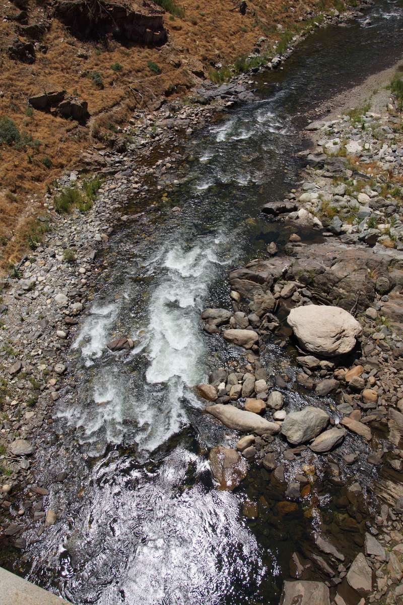
Concrete abutments on each side are all that remain of the old Camp Nine Road bridge. There is now a nice rapid at this location. A low head dam that used to be just upstream is now also gone. This allows boaters to float nearly an extra mile of river upstream.
On the downstream side of the bridge remains, are 3 raised rails leading down to the water. These look like rails for sliding rafts down to the water.
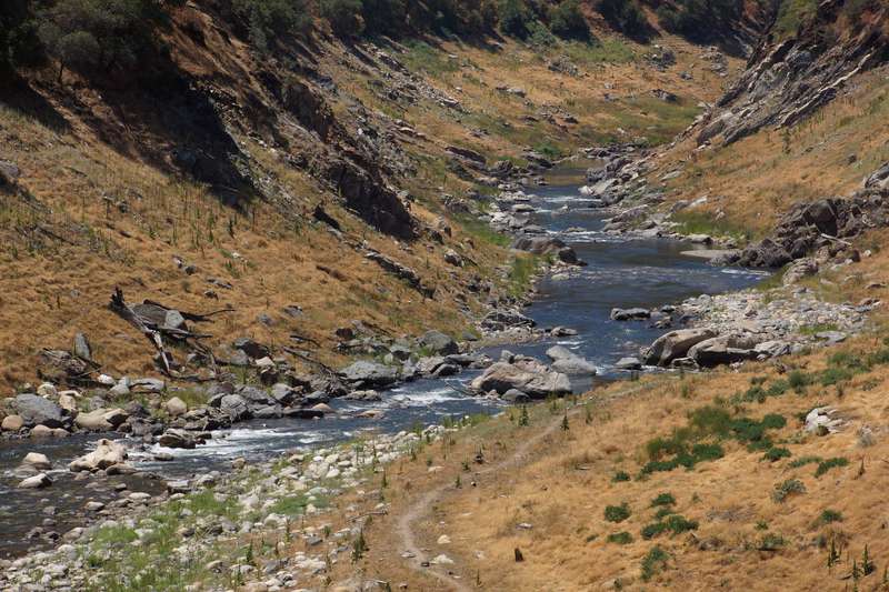
A series of very nice looking rapids are revealed as the reservoir drops past the new Camp Nine Bridge.
Elevation of the river is about 960 feet at Rose Creek.
The Camp Nine Road is still close by, but about 600 feet up a very steep hill.
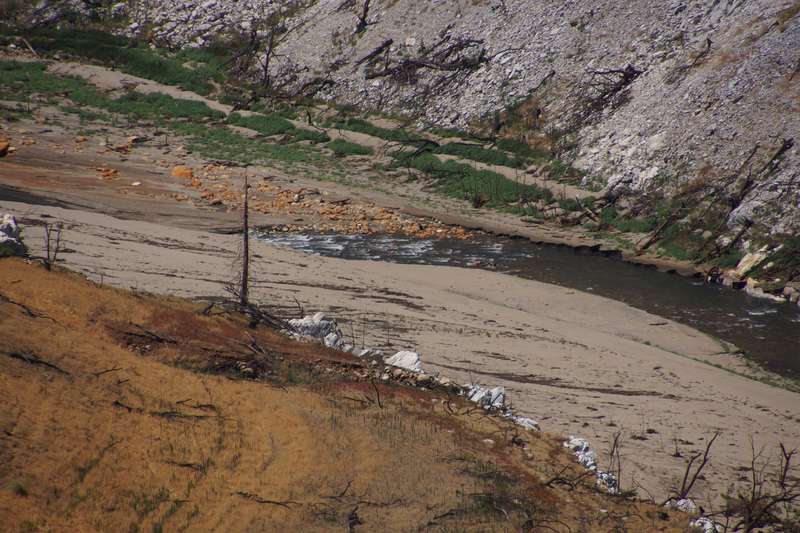
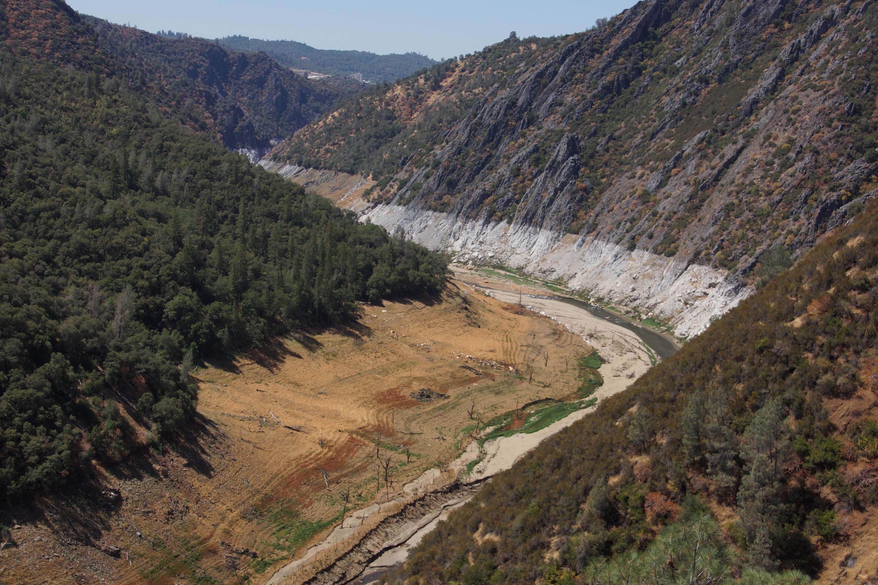
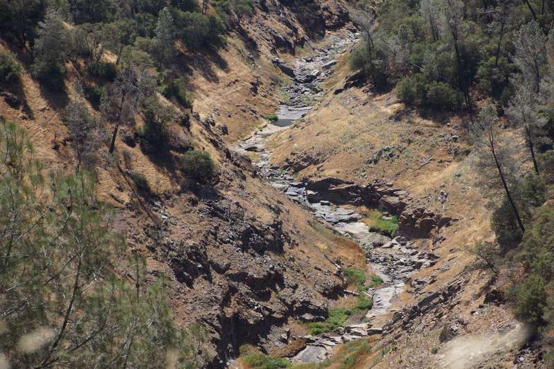
This is the last rapid that is visible looking downstream from high on the Camp Nine Road. It shows that the river has mostly cleaned out the silt from the channel up to and past this point in 2014. When the reservoir is low, the river will steadily clean silt out of the channel.
The South Fork Stanislaus confluence is just upstream of the 880' elevation mark.
This bridge is submerged in the reservoir and only appears when the reservoir drops to about 800 feet elevation. The old road down to the bridge is in rough shape and is gated at the top. The hike up to the gate from the bridge is about 3/4 mile.