School Creek
Luxemburg: Hwy.64 to Hwy.64 (4.6 miles)

| Difficulty | I(III) |
| Length | 4.5 mi |
| Avg Gradient | 21 fpm |
| Gauge | Dutchman Creek at Hansen Rd at Ashwaubenon, Wi |
| Flow Rate as of 1 hour | 2 cfsbelow recommended |
| Reach Info Last Updated | June 14, 2026 |
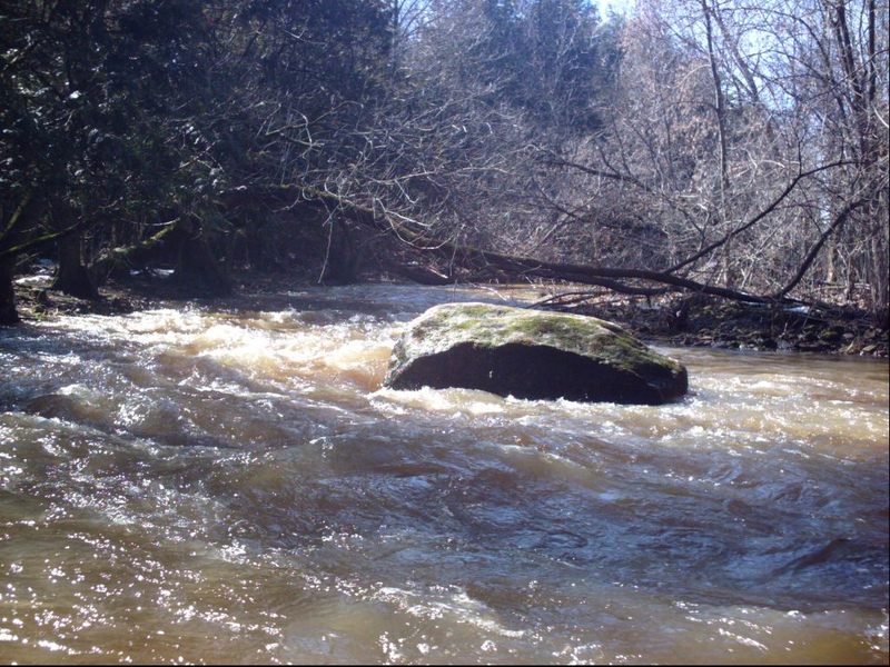
**Quick Facts:** Location: approximately 17 miles due east from Green Bay. Shuttle Length: 3.7 miles Character: **Very scenic** rocky outcroppings, cedar trees, a couple side-stream waterfalls (when wet); **fairly continuous class I-II**, with a fine ledge drop (II+/III-) at the edge of a golf course. Put-in is approximately 755' elevation. Take-out is approximately 657' elevation. Thus total elevation change is approximately 98'. **General Overview** The overall gradient of this reach would suggest decent whitewater would be likely. Indeed, from behind the private properties on School Creek Trail, down to County Highway A (Main Street) to Valley Road (and slightly beyond) the creek is almost continuous class I-II boogie. A few areas will require a bit of navigational skills, but (with adequate flow) the stream is generally wide, farily clear of fixed obstacles (rocks), and free of deadfall or snags (at least as of spring, 2010), so it makes a very fine and scenic novice whitewater float. The most difficult or 'tricky' spot on the run is right at CTH.A (Main Street). As the creek passes under the final bridge in North Brook Country Club, there are a few waves leading into a nearly 90-degree left-hand bend, down a short (1-2') ledge, followed immediately by a 90-degree right-hand bend leading into a vertical-walled 'dells' as the stream passes under the road. This area could prove difficult for beginner/novice boaters. (I would highly recommend people in canoes or recreational kayaks may need to back-paddle and try to be out of the strongest flow (head to the inside/right-side of the right-hand bend) to slow their craft, to keep from being pushed into the left wall of the dells under the highway.) Minor play (for more skilled boaters, in proper whitewater craft) may be possible at the golf-course bridge (just upstream), but virtually no play seems likely at the main ledge at most flows. There may be another spot or two which could allow minor play at some (high) f
...
At our listed put-in, drainage is about 22.7 square miles (as calculated by USGS StreamStats 4.0 Beta software). By our take-out, it is 27.4 sq.mi. (an increase of 21%).
Our 'reference gauge' is Dutchman Creek at Hansen Road (about 18 miles WSW), with drainage at gauge of 26 square miles. Thus, *IF* watersheds are similar, and are hit fairly similarly by rains, flow on School Creek *could* be quite similar to the reading on that gauge.
Shoulders along this road are barely adequate for parking. A couple 'stubs' (driveways to defunct homesteads or to fields) are nearby, but usage of them may bring problems. For that reason, we recommend the listed put-in. While it adds nothing but flatwater, it offers far better parking on wide shoulders of a state highway.
There is a cul-de-sac at the first property on this road, but the road extends a good distance parallel to the creek. IF permission to carry to the creek can be obtained from any property owner along this stub road, you could put in at the beginning of the gradient on this run.
However, since the run is not that long, even using the listed put-in, we prefer not bothering private property owners when it is not necessary for access to the run.
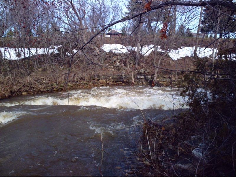
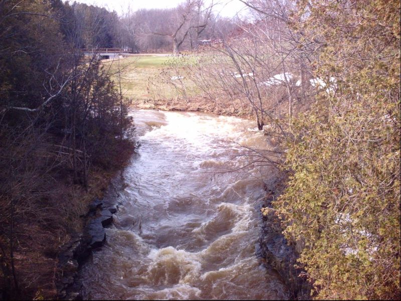
Note: the above photo is from the lower half of the run (I.E., not from this location) but typifies the scenery which can be found all along this run.
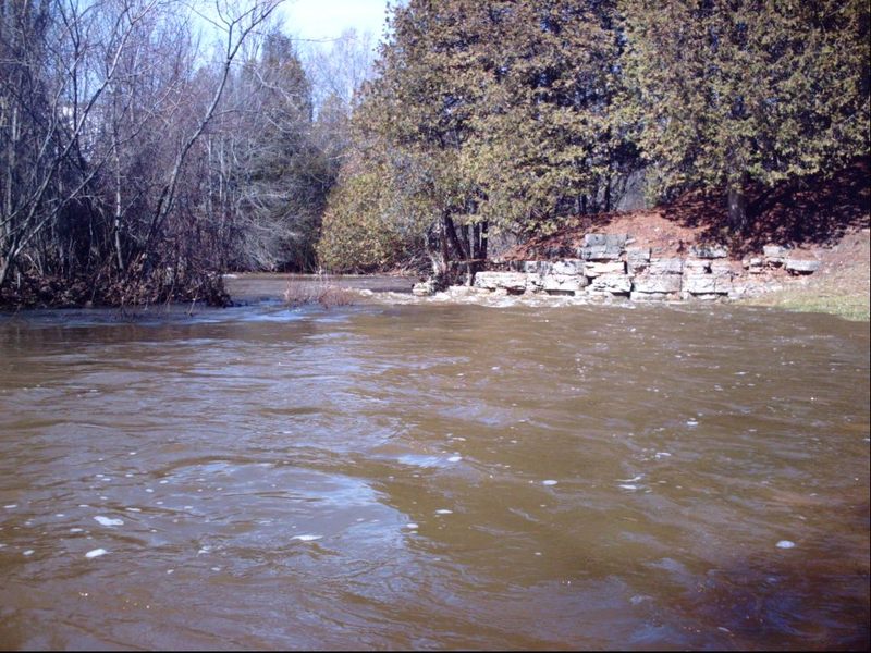
Situated under a bridge (giving golfers access for the 10th and 18th holes of North Brook Country Club) lies a bit of a wave. With adequate flows, some minor play may be possible here. (If golfers are present, you may be glad you're wearing a helmet! Fore!!!)
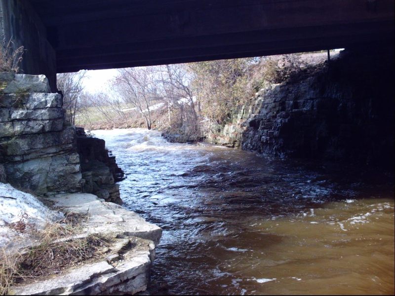
The creek rounds a bend (almost 90-degrees left) just before encountering Main Street (CTH.A). It tumbles down a small ledge combination, then immediately turns 90-degrees right, passing through a vertical-walled dells as it passes under the bridge. This zig-zag/ledge-combination may cause beginner/novice boaters a bit of trouble. At high water, this is a tricky maneuver to negotiate.
This is not really a 'waterfall', not really a serious 'hazard', and is not really a 'playspot', but it is definitely one of the highlights of this run, and (if you are in doubt) should be scouted before putting-in above this location on this run. Those who are uneasy about being able to make this move might be able to portage (carrying over the highway, though it's not real easy to re-enter river downstream).
Access may be possible here (to shorten the trip), but shoulders are not as wide as our listed take-out. At this point you have run the best of the gradient, but there are good rips downstream of this point.
Not far downstream (run mile 3.37), School Creek encounters the Kewaunee River. Flow will be increased accordingly, and the remaining distance to the listed take-out should pass quickly.
Mar 14, 2010
The 'Main Street' ledge.