Salmon, Yankee Fork
Upper road end 11.2 mi to Jordan Creek, 15.6 mi to Salmon R.
| Difficulty | III-IV |
| Length | 23 mi |
| Avg Gradient | n/a |
| Gauge | Yankee Fork Salmon River Nr Clayton Id |
| Flow Rate as of 52 minutes | 145 cfsbelow recommended |
| Reach Info Last Updated | July 7, 2024 |
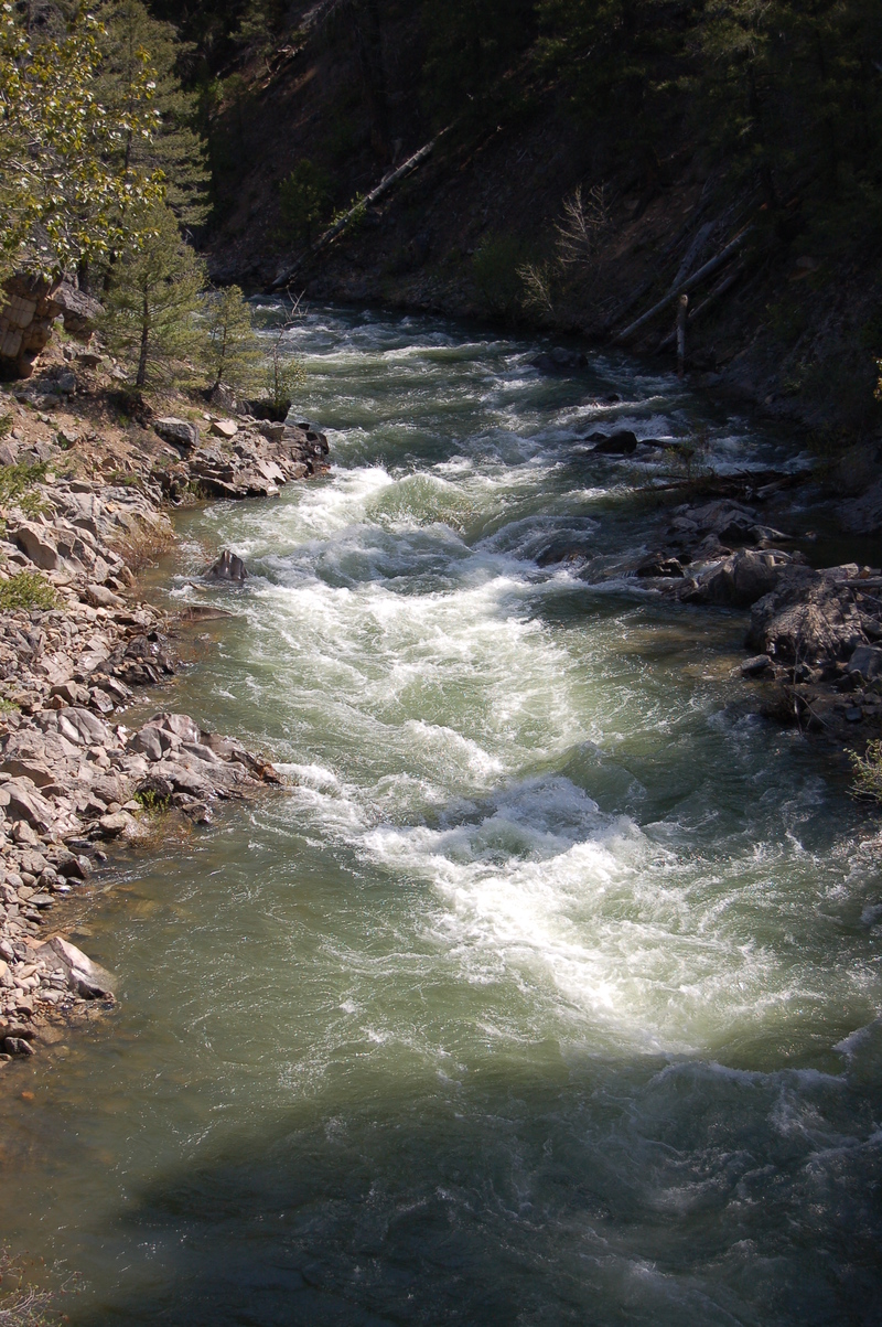
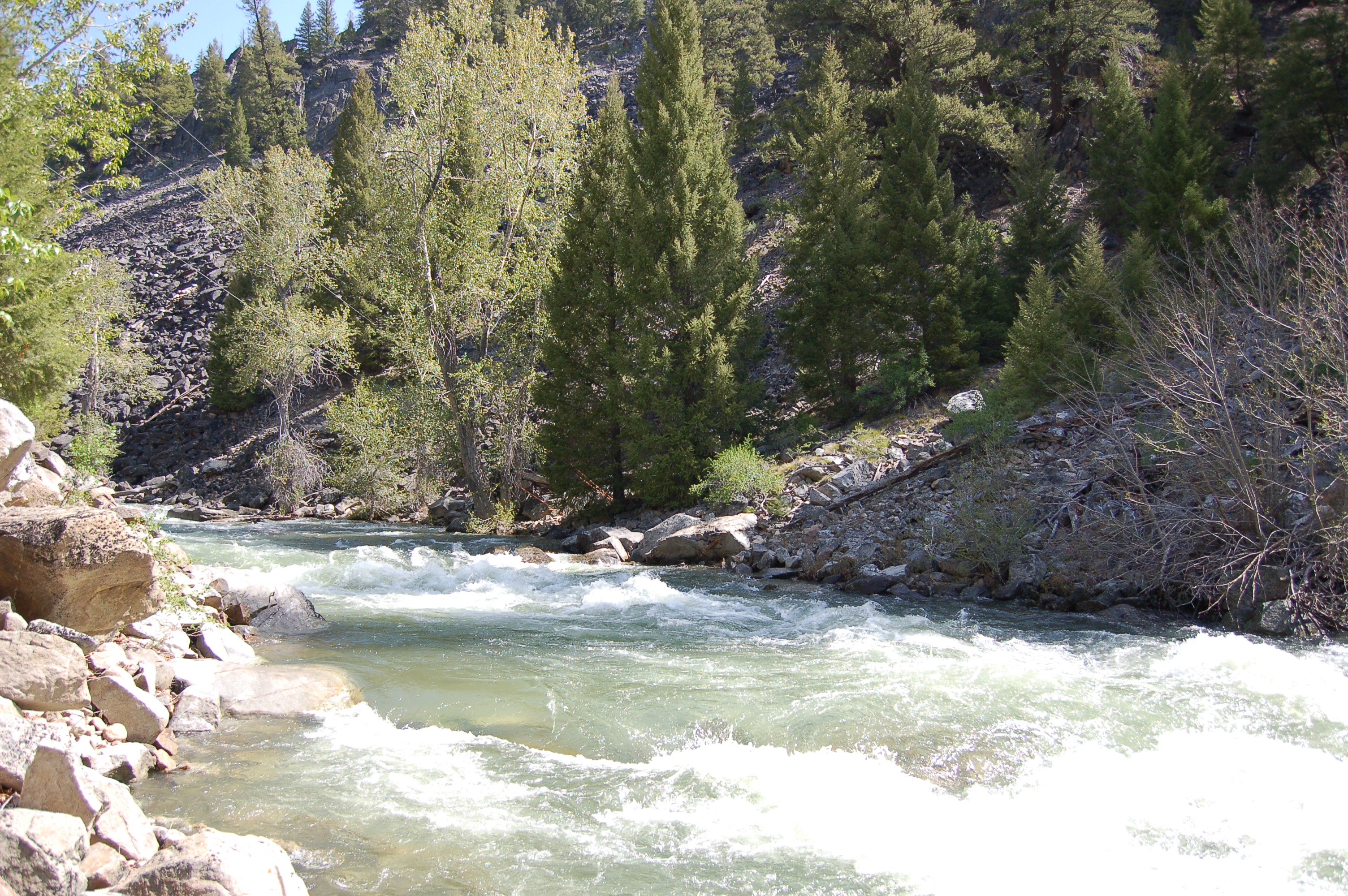
The last 2-3 miles of the Yankee Fork offer paddlers a fun roadside class III+ or IV+ romp depending on the level. It is some of the most accessible creek boating in the area, though feels more like a small river than a creek. It is all scoutable from the road. The rapids are boulder gardens at low flows and wave trains at high flows, and the creek stays runnable at a wide range of flows.
Most whitewater paddlers will want to put in at the first road bridge over the creek and paddle the last 2 miles of the Yankee Fork. There is another mile of good warm up that you can add. Above that are many miles of floatable and mellow creek. You can take out before the Salmon or keep paddling to continue on downstream through the remainder of the fun Class III Sunbeam Section of the Salmon. Check this one out on your way to an early season Middle Fork Salmon trip, and don't miss the historical sites at Sunbeam Dam and further up the Yankee Fork.
Lat/Longitude data are very approximate.
Jun 16, 2022
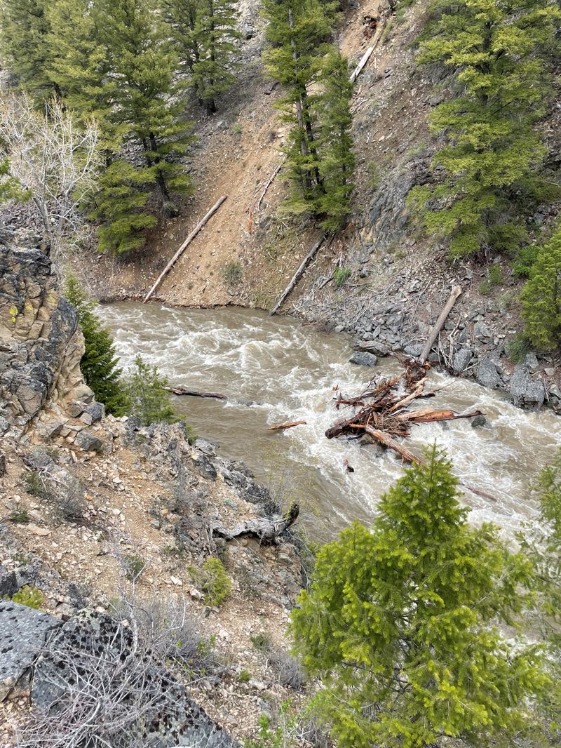
We ran on 14-June-2022 at 1800-2000 cfs, class IV at this flow in my opinion. There was a wood pile blocking the left half of the channel about 1/4 mile below the forest service bridge in the crux of the run. This jam is probably the same as the picture posted on 29-May and is visible from road side but not from the bridge. The right channel was clear. There was also a river-wide wood pile completely blocking the channel approximately 200 yds above the confluence, but not visible from the highway bridge. We carried out above this last jam thru a dispersed camping area next to the Sunbeam Village.
May 29, 2022
Yankee Fork Update 5/28/2022
We launched roadside approximately 3 miles upstream of the confluence with the Salmon at about 1500 cfs, great run. There is a few pieces of wood visible along the road during the scout that were straightforward to approach, but I highly recommend you walk out to the final sharp bend and take a look at that woodpile before running. We neglected to do this and took the beta from a local river guide and got into a sticky situation on this logjam in a Jack's Culebra, R2. Right now the logjam covers 7/8 of the river width, with a small clearing on river right that is a difficult move in a larger boat, kayaks should be ok but should scout the line.
Mar 1, 2007
from the dredge to the salmon confluence is a pretty run, somewhat continuous class II+ III- or so at mid summer flows. in 2006 one log posed a small danger to the unwary but a 3ft wide channel remained open river left. lots a pin boulders but very passable, runs next to the road.