Vermilion
N.2249th Rd. to landing off of Ed Hand Hwy. (8.15 miles)(Wildcat Canyon)
Jun 10, 2020
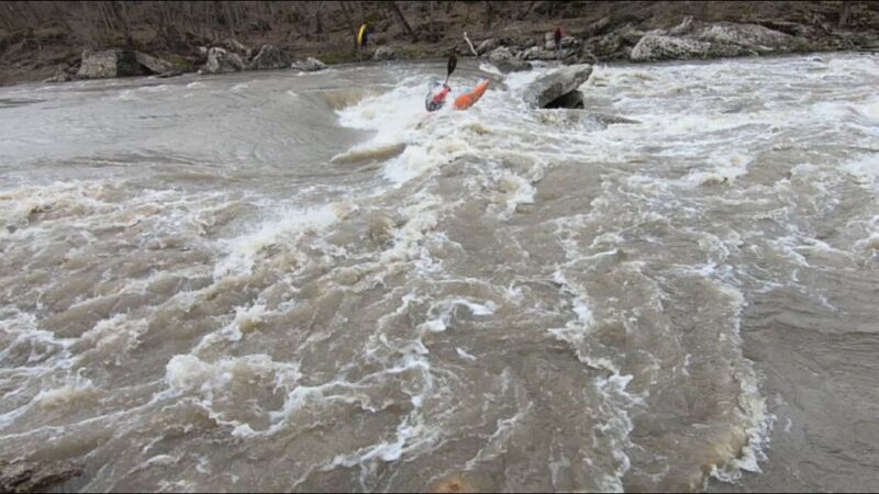
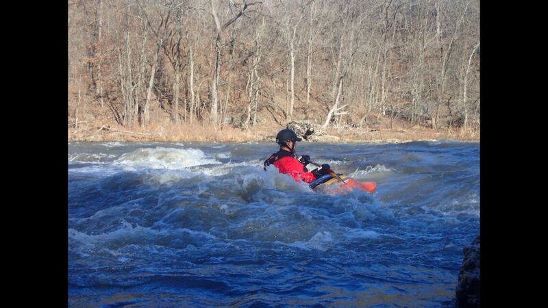
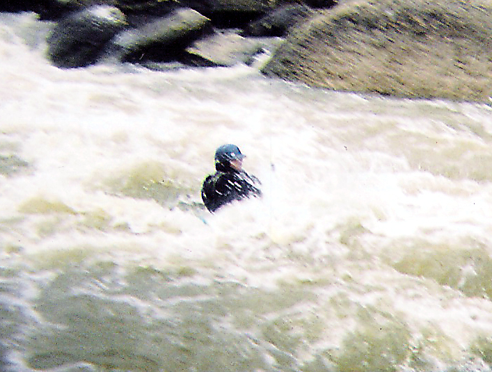
Just did this run @862 CFS on 6/9/2020 and it was GREAT!!! The put-in off 2219th was full of no trespassing and private property signs so I used the Lowell Canoe Launch on 2249th by Vermillion River Rafting. There is fairly limited parking at the put-in so take this into account when planning shuttles. The take-out at the Vermillion River Boat Launch is well marked with ample parking as well as a port-a-potty and plenty of grass for a picnic. As far as the actual run it was pretty tame at 862: I ran Wildcat on the left and it was a cinch, I swam at the dam because I dropped my paddle and couldn't roll barehanded, but it was still more fun than anything else. I would strongly suggest beginning paddlers portage the dam at these levels.
Oct 26, 2018
YAHOOOO!!!! *********************************************************************************************************************
As of Oct.25, 2018, the state of Illinois has purchase the BUZZI UNICEM property to add it to Matthiessen State Park and Starved Rock State Park. *********************************************************************************************************************
http://www.newstrib.com/free/springfield-acquires-buzzi-property-for-million-video/article\_203e37f8-d89a-11e8-9a7e-e72ef52ec0d6.html?fbclid=IwAR0Ry4xcff6cheH1HIIlR43f0OufMURYJNTq1rcGbVIXW5ddXwhac7Qpd2E
\\\*******************************************************************************************************************
The above article does say 'The project will indeed bring Bailey’s Falls, Wildcat Rapids and a number of ponds and wooded areas into the public domain, along with expanding access to the Vermilion River for boating and rafting.
It will be some time before the public can set foot in any of the newly-acquired areas.
Kerry Novak, complex superintendent for Starved Rock and Matthiessen, said the agency will have to conduct a number of time-consuming assessments to ensure wildlife is protected and to minimize risks to human safety.
“They’re going to have to be patient,” he said. “It’s going to take a couple of years to get in there.”'
Apr 6, 2015
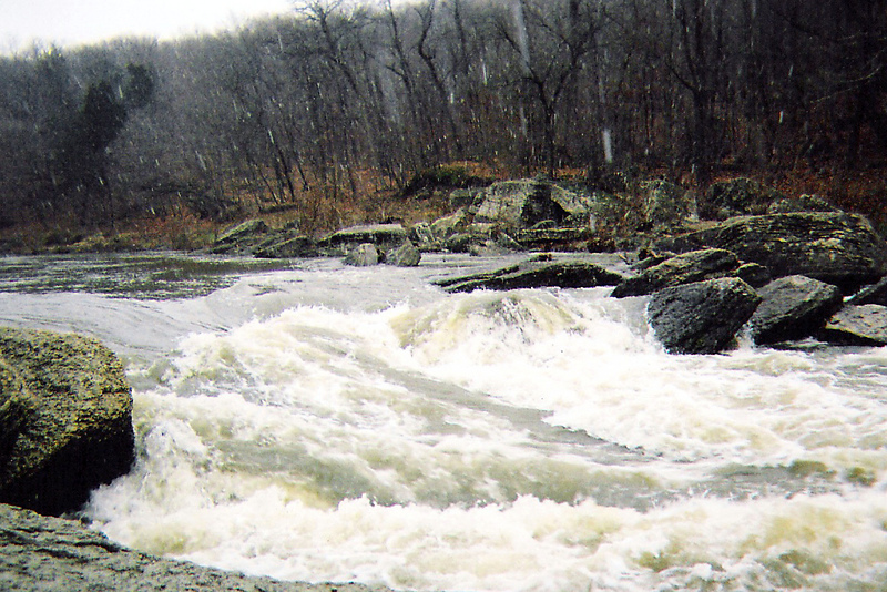
Wildcat has changed again. Not so noticeable above 1000, but down at ~500cfs, the line is rather tight. Most folks let them selves get pushed too close to the boulder on river right, and end up flipping up stream. Below the drop looks like a mess, but it's is plenty deep - no one had any issues pitoning or anything.
Apr 27, 2013
As of Friday 4-26-13 @ ~ 3000 cfs The logjam at the bridge upstream of the put in is gone. So are the waves it created just below the bridge. The old waves right at the put in came back. No change at the Cat. Narrows seems very erroded on river right and no waves exist. This may due to the IL river being so high? About 1/2 mile below the Narrows on river left is one of the most impressive collections of trees ( wood ) in trees I have ever seen. 30 ft high and it goes on for 1/2 mile. With the IL so high you can easily paddle all the way back into Mathiesen Dells.
Rich
Apr 3, 2012
The DNR opened the Vermilion to public recreation on 3/31/12. Note that at the cement plant, paddlers must stay to the right of the overhead buoy line, as the area to the left is now a NO ENTRY zone.
The DNR also says the lease agreement does not include the legal right to scout and/or portage on cement plant property, but technically this right also didn't exist before the river was closed.
Jun 20, 2010
I have kayaked the river in May as well. I have seen wildcat since the landslide and it is much different but wildcat is not easily a Class V+, maybe a class IV at best.
Jul 6, 2009
The sections of the Vermilion River from Undercut Rock almost all the way down to the Oglesby take out have been closed by the cement plant. There were several accidents on the river over the last few weeks and evidently the cement plant is concerned about liability. Anyone who has ever run this section of the river knows that the cement plant low head dam MUST be run on the right side. There have been several accidents when people have not gotten river right before the dam and have been caught in the waters strong undertow below the dam on the left side. I still don't think they should close the river. If anyone knows anything about the law that would pertain to this, please contact me, as we are just beginning a fight to have the river reopened in time for next spring. So, at this point in time, the river is closed. Anyone attempting to run the river past undercut rock (including Wildcat) is threatened with arrest. We would surely appreciate any backing of our fight to have the river re-opened, as we feel it is a public waterway, even though the cement plant owns some of the land on both sides of the water. Most of the land on the right hand side of the river is owned by the State of Illinois and is a part of Matthesien State Park. I am not sure how the cement plant can close an entire stretch of the river, especially when a portion of the land on one side is owned by the state. If anyone out there knows anything about the laws regarding this, your assistance would be greatly appreciated.
May 20, 2009
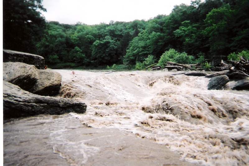
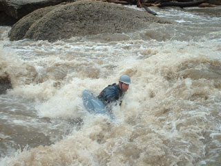
Just wanted to give everyone a heads up. I was on the river early 5/17/09 with 2 friends, when water was about 20ft at Leonore (9ft at Lowell) and around 16000cfs. At these levels we expected Wildcat and the dam to be totally washed. We were erroneous in our forecast. The put in was irregular with about 3 to 4ft waves. The S-turn was beautiful… a solid 6ft+ wave (which we heard wiped out a raft). Wildcat was a nice wave train about 6ft+ (much bigger on river left) although there was not much of a hole present at this level. Finally, the NARROWS…… WOW…. I have never seen it so big. There were 8ft+ irregular waves everywhere. River right was a little smaller but still chaotic. Although risk was minimal due to the depth of water over the river bed I would still recommend re-classing this section at this level based on the power and unpredictability of the water. I RECOMMEND THAT NO ONE TAKE THIS RUN AT THESE LEVELS UNLESS YOU ARE VERY EXPERIENCED WITH HONED SKILLS….. OR A VERY STRONG SWIMMER FOR LONG DISTANCES WITH NO AIR.
May 1, 2009
(http://www.youtube.com/user/McNaterson) here is a link to some videos of this section