Fox
D) De Pere Dam (PnP) *Access Issues*

| Difficulty | II |
| Length | 0.66 mi |
| Avg Gradient | n/a |
| Reach Info Last Updated | March 2, 2022 |
Quick Facts:
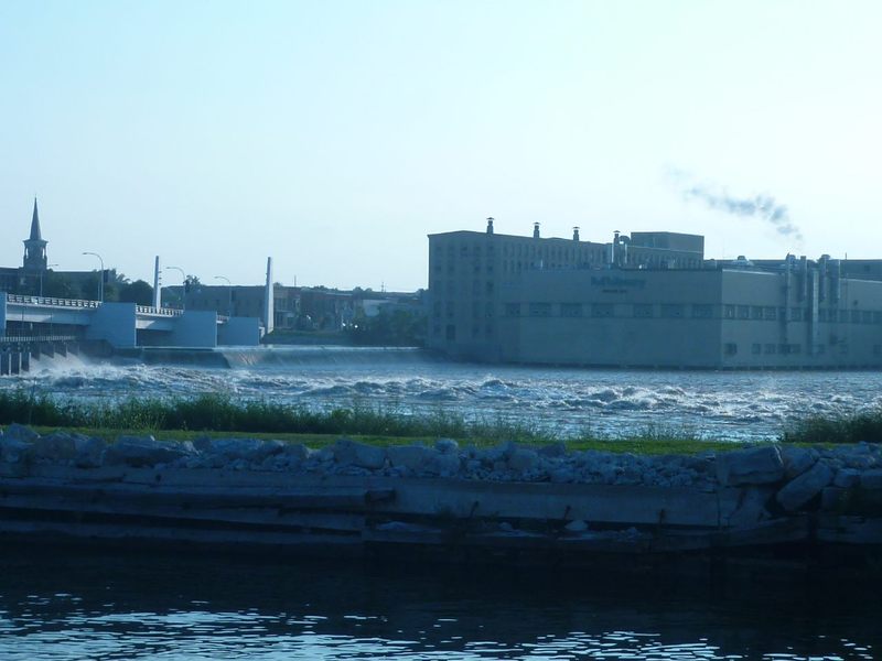
Location: Approximately 6 miles upsteam (SW) from mouth and downtown Green Bay.
Character: Outflow from wide low-head dams in a large river may create waves and potentially playable spots.
General Overview
Outflow at a dam could (at times) provide some whitewater entertainment. However, most (all?) dams on the Fox are posted 'Keep back 500 feet' (presumably upstream and down?), and virtually all potentially interesting water lies within that distance. (For what it's worth, the towers supporting powerlines which span the river, those are ~575' downstream of the dam, so you are illegal almost anywhere upstream of those to the dam.) As a result, we cannot recommend attempting to boat here. (We are cataloguing this location only to dissuade anyone from thinking they have found some new unknown opportunity.)
Conditions are likely to vary greatly depending upon flow of river, how many gates are open (and how far), and various other factors. We do not know what levels could otherwise provide reasonable play, versus levels which are either dangerous or just unplayable. Furthermore, access here is very inconvenient, as there is not only the dam, but the locks on river-right, for motor boat passage up and down the river.
HUC has been 'fudged' (to 04040003 rather than 04030204) to allow this reach to sort into the 'Southwestern Lake Michigan' drainage rather than the already overlarge 'Northwestern Lake Michigan' drainage. If this causes anyone trouble or concern, post a note in the 'Comments' tab.