Cumberland
2) Cumberland Falls to Laurel River (10.5 miles)
Nov 4, 2019
STAY RIGHT AT LAST DROP!!! I want to report a HAZARDOUS strainer in the Last Drop Rapid. We ran this Saturday November 2, 2019. Williamsburg guage read 1,750 cfs. Actual flow was approximately 3,000 cfs according a couple of local raft guides whe were in our group of 9 kayaks. There is wood pinned up against Pillow Rock on left side. At 3,000 cfs the wood was not apparent when we scouted from the river right bank. When going left of Pillow Rock I didn't notice the wood until I was almost on top of it. It was also creating a VERY sticky hole that was hidden behind it. I punched through and was surfed backwards for a few seconds before I was able to paddle out with some hard foward strokes. After punching through another hole on the left side bwtween 2 more rocks I was through. It turned out another person in our group took the left line ahead of me as well and ended up swmiming, but not before getting window shaded on the hole created by the strainer which also slammed his head on something below that protruded like a think branch hitting him on the back of his neck below his helmet. Luckily, he was just sore for a couple of days. At this level a swim above the feature on left slot would be deadly. At lower water this could easily be a terminal pin spot for a boater. I would also upgrade this rapid to a class IV based on that deadly strainer. STAY RIGHT...at least for now.
Oct 15, 2017
3 of us ran this on August 26, 2017 @ 2000 cfs then the next day @ approx. 1800 cfs. We took the Sheltowee Trace Outfitter's ride in and ride out with the rafting expedition.
We had a perfect sunny day for paddling with water temps in the high 60's F. This was out first time paddling this river, and we had a blast!
Center Rock was moving quicker at lower water on the 2nd day and had a crispy eddy line.
Bradford's Rock is pretty easy to avoid the under-cut rock on right.
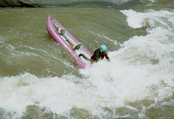
The under-cut rock on river Left @Dog Slaughter Shoals was a bit more treacherous as the current feeds strongly into it @2000 cfs (and above I would guess). One of our boaters was nearly pinned there. She was able to work herself off to the Right side of the pinning rock before flipping and getting washed downstream. Not exactly sure what happened in this instance. Though the current feeds into the undercut it is fairly easy to recognize and avoid. Don't stare at the hazard, rather where you want to go
All 3 of us flipped on Screaming Right the 1st day. The 2nd day we all took a different line...only one of us made it without flipping.
The first day we weren't sure which rapids we were on after the Center Rock because the descriptions of how far the rapid is into the trip are completely wrong!
I used my Garmin Montana 680 on both runs and here are the actual mileage of the rapids:
No Name (class II) 0.3
Initiation 0.5 miles
Center Rock 1.0 miles
Misery 1.27 miles
Bradford's Rock 1.62 miles
Willie Nelson's 2.10 miles
Dog Slaughter Shoals 2.97 miles
Surfers 2.74 miles
Pinball 3.44 miles
Screaming Right 3.75 miles
Stairsteps 4.2 miles
the Last Drop 4.5 miles
All of the rapids were in on our trip except the Last Drop which was still covered by Lake Cumberland.
On the 2nd day we took a side-trip-hike up to Dog Slaughter Falls It is about a 1/3 of a mile hike with some nice scenery and a waterfall you can play and swim in.
It took us a little over 2 hours to run the rapids part of the river and paddle to the riverboat buoy. The river boat ride is just under an hour once they get all the rafts and kayaks loaded. For an extra $10 you can eat at the buffet on the riverboat. It is just cold-cuts, chips, and potato salad with soda, but it did in a pinch and satisfied our hunger.
Aug 13, 2016
Usgs has a gage at Cumberland River at Cumberland Falls that has been collecting data for 105 years. The discharge from this gage is much more accurate for flow if you are interested in running from Cumberland Falls to Mouth of Laurel than the Williamsburg gage. The Williamsburg gage would be your choice if putting in at Williamsburg. If you go to our website you can see actual measured discharge ( red dots) on the discharge graph. The graph will go back 120 days if you want to compare what the discharge was and what you thought it was on the day you took the trip.
Jun 20, 2016
I ran this one with my older brother and we had a blast for the first few miles. After that it was a very long paddle to the take out. The flow was at 434cfs and the lake level was at 720. A fun run but the lake paddle did indeed take a while with the strong head wind we paddled against.
Aug 9, 2011
John Grace and Nate Helms ran the falls. It's supposed to be recorded on LVM #37 'The Last Dwarf Drops His Drawers'. Last I heard it's illegal...and not so intelligent.
Nov 22, 2009
Great River! 10.5 miles of water, 3 or 4 rapids, the rest was flatwater. I won't be running this one again....
Jul 11, 2009
We ran this section of rapids in early July after some rain storms.
Dec 4, 2007
When the lake is filled again there are two possibilities of a takeout about 3-4 miles before the boat ramp at devil's creek and bark camp creek. Devils creek is an old road that would require a 4x4 outfitted for aggressive situations and bark camp is a 1/4 mile up hill hike back to the road. I had directions posted for devils creek, but thought best not to advise this one. Bark camp can be accessed via 1277, left onto FR 193, first right onto FR 551 and go to the end of the gravel. Trail will continue downhill. Otherwise, just paddle to the ramp.
Jul 28, 2007
Dad showing the girl the perfect setup on big nasty at a great level
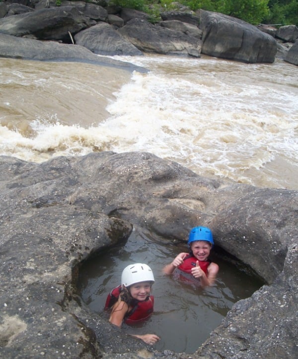
the kids enjoying the hot tub at screaming right.
A great day on the river for the whole bunch.
Jun 16, 2007
Codi Foley running Screaming Right, Summer 2007
Jun 9, 2007
Good entrance line for the boof over the bottom little ledge
One of my heros Gordon Byrd.
Adam showing Codi how to run the eddy catch and peel in the middle of the rapid at low water. Another one of my heros!
May 15, 2007
Adam Thomas running Screaming Right while Cody and Jason Foley prepare to take their turn next. Cumberland River below the Falls, Summer 2007.
May 12, 2007
Looking Good!
Apr 30, 2007
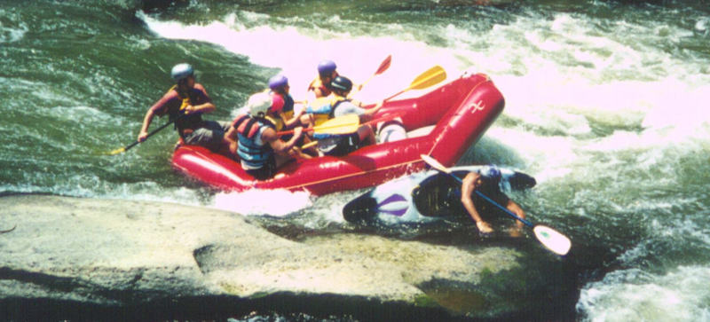
Myself and two friends paddled the cumberland river this past weekend and learned two things. One, to find the take out you must turn left on 1193 when headed east on 25 to find 1277 and the take out. Secondly, Last Drop is a bit tricky when the river is running at 5000cfs or more. My friend had to wet exit at the top of the rapid and was pushed into the boulder mid stream where he was temporarily pinned then continued to river left of the first big boulder to a second boulder which he was pinned on then sucked underneath giving me the impression that the boulder is undercut. When looking downstream from up above last drop @5000+ cfs, you see a huge boulder where the main river flow hits, to the left of that main boulder its the second boulder over that is undercut. Please use caution when running this rapid!
Mar 31, 2007
This is an easily avoidable undercut at most levels. Below 1000 CFS the rapid narrows down and eventually the far right line (in front of the undercut) is the only option.
Nov 25, 2006
Guy avoiding the best hole for play on the river.
This shot doesnt do the drop justice. It is washed out at this level. Another great place for play at lower levels. After this drop is mostly flat water for about 3 miles to the mouth of the Laurel.
Jul 15, 2006
Steve and Beth Wiggley running screaming right at 500cfs, Summer 2006.
Dave Wisner at the bottom of Cumberland Falls in Ky. 500 cfs, Summer, 2006
Mandy Williams running Screaming Right at 500 cfs, Summer 2006.
Dave Wisner at Screaming Right at 500 cfs, Summer 2006.
Mandy Williams below Cumberland Falls at 500 cfs, Summer 2006.
Steve and Beth Wiggley below Cumberland Falls at 500 cfs, Summer 2006.
Cumberland Falls, 500cfs, Summer 2006.
Gordon Byrd, Mandy Williams, Dave Wisner, Steve and Beth Wiggley
Jul 1, 2006
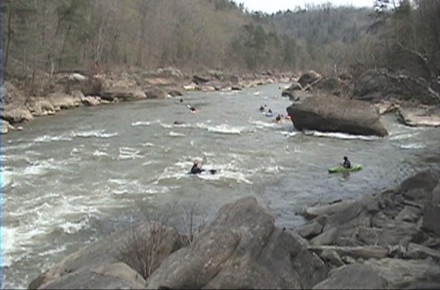
The two drops of Center Rock with the bigger one(bottom in front of the rock) hidden a bit. This is the first significant rapid on the river about a mile into the run.
Jul 10, 2005
resized & cropped from original
Jul 15, 2004
Great playspot and great eddy service.
Jul 15, 2004
Gordon Byrd surfing at Surfing Rapid on the Cumberland River, below Cumberland Falls down to Laurel Lake in Ky. 1,500 cfs.
Omer Hall and Jason Foley riding the wave at Surfing Rapid on the Cumberland River below the falls. Summer 2004.
Gordon Byrd hands paddling at Surfing Rapid on the Cumberland River below the falls, Summer 2004.
Dr. Keith Woodward and Jason Foley on the Cumberland River in Ky. at 1,500 cfs Photo by Gordon Byrd.
Dr. Keith Woodward hitting the eddy at Center Rock Rapid on the Cumberland River in Ky. Photo by Jason Foley and Gordon Byrd.
Dr. Keith Woodward at Surfers on the Cumberland River. Photo by Jason Foley and Gordon Byrd.
Gordon Byrd hands paddling at Center Rock Rapid on the Cumberland River in Ky. at 1,800 cfs.
Doug Simpson and Crew take on Center Rock Rapid on the Cumberland River. Photo by Gordon Byrd and Jason Foley.
Jason Foley at Surfing Rapid on the Cumberland River in Ky.
Doug Simpson and Crew and Jason Foley surfing it up on the Cumberland River in Ky.
Oct 18, 2003
This is pinball rapid between Surfers and Screaming Right. resized from original image.
Oct 18, 2003
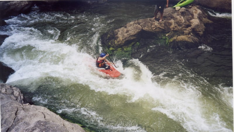
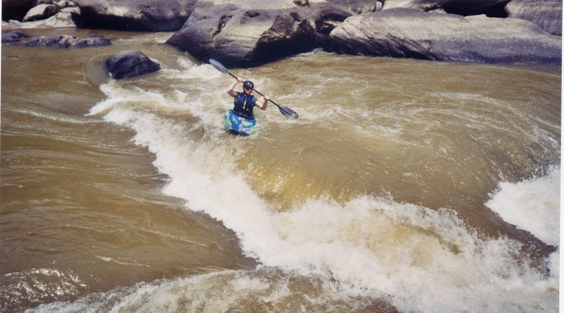
This rapid appears between Surfing Rapid and Screaming Right-Hand Rapid. It is a wavy chute that is easily managable, but just around the corner is Screaming Right-Hand Rapid. There is plenty of time between this rapid and Screaming Right-Hand to regain your thoughts.
Aug 15, 2001
Adam running Screaming Right Hand Rapid on the Cumberland River in Ky.
Adam riding the wave at Screaming Right.
Gordon Byrd surfing the curler at Screaming Right on the Cumberland.
Haleigh Byrd running Screaming Right Hand Rapid on the Cumberland.
Jake gets a little sideways at Screaming Right.
Gordon trying to make it out of Screaming Right without being eaten.
Jul 15, 1999
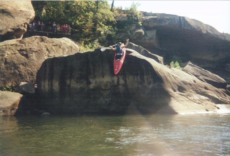
Gordon Byrd launching off of a 18' rock below Cumberland Falls
Jan 1, 1900
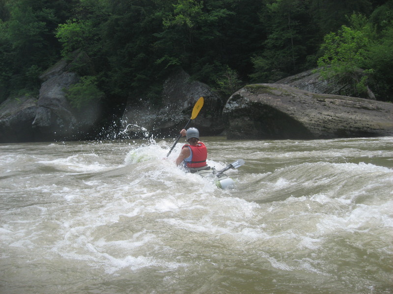
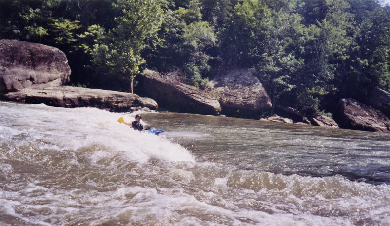
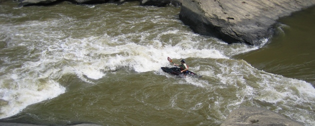
This is Screamin Right at the perfect combination of lake level down and water up.
Middle Drop of center rock above the boulder(not pictured) that gives the rapid its name.
Jan 1, 1900
Dave Wilson 'in the raft' telling Jeremy Perry to 'move over I'm coming through'. Cumberland River Below the Falls at Stairsteps Rapid.
Jan 1, 1900
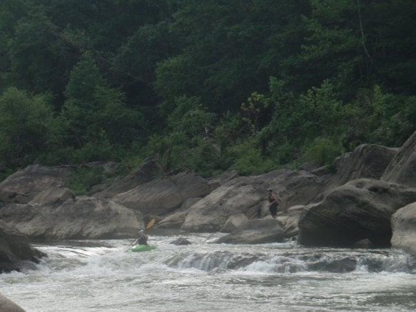
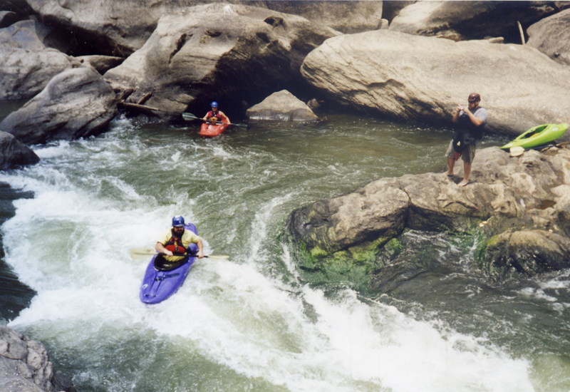
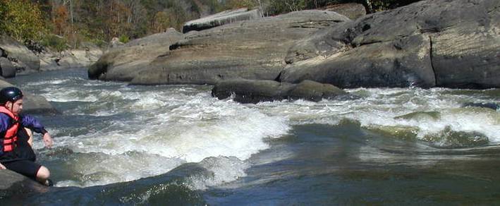
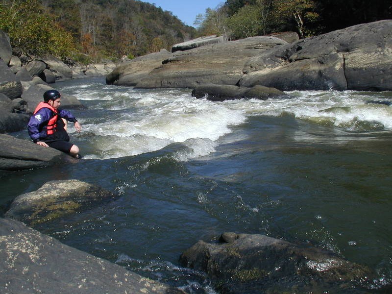
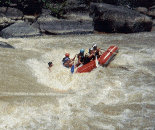
This is a look up river at last drop rapid. Level was around 4000 to 5000 cfs. See next pic for a closer look.
Here is a closer look. At lower levels (around 1000) the center boulder rises about 6-8 feet above the water level when view from up stream. However, when the water is higher it only sticks out of the water about 2 feet (when viewing it from up stream). It does not look like much from up stream, but it drops down behind it. Be careful, if you drop in to close to the center boulder on its river right side, it will suck you in behind it and it is a dam hard swim (ball up and or dive deep) to get out. About 100 yards below this boulder is the second part of last drop; so if you have to bail at the top, save some energy to swim though the bottom.
Jan 1, 1900
Herbie gets swallowed up at Screaming Right Hand Rapid on the Cumberland River in KY.
Gordon Byrd at Screaming Right Hand Rapid on the Cumberland River below the Falls.
Haleigh Byrd going into Screaming Right Hand Rapid on the Cumberland River at 1,500cfs.
Jan 1, 1900
Dave Wilson doing only as a raft quide could...
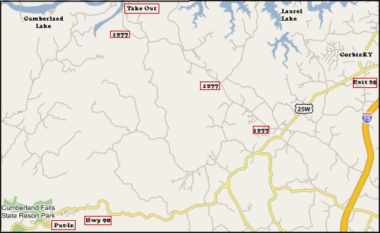
Shuttle map