Clear Creek
A) Schaberg to Chester (5.1 miles)

| Difficulty | II-III |
| Length | 5.1 mi |
| Avg Gradient | 45 fpm |
| Gauge | Frog Bayou at Rudy, Ar |
| Flow Rate as of 24 minutes | -1.23 ftbelow recommended |
| Reach Info Last Updated | December 8, 2009 |
Put-in elevation is approximately 1070'. Take-out elevation is approximately 840'. Thus, total elevation change is approximately 230'.
This section starts just below a low water bridge leading into the hamlet of Schaberg. Parking at the putin is limited. There should be little if any air space on the upstream part of the bridge for an enjoyable run. The riffles just below the bridge may seem a bit boney at low level. If you can paddle down this riffle enjoyably there will be enough water.
The upper 2 miles (approximate length) from the putin to passing under the I-540 bridge is a fair tight creek run. In this part keep an eye open for log jams; they come and go with floods. Also there are numerous ledges in this section that make for good surfing. One very good surf spot is towards the end of a right to left turn, half way through the creek is bordered by sycamore trees on both sides. These trees create eddies from whcih the wave can be accessed. Immediately before the I-540 bridge is a fast moving pool. Nice wateralls feed into Clear creek around the bridge.
Just beyond the bridge starts a fair steep set of rapids. The first part of these rapids is a recent cut through a temporary bridge that was constructed buring the building of I-540. Be care of cement and steel bars, especially along the river left bank. Below this set of rapids, the gradient decreases.
Approximately 3 miles into the run, there is a low water bridge that should be portaged. The bridge in in the middle of a fast moving pool and is readily visible from upstream. At least some water will be runnning over the bridge at floatable levels.
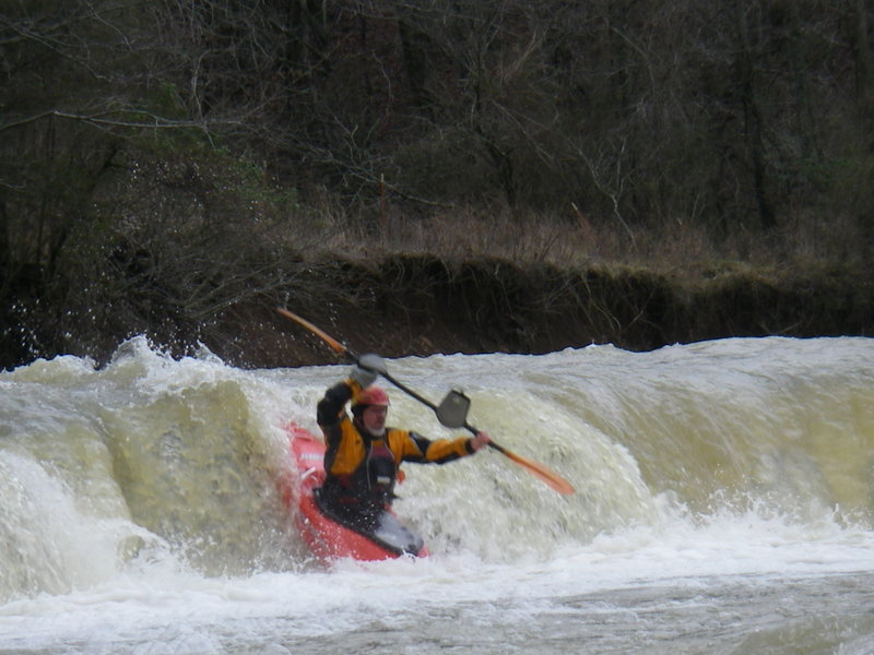
Approximately 4 miles into the run is Clear Creek Falls, a river wide 4 foot water fall. The falls is in a right to left turn and is not visible at the beginning of the turn. Falls is just downstream from a point where the railroad track comes close to the river left bank. The bank above the falls allows for easy scouting of the drop
...Feb 17, 2008
This rapid is locted on the Schaberg to Chester reach. The falls is within a mile of the takeout at Chester. This is a relatively new featured that formed after a flood a few years ago. The rapid is an aburpt 4 foot drop. Falls is located in a gently right to left turn. As soon as you see the horizon line, get to the river left bank which is a gravel bar to scout the drop. Below the falls the water is deep enough to roll up but not much deeper.