Assabet
Route 117 to Route 62
Jun 8, 2021
Put in & take-out address:
Put-in is behind an office building at the Intersection of Routes 62 & 117: The address is 62 Great Road, Maynard Ma. Note, it's unclear if they will enforce parking restrictions.
Take-Out: Elks Lodge, 34 Powder Mill Rd, Maynard, MA 01754
Jan 19, 2020
Ran this stretch with a friend on 1/11/20 and happy to report there wasn't any wood in play.
Mar 22, 2018
Thanks! Hit me up for more runs with the kids! I have two interested
Jun 16, 2017
I wanted to comment because there haven't been any updates for a few years on this river. I brought my kids down it in a canoe (Rogue River 14' - a giant slow plastic canoe). I ran it last sprint in the canoe during snow melt season around 5' and it was wild. Good sized rapids, not stuck anywhere, the whole trip was 20-30 minutes. We got up to 11 mph according to a GPS we carried with us. There were a couple down trees that posed hazards that were avoidable and once we slammed hard into a bridge. It was a great time.
We ran it again 6/15/17 and the gauge height was 2.39 - below recommended. Scratchy isn't the right word, we got stuck a few times. I had to get out and push the boat. Rapids were exciting for the children and not overwhelming. The water was very warm to stand in. Great trip. I'll watch and go again after rain, it is really a good time if you live in the area. I live about 15 minutes away.
Parking note - On weekends the building at the dam appears closed/no one is parked in back. I parked there with no problem. Weekday there were people around but lot was still mostly empty. I look for the no river access sign but didn't see it until we were leaving. It is still posted but has been bent over. No one said anything to us and my car was there for about 3 hours total. There is a canoe launch called ice house landing above the dam but I haven't scouted it to check parking.
The best take out is Elks as suggested, but the river continues. We went down to West concord and took out there, and in the past have gone all the way to Concord's Lowell Rd Boat launch. There is a really difficult portage around a dam across from the Buick dealership. After that dam there is a couple more small rapids and by the old Damon Mill building there is a rapid though a broken dam. A bit downstream the river is blocked by down trees but in an area of flat water. I was able to pull my canoe over it.
Nov 9, 2013
In reference to the map under the photos: there are a total of six bridges that you go under. You probably only want to scout 6.
1: Straight shot through the middle is easiest.
2: Trickiest one. Sneak route is to stay right of the two islands & then through the right of the 3 arches. Center arch is easy enough to line up, but be careful to not get pushed sideways. Left arch is toughest to get to due to a constriction just upstream creating a strong rightward push on the left side of the river.
3 & 4: Essentially flatwater, at least at medium levels.
5: Easiest to stay on the left half of the river when approaching, the bridge is after sharp leftward turn.
6: Straight shot, but there is seemingly always a blockage in at least one of the tubes. Scout it!
Jan 31, 2012
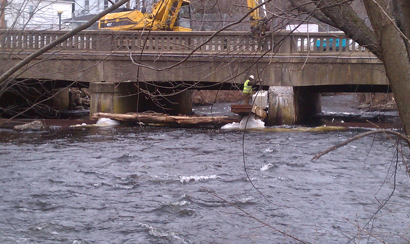
Now, they have all 3 tubes blocked, with beams, trees and sandbags. For what reason, I still don't know. I know they are removing the pylons, but why blocking the waterways aids in this effort, I have no idea. I was going to slip just to the right of the right pylon in a small space, but there were construction guys right there, a crane slowly dropping a slab of stone overhead, etc.......looked a little dangerous, plus I may have gotten hung up on the sandbags below the surface. I ended up having to port on the right side, and carry up over 62 to put for the final stretch to get my car at the Elks. Looks like I'll have to end my run at the McDonald's parking lot instead, find a way to avoid the evil allure of the deep-fried smells, and get a healthy lunch elsewhere. Bummer, the Elks was a nice take out with plenty of parking. Hope the bridge is fixed soon.
Jan 30, 2012
We ran it last Saturday (1/28/12) and there was contruction at the last bridge before the Elks Hall (Acton Street?) The right and left shoots were blocked with steel, and there were sandbags (or something else) in the middle shoot. We ran through it fine, but it looked like the work was ongoing.
Jan 30, 2012
By golly, you are right, but I swear only the right side was blocked the day before and I didn't see any sandbags that time either! It was dusk, so I may have missed them. Anyway, I just uploaded some pics here, and one is of the bridge from the Tedeschi's parking lot next to the construction site........it sure makes for a fun rapid chute!
Jan 30, 2012
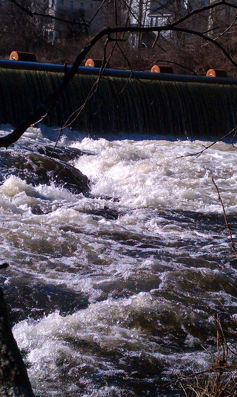
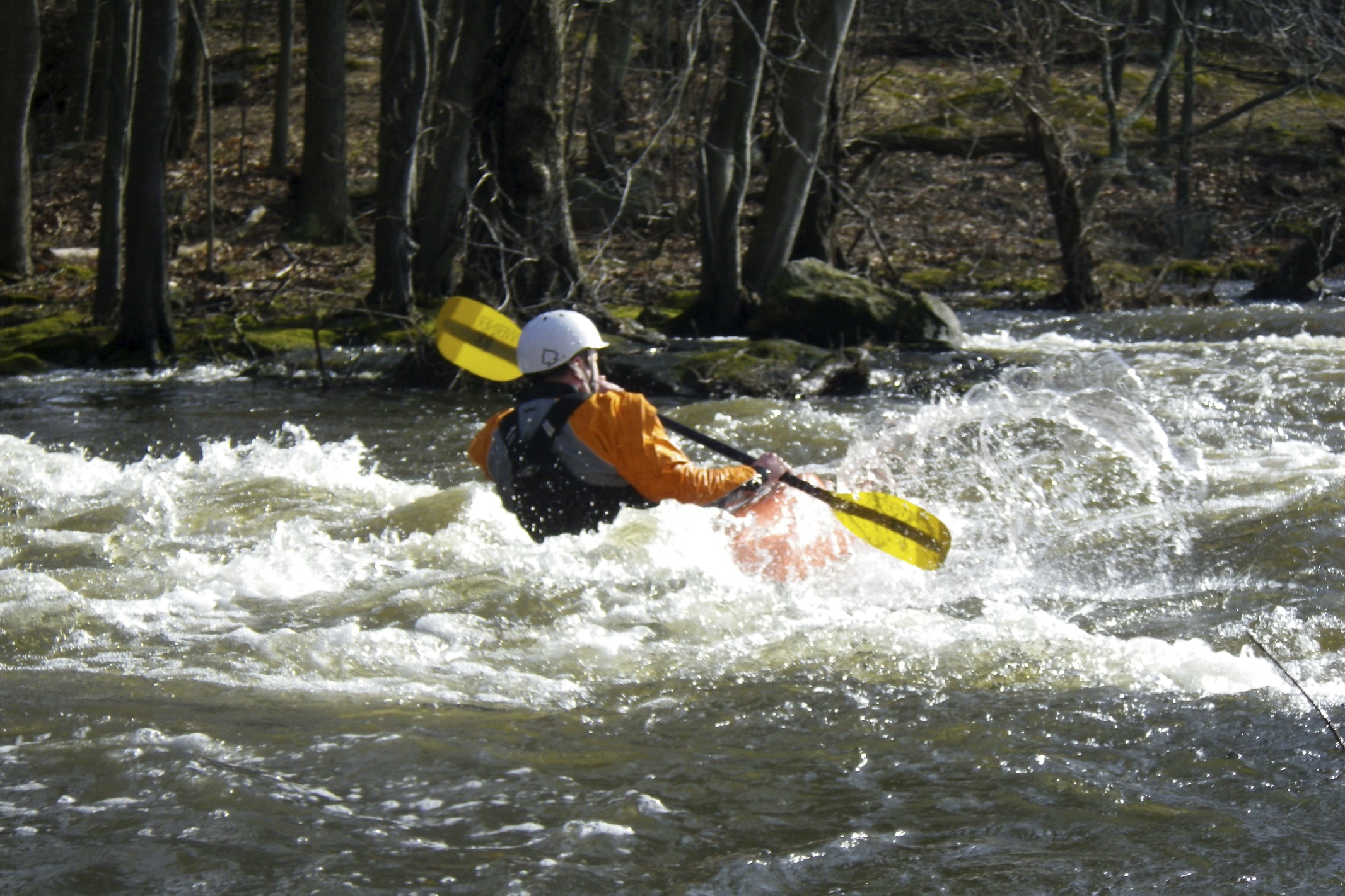
Frothy fun to play in, just below the Ben Smith Dam
Jan 30, 2012
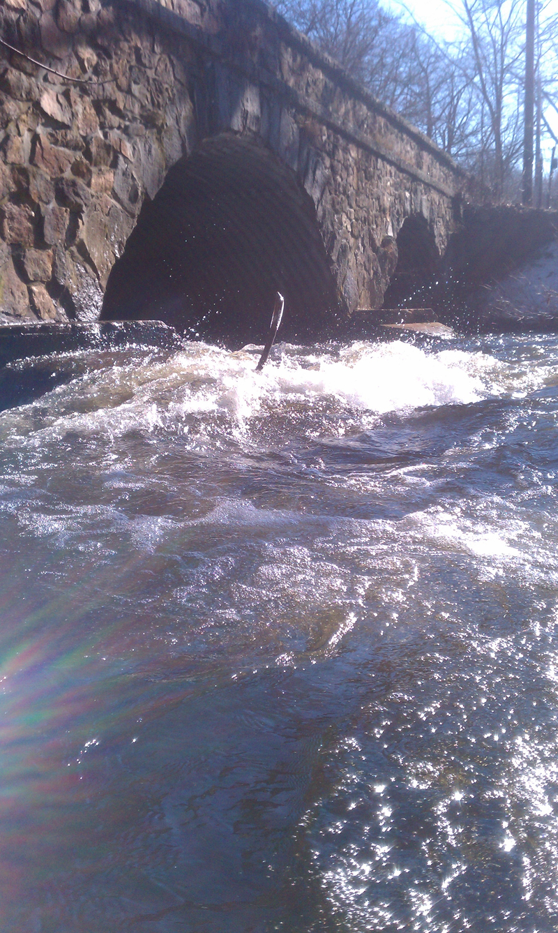
The Mill Rd. Bridge is the second bridge you have to pass under on the Maynard Assabet run, and possibly the trickiest. The level today was 3.6 feet or so, and it wasn't too bad, but the flow (as described astutely by other members here) can push you into the pylon and pin you if you aren't careful. It happened to one of my buddy's sit-on-top kayaks last summer.
Jan 30, 2012
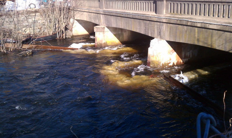
Here is the last bridge on 62 before the Elks club in Maynard. I ran it just before dusk Friday, and saw the right tunnel was blocked with a steel beam. I was thinking it was a mistake by the construction on the bridge above, but after speaking to one of the guys on the site, I realize it's intentional for some reason. I read the post after mine of a member who ran it the day after saying both the left and right tunnels were blocked and sandbags placed, which I didn't see at all the day before. The construction worker didn't know why they were diverting the flow to just the center tunnel, or what the sandbags were for, but he said eventually, they are going to remove the supports, so it will have one big chute. It's a fun rapid chute like this, so I hope it doesn't happen soon!
Jan 28, 2012
CAUTION! I just ran the Assabet through Maynard yesterday, and the water level was higher than it's been for a while, around 3.2 feet.....now it's at 3.7. The reason for this post is at the last bridge before the Elks club, there are two tubes, which were both open weeks ago. Now there is a large metal support across the right side, making it impossible to go right. The good news is, this blockage greatly increases the left side water flow. It makes the left side a fun little chute log ride, and a really fun end to the run. Come on rain, keep coming!
Jan 2, 2012
Park on Taft Avenue off of 62/117, there is a small concrete pad on the river side, directly uphill from the dam. I usually park at the Elks Lodge on 62 to take out.
Jul 10, 2011
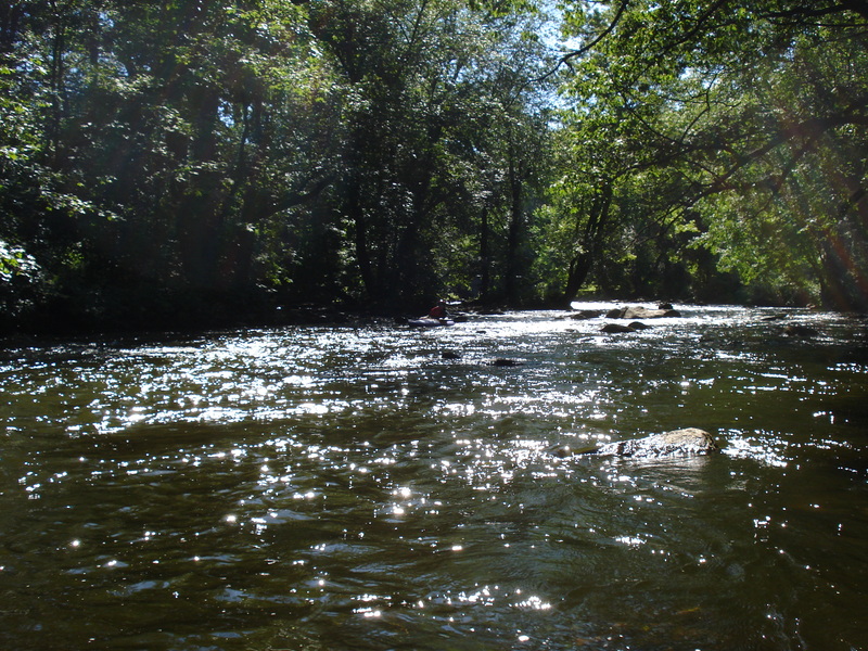
This was about 1/3 of the way downriver, looking back upstream. This level was too low to paddle, in hindsight, but there wasn't much else available.
Apr 22, 2008
We ran this stretch last weekend in our 17 foot canoe. The river was at 2.77 and was only a little scratchy. The play waves were a little small for surfing this boat. We are fairly new to whitewater canoeing and this class II was near the limits of our abilities.
Jun 6, 2006
I ran the Assabet at about 4.5 feet on 6/4/06. It's not too technical, but I would definitely call it a class III run at that level due to wood and bridge pylons.
We took out a few hundred yards below Maynard Elks (I'm not sure you can see that building from the river) where the river broadens and flattens out. The dam is significantly further downstream.
May 12, 2005
Hey all when you run the Assabet use caution at the put in there are two tubes just after you start off make sure you go through the one to the left. There is a ledge at the end of the right tube that will hang you up. I ran with open cockpit boats and within 2 seconds of getting stuck the water came into the cockpit and swamped me.