Concord
City of Lowell to Merrimack River
| Difficulty | III+(IV) |
| Length | 2.2 mi |
| Avg Gradient | 35 fpm |
| Gauge | Concord R Below R Meadow Brook, at Lowell, Ma |
| Flow Rate as of 44 minutes | 84 cfsbelow recommended |
| Reach Info Last Updated | August 20, 2014 |
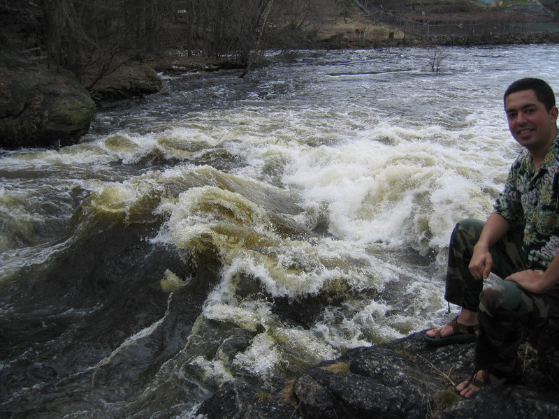
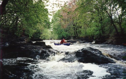
The Concord runs through the heart of downtown Lowell. While the area is highly urbanized, the city is hidden from the river by trees and thick greenery. As a result this is an attractive run even though it runs thru the heart of the city.
The Concord river has been modified, damed, and diverted into canals for hundreds of years. Most of the dams and canals have washed out or filled since the mid-20'th century, but a small hydro facility (operated by Centennial Island Hydro) was built on a 19'th century era diversion canal in the early 1980's. This newer project in the upper section diverts some of the flow from the put-in to just past Twisted Sister. The hydro facility can be seen just past Twisted Sister on the left.
Of special interest is the U.S. National Park devoted to the canal system. With special arrangement, paddlers are allowed to make use of the locks below the last rapid. Thus allowing one to use the power of the river to float oneself up to a canal for an easy paddle to your car.
The river has also been narrowed over time in an effort to gain more real estate. Therefore it does not require as much water to run as it was in its natural state. The river also has a huge watershed, encircling the towns enclosed by Westford, Shrewsbury, Hopkinton, Wayland and Bedford (36 towns total). This results in a very long boating season; the river should be runnable from late Fall and Winter (after a moderate rain) thru the spring (usually into June). The large number of wetlands, swamps, and dams in the watershed also delay the effect of rain and act as a big sponge. There is usually water for a couple weeks after any substantial amount of rain. Additionally the southern New England location close to the coast means the river is usually boatable throughout the winter and early spring.
The whitewater section has only four 'named' drops or rapids, however it
...![New [Upper] Put-in](https://images.americanwhitewater.org/photo/medium/0.jpg)
There is a new put-in a hundred yards upstream of the put-on by the dam (on the upstream side of the railroad track.)
It is a public park with a boat ramp and plenty of parking. When driving in from I-495 just go straight instead of turning right and passing under the railroad tracks.
Put in either above or below Centennial Dam.
Put-on just below where Lawrence Street crosses the river. You can put on either above or below a runnable dam at the put-in. The dirt road running along the river is gated but not locked. Boaters are allowed to open the gate and drive down to one of the put-in's. Raft trips normally put on slightly furthur down the river by a large eddy.
In between the two put-ins is dam used to divert water down the canal for the small power plant. Run the dam approximately 50 feet off the right shore where a V-shaped bend in the dam creates a channel and narrow tongue. Be aware this drop is very rocky and can be full of debris. Make sure you scout it carefully or watch someone else run it. At river levels below 6 feet the run starts to bottom out and gets rocky.
The dam (also called Wamesit Power Company Dam) completed in 1900, is owned by Wamesit Real Estate Trust.
Constructed of concrete, rebar, and wooden boards, it is 320 feet long and has a height of 5 feet. Its capacity is 415 acre feet; normal storage is 75 acre feet. The fishway is 79.5' long and was opened in 1991.
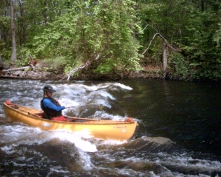
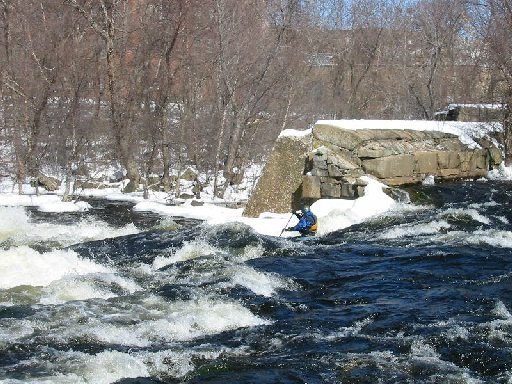
Immediate above the eddy leading into Twisted Sister on river-left is a great surfing wave.
Immediate above the eddy leading into Twisted Sister on river-left is a great surfing wave.
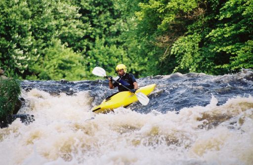
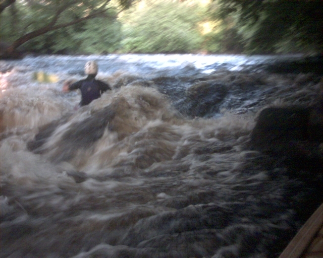
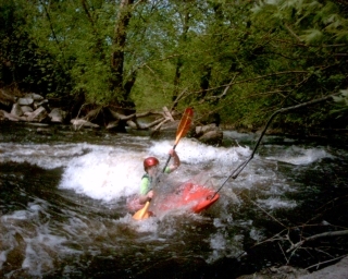
The river drops suddenly after a nice series of play holes just above. The best route is to eddy out on river right just above a big hole. Peel out from the eddy, cross the channel and thread your way down along the right between the holes. At higher levels (6.5+) the holes become huge and a channel straight down the left edge opens up.
At the bottom of Twisted Sister is the one of many great surfing spots. There are handy eddys on both sides for easy access.
A small (700 Kwatt) hydro-electric plant is fed by a 2,300-foot long, 36-foot wide, 8-foot deep diversion canal that transports water from the dam at the put-in to the powerhouse. Operated by Centennial Island Hydro and Olson Electric, Olson electric has been co-operative in the past when asked to temporarily shut down electric production for a group of paddlers to run this section. License was granted in 1981. Pictures of the turbine upgrade can be found on the French Riverland Company pages.
The gage is hidden under
the trees just below the Rogers Street Bridge.
Hidden under the trees on river-right just below the Rogers Street Bridge is the USGS gage. The area is fenced off, you'll have to hop the fence next to the bridge to access the outside staff or to scout the rapids below. Be aware the area is loaded with poisen ivy.
The gage is totally invisible from the river during the months when leaves are on the trees. You can paddle right by it without knowing it is there.
Below USGS gage the river splits into two channels around an island. Take the left channel for a very sweet river-wide surfing wave about half-way down the island.
At the very bottom of the island the left channel turns and joins the main channel; here you'll find an enjoyable (and sticky) wave. Hug the channel to the right to grab the eddy around the corner and allow yourself to play on this wave over-and-over.
At the very bottom of the island the left channel turns and joins the main channel; here you'll find an enjoyable (and sticky) wave. Hug the channel to the right to grab the eddy around the corner and allow yourself to play on this wave over-and-over.

At the very bottom of the right channel along the island (just at the top of Straight Shot) lies a very meaty (but fun) surfing hole. The hole can be easily reached from the left channel by swinging inside close around the bottom of the island, than attaining up into the eddy along the right channel. From here you can ferry across and enter the hole from eddies on either side of the river.
At the very bottom of the right channel along the island (just at the top of Straight Shot) lies a very meaty (but fun) surfing hole. The hole can be easily reached from the left channel by swinging inside close around the bottom of the island, than attaining up into the eddy along the right channel. From here you can ferry across and enter the hole from eddies on either side of the river.
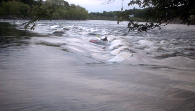
Once the two channels come together the river drops precipitously into a series of much larger wave/holes. The center is more of a wave than a hole therefore it is easier to punch through. There is no maneuvering needed and the run-out is flat. There is good surfing and playing in the last wave at the bottom of the rapid.
At higher river levels this rapid just gets bigger-and-bigger!!!
Park in an open lot on Chestnut Street. Take out on the lawn of a retirement home. Be aware the back gate of the home gets locked at night after 8:00 PM.
You can also take-out below Middlesex Dam by climbing thru the woods on river-right just below the dam and hopping the fence to get to the Chestnut Street parking area. Note 4/11/03:
Graham Fitter reports that the fence was highly charged! Rob, Ken and Graham all got pretty big shocks when they tried to climb over
the fence having run the dam. The lights surrounding the parking lot are probably responsible.
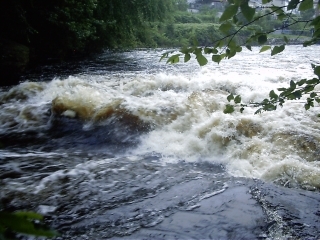
After the Route 110 bridge the river takes a sharp left then a sudden right over the remains of Middlesex dam. At low-to-medium levels It's a pushy, rocky abrupt drop route over the remains of the dam.
This drop should be scouted each trip since rubble can collect, especially on river left where there is still rebar, lumber, and other debris on the river bed. Scout from the island that the ramains of the dam juts out from. DO NOT attempt a run thru the diversion canal on the right side of the island. This route is blocked by dangerous steel beams cutting across the channel.
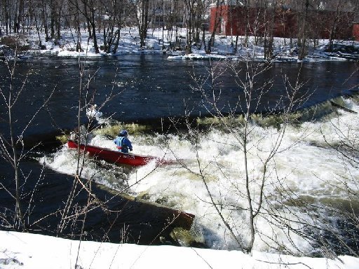
_Skirting the big rock..._Photo of Tom Todd taken 5/98 at 5.85 (985 cfs).
There are two normal routes thru Middlesex dam. The classic route runs along the far right edge of the channel, brushing
as close to the ramains of the dam as possible. Start on river-left just above the rapid, cut across the rapid to the
right paddling hard directly towards the dam. Don't stop paddling even though you think you're going to hit the dam, the
fast current will quickly pull you by it and down a lighting quick 6' abrupt drop. This route is paddleable down into the high 5's on the gage.
The center route (a favorite of rafts) starts on river right, following the flow of the current. Cut left just past a big rock-hole combination and thread your way towards river-center just above the meat of the drop. Turn right and head over the drop, just to the left of a big hole, and next to one of two big rocks which form rooster tails.
This route is runnable from the low 6's and higher.
You can also sneak the dam by creeping up along the face of the dam and swinging around the right edge of the channel into the eddy below.
At higher levels this rapid tends to wash out and gets easier.
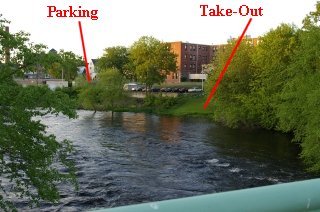
Open boat takeout off Warren Street next to the garage.
Park either along Warren Street or in a public parking garage next to the Doubletree Hotel. Take out along a break in the fence, climbing over a concrete drainage pipe just below Middlesex Dam on river-left. There is a paved area used by the city to practice roadway line painting.
This location is favored by open boats since there's no requirement to drag a bigger boat thru the brush and over the fence.)
This is also a great spot to scout Middlesex Dam.
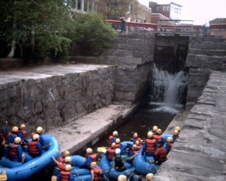
Below Middlesex Dam just above where the Concord flows into the Merrimack River are a set of 19th century locks used to access the canal system from the Merrimack. They are still in operation today and usable by river trips by prior arrangement. Note: As of 2006, the innermost lock gate is jammed shut by a large log and the gates are partially silted shut. Once the locks raise you up to street level you have to take out and portage around the last lock gate. This area is the raft take-out since they use the nearby Doubletree Hotel as a base of operations. Hamilton Canal connects to the other canals in Lowell as well as the
Merrimack River upstream of Lowell.
After passing the locks, the Concord River flows into the Merrimack River. Continue on downstream and just above the final take-out are a series of river-wide ledges with some glassy surfing waves.
Play on river-right to avoid being swept by the take-out.
When the Merrimack river is low and the Concord is very high getting to the takeout from a river left line over Middlesex Falls can be tricky. Buildings downstream will keep you in the river until you enter the Merrimack river. The final takeout is found about 1/2 mile down the Merrimack River on river right. Park near the end of Stackpole Street for good access.
Jun 14, 2017
840 cfs R2
Feb 5, 2017
The take-out just below Middlesex Dam is on Davidson St, behind 77 E. Merrimack St.
Jun 23, 2015
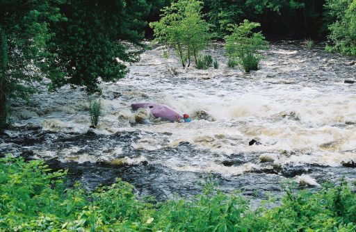
Went left at Massic Falls on my Coleman toy raft because river right has a massive tree blocking the whole main channel. Got sucked under a log at the re-entry point, had to dismount and retrieve my raft from the suction. Putting back in at the confluence caused my raft to hit the Meaty Hole sideways because I couldn't get straight quickly enough. Got swamped, flipped, swam, lost paddle, hurt my shin on a rock, bled a lot, swam the falls. This hole is deeper at low flows than high. A couple weeks ago I ran it at 786 cfs and it wasn't nearly as evil, bounced right through it. Watch out at lower flows, not as pushy, but much deeper and stickier.
If you see a black paddle with a black duct tape handle. That was mine.