Manitowoc
B) Union Road to Michigan Avenue (7 miles)
| Difficulty | I-II |
| Length | 8.3 mi |
| Avg Gradient | 10 fpm |
| Gauge | Manitowoc River at Manitowoc, Wi |
| Flow Rate as of 36 minutes | 20 cfsbelow recommended |
| Reach Info Last Updated | March 4, 2025 |
Quick Facts:
Location: Just west from Manitowoc.
Shuttle Length: 2.3 miles.
Character: A fine stretch of wide-open boulder-bed rapids.
Put-in is approximately 650' elevation.
Take-out is approximately 595' elevation.
Thus total elevation change is approximately 55'.
The overall gradient is ~8 FPM.
General Overview
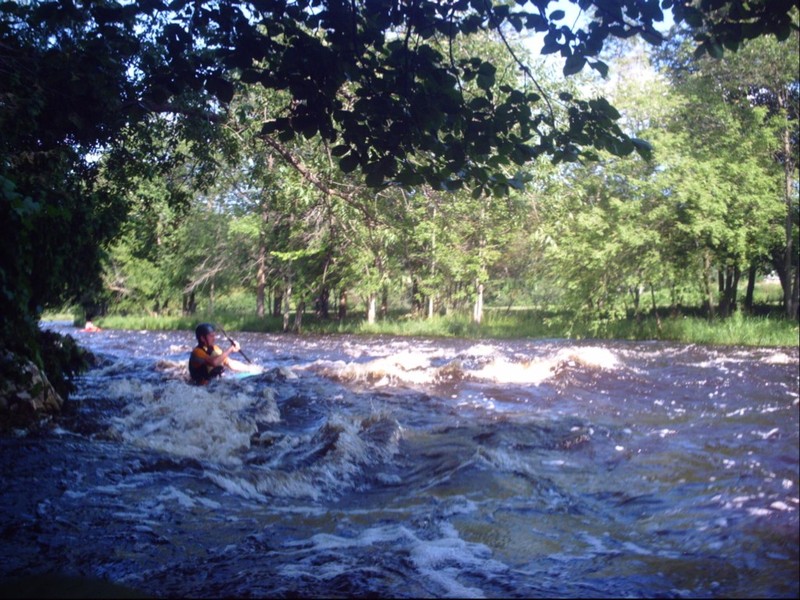
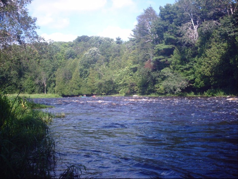
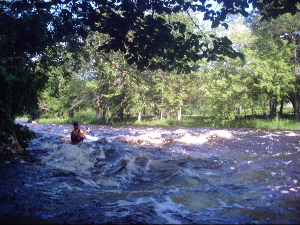
Just above I43, paddlers will find 3/4 mile of fairly continuous class I-II rapids. There will be a few really sweet surfable waves (especially at flows of 1000-2000 cfs) but most will be 'catch on the fly', having little or no eddy service. Canoeists and recreational kayakers may extend their trip another three river-miles by continuing down to Schuette Park (Broadway Street at Clay Pit Road), however that stretch contains no additional rapids.
We formerly listed put-in/access from the end of Logwood Lane, right at the start of the gradient. However, some paddlers (likely recreational kayaks and canoeists, and perhaps at least as likely, fishermen and other sportsmen) have had far too little regard for private property. Property owners complained about having their driveway blocked, people walking across lawns (to avoid having to walk through snow in early season, or mud and shrubs at other times), tossing trash (soda and beer bottles and cans), and any number of other totally inexcusable behaviors. While you have the right to be on the water, you do NOT have the right to cross private property to get to the river (no matter how brief it may be to get to the water), unless you first get the owner's permission!
It has been reported that 'No Trespassing' and 'No Parking' signs have been posted all along the end of Logwood Lane, necessitating the use of alternate put-ins. Unfortunately, the next best public access is the bridge at Union Road. Another alternative i
...
Want to explore a bit more? This put-in on the Branch River gives you 6.8 miles to the listed put-in for the lower Manitowoc run. We have no awareness how feasible parking and access are here, nor whether this stretch of the Branch River has any meaningful whitewater. Anyone having first-hand awareness is encouraged to add a comment below to help out your fellow boaters.
This location on the Manitowoc adds 4.6 miles to the run (for a total of 8.45 miles). This more than doubles the length of the run, and adds mostly flatwater and riffles.
This alternate put-in is on the Branch River. It adds nearly two miles on the Branch (a fair amount of which lies within a golf course; It is unknown at this time whether cart bridges allow sufficient clearance at boatable flows) and 2.35 miles on the Manitowoc for a total of 4.3 miles more to the run (and a total of 8.15 miles). There are other possible access points, but this location appears to add a fair number of shoals and possibly playable rapids.
From aerial views, this looks unlikely to have adequate shoulders for roadside parking as a put-in. However, it may be advisable (for boaters who may be using a put-in further upstream) to drive by here to check clearance under the golf cart bridge just downstream. (We have no knowledge at present whether it is high enough as to not ever be a hazard to passage. Anyone with first-hand awareness is encouraged to help your fellow boaters by adding a comment below.)
This may be the shortest access (other than private properties, with permission). It is not known how reasonable parking and river access might be at this location. (Anyone having first-hand awareness is encouraged to help your fellow paddlers by adding a comment below.)
Property here is all private, but if permission can be obtained to park and access the river, this road and the properties on it are immediately adjacent to the river.
The head of the gradient is at a point where Logwood Lane dead-ends at river-right. (Ok, technically, maps actually list the final stub as 3rd Street.)
This was our formerly listed put-in, but bad behaviour by some paddlers has made this area off-limits to all recreational access. As you can see, we have opted to leave all mileage figures (upstream and down) based upon this location, since paddlers may opt for differing put-ins.
Drainage area at this point is about 515 square miles.
Gauge is 300' upstream of the listed take-out for this reach, thus should very accurately portray flow in the reach.
As mentioned in the main description, canoists and recreational kayakers often continue their trip downriver of our listed take-out. However, there are no additional rapids of any note (maybe a few minor riffles), so most whitewater paddlers will prefer to exit here.
Aug 3, 2010
This is just downstream of freeway, and typifies the character of this stretch of the river.