Onion
Falls (PnH)
| Difficulty | V |
| Length | 1.7 mi |
| Avg Gradient | n/a |
| Reach Info Last Updated | April 2, 2019 |
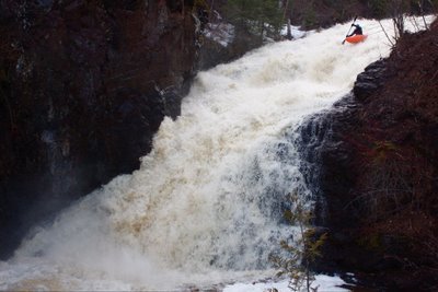
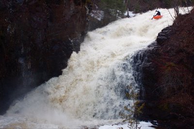
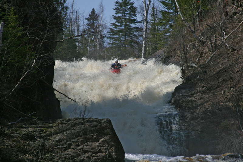
OK. This is serious park-and-huck stuff. Gradient is off the charts (OK, not literally, but . . .). Your first view of this long sliding falls is impressive. The first time I hiked up for a look (with not enough water in it to boat, even if I were so inclined), looking at the whole thing I thought 'no way'! Then as I looked at the bottom-most stretch, I thought 'I could do that'. I hiked up some more and said 'by itself, I could do that'. Hiked up some more and said 'Hmmm, I could see doing that.' But . . . feeling good about putting the whole thing together (at a time when there was enough flow) . . . I had a hard time convincing myself I would want to do that. However, a good number of folks have done it. The ride has got to be amazing. And the view is impressive, looking out to Lake Superior (AS IF you have time to take that in, once you are in your boat dropping this monster).

Note: Distance listed is NOT accurate or actual, but merely to sequence the photos/descriptions.
This trail/bridge is (approximately) at the 1180' elevation contour (via topo maps), and lies 1.0-1.1 mile (as measured online via GoogleMaps) upstream of the Lutsen Trail Bridge (at about 900' elevation). Thus, from this bridge to the next, there would be ~280FPM.
Note: Distance listed is NOT accurate or actual, but merely to sequence the photos/descriptions.
This trail/bridge is (approximately) at the 900' elevation contour (via topo maps), and lies 3,803' upstream of mouth (as measured online via GoogleMaps). Mean water-level elevation of Lake Superior is 602'. Thus, from this bridge to the lake, there would be ~298' of drop, making an 'equivalent' gradient somewhere in the 410-420 FPM range. (This is not to suggest anything regarding where the actual suggested put-in and take-out would be, but merely to provide some indication of drop here. Anyone having more/better measurements and info is very much welcome to provide their detail via comments below.)
Also, by my best measurements via online planimeter, drainage area at this point is only about 8 square miles. This should tell you how seldom this river will have enough flow to make any run possible. It will take peak snowmelt and/or significant rains to crank this up, and flow will drop off rather quickly. (Your window of opportunity will be extremely limited!)
Note: Distance listed is NOT accurate or actual, but merely to sequence the photos/descriptions.
Note: Distance listed is NOT accurate or actual, but merely to sequence the photos/descriptions.
Note: Distance listed is NOT accurate or actual, but merely to sequence the photos/descriptions.
Mar 1, 2015
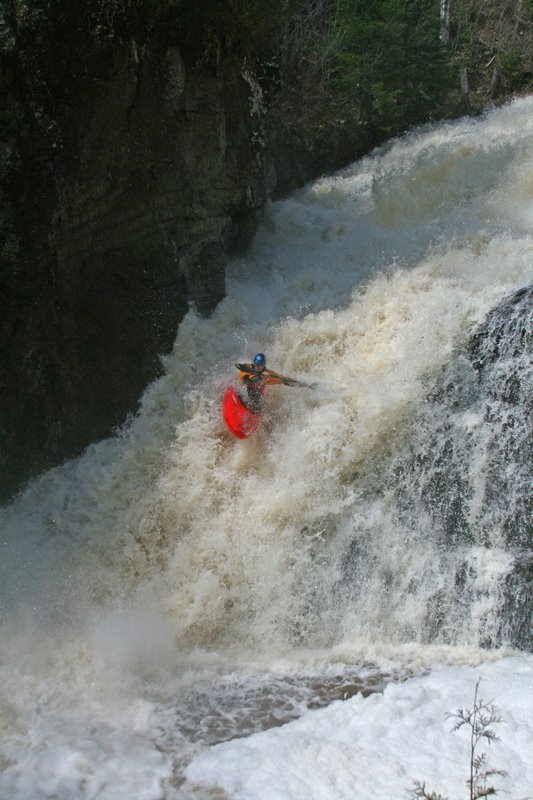
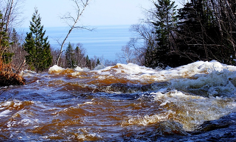
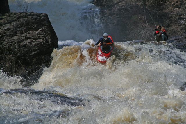
To access and run the slide, park at the pull-off from the highway. There exists a faint hiking trail that goes upstream from here on river left. It is easy to access and scout this entire multiple tier slide called, 'Tears for Fears' from the trail. Put in where you feel comfortable. The traditional put-in is in an eddy where the river makes a sharp left turn and exits a small gorge well above the slide. This adds a few great features with an entry slide and allows one to take in the massive horizon line of the Lake. The slide was first run by John Kiffmeyer and a visiting East coast crew.
The first full run of the Onion was completed by John Kiffmeyer and Loren Moulton back in the early 2000's.
Sep 1, 2014
First of two steep slides on 'Tears for Fears' - the final cascades of the Onion
Sep 1, 2014
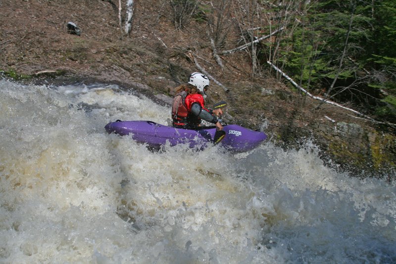
John McConville from a different perspective of the first tier.