| Difficulty | III-IV+ |
| Length | 1.5 mi |
| Avg Gradient | 120 fpm |
| Gauge | Wanaque River at Awosting Nj |
| Flow Rate as of 38 minutes | 16 cfsbelow recommended |
| Reach Info Last Updated | December 6, 2020 |
River Description
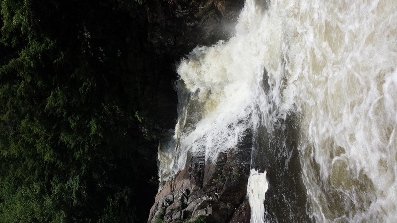
This is definetly a 'wam-bam-thank-you-mam' kind of run and you get a lot of bang for your buck. By name it's the Wanaque River but in reality it's a creek/brook run. early May 09, we ran it at a low level, about 110cfs or 2.70ft. I would say at such a low level it was basically a CL3-3+ run with the drops being CL4. At such low level, a person O.K. on CL3 wanting to do CL4 should be fine since it's not too pushy and making the small micro eddies should not be too much of a problem as well as if one gets caught in a strainer, he or she should be able to get out and help from others a bit easier. At more acceptable levels I would just say CL4. At such levels, catching micro eddies will be real important and nessacesary. There's a fair amount of wood.
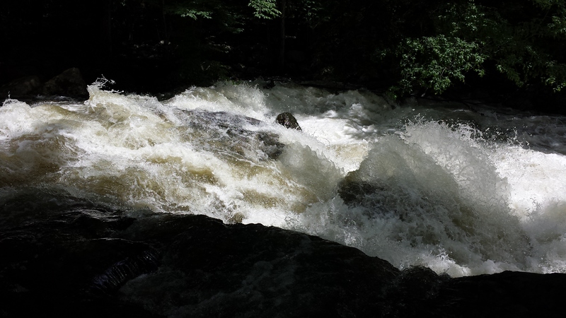
We started at the hikers' bridge across the road from the dirt turn-out on East Shore Road. Some of us started just downstream of the bridge (too low to paddle under), and some of us walked a couple of yards to avoid the first drop http://www.youtube.com/watch?v=SpabXT-fQF0 Said drop is scoutable from the road before you unload your boats. The first drop is I guess 5 ft. There's a rooster tail that will A) pin you B) you'll boof over but I doubt) or C) if you hit, but not dead-on, you'll flip. Let us know what happens to you if you hit, we wanna know without the possible consequences. We ran it just left of the rooster, no problems. After the drop, a small rapid then a short pool. From this pool, if I remember correct, from where I was, creek-left, I only saw one way, through vines and rock bouncing, messy. I think someone else took a clean line on the right that I didn't see being too lazy to ferry over. After a few drops and whitewater you get to a drop worth mentioning, perhaps we'll call it 'kiss rock'. At the days low water level, there is only enough water for one route. All the water goes down this drop, I guess about 5 to 6 ft and slams into a bo
...River Features
Put In
Access PointDistance: 0 mi
Take Out
Access PointDistance: 2 mi
Trip Reports
Log in to add a reportDM
David Millrod
Oct 30, 2016
Today the park ranger was camped out at the put in foot bridge telling everyone kayaking is prohibited. Some paddlers spoke to her at length and requested that she call her supervisor, but that didn't help. She said all access to the creek was across park lands and their park rules prohibited running the river in a boat. She claimed she would call the police if she saw anyone on the creek. Many people left after long drives without paddling, but some instead put in out of view of the ranger and had a good run.
As of today there was only one mandatory portage for an easily spotted log jam. The largest couple of drops were paddled safely, but are definitely worth scouting from shore.
AS
adam smizaski
Jul 18, 2013
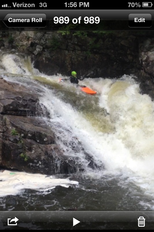
Adam about to ride the pillow. Good medium level.