Little
1. Hwy 35 to Upper Two(Suicide Section)
| Difficulty | IV-V |
| Length | 3 mi |
| Avg Gradient | n/a |
| Gauge | Little River Near Blue Pond Al |
| Flow Rate as of 1 hour | 149 cfsbelow recommended |
| Reach Info Last Updated | January 2, 2017 |
River Description
LITTLE RIVER CANYON
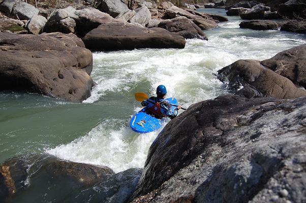
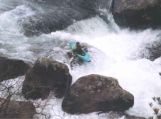
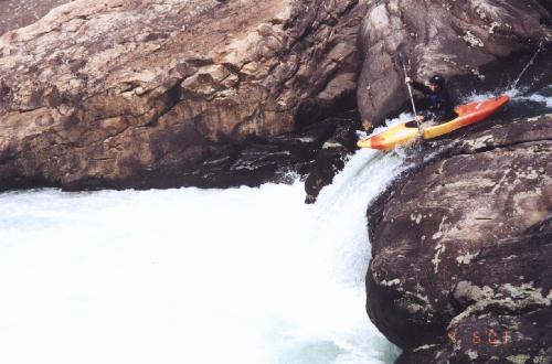
Little River is the premier whitewater river in Alabama. What makes it so good? Maybe it’s the incredible 10 mile long sandstone canyon it rumbles through, it could be the drinkable blue green water, and it is definitely the large distinctive rapids that crowd this run. Located atop Lookout Mountain just outside of Fort Payne AL, the canyon is divided by boaters into four sections, the Lower Canyon [ III-IV ], the Upper Mile [ IV ], the Upper Two [ IV-V ], and the Suicide Section [ IV-V ].
This is a large free flowing river with numerous side creeks that also contain quite a bit of quality whitewater. The natural flow often dries up to a trickle in the summer ,but in normal wet winters it will run from early winter all the way into May. It can run sporadically in the summer ,coming up on decent thunderstorms.
HISTORY
Canoeist began running the canyon in the 60’s. The lower canyon was a common destination for southeastern boaters through out the 70’s, though at that time it was considered “an expert run”. The upper canyon was considered unrunnable by the boaters who drove along side it on the winding canyon rim road on the way to the chairlift put-in. These early pioneers must have scouted the numerous big drops that can be seen from the overlooks with fear and anticipation.
Around 1972 or 73 a group from GA Tech made an exploratory run of the upper section. Even though no one was killed, many of the lower canyon regulars considered it a “suicide run”. The name stuck and is with us to this day.
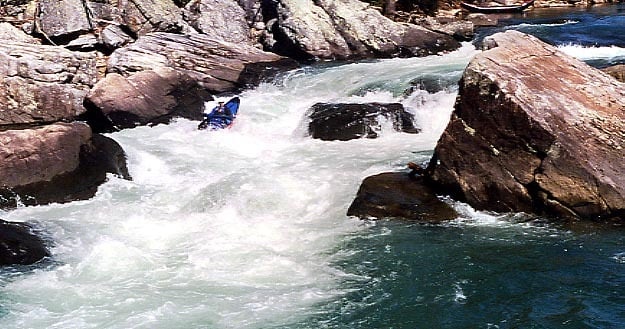
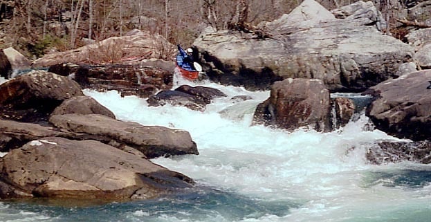
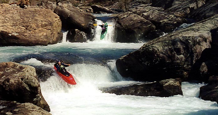
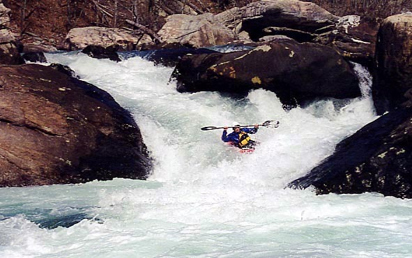
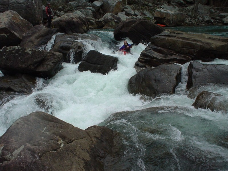
SUICIDE SECTION
The Suicide Section is indeed aptly named. No matter how many times I’ve run this, I always feel a little apprehensive at the put-in. The run is full of sieves, siphons, undercuts, and slots that you don’t want to go down. Many rapids have alternate routes that are seldom or never run. In addition to that there isn’t really an “easy” water level. At lower levels the run many of th
...River Features
Falls
Blue Hole
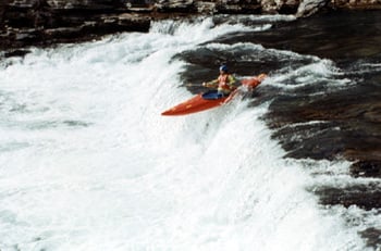
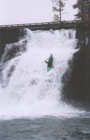
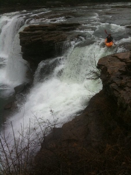
The first riverwide ledge and the last point for an 'easy' hike back to the put-in.
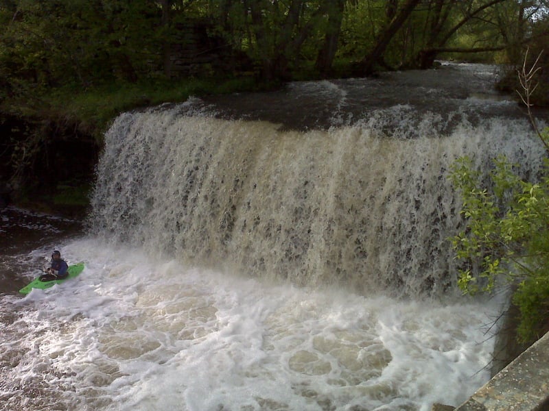
Mammoth Rock
Boulder Garden
Terminal Eddy
Avalanche
Cable Falls
Pinball
Trip Reports
Log in to add a reportDouble drop at LRC falls. Mason is boofing the first ledge which is followed by a 20 foot drop. It takes around 6 inches on the bridge gauge for the falls to go.
Chris McCoy on LRC falls around 7 or 8 inches at the bridge
Running the falls in the town of Remsen, level was low for the creek but good for the falls.
Things get pretty ugly over on river left... undercuts, sieves, and wood.... STAY RIGHT!
Are You Ready is the first real rapid one encounters after a few class II ledges... if you have any trouble here you might want to hike back out.
Just below the put-in and before Are You Ready is a series of small ledges.
This one gets harder and more dangerous at low levels. Not a place for mistakes.
This verticle drop of about 6' is a little out of character for LRC. Its also probally the easiest of the named drops... it can be run anywhere.
This is the low water line at the first drop of Cable Falls. It involved an 'around the world' move and a boof to the right to land clean.
In the unnamed rapids between Avalanche and Cable is one of the funnest boofs on the run.... The Mushroom Boof
too fun!
David likes those big drops especially if freewheels are involved.
Stein makes it look easy.
Sweet drop at a good level.
I think the guage has been fixed and is back to the old levels.
this is just below the first drop on pinball...ferrying above a nasty sieve to the drop.
The Little River at Blue Pond gage was recalibrated after Hurricane Ivan in 2004. Here is the new correlation for the Blue Pond gage and the Hwy 35 bridge gage. These levels should be considered in flux, because the Blue Pond gage will be recalibrated in the near future, as water levels permit. (3/1/05)
Blue Pond = 35 Bridge
500-650 cfs = -2.0
650-800 cfs = -1.0
800-1100 cfs = 0.0
1100-1300 cfs = 2.0
1400-1500 cfs = 4.0
1600-1700 cfs = 6.0
2000-2100 cfs = 7.0
2100-2200 cfs = 8.0
2600-2700 cfs = 12.0
I have an Excel 2000 spreadsheet that predicts the levels for Little River and several other rivers in the southeast. If you
Falls first run by Bo Eakens, right side run by the late Rich Weiss in a glass slalom boat (shallow). Bo and I ran 2 lines off the center around 13'' - still scrapey.
Some challenging lines:
Right to left line at Avalanche (through a narrow gap) - low flow only.
Left line at Cable Falls - very tight (low flow -only route)
Right line at Cable Falls (not too low, check for trees on this tight double drop).
Left to right at Cable Falls second drop - boof out from left bank into overhung cauldron driving hard right. ( Low flow only!) Right line kinda lands on your head.
Left lines (2) at top of Humpty Dumpty (top and bottom). Bad hole below very last left channel / slot.
Right line at top ot Humpty Dumpty (med-high flow) boofing through the crack.
Have fun -
C.
Shot of Cable Falls from the canyon rim.