Millers
1) Upper(South Royalston to Athol)
| Difficulty | III |
| Length | 7 mi |
| Avg Gradient | 32 fpm |
| Gauge | Millers River at Erving, Ma |
| Flow Rate as of 1 hour | 1.50 ftbelow recommended |
| Reach Info Last Updated | April 13, 2026 |
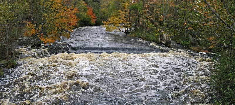
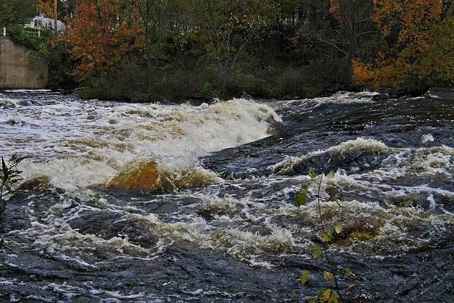
The Upper Millers is a long and scenic run that contains plenty of class II-III action, popular with open boaters and anyone else who enjoys catching lots of eddies. It is a step up from the Fife Brook section of the Deerfield. Note that this stretch is remote by Massachusetts standards and you are in the wilderness of Forest Conservation Area. You are commited to the 7 miles to Athol. However, after about three miles, there is an intermediate takeout option on river right, see directions below.
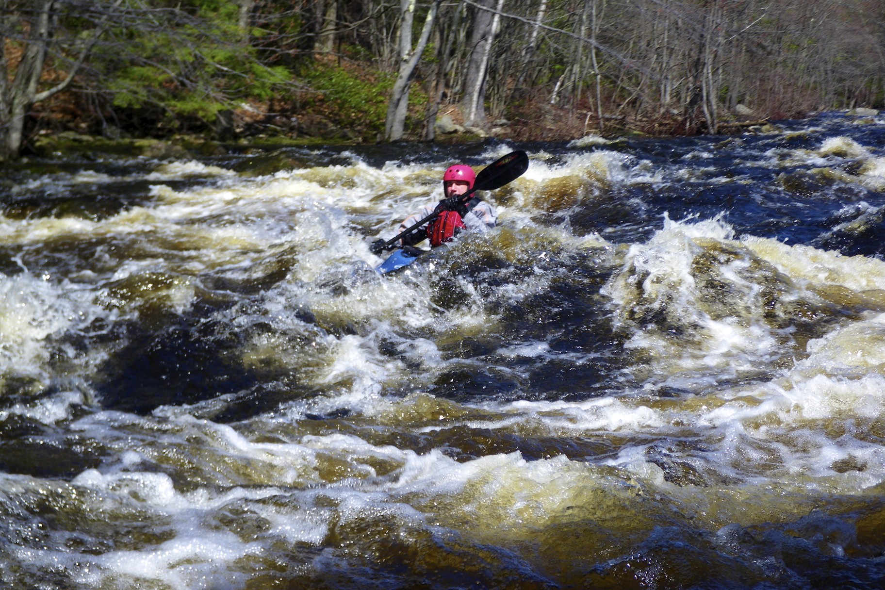
Some people hike upstream to run the broken dam under the King St. bridge, while other people put in below. Either way, some busy III action follows until the first railroad bridge, where there is a big wave train with great access from a river-right eddy.
Many more II and III drops follow on the way down to Athol. After the second railroad bridge there is a double drop that features a couple of larger waves (that can be bypassed on river right) and further down there is a III stretch with a more gorge-like character.
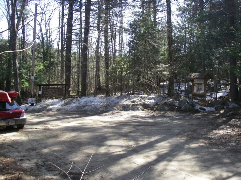
Take out under the power lines and be advised that you must complete a somewhat arduous trek over sand and gravel slopes to reach the gate at the end of Crescent St. Paddlers park at the take-out on the north side of Crescent St in Athol; please be courteous to the neighbors. From the take-out, follow Chestnut Hill Ave north to Royalston and hang a right on Route 68 to South Royalston. At the put-in, park along the south side of Blossom St. in South Royalston, between the river gauge and the parking spaces by the (closed) King Street bridge.
The put in is located in South Royalston, MA
From route 2, take the route 202 North exit. It is the last exit before the divided highway ends.
Stay on route 202 North until you reach route 68. There will be a sign on the left that says BIRCH HILL DAM 4 MILES. Go that way.
Once you cross the river, go left with the road and immediately park on the
...Put in at Army Corps of Engineers access area on Birch Hill Dam Road to run some warmup rapids and the broken dam. This spot has a smaller parking lot, but some nice grassy areas.
The broken dam is immediately above the closed King Street bridge for the lower takeout. Before it there are some nice waves and lead in rapids. The old dam structure while broken, forms a almost river wide low head. It is large and retentive. Run the broken dam down the far river left size, cutting back right after you pass the low head. There are some more waves below the bridge and before the lower put in.
Put in below the closed King street bridge to skip running the the almost river wide old dam. There's plenty of parking here as well as some picnic tables.
At the first railroad bridge you come to there is a series of good surf waves in on the right side of it depending on the level. There is some good lead in as you approach it. Depending on the level and your skill there are some catch on the fly waves above the bridge
Mile Long is a nice long section of continus class III. There are many waves to catch and eddys to weave in and out of.
As you get close to the end of the run you will come across the gorge section. The river constricts a bit and forms a number of good waves some which have good eddy service.
Take out at the Department of Fish and Game canoe and kayak access before the dam. There is a nice ramp out of the river and road up to the parking area which has a good deal of space.
Feb 10, 2026
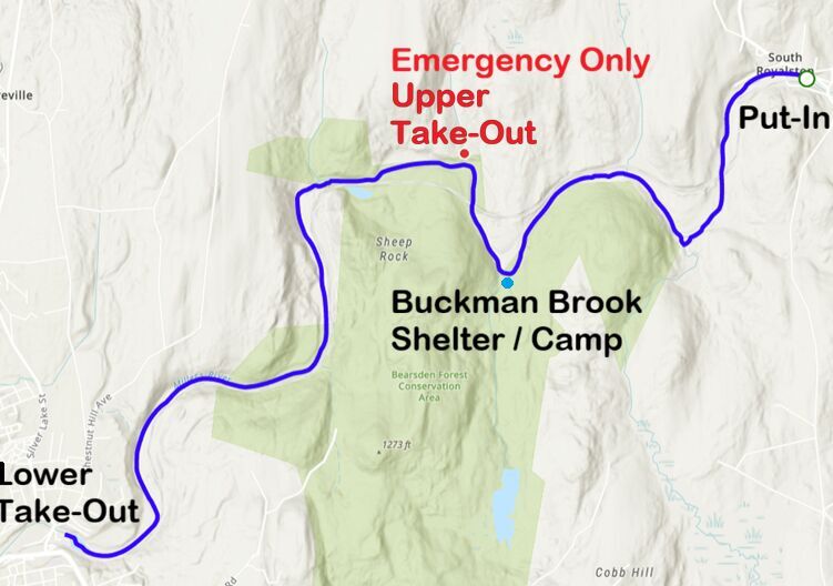
The Buckman Brook Shelter in the Bearsden Conservation Area is FREE of charge and requires a reservation made at this link. The Town of Athol manages this site. This video shows the shelter (at minute 7:30) when accessed from the road (about a 1 mile hike). That is what makes it perfect for a river access site. Could camp here overnight and break up the 7-mile river trek into two days. Perhaps the tricky part is securing your vehicles at the put-in and take-out locations so they are not towed away by the local police!
Mar 29, 2023
New link to Birch hill dam inflow and outflow
https://reservoircontrol.usace.army.mil/nae\_ords/cwmsweb/cwms\_realtime.projectpage?gagecode=BHD