Deer Creek
2. Eden Mill Dam to Rocks State Park
| Difficulty | I-II(III) |
| Length | 5.2 mi |
| Avg Gradient | n/a |
| Gauge | Deer Creek at Rocks, Md |
| Flow Rate as of 1 hour | 1.97 ftbelow recommended |
| Reach Info Last Updated | April 18, 2024 |
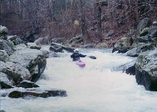
There is a two part Class III rapid called 'Deer Creek Rapids @ Rocks' upstream of the gauge at the end of the run. The run upstream of 'Deer Creek Rapids @ Rocks' is rather tame. Most people just run the 'Deer Creek Rapids @ Rocks' putting in just above it along MD 24 and take out just below the second drop (there's parking both above and below the drop). Of course, beginners running from Eden Mills who might not want to run this rapid, can easily take out above it.
At the very top of the first drop, there is a little wave that will push your bow to the left, if you let it. Don't let it, because the left channel is especially trashy towards the bottom. Try to punch this little wave and stay more right of center in the beginning part of the rapid.
The second drop is deceptive, because it looks like a clean chute (which it mostly is). But just to the left of the chute, there is a rock that presents a pinning/foot entrapment risk. General public swimmers have been known to play in the chute as a slide and every now and then someone hits it wrong and gets their foot entrapped by this rock requiring rescue or recovery. Whitewater paddlers can avoid this by setting a right angle at the lip of the chute. Of course, it would be wise to scout both drops before running them.
See Gertler, Ed; Maryland and Delaware Canoe Trails.
Lat/longitude coords are VERY approximate, from TopoZone.
Ed Evangelidi testifies:
The Class 3 rapids at Rocks may be negotiated down below 150 CFS, as it is quite constricted.

Most people just run the 'Deer Creek Rapids @ Rocks' putting in just above it along MD 24 and take out just below the second drop (there's parking both above and below the drop). Of course, beginners running from Eden Mills who might not want to run this rapid, can easily take out above it.
At the very top of the first drop, there is a little wave that will push your bow to the left, if you let it. Don't let it, because the left channel is especially trashy towards the bottom. Try to punch this little wave and stay more right of center in the beginning part of the rapid.
The second drop is deceptive, because it looks like a clean chute (which it mostly is). But just to the left of the chute, there is a rock that presents a pinning/foot entrapment risk. General public swimmers have been known to play in the chute as a slide and every now and then someone hits it wrong and gets their foot entrapped by this rock requiring rescue or recovery. Whitewater paddlers can avoid this by setting a right angle at the lip of the chute. Of course, it would be wise to scout both drops before running them.
Mar 23, 2022
Sep 12, 2011
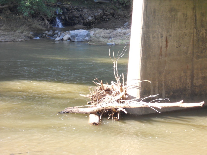
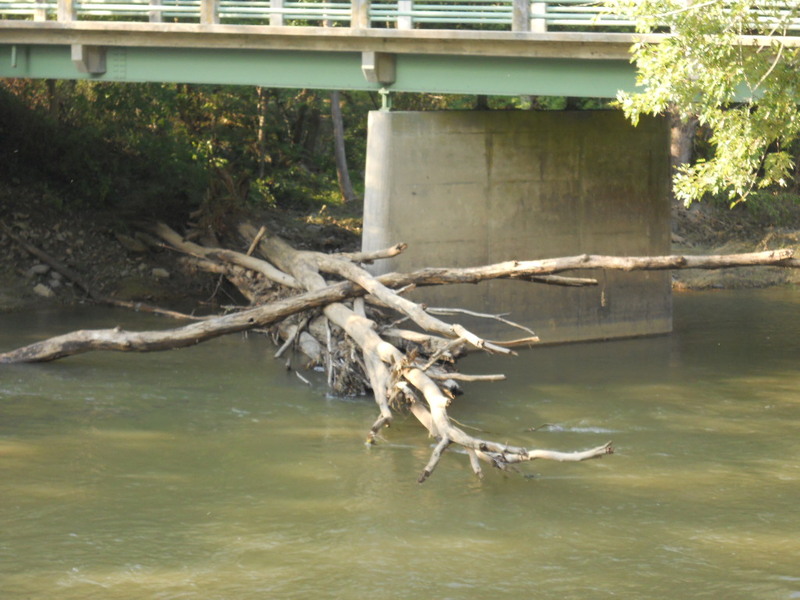
There used to be a significant strainer here which is now gone
Sep 12, 2011
the strainers at the bridge on rock run rd have moved. The pile at river right is gone, however, the pile at river left has turned and extends most of the way across the creek. Not sure what this will be like at lower levels (2' or less)