| Difficulty | II-III |
| Length | 7.5 mi |
| Avg Gradient | 20 fpm |
| Gauge | Gunpowder Falls Lower |
| Flow Rate as of 1 hour | 208 cfsbelow recommended |
| Reach Info Last Updated | May 1, 2025 |
River Description
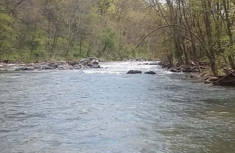
The typical put-in for the Lower GunPowder is at the US1/Belair Road Bridge. There is a really nice gravel parking lot with easy access to the river on river left. The take out at Jones Road has been closed permanently. Currently the only available take-out is at Mariner Point Park which increases the length of the run from 3.4 miles to 7.5 miles.
For more information about this run, see: 1) http://www.baltimorecanoeclub.org/index.php/en/paddling-resources/2013-10-02-01-22-40/2013-10-02-01-46-11; 2) Maryland and Delaware Canoe Trails, Ed Gertler.
John Berg relates: This is a great run if you can catch it after a rain when Loch Raven Reservoir is full. At lower levels there are not too many playspots. I have not run the upper sections. I usually put in at the Belair Road (Hwy 1) bridge for a shorter but more action-packed run.
Ed Evangelidi relates:
There has been some theft problems at the Jones Rd. takeout, so don't leave your boat or gear unattended or leave anything of value visible in your car. Use the hiking trails (river right is usually best) to scout any rapids that you are unfamiliar with.
River Features
US1/Belair Road Bridge Put-in
Access PointDistance: 0 mi
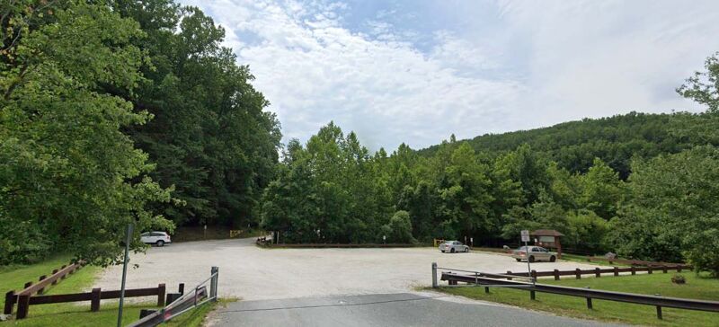
The typical put-in for the Lower GunPowder is at the US1/Belair Road Bridge. There is a really nice gravel parking lot with easy access to the river on river left.
"Pot Rocks"
RapidClass: IIIDistance: 1.05 mi
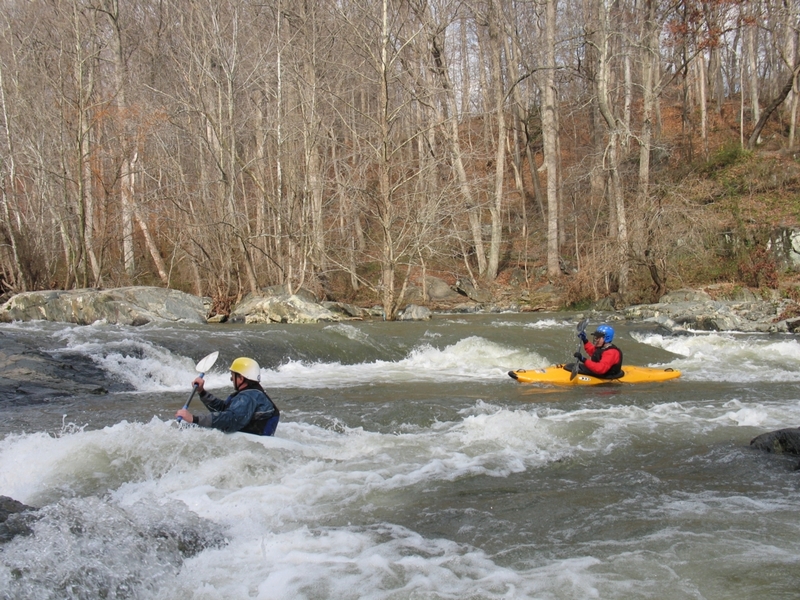
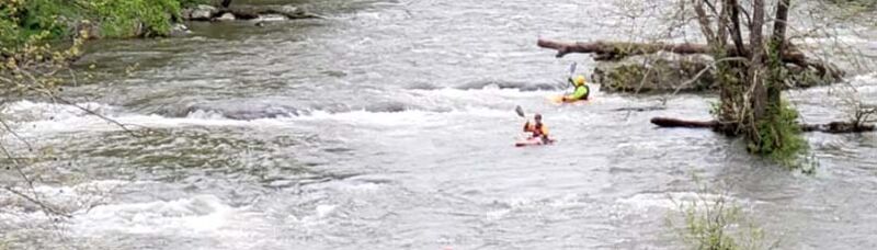
'Pot Rocks' (Mile1.0) - This is the first real rapid. The classic line up to about 1.5' is to run the first drop and catch an eddy on river right, peel out from this eddy and use the eddies behind one rock to slingshot you into an eddy behind a larger rock. From this eddy, run the tongue in the center (or a little right of center) on the final drop and eddy out. As the level gets higher, this line gets more and more tricky so that at higher water levels, the line is to start in the center and keep moving left, choosing the best slots between the rocks to get you to the tongue at the bottom drop. At most levels, there is a descent surf wave at the very top of the rapid. The eddy at the bottom of the rapid on river right is really great for enders and cartwheels. At some levels, the hole right after the ledge is really good for spins.
"Pots 2"
RapidClass: IIDistance: 1.2 mi
'Pots 2' (Mile 1.2) - Below the pool at the bottom of 'Pot Rocks', class II rocky rapids continue, ending with a channel that splits evenly on a rock -- the easiest line is to move from left to right above the rock, but a right to left move is also possible.
"I-95"
RapidClass: II+Distance: 2.19 mi
'I-95' (Mile 2.19) - A series of rapids starts at the I-95 bridge. Here, the river is split in two by a bridge pier supporting I-95. The most common line is to stay left of the pier and just at the end of the pier is a slot that moves right and then left, eddying out below. There is a nice surfing wave to the right of the pier, but it can be hard to get to at lower water levels or if there's wood, which tend to collect at that side. With some effort, you can sneak behind the bridge pier to attain back up to the surfing wave.
"BBQ Grill Ledge"
PlayspotClass: IIDistance: 2.31 mi
Below the I-95 bridge, the easy line is to stay center left, although, if you stay to the right, there is a ledge ('BBQ Grill Ledge') with some slot moves to play with and to do attainments. The sweet smell of the grill at the Big Falls Inn is usually evident while playing in these ledge slots. This series of rapids ends at MD 7 bridge (Philadelphia Rd).
Lead in to "Fall Line"
RapidClass: III-Distance: 2.44 mi
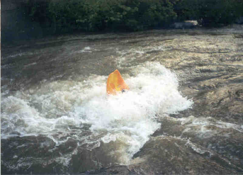
Lead in to' Fall Line' - (Mile 2.44) - This series of rapids begins right after you go under the MD 7 (Philadelphia Rd) bridge. It starts with a short series of back-and-forth lines that culminate in a large staging eddy on river right. From this staging eddy the next rapid ('Fall Line' rapid) can be easily land scouted or portaged from the paved trail on river right or boat scouted from the eddy.
"Fall Line"
RapidClass: IIIDistance: 2.54 mi
'Fall Line' - (Mile 2.54) - Starting from the large staging eddy on river right (see photograph), the basic run is to enter on a center tongue and keep moving left. Avoid a tendency for the river to push your boat to the right, because if you try to float the rocks to the right, you'll find yourself swimming. Which is not to say that you can't work the eddies on the right, they just have to be worked, not floated. There are tons of little play waves and holes on the way down this rapid, and eddies and micro eddies both right and left, but the basic line is to keep moving left. About halfway down there is a big eddy on river left where you can stop. From there, just peel out, missing the rock on the left and run the rest of the rapid in the center or a little left of center catching an eddy at the bottom. At higher levels, there is a really fun slot move on river left from the big eddy mentioned above. Directly at the bottom of the slot move, there is a really good surfing wave.
Just below 'Fall Line' there is a small beach on river left and, a little farther down, a relatively gentle surfing wave on river left which is good for beginning surfers to use to learn to surf.
(This rapid gave the river its name: 'Gunpowder Falls', or just 'The Falls'. But to avoid confusion, since this is the same name as the river and the run, paddlers use the name 'Fall Line' for this rapid.)
"Overstreet"
RapidClass: II+Distance: 2.78 mi
'Overstreet' (Mile 2.78) - This rapid is a continuation of 'Fall Line'. You run this rapid in the center prepared to make a few sudden moves to accommodate the sudden appearence of rocks to be avoided or hit as necessary. The exact line for this rapid varies considerably with levels, but is generally in the center.
"S-Turn"
RapidClass: II+Distance: 3.02 mi
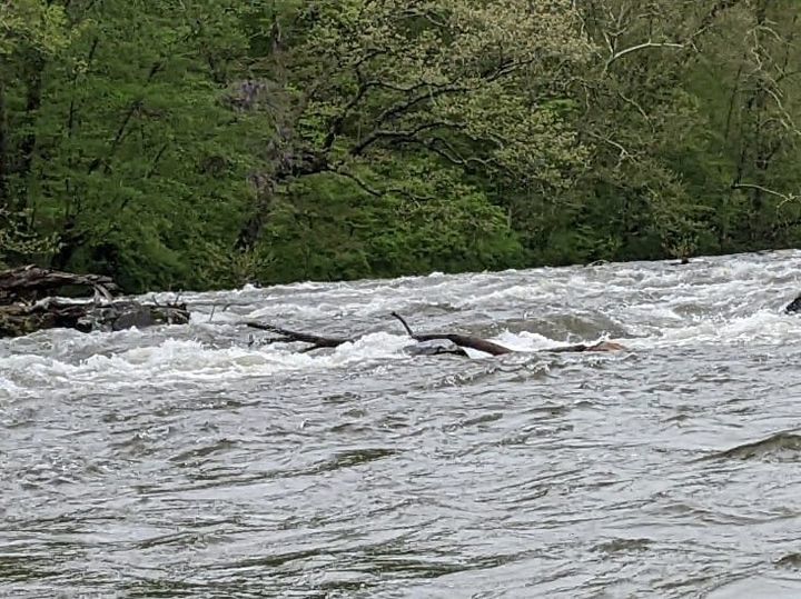
'S-Turn' (Mile 3.02) This rapid is the last rapid on the river. The rapid was formed by a long gone Dam that left a rocky delta on river right that pushes the river to the left and a large rock just downstream on river left that pushes the river to the right . The result is as soon as it begins, there's a hard turn to the right against the large rock and then a turn left (down river) again to the runout. At the top at lower water there is a nice surfing hole with good eddy access. At the bottom on river right there is a nice crisp eddy line for doing stern squirts. The inside corner of the last turn at lower water usually allows an “elevator” move to go back up to the top of the rapid. Sometimes it can be a play wave or hole at higher water. You can also hike down the railroad track from Jones Road if you want park and play.
US 40/Jones Rd. Take-out
Access PointDistance: 3.4 mi
'Jones Rd.' Take-out (Mile 3.4)
The Jones Rd. Takeout and parking area has been closed permanently. Also, US 40 in the vicinity of the river has been marked 'No Parking, No Standing, No Stopping' by the Baltimore County Police.
[Old description: The take out is at Jones Road, just before the US 40 bridge across the Gunpowder (if coming from the East) or just after (if coming from the west). Because of overuse and trash accumulations over the last few summers, the Jones Road take-out will be closed from Memorial Day weekend through Labor Day weekend (inclusive).]
Mariner Point Park Take-out
Access PointDistance: 7.47 mi (approx.)
'Mariner Point Park' Take-out (Mile 7.4).
To get to Mariner Point Park, continue on US 40 east until you cross the Little Gunpowder (Harford County line). Immediately after the Little Gunpowder is a stoplight at Joppa Farms road, turn right at the stoplight onto Joppa Farms Road and go 1.7 miles, then turn right onto Kerney Drive. Go 0.6 miles on Kerney Drive to Mariner Point Park.
Trip Reports
Log in to add a reportTA
Jones Rd. closed Permanently - Tony Allred
Sep 24, 2023
The Jones Rd. Take-out and parking area have been closed permanently.
TA
2023 closure of Jones Rd. Lower Gunpowder Take-out - Tony Allred
Sep 23, 2023
In 2023, the gate at the Jones Road take-out will be closed beginning Memorial Day Weekend (closing May 26, 2023) and there after permanently. (Also, US 40 anywhere near the vicinity of the river has been marked 'No Parking'). For a more detailed description of the river with current warnings, current level correlations/calibrations and the correct rapid names see: http://www.baltimorecanoeclub.org/index.php/en/paddling-resources/2013-10-02-01-22-40/2013-10-02-01-46-11.