Trip Reports
Log in to add a reportBB
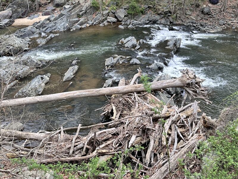
Major Strainer/Log Jam River right last drop of the ledges - Bobby Barker
Apr 7, 2025
AF
Andrew Froom
May 19, 2015
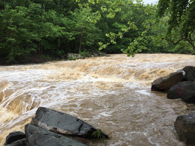
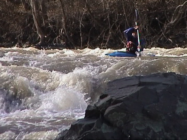
Fall line on the Little Patuxent at 1100 CFS 7.2 ft after an overnight thunderstorm.
AF
Andrew Froom
May 19, 2015
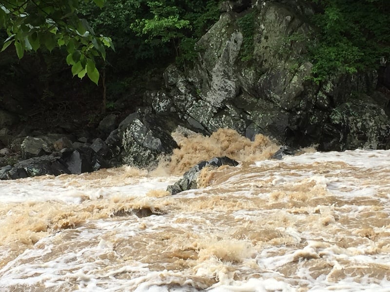
View of the river right slow that crashes into a wall. Pourover at lower flows and a nasty hole with huge deflection wave off the undercut on river right. Do not run right side at higher levels.
?
Untitled
Feb 4, 2008
Robert Farmer---New and improved directions: Take I-95 south of Baltimore or north from Washington to Route 32 east. Turn south on Route 1. Follow directions below from this point. There is a put-in just off Guilford Rd, which is the first traffic light north of Route 32 on Route 1, for a longer run of a few miles, rather than just doing the big drop section. I ran this Feb 2, 2008. The day was so nice that I was surprised that no one else was there, at least until late in the day when a group arrived from upstream.
Although the center route over the main (#3 of 5) ledge looked adequately covered at around 400 cfs, I pitoned against an unseen rock and stopped dead before floating over or around it.
The bottom right slot seemed decidedly Class 5-ish: The first time, I made it through nicely, but flipped. The second time, I stayed upright, but got pushed left to a spot under the falls sort of on the edge of the hole, where I stopped near, but not touching, the rocks; if I had flipped, it would have been ugly, so I definitely would not call this Class 2. Also, this entire section was quite bony at 400-or-so cfs; I think it could go a bit higher for the maximum, although it looked extra-exciting the night before at 3,000.
There are some excellent surfing waves just upstream of the ledges section.
RS
Robert S. Farmer
Mar 18, 2007
Directions: Savage Mill is approximately 18 miles south of the Baltimore Beltway and about 5 miles south of Route 100. Take Route 1 south (Washington Blvd). Turn right 0.5 mile south of Route 32 on Gorman St. Go about 0.4 mile and turn right/park on Foundry st.
Looking at the drop at low water, the two right-side routes over the first ledge end at piton rocks and have sticky-looking holes; the far-right is a quintessential keeper. The right side of the third ledge also looks sticky. This series of drops isn't so much 3 ledges as much as 3 erratic piles of jumbled, haphazardly scattered pinning rocks. Every line has little uglies just under the surface. It's probably safer with more water, but be careful about what's underneath you.
MC
Mark Cooper
Oct 25, 2005
We ran down the left side. Stay altert of the rocks and holes on the approach. Be careful of the little rock below the first drop on the left, it can knock you off line. Avoid the sharp rock sticking out next to the big rock in the center of the second drop. Your good to go left or even center down the third drop.
JS
Jason Sullivan
Mar 23, 2005
High Water run,Jan 14,05.I made a run from Brokenland Parkway to Savage at 4000cfs??, is what the gauge said, The first section to 95 bridge was easy fast water,after passing under the first low bridge it was 'very' pushy,and there was on bad tree in a very fast rapid,as I approached the ledges. I eddied out on the left to scout.My sneak that I normally take at high water on the extreme left was now a monster hole,and the hole on the bottom right had a pillow coming off the rockwall behind it 6-8' high!!,I'd call it class 5, It could of been run in the center but I shouldered my boat. The section right below(dogleg)was very fast and fun.I wouldnt reccomend running it at this level, its was very pushy. I dont think the rock on bottom right is undercut, I have seen it at extremely low water. Jason
NW
Nathan Winslow
Mar 24, 2003
We had multiple runs and ran every line in there at 500 cfs on 3/20/03. The move for the last ledge on the right looks weird, but is a forgiving II+. As long as you don't try to bow stall into the center of the pour-over with a play boat, you will be fine. Other than swimming, the piton rock on the second ledge is the worse hazard in there.
NW
Nathan Winslow
Mar 9, 2003
Note the clear look of insanity in the subject's beedy eyes
Ledges on the left are easiest. Center ledges have the most water and are fun. Last ledge on far right could get ugly
Dog leg after the falls is a wave train into a boulder. It's straight forward compared to the ledges. Could get interesting up around 1000 cfs.
NW
Nathan Winslow
Mar 9, 2003
The center right ledge with the piton rock can be run straight on with a little right to left momentum. Just don't broadside that rock. It looks sharp. Center line on the next ledge is juicey. We threw a couple of sticks in the far right pour over-undercut thingy. One popped right up and flushed out. The other was down for quite a while. What's down there anyway?