| Difficulty | III-IV |
| Length | 4.4 mi |
| Avg Gradient | 75 fpm |
| Gauge | Savage Riv Bl Savage Riv Dam Near Bloomington, Md |
| Flow Rate as of 34 minutes | 61 cfsbelow recommended |
| Reach Info Last Updated | June 1, 2024 |
River Description
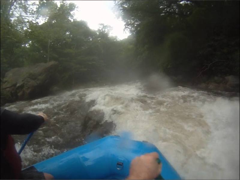
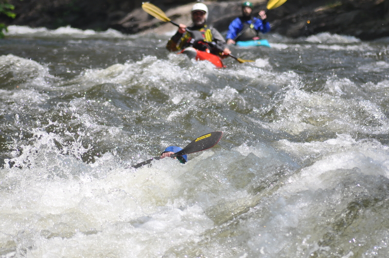
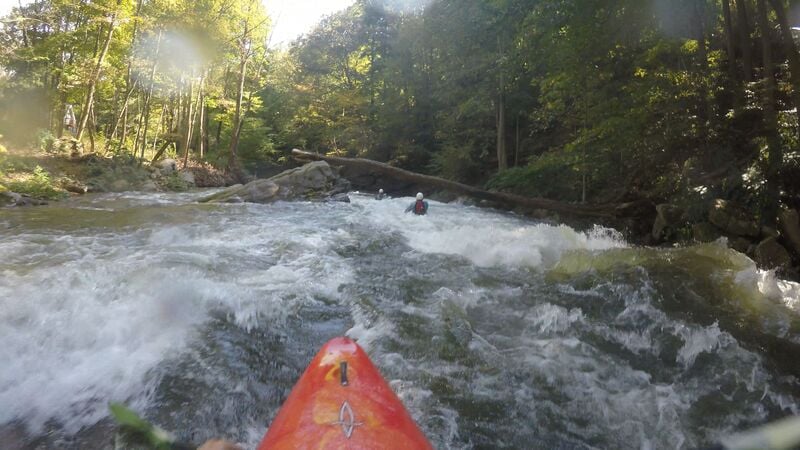
The Savage is THE whitewater rocket ride! With an average gradient of 75 feet per mile (with sections exceeding 100 fpm) the action is fast and continuous. The Savage's overall difficulty rating below 800 cfs is Class III-IV. At 800 - 1,200 cfs it is Class IV. Above 1,200 cfs the Savage is the longest Class IV-V rapid in Maryland!! Due to the steep, narrow and unrelenting nature of this run paddlers should be: 1) Well insulated (water temp 46), 2) Adept at fast self-rescue and wave-crest scouting, and 3) In possession of paddling skills commensurate with water levels: below 800 cfs - intermediate to advanced, 800 - 1,200 cfs - advanced to expert, above 1,200 cfs - expert only.
SOURCE: William Nealy's Whitewater Home Companion, Southern Rivers Volume I, which has more on this run. Text used with permission.
Savage River Road follows along the entire 4.25 mile run. At approximately mile 1.5, and just before the swinging bridge that marks the end of the slalom course, a large undercut rock (House Rock) is located on river left.
The take-out is on the North Branch of the Potomac just upstream of the confluence. Please respect the locals and refrain from drinking or changing clothes in the open, here. The put-in is just minutes up the road and its relative remoteness lends itself to these activities.
Whitewater Releases:
American Whitewater and others worked to obtain regularly scheduled recreational whitewater releases (600 - 1000 cfs) on three weekend days annually, June through September. You can see the upcoming scheduled releases, and unscheduled releases on the dam owners' website. American Whitewater volunteers meet with other stakeholders twice each year to coordinate the releases.
Another good source of information about this run is Ed Gertler's Maryland and Delaware Canoe Trails.
River Features
Upper put-in
Access PointDistance: -0.35 mi

Instead of crossing the bridge over the savage, you can hike up the river left side. Go past the gate, then through the field. Stay to the left at the top of the field. This puts you below the spillway on the river left channel a little upstream of the joining of the two channels. Provides you some bonus class 3 boogie. Generally considered not worth the hike.
Bridge Put-in
Access PointDistance: 0.05 mi
Typical put in location, just upstream of the Savage River Rd bridge (second when going upstream) by the camping and parking area. USGS gauge is located at the end of rapid below the putin and above the bridge
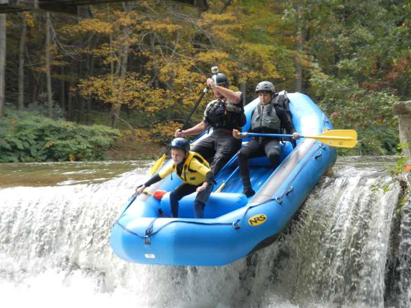
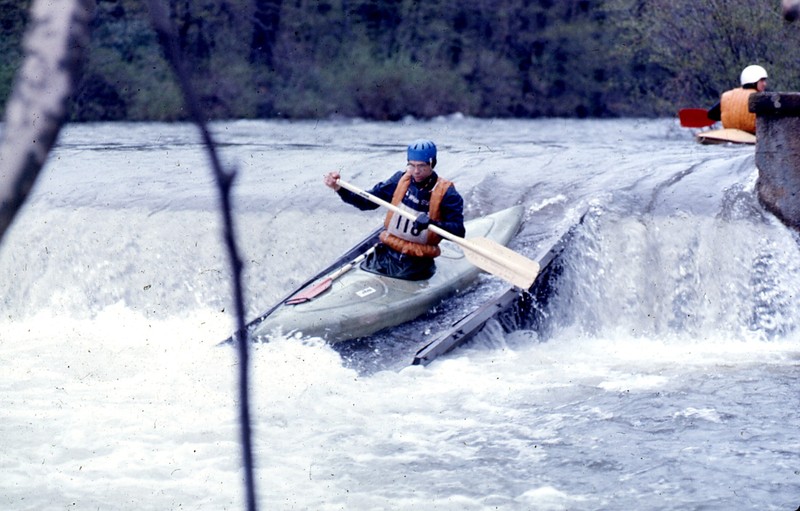
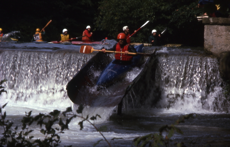
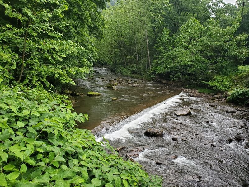
Swinging Bridge Dam
OtherDistance: 0.85 mi (approx.)
Dam underneath a swinging foot bridge. Marks the end of the slalom course. There are a couple different lines to take.
The standard line is to run the cut out slot on the river left side of the dam. It is a sloping tung of water that ends in a hole that has a tendency to flip boaters and even backender creek boats. One can also boof off the dam into the pool. This is typically done a little to the right of some vegetation growing on the dam to the right of the slot.
The more challenging and interesting lines are on river right. One is to hug close to the river right shore, 3-6 feet off the bank. You drive with right angle, punching through the hole to get up on the flow. Then either catch the right hand eddy, or keep going following the flow back to the pool below the dam. Another line here is to boof off of the right hand side of the dam into the pool. There is a slight mound that indicates where you should be. Care must be taken, if you go too far right or are sideways you will get worked in the pour over that forms on the dam.
Crisscross / Double Hole
OtherDistance: 1.2 mi (approx.)
Crisscross / Double Hole is indicated by the river turning to the right as it meets the road. There will be a very large boulder on the river left side. The rapid consists of two offset holes with a tongue between them, first one on the right, second in the center. The standard line is down the center, starting center and going to the right on the tongue after you have past the first hole. The sneak line is to stay to river left in the mank and ducking to the left of the rock that forms the scond hole in the center. The advanced line is to boof off the center left of the rock that forms the second (center) hole. It is a very sweet boof, but if can easily be messed up.
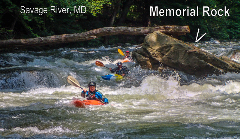
Triple Drop / Memorial Rock
OtherDistance: 1.35 mi (approx.)
Triple Drop / Memorial Rock has a large boulder in the middle of the river and shelf boulder on river right. The standard line is start center aiming towards the boulder. As you approach it you will go on the right side a couple feet away, driving right. Behind the boulder and in the flow is a hole. The goal when driving right is to miss the hole and catch the eddy. The advanced move here is to boof off of the left side of the river right shelf boulder, landing in the eddy.
Hutch's Demise
OtherDistance: 1.85 mi (approx.)
The river again come towards the road and follows it to the right at the entrance of the rapid. The main flow stays to the left, there is a very small river right channel, usually with some wood.
It starts off with a 3-4 foot ledge drop. There is a boulder in the center left of the drop that can be boofed off of. Typically this part of the drop is run to the right of the boulder. After this make your way to the left. The center is manky, and even though the rock in it looks like a nice boof it is not. It lands on a rock. There is a boulder on river left forming an eddy, typically you stay in the flow to the right of this and pas the end of the mank/island on the right. This puts you about in the center and lines you up for one more final small hole at the end of the rapid, easily punched.
Metal Bridge
Access PointHazardDistance: 3.25 mi (approx.)
As things calm down you come to the first (when driving upstream) bridge (metal bridge). Right above this is a very small low head dam type feature. Easy to run river left as it has been broken down on that side. On river right it is retentive and potentially makes a surf spot depending on levels. Small amount of parking here, can potentially be used as a take out. Aaron run comes in from river left just below the bridge. There is a large strip mine upstream in the Aaron run watershed, which results in a great deal of erosion and fallen trees in the Savage below the confluence with the creek.
Island 1
OtherDistance: 3.9 mi
Typically run river right. Left channel is smaller, may collect wood, and has an abrasive concrete boulder in it.
Island 2
OtherDistance: 4.07 mi (approx.)
Typically run river left, right side collects wood. After the island all the flow slams into an undercut wall river right. Catch the eddy on river left. This sets you up for the last rapid. Typically run on the center left side. There is a very level dependent boof in the river right mank. However, if the level isn't correct you will land on a rock, possibly pinning.
Release Takeout
Access PointDistance: 4.34 mi (approx.)
Just upstream of the bridge over the Savage at MD-135, on river left, immediately above the NB Potomac confluence is the takeout parking area. During releases, paddle under the bridge and down the right channel and then slightly upstream to take out by the abandoned bridge on the North Branch.
Trip Reports
Log in to add a reportJM
Jeff Macklin
Jul 22, 2022
MA
Michael Abernethy
Jun 1, 2015
Ran this reach during the release on 05/29/15. Log mentioned by the previous commenter at memorial rock had been removed by the ASCI crew prior to the event. Great run even though the release was 600CFS less than last year. The shuttle lines were extremely long and the release was only 4 hours, so you had to get on early to get two or more runs in.
Full-length video of our first run can be found here: https://www.youtube.com/watch?v=Nr1kkONLEVo