South Sauty Creek
Intersection of County Roads 43 and 56 to Bucks Pocket

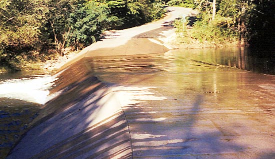
A good visual gage for South Sauty Creek is the low water bridge that crosses it at the entrance to Buck Pocket State Park. In this shot, there is about 5" of water flowing over the bridge which translates to 0.75 on the South Sauty paddler's gage. The creek is runnable when there is a thin sheet of water flowing over the bridge. 1 foot of water is over the bridge is 1.5-2.0 feet on the gage. If your car will get swept downstream into the lake its over 3.0 feet on the paddler's gage.
Rob Maxwell
n/a
Low Water Bridge Crossing South Sauty Creek