South Sauty Creek
Intersection of County Roads 43 and 56 to Bucks Pocket
| Difficulty | III-IV |
| Length | 6.4 mi |
| Avg Gradient | 60 fpm |
| Gauge | South Sauty Creek Near Rainsville, Ala |
| Flow Rate as of 20 minutes | 7.44 ftbelow recommended |
| Reach Info Last Updated | November 25, 2015 |
South Sauty is pretty hard to beat, good continous action top to bottom. Plenty of steady class 3 and 4 action ending with your car in view and a hot shower just steps from the take out.
Buck Pocket State Park is a great takeout. Please show your appreciation for this state park and donate a dollar or two for using the facilities. They use the money to help maintain the restrooms and keep the place up. Oh, by the way, if you need a shuttle, ask Bruce what you can do!
Sauty is boatable at a wide range of flows. There is a paddler's gauge at the take out which is the best indicator for whether the creek is runnable. From the parking lot near the restrooms, walk straight down to the creek and look at the stick attached to a large tree. There is a USGS gauge upstream of the put in which has a fairly reliable correlation to the stick gauge at the take out. For a rough conversion use the formula (USGS reading in feet x 8.7) - 65 = stick level. See the 'flow info' tab for more detail on the ranges.
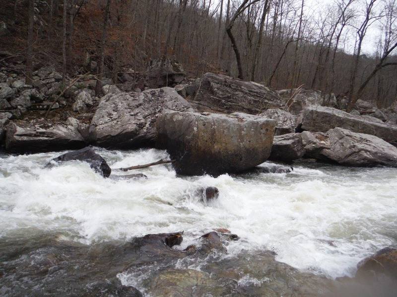
An 8 foot river wide ledge usually run on the river right side where it is a straight drop. The middle is more of a slide and the far left side is avoided.

After a few hundred yards below the bridge, the river makes a bit of a bend to the left. Towards the bottom a slot is formed that is usually run by staying right and avoiding dropping into the meat of the slot at higher levels. It gets pretty boily.
Not a named or considerable rapid, but a sticky hole forms bottom right at some levels, can be run anywhere.
Somewhere before Welcome To Sauty is a rapid commonly referred to as 'Tits' which looks totally harmless and unremarkable from the top. There are two rocks in the middle of the creek and the right bank is ledgy and exposed. The right rock will be covered at levels around 12 inches, but the pillow should still be visible. Left rock will be visible at most levels. Run in between the two rocks, do not go to the right of the right rock It pinches against the bank on the right which is undercut with just enough of a gap to form a sieve that loves to collect logs. A few close calls here just due to not knowing the hazard and line.
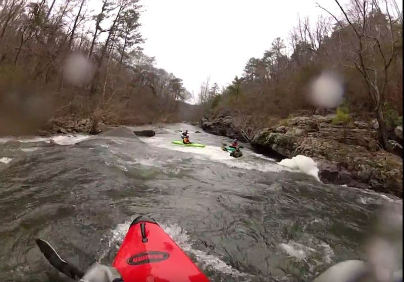
The first notable horizon line on the creek. Run a variety of ways at different levels with boat scouting eddies all the way down to the entrance drop. A two part rapid with moving slack water between a top and bottom drop. If anyone is having big problems here, now is the time to reconsider paddling the rest.
An unnamed rapid that has a hidden rock right in the main flow below a single drop. The drop is on the left side of the creek, about a 3 feet tall, and at levels 18 inches and below (especially 12 or below) there is rock directly in the main flow 15 feet down from the drop.
A fun rapid where the water constricts against the cliff wall on the right side of the creek. After a short lead in, the main drop is a folding tongue from right to left into a turbulent pool with strong eddies on right and left.
On river left as the creek is making a bend, you will notice the largest tributary on this stretch entering. Just visible from river level is the 25 foot final drop of Reedy that plunges into a lush pool below. This signals Jonahs Whale downstream.
A noteworthy rapid for sure and definitely one to scout for a first time. Eddy out river right near the top. The majority of the flow at the bottom of the rapid goes straight into a whale sized rock with a gaping mouth that tends to collect wood. Low water closes off a rocky right channel, forcing you to stay in the current longer, although there will be less push. At levels 8 inches or more though, and especially above 12, it's easy to get into this right channel and avoid the whale by the widest margin. Walking is easy on river right.
An unnamed rapid generally run on the right side with large boulders defining the left side of the creek. If you drive left at the top, eddying out behind the first large rock, you can paddle back into the rock pile into a 4-5 boat eddy (shhh! it's a secret!)
At mile 2.4, you will reach an island where the majority of the flow goes left towards the rather high, exposed cliff wall.
Going left of the island takes you through Cliff Left rapid, which consists of paddling under the overhanging cliff and generally staying left and finishing on a low angle slide. Be aware of a large rock on the right at the bottom which does tend to collect logs which hang out into the creek blocking parts of the left line occasionally.
I have no clue how it got the name, but that's what it's called. Going right at the island split above Cliff Left (forgoing the main Cliff Left line) will take you to this great boof training spot. Two rocks form a pretty tight pinch where a boof off the left rock is the objective. It's a 10 foot walk to get out and do it again.
The flow rejoins the Cliff flow at the bottom of the rapid.
After almost a mile of class II/III boogie, you will reach Drunken Horseman. The creek pools up behind some big rocks on river left forming an elevated eddy that allows you to boat scout the main line through Horseman from about 8 foot above and downstream of the rapid!
The entrance move constists of just going left of a boof rock (or boofing the left side of the rock) to avoid an undercut rock that likes to collect wood on the right. From the scouting eddy, it will be the gigantic rock straight across from you. Right lines are certainly doable but are generally avoided.
The runout continues for another 50 yards beyond this.
Shortly after Drunken Horseman, you will reach another rock jumble with a few lines. On river left, you have a sloping rock pretty similar to the Whale Tail on the Green.
Or head over to the river right side for a good, cheesy 2-3 foot boof.
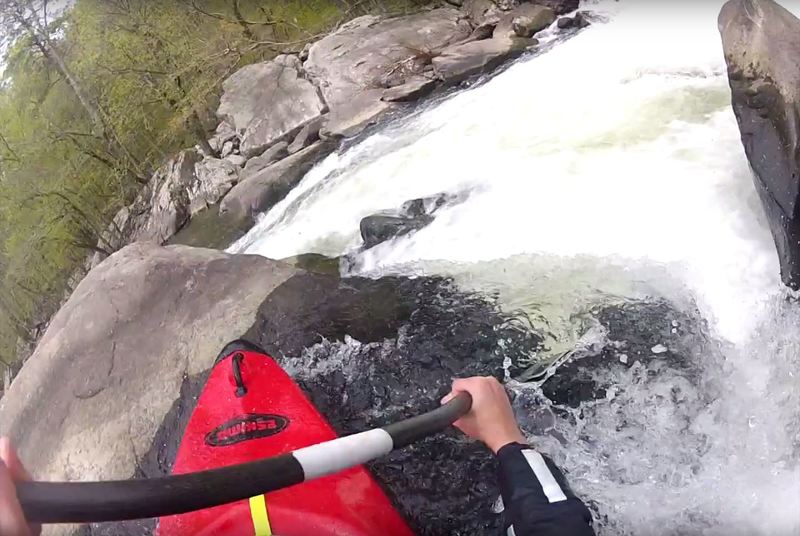
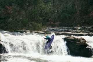
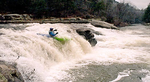
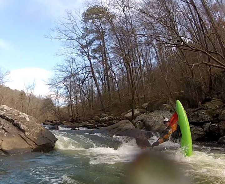
This is the rapid I think of when I think of Sauty. Nearly 200 yards of class IV fun. At low levels, it's technical and needle threading. At high levels it's rompy and pushy. Eddies and boofs exist throughout at a variety of levels.
A fantastic entrance boof on river left is open all the way down to 5 inches.
About 400 yards below Upper Minefield, you will come to another boulder strewn section of read and run fun. I'm not sure where Lower Minefield really starts or ends but after about 250 yards of fairly continuous rapids the action will mellow into a pool that is about 100 yards long, where the left bank is blocky and exposed. You should notice a few CFS disappearing into the ground here.
After the roughly 100 yard pool below Lower Minefield, you will come to a short rapid marked by a huge 50 ft x 50 ft rock laying at a 45 degree angle on the right. It can be run by staying left, or by starting right, going through a slot (not the Slot) that runs diagonally from right to left. You really don't want to end up pushed to river right if doing the right to left line. It apparently changed around 2003 becoming quite dangerous and forming a sieve against the right bank.
Where this bottom drop hits the pool is a good, deep spot for enders. I have also seen otters here more than once.
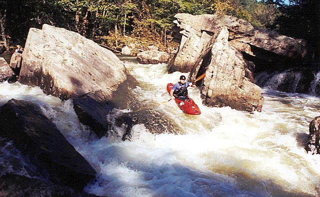
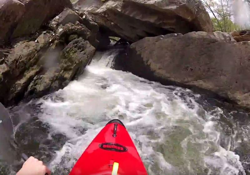
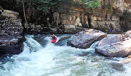
At almost exactly the four mile mark, and just below the ender spot mentioned in Lower Minefield, you will reach The Slot.
The line for which the rapid is named involves paddling to a river right setup eddy where you will see the current entering a two boat width gap between some rocks, making a 90 degree right turn out of sight. Enter prepairing to make the right turn, going through a 30 foot long slot between two giant rocks, ending in a 3 foot drop through a diagonal hole. Generally staying right and finishing with a boof will give best results.
There is a left line consisting of a 6-7 foot boof is available with good water levels.
From below, it's possible to attain up the center of the creek to behold the 'center line' of the Slot, which is the stick and log filled sieve that goes under the main rocks that form the Slot.
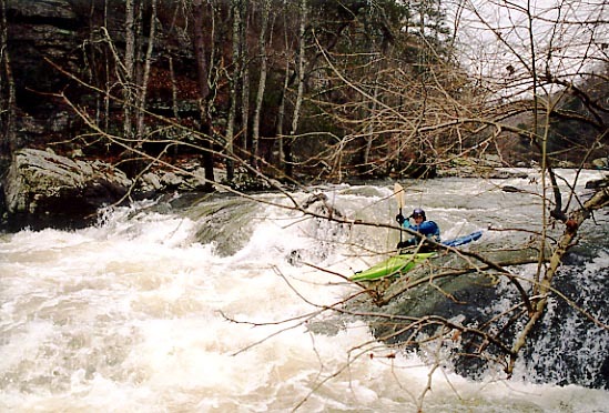
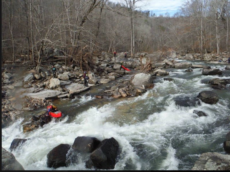
About half a mile below the Slot, after a few good class III rapids, you will be approaching Bonecrusher. In the winter months, this will be one of the sunniest spots on the creek, as it makes a sweeping bend to the south. The canyon wall on river left pulls back allowing the low winter sun to peak over and warm your bones on the approach to Sauty's most intimidatingly named rapid: Bonecrusher.
You generally have to at least run this entrance section, which at typical flows involves going from river right (from the sunny pool at the top), to river left, then back right to get into the usual setup/scout eddy. I have heard of people being lead down for their first time being told that the rapid is called 'Mary's Cakewalk' or something to that effect to keep their nerves down until they are in the setup/scout eddy before being told that they are in Bonecrusher and the main part of the rapid is just below!
As of January 2016 Bone Crusher has changed as a result of heavy rains. You should get out and scout this section BEFORE running. At the current moment there are several new rocks and the final boof does not appear to be an option as it was previously. There is also a tree pinned between rocks at Bone Crusher Rock. Please help me update this with a solid description of the new lines.
Somewhere shortly after Bonecrusher, the creekbed drops into the karst/porous base rock of Sand Mountain. If it's been awhile since it rained, you will lose quite a bit of water here. There are large sinkholes in several spots.
Unfortunately from Bonecrusher to Bucks Pocket is around 2 miles. Some III and III+ is in here, but after about a mile, you will find yourself boating through a thicket of saplings growing directly from the streambed.
This is where you will be punished if you are paddling less than 6 inches. Still, it's usually possible to boat through this section without getting out anywhere.
Although I have seen the total length of the run listed at 7+ miles, I have measured it pretty repeatably on Google Earth at 6.3 from above Matheny's Ledge to the parking lot in the Pocket.
Oct 17, 2014
USGS for this run is
http://waterdata.usgs.gov/al/nwis/uv?cb\_00065=on&format=gif\_default&period=14&site\_no=03572690
Translate gauge to Bucks Pocket stick gauge at AL WW @
http://alabamawhitewater.com/forum/phpBB2/viewtopic.php?t=10535&sid=4db2d85582e0538e423e2f9b77f5f394 .
(12' to 24' is sweet spot. 4'= piddly above 24' is hard to catch and more stout!)