Dead
Spencer Falls to West Forks
| Difficulty | II-III(IV) |
| Length | 14.8 mi |
| Avg Gradient | 31 fpm |
| Gauge | Dead River Near Dead River, Maine |
| Flow Rate as of 18 minutes | 325 cfsbelow recommended |
| Reach Info Last Updated | August 15, 2023 |
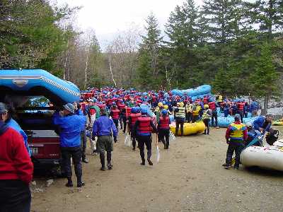
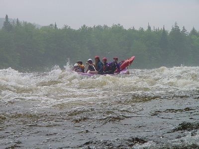
Located in an isolated corner of Northern New England, the Dead is one of the longest continuous sections of whitewater in the Northeast. With approximately thirty rapids
along a fourteen mile stretch it is an incredibly popular summer whitewater run.
The river is primarily release controlled, although it also runs after periods of heavy rain. The difficulty of the river changes greatly depending upon release level. At lower levels (1200–1800) it is primarily class II (except for the very first, and last couple of rapids). At medium levels (2000–3500) it is class III; and at higher levels (4500–8000) class IV. The higher releases are generally during May, early June, September, and October. Expect huge crowds of rafters and boaters during these high-water releases. Summer releases are normally in the low-to-medium range.
The river is mostly boulder type rapids with lots of holes and pourovers. There is simply too many features and rapids to be completely described. Only the highlights have been documented.
The shoreline and river bed are totally different from the neighboring Kennebec river. There is little shear wall cliffs on this river but thick vegetation grows right up to the rivers edge. This makes it very difficult to rescue swimmers and equipment.
Put in elevation........1000'Take out elevation......591'Total drop..............409'Average drop/mile.......31'Distance................13.35 miles1st mile drop...........22'2nd mile drop...........26'3rd mile drop...........43'4th mile drop...........27'5th mile drop...........9'6th mile drop...........19'7th mile drop...........37'8th mile drop...........33'9th mile drop...........34'10th mile drop..........38'11th mile drop..........35'12th mile drop..........32'13th mile drop..........47'13.3 mile drop.... .....7' (20' average)River width average.....120'River geology...........small to medium granite bouldersRiver water quality.....Good, cle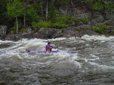
River narrows and pushes up agaist a rock wall on river right then drops into a pool like area. Good wavetrain at the end but tough to make it back up the eddy.
This is one of the best play spots on the river. It is a short ledge drop named for the series of surf waves that form at 3500 and up. Quattro lies on river right after a rather wide sweeping left hand turn. Catch the eddy on the right shore to setup to catch the waves. At lower water levels a nice wide smooth wave forms at the top of the eddy. There is usually enough room for up to 4 boaters to surf at the same time. Other waves below the Quatro wave form and can be surfed but these are more defined at the higher release levels of >5500 cfs. At that level up to a dozen boaters can be surfing at the same time within a very short distance.

After Quattro and a stretch of quickwater come The Minefield, long (1.1 miles) rapid that really shines at medium and higher levels. Filled with boulders at low water, holes at higher water. The difficulty increases halfway down and near the bottom. Both these spots are located where the river turns to the left.
A wide flat area where river opens up and turns left. Trips stop here to regroup and rest after Minefield. Play area at bottom of Minefield on river-right.
Easy rapid, class 1/2 leading into Hayden's Landing.
Good lunch spot here. After the large eddy below Haydens the river narrows back down with a few waves and holes along the way. Just above the drop there is a nice beach/campsite on the right often used as a lunch stop. Immediately after this beach the river drops sharply. The best route is river left over the large haystacks but move towards river right about halfway down to avoid a large trashy hole. There are many other smaller holes as you move to the right that need to be avoided.
Haydens is a tough rapid, as the river narrows significantly here. At higher levels it full of huge holes and waves. The cleanest route is start right-of-center, work a little to the left, the head back right of center towards the bottom. Nice play hole on river right just above pourover. Be careful, big wide eddy below the drop.
Approximately two miles of quickwater split up with an occasional drop/wave.4.
The traditional 'half way' point put on, really only one-third of the way down the river.4.27
Another easy rapid marks the end of The Basin.
Easy rapid approaching Enchanted Stream (halfway point) on left.
Good lunch spot where pool forms as stream enters the river.
Enchanted Rapid blends into Elephant Rock Rapid at 2400 and higher. (Mile 7.04–7.3)
Look for the rock a few feet of the river-right bank at the base of the rapid. Usually a pour-over, there is a huge surfing hole extending from the rock towards the center of the river that attracts rafts. At higher levels a hydraulic develops here. Best route thru the bottom of the rapid is in the center. Stay left through a nice series of haystacks. At the bottom you can go far right to run 'Pinball'. This is a narrow slot between the 'Elephant's foot' and the river-right wall. (Mile 7.55–7.75)
Easy rapid below Elephant Rock. (Mile 7.80–7.85).
A popular lunch spot for rafting trips. Look for the beach on river-left just below the rapid.
A short drop, similar to Quattro. Good play waves/holes.
As the name suggest this is a long rapid that gradually increases in difficulty as one heads downstream. At high release levels this rapid is full of holes, some sticky. The biggest ones are at the bottom of the rapid. The best route at the bottom of Mile Long is in the center along the boiling wave train. Note: After GPS measurements during 2007 and 2008 it was determined that Mail Long Rapid is really only 3/4's of a mile long. (Mile 8.9–9.67).
Near the bottom of Mile Long Rapid there is a very dangerous hole and hydraulic. This was
the site of a fatality
in October 2005; a near drowning in September 2006 that required an airlift evacuation;
and numerous other close calls where both raft guides and passengers were trapped and unable to get
free without outside assistance. Additionally the fatality in June 2017 was reported [second hand] to
have occured here as well.
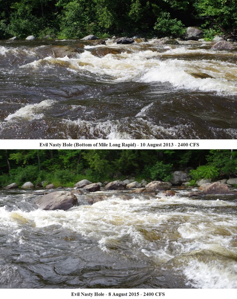
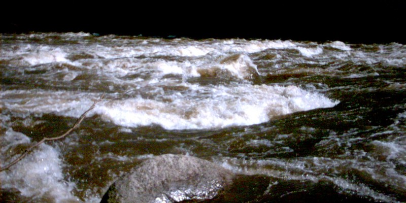
Evil Nasty Hole at 5500 CFS__Photo taken from river-left shore on 9/2/07._Bottom of Mile Long at 5500._Downstream river-left shore view; Evil Nasty Hole in the foreground, FBI Hole on river-right in background. Photo taken on 9/2/07 from shore approximately 10 yards upstream of hole.
The name 'Evil Nasty' is one name for this feature. Individual rafting companies and
paddling clubs may have their own names for different rapids and features. Regardless of what you
call it, this is the well-known dangerous spot on river-left near the bottom of Mile Long Rapid.
The problem hole is fairly benign looking (especially from above). Just looking at it you would not expect
it to cause these type of problems, but it is surprisingly retentive with a strong recirculating current. Only after
passing by is the steep drop-off and strong hydraulic visible.
The hole is formed by a big, flat, round rock left-of-center. The resulting hydraulic is huge and deep,
with a visible horizon line and a 'frowny face' characteristic of dangerous holes of this type (sometimes
called 'drowning machines). At lower release levels the hole does not exist. At 2500 CFS the rock forms a slight
pour-over, at 3000 CFS a hole has formed, by 4500 CFS it forms a dangerous hydraulic; at 6000 it's downright nasty.
The victim in the 2006 accident later described himself as 'fighting like mad', trying to go up, down, left
and right to get free before he lost consciousness after being recirculated many times. If a paddler does find
themselves in the hole the best approach is to attempt to stay in their boat. The highest risk is to swimmers
since the hole is so deep; the hole surges and objects floating on the surface eventually tend to get flushed out.
This is a wide section of the river, this is not the only hole in the vicinity.
The bottom of Mile Long is full of holes, including one big wide one near the bottom on river-right called
the 'FBI Hole'. However these have all been generally described as 'very flushy' and unlikely
to hold someone for long. There is also another raft-surfable hole just upstream of Evil Nasty, so people sometimes
may mistake the Evil Nasty one as being surfable. (This hole upstream of Evil Nasty can also flip boats and
rafts, depositing swimmers directly into the path of the bad hole.)
Above Big Nasty is a relative calm section that may draw paddlers towards the left
side in an attempt to avoid the large boiling wave train down the center. However the short calm section ends
with Evil Nasty Hole followed by a final ledge drop into a flat area on river-left. With several 'mean' holes
on the right, and Evil Nasty on the left, the cleanest line thru the bottom of Mile Long is generally straight
down the boiling wave train in the center of the rapid (although it doesn't appear so from the approach).
Some people prefer a right-of-center run as the currents sometime push you left and a larger safety-margin is preferred.
Some descriptions place this hole as much as a quarter-mile below the bottom of Mile
Long Rapid. Others place it just before the end of the rapid. These differences are attributed to the lack of a
definitive location as to the exact end of the rapid. (Depending upon water level, the characteristics of the rapid
can change greatly.) However, below Mile Long the river gets wide and flattens out with a huge open area and
eddy along river-left where paddlers and rafts stop and regroup. (This flat area is also immediately above a very
recognizible long rock wall lining the left bank.) The problem hole is located on river-left a few dozen yards above
the flat area with a narrow channel between it and the left bank. In a hard boat it is fairly easy to skirt the hole
between it and the bank, but rafts tend to be drawn back into the hole when this is tried.
At very high levels (7000 CFS and higher) two really big wave-holes form in a row
just right-of-center at the end of Mile Long. One kayak was stuck in one of these at 13,000 CFS for
a reported 10 minutes until it was literally flipped into the air.
_Evil Nasty Hole at a low level._Comparision showing river features that create Evil Nasty two different years illustrating the difference
in release levels since the new USGS gage [upstream] was brought online. August 2015 was also a dry year and inflow from side-streams was minimal.
2297
Wide area at bottom of Mile Long where trips stop and regroup along the left bank.
Named for the high rock outcropping on river-left, visible from river-right as you approach.
Rest spot on river-left where jeep trail comes to rivers edge. Look for an opening in the woods with a painted rock. It's also possible to walk out from here. The road on river-left circles back to the river at the bottom of Lower Poplar. On river-right is an old railroad bed that follows along the river. This is also the spot there the US Nationals held in the 1990's started.
Upper Poplar Hill Falls can be identified by a marked rock on river left. This rock is painted red and has a black insignia on it that looks like a flag or could be a 'P'. The rapid after this is Upper Poplar. The river picks up the pace here, the rapid is much steeper then prior sections. Look out for a number of rocks and holes near the bottom. This rapid can be just as difficult as Lower Poplar should you chose a poor route through the rapid. There is a large river wide hole at the bottom that can easily be punched.
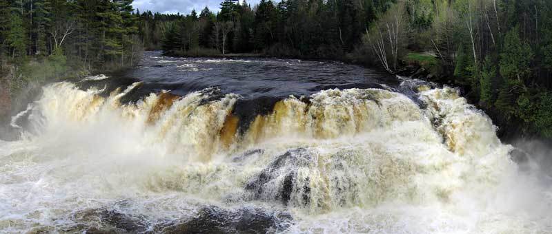
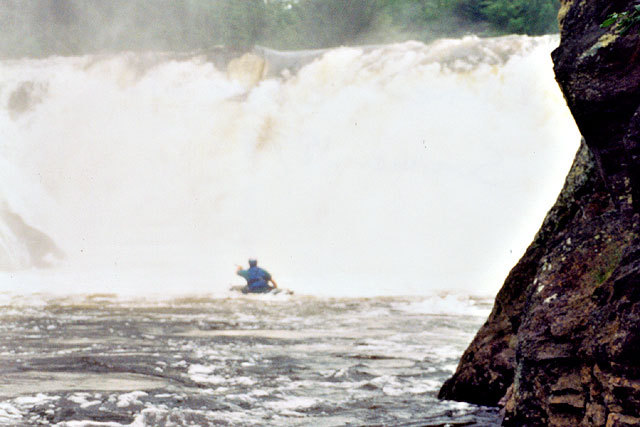
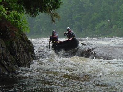
Class IV above 5000 cfs. This is the biggest rapid on the river. The river channels to the left bank and drops through a long boulder and hole strewn path. Boat scouting is the easiest way to run. Lookout for a nice wave train that leads right into a hole at the top.
There was a fatality here in May 2016 where an adult raft passenger fell out of a raft when the raft tilted going thru a big breaking wave left-of-center in the first quarter of the rapid (about 50-100 yards above the Fry-o-lator hole). The passenger immediately went unresponsive after entering the ~45-degree water; and was pulled into the raft within a minute. No heartbeat was detected, CPR was started immediately and continued throughout the trip to the hospital. Swims are common in this rapid; there are no significant river features at the site of the accident that appear to pose an undue risk. The victim was wearing a full wet suit, but since this is the final rapid of a long 12-mile trip, exhaustion or cold are likely the most significant contributing factors to the accident.
Jeep access road at bottom of Lower Poplar. Just above the bridge abutments for the old railroad. The road lead out to the Magic Falls facility and public parking area.
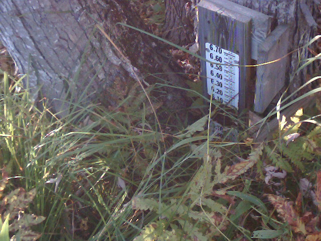
Local of (retired) USGS gage. All that remains is the staff fastened to a tree and extending out of the water. Buildings appear on river-left shortly after this.
Take-out and public parking area next to Magic Falls Rafting facility.
Take-out and paddling hangout at Webb's Campground.
Jun 2, 2014
quick trip report for 1300cfs:
Three of us put on at 9:30 and set our own shuttle. One paddler had two swims: one in the first rapid that was just nerves coming into play and tightening him up…and then he swam about 1/2 of lower poplar before I got him to shore. We didn't get his boat back until almost the end of that rapid so he had a little hike to catch up to us.
The other paddler (there were three of us on the river) got caught in a little (shallow) hole about halfway through the run and he pulled his skirt because he was having a hard time rolling up. He self rescued about twenty feet below where he swam.
The run is quite shallow in spots and except for the Poplars would be a great intro run. The only thing I could think of and what I hammered home a few times to the new paddler is that if he swims, he needs to get into a feet up position until you are heading for an eddy. I think foot entrapment is a real risk at this level.
The bulk of the run is a casual boulder dodge. Poplars are solid class III and a bit bigger than the rest of the run.
There really isn't any play on this run (meaning eddy service play hole or wave). There are tons of spots to practice ferrying, eddying out, peel outs, and general boat control. The water is slow enough that if you blow your line you can correct it easily.
We took out at the public parking area above Webb's at 3pm…without any play stops and a short 10 minute snack break. So it was a long day, but sunny and 75 good company.
FWIW this would be a really nice open boat trip or good beginner to intermediate run with the caveat that foot entrapment is a real concern and with so many boulders you could get a boat pinned on something pretty easily and have to deal with that.
cheers,
Peter
Jul 3, 2009
Latest update from Nextera Energy:
This just in from Nextera Energy.... I suspect the last minute change is due to the US Canoe Nationals being scheduled on the Dead this weekend. They really-really wanted the 1300 release level. Kudos to the power company for being responsive to paddler requests.
---------- Forwarded message ----------
On Fri, Jul 3, 2009 at 10:29, Carol Clark wrote:
Subject: Dead River Release rescheduled for Satuday and Sunday
Hello-
Good news. The flow into Flagstaff Lake has slowed and the weather forecast is more promising. We will be able to do the 1300 cfs releases of Saturday and Sunday as originally scheduled.
Carol Clark, P.E.
NextEra Energy Resources and Kennebec Water Power