Warrior, Locust Fork
1) CR 1 (Five Points Rd) to US Route 231

| Difficulty | II |
| Length | 10.1 mi |
| Avg Gradient | 20 fpm |
| Gauge | Locust Fork Near Cleveland, Al. |
| Flow Rate as of 5 hours | 2.28 ftlow runnable |
| Reach Info Last Updated | January 11, 2018 |
Flow Information
For this section to be 'fun' (from a whitewater enthusiast point of view) minimum is 3.' For those looking for something to paddle, John Foshee states this section can be run all the way down to 1.5.'
River Description
The putin on CR 1 (Five Points Rd) has been known to have car break-ins, so be aware.
Described by John Foshee as a 'pretty stretch of the Locust' and a nice prelude to the whitewater section by 'gradually leading you from shallow shoals to harder shoals to rapids.' The first 4.8 miles are pretty flat. When you see a large island and a small island, the 5 foot waterfall is coming up. First timers, and at high-water, land on river right to scout. Similar to Powell Falls, the right side forms a stair step and the left side is more of a vertical drop. At higher water a pretty bad recirculating hydraulic develops here and it may be best to portage.
At mile 6.6 is the Graves Creek confluence. Around mile 8 you'll find yourself at Kings Bend which is the sight of the annual Locust Fork Invitational and Classic races. There are a series of shoals next to a rock bluff on river right which make for a scenic paddle through this section. Just below the 'slalom shoals' is King's Hole, about a 1.5' drop which makes a great playspot. The take out for this section at mile 10.2 is on RIVER RIGHT. Park your shuttle vehicle on the old road bed. This is the put in for the 'whitewater' section. Like most takeouts in Alabama, it's short but steep. *The river left side at the take-out is off limits to everyone. The owner is not friendly to trespassers. Use river right!*
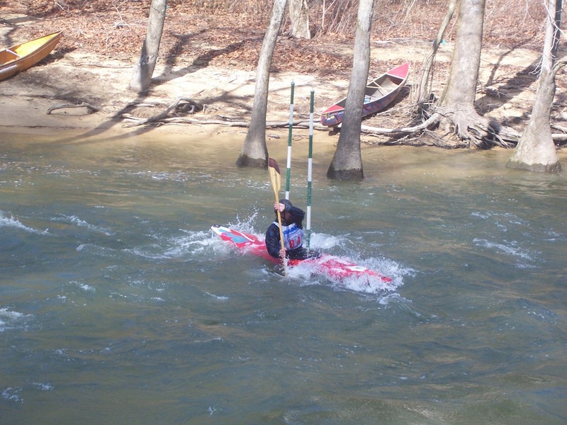
Race Information - Locust Fork Invitational and Locust Fork Classic
Races are held in February and March each year. Events include Slalom, Boatercross and Downriver. For more information visit: http://www.alabamacupraces.com/ind
...
Depending on the waterlevel, may want to scout this one.
Site of the Locust Fork Invitational and Locust Fork Classic Kayak races in February and March every year.