Penobscot, S. Branch
Canada Falls Lake to Pittston Farm(Canada Falls)
| Difficulty | III-V |
| Length | 3.8 mi |
| Avg Gradient | 45 fpm |
| Reach Info Last Updated | August 25, 2015 |
Source: Greg and Sue Hanlon's Steep Creeks of New England, which has more info on this run. Text used with permission.
Located in the remote wilderness of northwestern Maine Canada Falls section of the South Branch of the Penobscot River is the latest success story for American Whitewater. The first summer recreational release occurred on Saturday July 2nd 2005. An agreement hammered out by AW director Tom Christopher with Brascan power, Plum Creek, and the Piscataquis and Penobscot Indian tribes guarantees releases every Saturday during July and August of each year for the next 50 years.
North Maine Woods Inc.
The Canada Falls section of the Penobscot lies in what is known as the North Maine Woods. North Maine woods is a consortium of private landowners (mostly paper companies), encompassing 3.5 million acres of working forest. It is rugged remote country many miles from the conveniences of modern day life. To get more information on access fees, gate locations and hours, camping information, etc. go to the North Maine Woods website.
It's not the easiest place to get to but the scenery is nice and the dirt roads are not too bad. You will want to start your trip into the small town of Rockwood Maine on the western shore of Moosehead lake.
To get to Rockwood
If you are coming up from the Forks area
...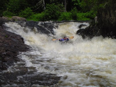
Probably the most visually intimidating drop on the river. As the river splits around a large island take the narrower right hand channel to the slack water just above a sharp horizon line. Take out on river right to scout or carry around. Just above the drop the two river channels meet once more then plunge over a slanted rock slab. The left side of the slide is a vertical wall that may be undercut. At the bottom of the slide the channel constricts to just about 20’ into a huge exploding boil. At higher levels a rather large keeper hole forms. The usual route is to start at the converging river channels above then run through the center of the slide down into the boil with a left lean as you hit the bottom of the slide. The rock slab on river right gradually angles down to the river bed forcing the water to push to the left creating the exploding boil at the bottom of the slide. Just below the boil there is a shallow spot followed by a large recovery pool.
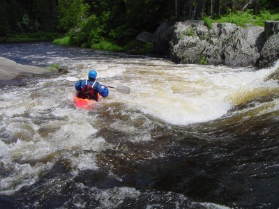
After a fairly long section of class II and III water you may eye several exposed ledges protruding from river left. Take out in the large eddy on river left just above one of the ledges. Just downstream river left (and out of site from river level) is the South Branch campsite where you can access the river to scout before you run. The river drops sharply towards the right vertical river bank then takes a rather sharp left turn then drops over a two foot ledge into a very large keeper hole. The hole is nearly river wide with a passage on river left. Run the upper rapid directly to a river right eddy just below where the river hits the right bank and takes a hard left. You will need to be fairly aggressive to punch into this eddy. From the top of this eddy set up and execute a hard ferry to the river left eddy, once here it is a simple run to the left of the hole. Do not underestimate the power of the current here and get sucked downstream into the hole. Just after the slot the river splits around a midstream rock ledge then leads into a calm pool.
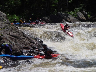
Not far below SYBOF the calm water ends and you are once again in class II and III waters. A couple ledges and turns down and you will notice some rather large midstream rocks and obstructed passages. Pull out on river left and scout. The top of the rapid has a river wide hole, weakest on the left. Once past the hole the flow splits around a large midstream ledge, the left channel runs through a rather obstructed and shallow drop at the lower release levels. River left drops over an “L” shaped ledge easiest run on far river left. The more difficult line is up close to the midstream ledge where the flow piles up against and takes a sharp and steep left hand turn. I then drops into a two step drop with a trashy hole at the bottom of each. Do not hug up too close to the midstream ledge; at the bottom of the first step there is a large semi-submerged rock that may knock you back into the hole.
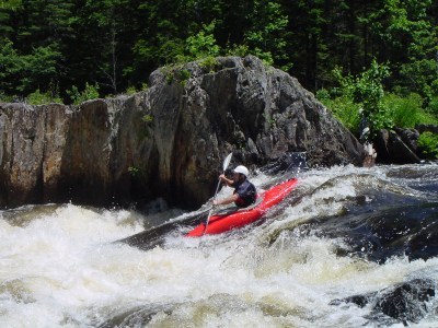
This is really just the lower part of the same rapid. Shortly after the upper drop the river once again splits around some midstream ledges. The river left route has a steep drop by a large protruding ledge. Downstream from here the river is somewhat shallow at the lower release levels and requires some maneuvering to get through.
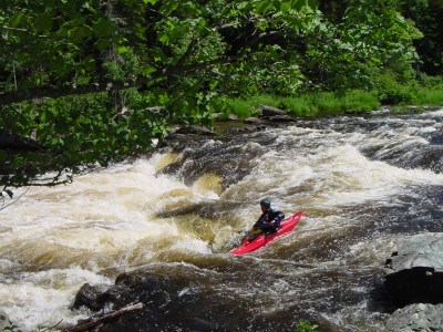
Towards the bottom Lower Split Decision there is a near river wide hole that is best run on the far left.
Nov 11, 2010
There is a gage available at http://www.h2oline.com/235119.asp The gage is never that accurate due to the dam type but it will give you an idea. Also Brookfield's 'Forecast' flow is very unreliable, check the gage the morning you leave.
Jul 8, 2009
There is a gage spray painted on one of the rock out cropping at the dam, however it was pretty faded when I saw it last and I don't know how it relates to actual level. I believe section is easier then this thread suggests, a couple extensive rapids (namely split decision or 'Three Doors' as I was taught) but everything is pretty straight forward. I have always run it with a playboat however creekers might make the moves a little more fun. I haven’t done it real high though, only up to 1100ish.
Jul 2, 2005
SYBOF hole on the right is a real keeper.
May 15, 1987
See more pictures at http://www.alexjharvey.com/Misc.htm.