White's Run
Up Forest Service Road to Seneca Creek
| Difficulty | IV |
| Length | 1.9 mi |
| Avg Gradient | 200 fpm |
| Reach Info Last Updated | July 14, 2001 |
Ryan Emanuel reports of a possible first descent, May 19, 2001:
I turned and headed upstream, following Seneca Cr.
I turned off of US 33 and followed Seneca Cr. up the mountain towards Spruce Knob, and after a few miles, passed the confluence of Seneca Cr. and White's Run. Seneca Cr. heads into the backcountry towards Judy Springs, while White's Run accompanies the FS road up the mountain. I basically drove uphill from the confluence until White's Run was too small to paddle. My odometer read 1.8 miles from the confluence.
After scouting the entire section on foot and dragging several deadfalls from the tight creekbed (and still seeing no other boaters), I put in.
From the second I left the bank, I became a human pinball, crashing through narrow slots, fast enough for a speeding ticket. Elbow Pads were a godsend with an average stream width of < 10'. Often times, I wanted to eddy out to see the ledge or slot that I had just negotiated, but by the time my brain had processed the drop, I was rounding the next blind curve, and bracing for another.
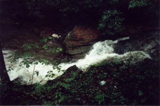
Most of the creek was bony, but the major ledges and slots had surprisingly deep pools at the bottom. I actually subbed up to my chest on one drop - which is a very pleasant surprise when a scrapey pin is your primary concern.
The runoff was cold and clear, and the scenery was rainforest-like with moss and evergreens everywhere. A light rain fell all day long, and a Nantahala-esque mist rose from the water. The creek had a very healthy gradient, which compensated for the relatively low flow. I mapped it out on Topozone (I believe it is on the Whitmer, WV Quad), and found the gradient to be >200 fpm. There were only a few single drops exceeding about 5'. The most memorable was a twisty 6'-8'(not positive) semi-slide right at the very beginning.
Most of the rapids were small constrictions over multiple bumpy ledges, with one really nice, long, low-angle slide. There was also 'l
...