| Difficulty | IV |
| Length | 1.3 mi |
| Avg Gradient | n/a |
| Gauge | Royal River at Yarmouth, Maine |
| Flow Rate as of 1 hour | 32 cfsrunnable |
| Reach Info Last Updated | July 20, 2026 |
River Description
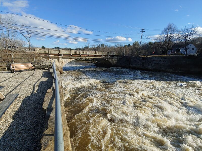
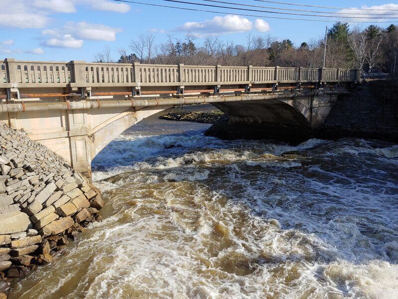
7/20/26 Bridge and Elm Street Dams are being removed by the Town of Yarmouth.
Put in at Yarmouth Community Services on East Elm St, take out at the town landing on Old Shipyard Rd.
https://youtu.be/CTeGtw7SA8o?t=451 for footage of first drop and fourth drop.
Comment from 10 years ago:
'Scout all 4 drops before running, this is unrunnable at many water levels. For the first section put in above the Waterworks park and try for the far left drop over the dam. The second drop may be Class VI, to view it follow the footpath down to the Rt1 bridge and look upstream. At high water levels there is a huge ramp of water that I'd love to see somebody try. There is a sneak river right but accessing it is very tough. The thrid drop can very rarely be made. It is a 8-10' poor over dam which can be scouted at Bridge St. A sweet surf wave develops just below the Sparhawk Mill building, park in their dirt lot for some park'n'play. The last drop can be viewed from Grist Mill park or the Rt88 bridge. It is generally runnable at all levels. Watch out at high water, the tide may have changed while you were paddling and turned the last rapid under the bridge into into a giant hole with lots of recirc.'
AMC River Guide: Maine by Appalachian Mtn Club
River Features
Put In
Access PointDistance: 0 mi
First Drop
RapidClass: IVDistance: 0 mi

The dam at East Elm Sreet, it can be boofed on river left or run as a slide down the rocks river center. Not an overly pleasant rapid either way.
Alternatively, take the side channel on river right (starts above the bridge) and boof the small drop partway down it.
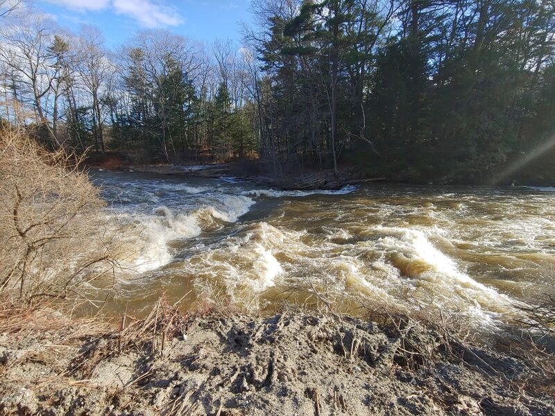
Second Drop
RapidClass: IVDistance: 0.25 mi
Difficulty highly dependent on water level. Enormous crazy ramp of water at high levels (class VI?). At normal levels, fairly moderate two step slide on river right of the main channel and alternate deeper water route on river left. There are alternate small channels that go outside the main channel into the ruins of the old mill that seem dangerous. Don't go there.
This is someone paddling it at the low end of runnable https://www.youtube.com/watch?v=gIoBI1YlEYA
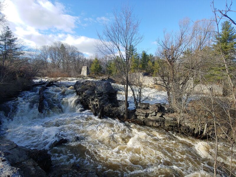
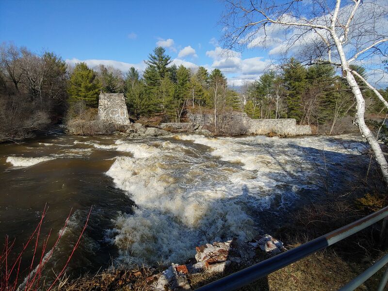
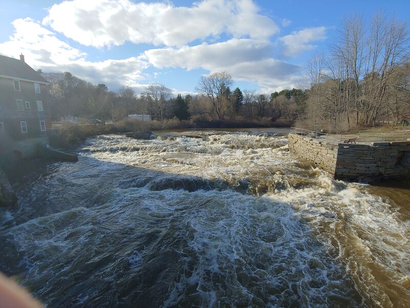
Third Drop
RapidClass: IVDistance: 0.7 mi
Second dam of the run at Sparhawk Mill. The dam can sometimes be run but isn't recommended. Put in as close below the dam as possible to maximize distance. There is a nice play wave at the end of this rapid at higher flows. Park in the lot behind Sparhawk Mill for a fun park and play.
Fourth Drop
RapidClass: IVDistance: 1 mi
Probably the best rapid on the river, this is runnable at many levels. At low tide this is a much longer rapid than at high - it ends in the ocean! A very large hole forms under the bridge at low tide and high flow.
Take Out
Access PointDistance: 1.1 mi