Cossatot
3) Ed Banks Road to Highway 278/4 (6.25 miles)(Falls Section)
| Difficulty | II-IV |
| Length | 6.4 mi |
| Avg Gradient | 20 fpm |
| Gauge | Cossatot River Near Vandervoort, Ar |
| Flow Rate as of 21 minutes | 3.28 ftrunnable |
| Reach Info Last Updated | April 7, 2014 |
Put-in: To reach the Falls, Sandbar bridge and Ed Banks access points, go East from the takeout and turn left on either the first road (high water route) or second road (main route). Both roads are rough dirt/gravel and have signs directing to the Falls and access points. The first road is longer but is located between the Hwy 278 bridges over the Cossatot and Baker Creek. The second road is East of the Hwy 278 bridge and crosses the normal low-water take-out bridge for Baker creek. Normally passable when the Cossatot is below 6 feet.
Alternate access to the Falls and access points can be reached from these roads where they connect with Hwy 246 (East side of River).
Take-out: Reached by taking the access road on the West side of the Hwy 278 bridge over the River. Located about 9 miles East of Hwy 278/Hwy 71 intersection in Wickes.
Those who don't wish to paddle the falls, can opt for the 2 mile class III run from Ed Banks access to the Sandbar Bridge or the Falls access points. The Falls access can be used as a park and play area, as the carry back up the falls is not too bad.
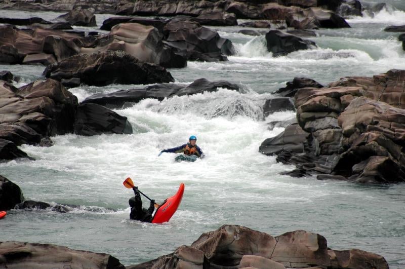
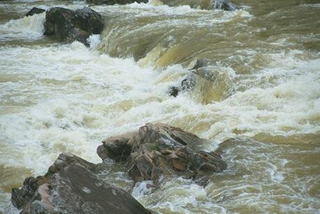
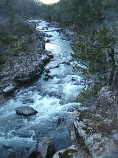
Main rapids are The Esses, The Falls, Deer Camp Rapid, Devil's Hollow Rapid and Devil Hollow Falls. Several other class II-III ledge type drops are scattered throughout the run with small pools in-between.
There are nice but small campgrounds at the Falls and at Hwy 278. Both campgrounds offer nice tent sites and tables, the Falls has a restroom and campsite fees. Hwy 278 currently only has a portajohn and no fees. Primitive free camping is available near Ed Banks Bridge and Sandbar Bridge above the Falls.
Gradient by mile: 25, 25, 45, 15, 30, 5. The Falls area drops 30+ feet in about 0.25 miles.
More info at the Cossatot River State Park - Natural Area site.
When large boulders appear to block the wide river, look for the chute to the left under the overhanging branch. Eddy to the left after the branch and line up for the double ledge drop. The current tends to push hard to the left in the middle of the drop.
Numerous lines are available through the boulders on the right. Nice small wave and eddy line to play on at the bottom of the drop.
Main channel is constricted down the left and starts with straight forward line for the first 200 feet. Middle of the rapid features a 3-4 foot ledge with some blocker rocks above it. Easier line is down the right. Lower part of the rapid offers some nice waves with a few more rocks to dodge in the middle. Beware of the rocks along the right bank near the bottom opposite of the start of the river left bluff. Portage and scout on the right bank (actually an island). High water runs over 5 ft offer some creek lines down the right channel or large waves down the main left channel.

Alternate access point. Primitive camping on both sides of the river. Beware of this bridge. It can be run under at lower levels <3.5 ft, but some folks have been sucked under it at higher water when no airspace is present.
Good surfing ledge holes below on river left at levels > 5.0 ft.
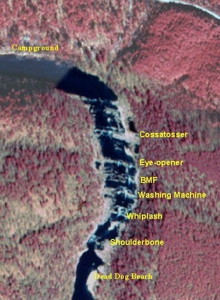
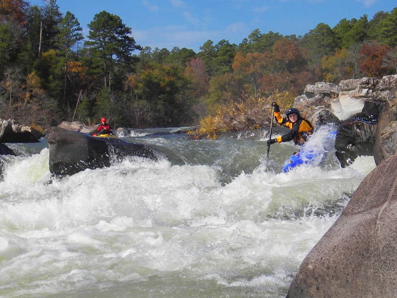
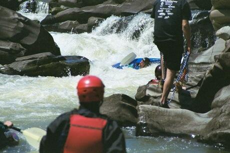
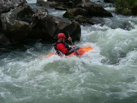
The Falls consist of 6 distict back-to-back drops totaling 30+ feet in a quarter mile.
First Drop is Cossatosser: Avoid the sneaky hole at the small entrance ledge then drop over the 3-foot ledge and through the hole.
Second drop is Eye Opener: Straight forward 4-foot drop in the middle of the river. A large grabby hole develops at levels of 5-foot and higher, optional line a high water levels is the river left channel.
Third drop is BMF: Several options to weave through the rocks. Standard is to enter left from the center of the river and avoid the river left rock on the way down.
Fourth drop is The Washing Machine: Largest single drop. Multiple ways to enter the main line in the middle of the river. At levels of 3.5 and lower the hole at the bottom reveals the meaning for the rapid's name.
Fifth drop is Whiplash: A double ledge drop followed by a run-out. Watch out for cross currents, holes and swirling eddy currents.
Last drop is Shoulder Bone: Fairly straight forward drop into the pool below the Falls. Kayaks can find big enders in this drop.
Drops 2 through 5 merge into one Class V rapid at levels above 5 ft with some small eddies scattered about. Very large holes develop throughout the Falls at levels above 6 feet.
Dead Dog Beach is a large gravel bar on river left of the pool below the falls.
Long continuous rapid with holes and shallow rocks. Some pin potential on the rocks in the middle of the drop. Nice spin hole near the bottom.
After a pool at the bottom of Deer Camp rapid, the river splits around an island. The main flow goes left and terminates at a steep rocky drop with a couple of ledge holes and several shallow pin rocks. As the creek turns right away from the left wall. Portage left or aim for the left side of the large rock in the middle of the rapid and pick your way through the chaos.
The right channel offers a couple small ledge drops. (watch the holes at higher levels)
Located at the end of the pool below Devil's Hollow Rapid. A broken 6+ foot ledge formed by upstream facing rocks. Pick your line carefully to avoid a hidden piton in the froth at the bottom. Portage/sneak river right.
Jan 9, 2005
Per request by C.Kelly