Falling Water Creek
Falling Water Falls to Richland Campground (7 miles)
| Difficulty | II-III+(IV) |
| Length | 7.2 mi |
| Avg Gradient | 50 fpm |
| Gauge | Richland Creek Near Witts Spring, Ar |
| Flow Rate as of 47 minutes | 0.90 ftbelow recommended |
| Reach Info Last Updated | April 3, 2017 |
Note: The combination of steep banks and lots of dead red oak trees (thanks to the borer beetle infestation) tend to clog the creek with wood from time to time, so keep a look out.
Put-in: Go East on Hwy 16 from Ben Hur for 1.5 miles and turn onto Upper Falling Water Road (NFS 1205) and following to the Falls on the side of the road. There is limited parking along the road and several primitive camping/parking spots upstream a few hundred feet.
Take-out: Continue downstream to the NFS Richland Creek Campground. This road will parallel Falling Water Creek most of the way. Multiple access points are available along the road. This road can also be reached by taking Falling Water Road(NFS 1313) farther East off Hwy 16. Or from Searcy County Road 265 (NFS 1219) from Hwy 16 near Witts Spring.
Falling Water road will cross the creek about halfway between the Falls and the campground. At lower levels, many opt to just run from the bridge down.
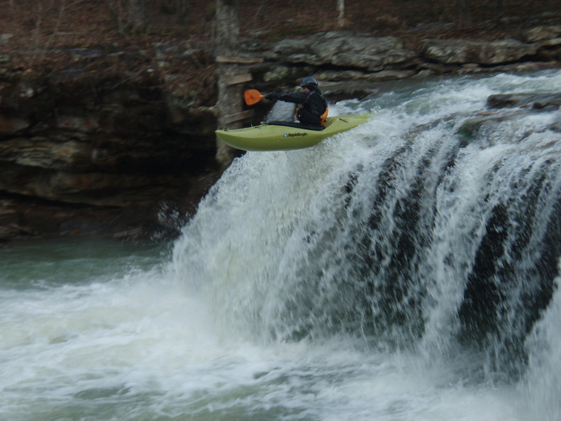
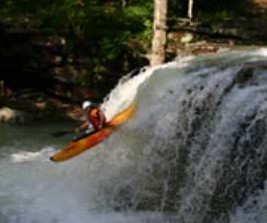
The Falls are the highlight (10-12 feet) with the rapid immediately below being the most difficult. It offers an undercut on the right and tight slots for pinning elsewhere. The other significant rapids include the shoals below the bridge, which can develop powerful hydraulics and 'The Grotto' just before reaching the campground.
At medium to high water levels, the shoals (especially below the bridge half-way down) offer some fun play.
Put-in above the falls. Park in the pull-out above the falls or at the primitive campsites above the falls

Most difficult and potentially dangerous rapid on the creek. Most portage. Main flow is down the right with an undercut and pin-rocks to deal with.
Can't miss this roadside drop. Drop is straight forward. Can plug, boof or freewheel. Watch the hydraulic at higher flows. Easy to carry up and run multiple times.
Below the falls, the creek drops away from the road into a 1 mile long section of fun technical class II-III drops with a remote feel.
Alternate access below the upper gorge is available near the confluence with Bailey Cole Creek via some primative camp sites along the road. Some nice surf spots are located below here.
Below the low-water bridge, the creek runs through a 0.75 mile long section of bedrock which forms numerous ledges and with lots of surfing spots. Beware of some of the hydraulics at high water levels. The bedrock ends at 6-Finger Falls.
Six foot tall steep slide/falls with several chutes to chose from. The right side contains a boulder at the bottom to deal with.
Alternate access point. Below here the creek drops below and away from the road on its way to Richland Creek.
2-mile section that drops below and away from the road. Similar remote gorge feel as the upper gorge, but rapids aren't as tight. The Grotto awaits near the bottom with a shallow but grabby hydrauic. Watch for wood in the willowy sections.
Main drop of the lower gorge. A shallow grabby hole awaits at the bottom.
Confluence with Richland Creek at the campground. Take out here or continue through one more rapid to the campground bridge.