St. Croix
3) Milltown to Calais(Skutik)
| Difficulty | II-V |
| Length | 2.4 mi |
| Avg Gradient | n/a |
| Gauge | St. Croix River at Vanceboro, Maine |
| Flow Rate as of 51 minutes | 547 cfsbelow recommended |
| Reach Info Last Updated | April 20, 2025 |
See also Vanceboro to Milltown.
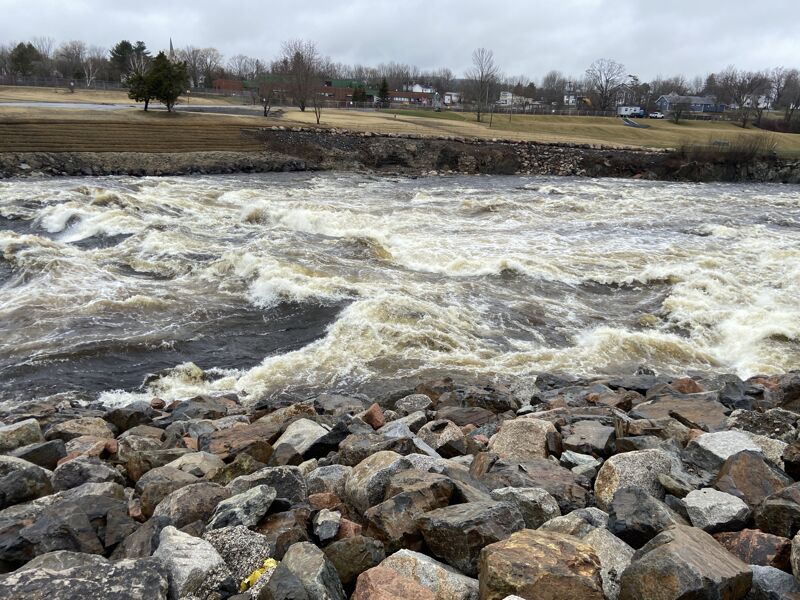
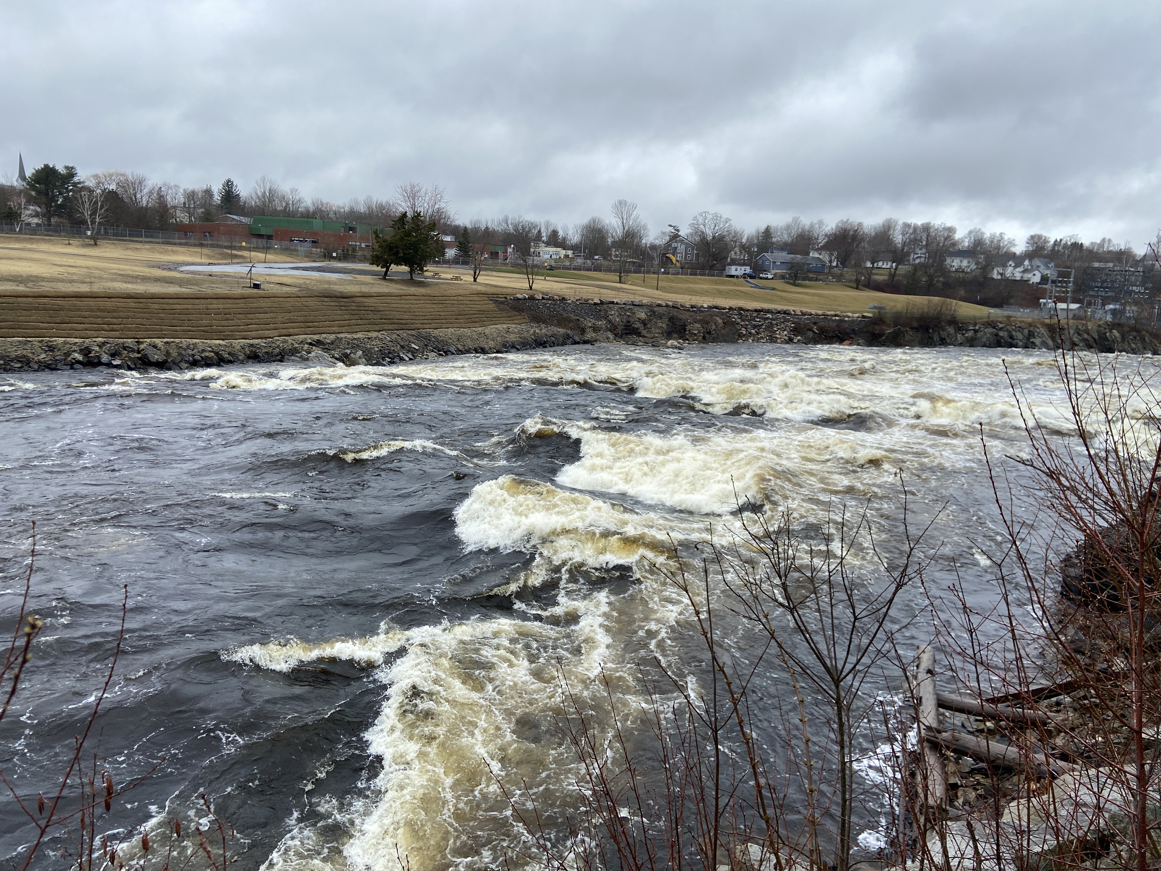
The 2023-2024 removal of the Milltown dam changed this from a short run with an inconvenient portage to a stretch of quality whitewater. Paddlers should scout the former dam site carefully, and be aware of powerful hydraulics in Milltown rapids at higher flows.
Lat/ longitude coordinates are a SWAG.
Put in to the left of the two buildings at the border crossing on North St (US side of border).
The put in is to the left of the Border Patrol station. Park in the small dirt lot to the right (before the train tracks) and walk over. It is very common for a concerned Border guard to come out and ask what exactly you are doing, but they have never tried to stop me.
The first rapid of this reach is made up of 3 channels. Scouting from land is almost impossible, especially due to the US/Canada border dividing the river. Line up for the channel you want at the bridge, as crossing between them quickly becomes difficult. The farthest left, and the center channel, are class 4+ and appear to need at least 2,000 cfs to run at all. Both are short and steep with a decent final drop. River right channel is flatter and longer, and quite bony below 1,700 cfs, but runnable. Between 1,700-2,200 this channel is probably a stout class 3, but quickly moves to class 4 around 2,200 cfs.
At higher flows, the center channel appears to have dangerous holes. The river right channel is powerful class 3+ to 4 at 9,000 cfs.
ALL CHANNELS CONTAIN OLD DAM PILINGS AND METAL - SWIM CAREFULLY.

This site was formerly known as Salmon Falls before construction of the Milltown Dam (removed 2023-2024, restoring the river and fish passage). There is a park on the New Brunswick side. On the US side, there is a view from the shoulder of Rt 1 across from The Sandwich Man shop, or it can be scouted from the railroad tracks below Poorhouse Rd.
About a mile of class 1-2 water depending on level
Short tidal rip, class 3-4 depending on river level and time of tide. Only appears on the lower end of the tide, so it is best hit from about 3 hours before low tide to about 3 hours after. From here paddle to the silver floating dock at Pike's Park in Calais (US side)