Ontonagon, M.Br.
A) Burned Dam CG to Bond Falls Flowage (6.4-11.5 miles)

| Difficulty | I-II(III) |
| Length | 11.2 mi |
| Avg Gradient | 9 fpm |
| Gauge | Middle Branch Ontonagon River Near Paulding, Mi |
| Flow Rate as of 54 minutes | 115 cfsbelow recommended |
| Reach Info Last Updated | January 2, 2018 |
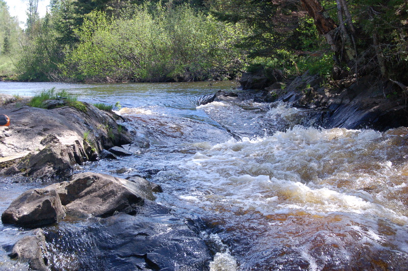
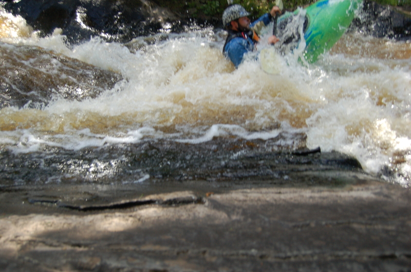
Put-in is at Burned Dam Campground either above or below Mex-i-min-e Falls, a class III or IV rapid depending upon flow. It may be noted that one of the holes in this drop has been known to forcibly extricate paddlers from their boat. Experienced boaters may be most likely to just park-and-huck this drop.
The reach from there is a pleasant float with intermittent rockbed rapids. Little Falls is marked on the maps where the river enters the Bond Falls Flowage. It is quite possible that the falls itself is buried beneath the waters of the flowage as there is only a short class II drop there now. There is an egress paddle over the waters of the flowage to a public access point off Bond Falls Rd. Bond Falls is located below the dam on the north side of the road and is well worth a visit if in the area. Like Agate Falls downstream, it is a high drop onto rock and not runnable but very scenic.
As the final miles of river before the flowage are primarily moving water, paddlers may wish to use an alternate take-out at Interior Road.

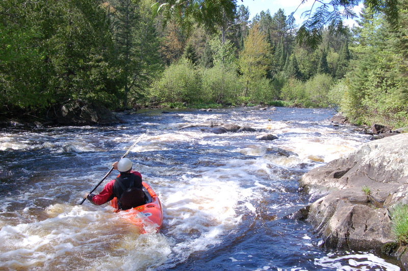
Downstream of Mex-i-min-e Falls gradient very quickly peters out. A few minor areas of riffles and rips intersperse the otherwise flat-but-flowing water until you arrive about a mile downstream. As the river takes a sharp right, action increases just a bit (class I-II). Within 0.1 mile, it button-hooks to the left, and a couple ledge/wave/holes may be encountered (possibly very briefly verging on class III), and then quickly reverts back to class I-II before petering out to flat/flowing once again.
After very nearly two miles of flat/flowing water, finally another short bit of minor rips (class I-II) is encountered. Flat/flowing water quickly resumes.
About a half-mile of flat/flowing (around a couple of good horse-shoe bends) brings you to a left bend and gradient picks up nicely, yielding low-grade (class I-II) rapids for the next half-mile.
After a hairpin right-hand bend (from North around to South), as the river quickly heads 90-degrees left (East) it encounters a stretch of low-grade (class I-II) rapids which does a sweeping left-hand horseshoe bend (to the North, then back to the West), and through a few more lesser bends before petering out (about a half-mile).
Not far downstream of McGinty Creek, another stretch of low-grade (class I-II) riffles and rips is encountered. This will be rather intermittent, extending pretty well down to Interior Road.
Many boaters may wish to take out here.
Gradient is generally less downstream, with just one 'significant' (named) rapids. Furthermore, unless one can travel some of the unimproved roads, egress involves paddling across the flowage.
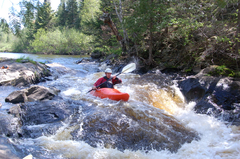
Less than a quarter-mile after passing a building (Cabin? Barn? Shack?) on river-right, the river bends left and trips across a minor ledge/hole (mostly to river-right). A brief pool and a right-turn leads to more river-wide scattering of ledge/waves (likely class II+). A slightly longer gap leads to a final ledge/wave before the river enters the backwater of Bond Flowage. If/when the water is high, this small ledge is very likely to be 'swallowed up' by the backwaters of the flowage below.
It may be possible to carry out river-left to an unimproved road (if it is passable, not gated and not posted against trespass). Otherwise, paddle (2.5 miles) across the flowage to the listed take-out location.
Description and photos of this very short ledge/falls are available at: Waterfalls of the Keweenaw. Interestingly, they have it listed as being on 'Interior Creek'.
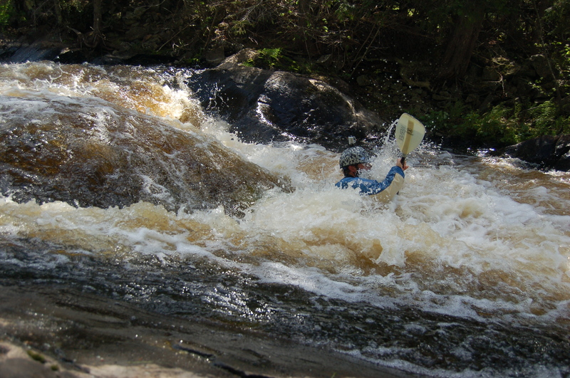
Here's Tom running off the lip of the second drop above the munchy hole. We found it was best to hit this one to the right to avoid the meat of the hole.