St. Louis
D) Hwy.61 (Scanlon) to CR210 (Thomson Reservoir) (3.4 miles)(Upper)
| Difficulty | II-III |
| Length | 3.2 mi |
| Avg Gradient | 12 fpm |
| Gauge | St. Louis River at Scanlon, Mn |
| Flow Rate as of 57 minutes | 841 cfsbelow recommended |
| Reach Info Last Updated | April 2, 2019 |
This stretch is a popular raft trip, convenient to Duluth and (slightly less so) to Minneapolis/St.Paul. Action is very pool/drop, with significant stretches of flatwater between the drops, as well as a reservoir to paddle across at the end of the trip to access the take out.
Put in is at a rafting outfitters, where parking of vehicles by private boaters is tolerated in the further reaches (closer to the frontage road) of the grassy lot.
A brief access paddle (crossing under I-35) leads to the first rapids. The river bends right, then left, through a series of small, smooth waves, and (on river left) a couple rocks which create a couple of good play holes. The rodeo crowd will spend much time here.
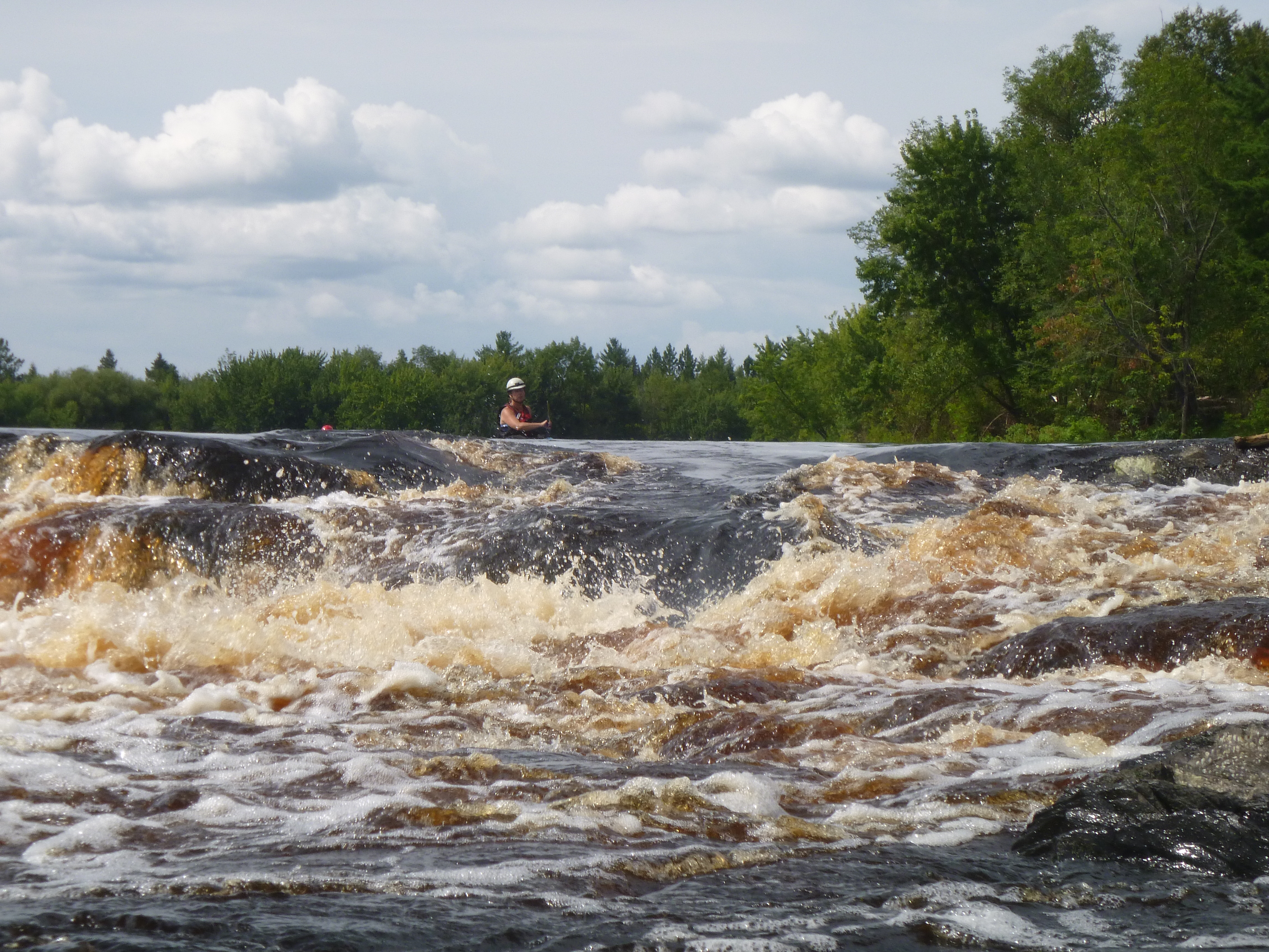
The main feature on the run is Electric Ledge. As power-lines span the river, a bedrock intrusion into the river chokes the stream to flow through a couple of waves and holes. Play may be possible here, depending on levels as well as boater confidence and ability.
Not far downstream, an island splits the river. The left channel (normal run) is Little Kahuna, a fine, long boulder garden, with a couple potentially sticky holes toward the end, river right. The right channel loses most of its gradient at the head of the island, as it trips down a particularly jumbled, boney falls, Big Kahuna. A couple possible lines exist to run this, though most choose to pass (running the left channel, as previously described).
There are a few other scenic dells and a couple minor rapids on the run before the gradient peters out, as one reaches the backwaters of the Thomson Dam. Nearly a mile (it will seem longer) of paddling across the reservoir will bring you to a pier (to the left of the dam), where you will carry across a poison-ivy covered berm, and to the parking lot at the paddling center at Hwy.210.
...
As the river takes a right-hand-bend, a series of sweet waves is encountered, leading to a decent hole toward river-left. A couple big rocks here alter the flow to create some good play waves and holes.
Playboaters will spend considerable time here (sometimes not bothering to even go downstream, but instead carry back to the put-in).
The river narrows through a bit of a dells. There are minor rapids leading in and out of this area. Some boaters enjoy taking out river-left and carrying up a path to a high outcropping from which they can do a high 'seal start' into the river. (Depth at the base is plenty good to 'go deep'.)
When you see the high powerline overhead, you'll know you have come to the biggest drop on the run. This one will change dramatically with different flows. A rocky ledge exists on river-right, from which you can scout the main drop (at low-to-moderate flows).
Downstream of Electric Ledge, an island splits the flow. Most traffic is advised to go to the left. To the right, right at the head of the island, there is a short, steep, rocky pitch. With the right flows, there are runnable routes down this falls, but you will definitely want to scout throroughly. Since river-right loses almost all the gradient here (there is vey little down the rest of the right side of the island), most folks who do run this will carry back across the top of the island or take the first available channel to the left to head down river-left side of things, where more action awaits.
In the river-left channel, most traffic stays toward the island (channel-right) to splash through (or catch) a couple of sweet wave/holes. At some flows, these may be a bit 'keepy', and better avoided.
Jul 19, 2021
I created a river guide of this stretch for low water conditions. If you find this useful, please share and subscribe. https://youtu.be/j0PqnFhNVmM
Dec 9, 2020
Apr 21, 2013
8/12/12
