Clark Fork
Cyr to Tarkio(Alberton Gorge)
| Difficulty | III+ |
| Length | 9.7 mi |
| Avg Gradient | n/a |
| Gauge | Clark Fork at St. Regis Mt |
| Flow Rate as of 1 hour | 4050 cfsmedium runnable |
| Reach Info Last Updated | March 21, 2026 |
American Whitewater played a pivotal role early in the efforts to protect 306 acres of former Montana Power Company lands along the Clark Fork River’s beautiful Alberton Gorge, along with excellent partners. Alberton Gorge is a popular Class III whitewater reach west of Missoula that runs parallel to I-90. [...]Read More
For over 70 years, the Clark Fork River was used as the dumping ground for the waste from one of the largest mining ventures on earth. The companies operating the mines and smelters in Butte and Anaconda unloaded metals-laced tailings directly into the headwaters of the Clark Fork River. [...]Read More
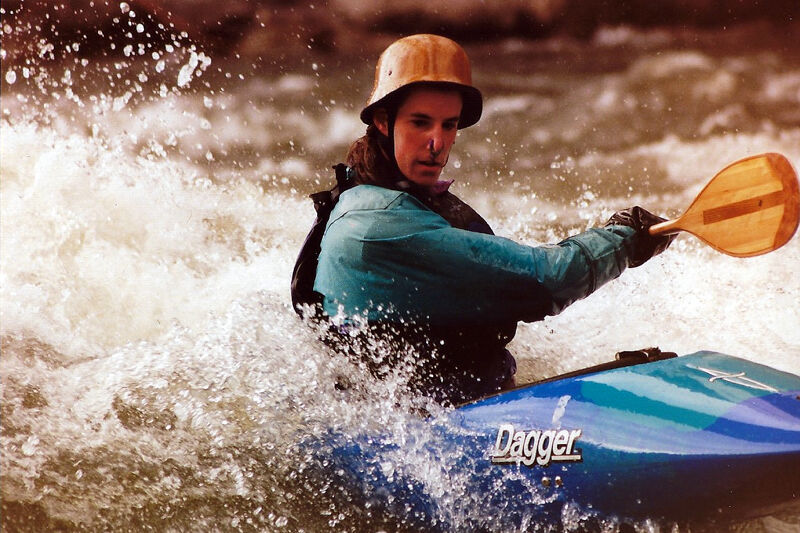
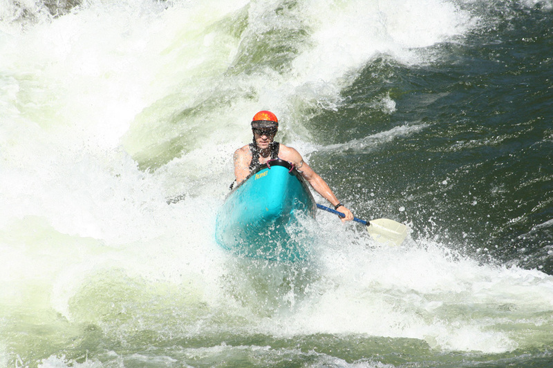
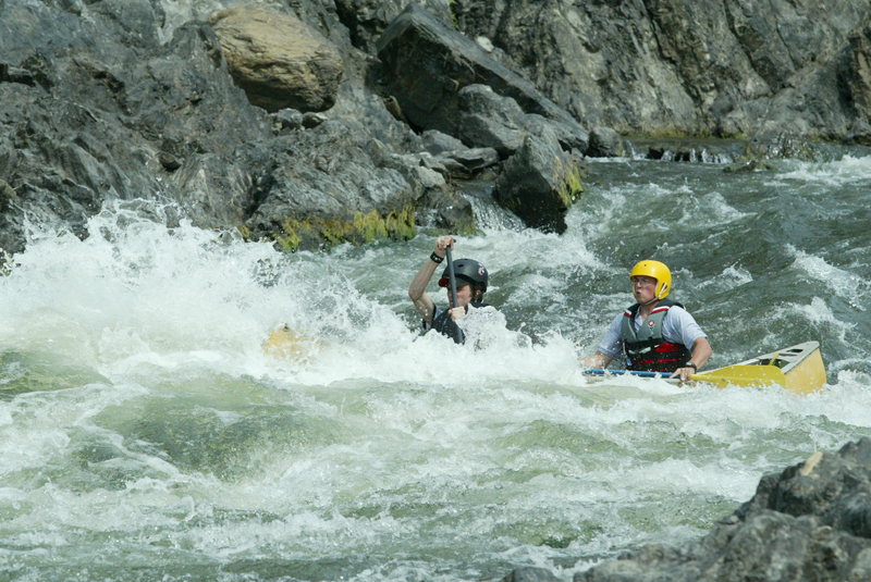
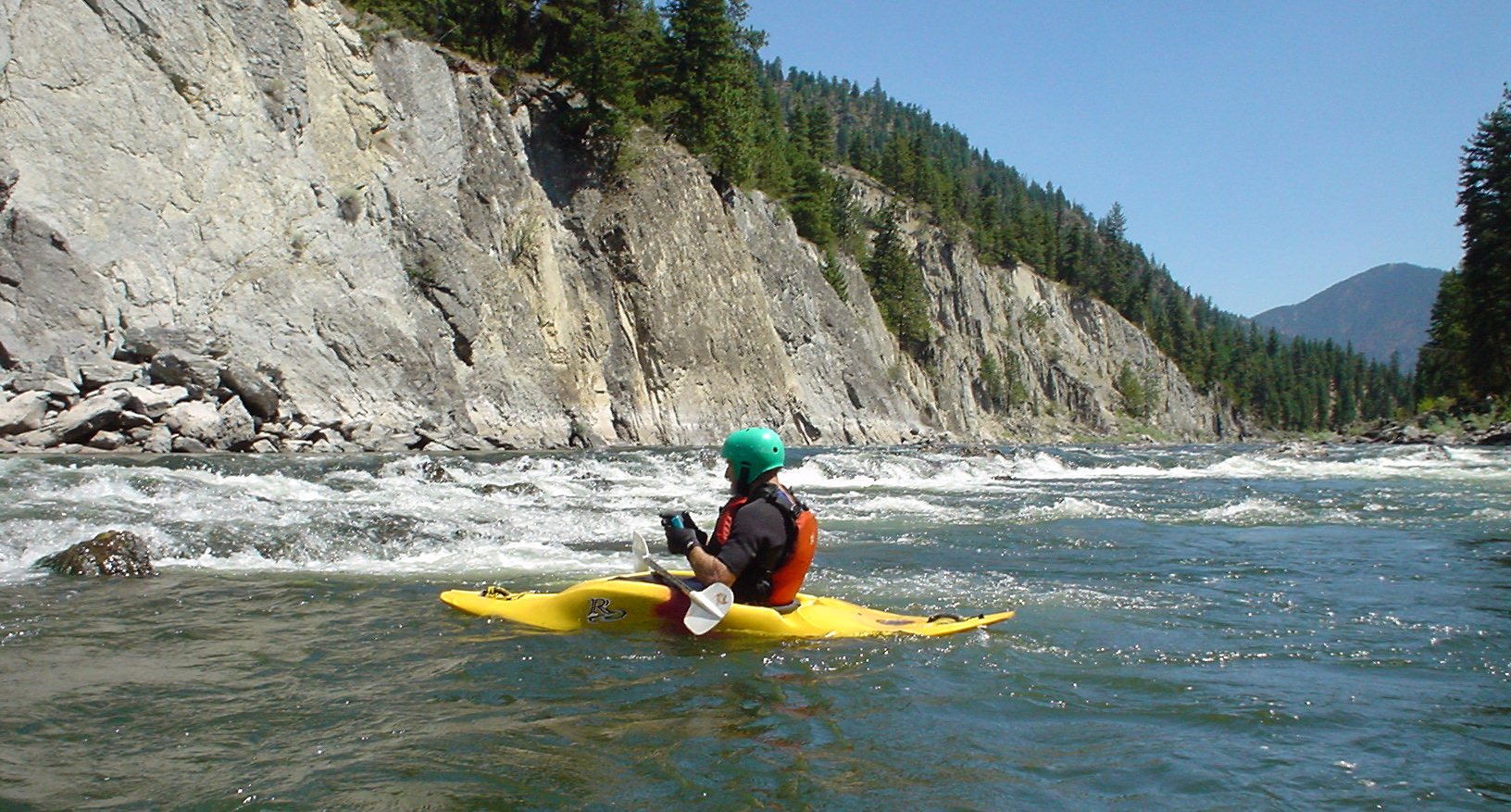
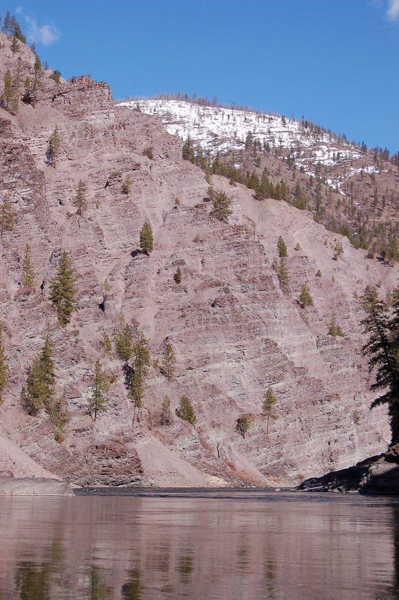
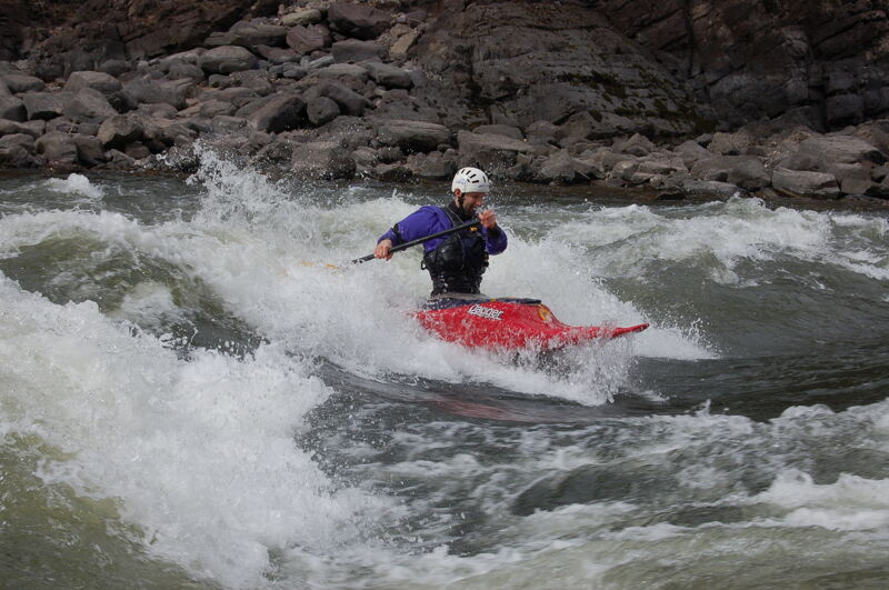
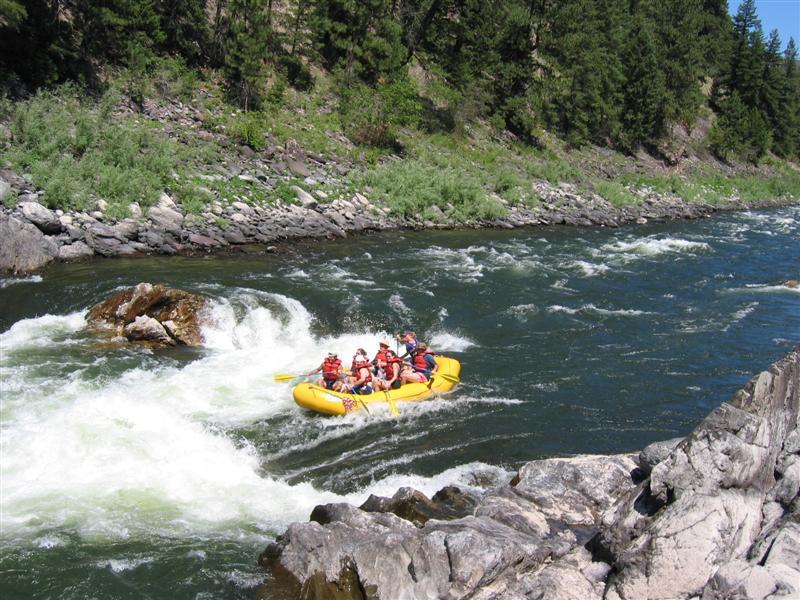
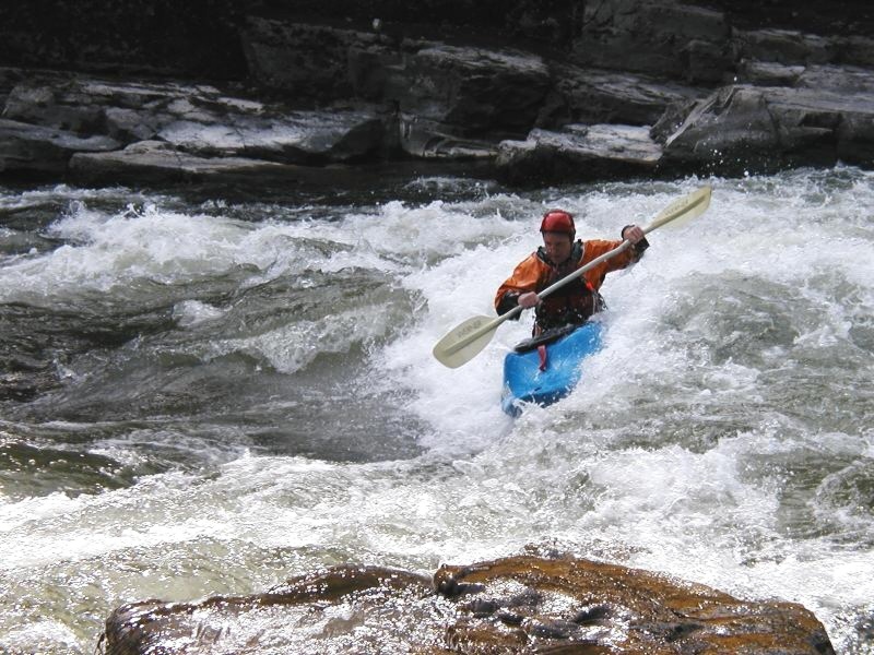
The Clark Fork River's Alberton Gorge is the staple of boaters from Missoula and much of Western Montana - and for good reason. The Gorge is runnable every day of the year, except for especially cold/clear winters when ice dams can form in the Gorge. At virtually every flow you will find at least one great eddy-accessible wave to surf somewhere in the Gorge, and usually there are a handfull of good playspots. The Gorge offers paddlers beautiful scenery, including massive purple cliffs rising from the river, deep green pools seperating rapids, the low walled gorge itself, sandy beaches, and open Ponderosa Pine forests. Paddlers often see beavers, bald eagles, deer, elk, otters, osprey, and even the occassional black bear. The rapids are often big and offer great playboating, while being fairly straightforward and non-threatening to the intermediate whitewater boater. Access and shuttles are easy. All of these factors combined make Alberton Gorge a wonderful place to paddle.
There are several sections of the Gorge that people paddle seperately or in combination:
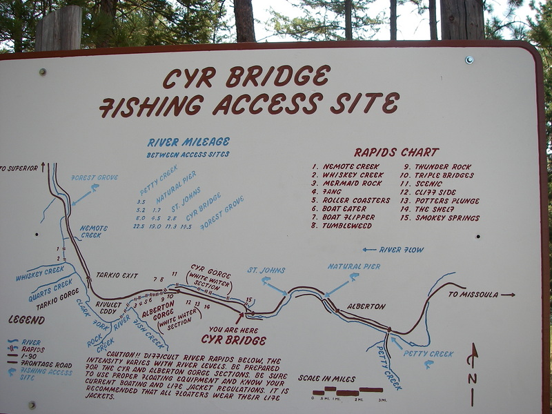
The access is reached from Interstate 90 exit 70. Follow the signs for the Cyr Fishinng Access located two minutes from the exit on Sawmill Gulch Road on the upstream river left side of the Cyr Bridge where Old Highway 10 crosses the Clark Fork. This put-in offers convenient amenities such as a boat slide for rafts, parking facilities, and a toilet. Starting your journey here allows for a 5-6 hour float under typical flow conditions.
Tarkio East Fishing Access is a good put-in for kayakers looking to run the just the lower gorge. Rafts can also walk down the fairly steep and rocky 80 yard trail to the sandy beach, but it is difficult. This cuts the trip in half from about 6 hours to less than 3.
Good waves on the left, pretty read and run at flows around 8000. Triple Bridges marks the beginning of the Lower Gorge. Triple Bridges Rapid offers a variety of playspots: a bottom right hole at base flows, a main wave above 3,000, and other waves above 6,000 cfs. Comp Hole, a local favorite at Triple Bridges, needs around 10,000 and up to be deep and retentive. There is a rough trail to the river on the downstream river-left side of the now-closed back-road bridge. This allows for park-and-play when the waves are good.
Small rapid that offers some play opportunities in the right channel.
Ice Box is a fun wave train that leads into Tumbleweed. Eddy out on the left for some tricky but fun surfing on the top wave.
Probably the most challenging rapid on Alberton gorge, the standard line down Tumbleweed requires paddlers to ride the wavetrain below Ice Box Rapid to the left of a large mid-river rock, where a wave-hole awaits.
Fang is one of the biggest waves on the run. Most paddlers start the rapid on river right to miss a midriver hole (that at the right level offers some good surfing) and fade back to the center left of the river to enjoy the ride over the main wave at Fang and the curler behind it. Eddy out on river right to chill on the rocks or surf the main wave, which varies in quality from year to year. When its good, its really good.
When running shuttle, this is where you turn left to reach Ralphs take out.
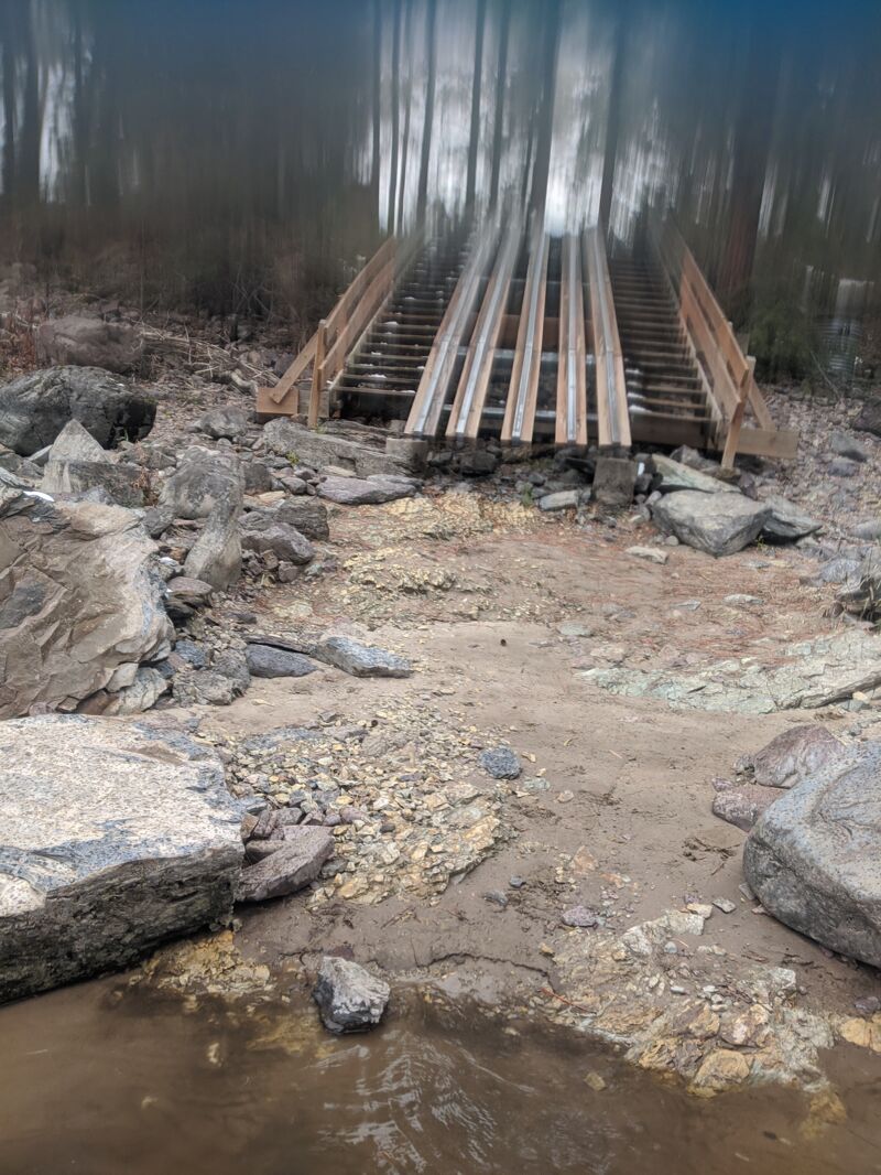
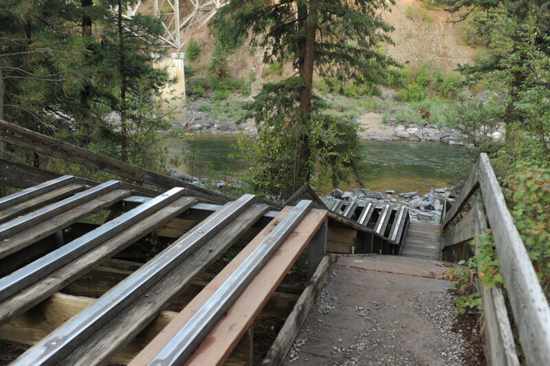
Kayakers generally take out at Ralph's which requires a hike up a rough set of wooden stairs and a steep road, to a wooded parking area. Look for the stairs on the right, near the end of a nice little wave train down the right bank. To reach Ralphs by car, turn left off of the main shuttle road onto a small gravel road that after a short somewhat steep section joins an old railbed heading downstream continue for a couple minutes and the road leaves the railbed to the left and enters a wooded parking area with a much rougher road and trail that descend to the river. Note the AW app does not geolocate this site correctly.
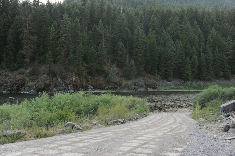
The access is reached from Interstate 90 exit 61 Follow the signs for the Tarkio Fishinng Access located 1.2 miles from the exit on River Gorge Road. A concrete ramp provides convenient access to the water for trailers. Amenities include parking facilities and a toilet.
Feb 20, 2026
I've paddled Alberton Gorge well over a hundred times and adore it, though I seldom took pictures. I am going to add some recent and older photos here as I run across them to spiff up the AW page and just for fun.
Aug 2, 2025
Oct 30, 2020