The National Park Service announced this afternoon that it is nearing completion on the Draft Colorado River Management Plan after a one year delay. The Park’s press release is posted below.
National Park Service | National Park | 86023-0129 928-638-7779 phone 928-638-7609 fax |
DATE:
For Immediate Release
Maureen Oltrogge 928-638-7779
GRAND CANYON NATIONAL PARK
COLORADO RIVER MANAGEMENT PLAN
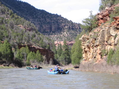
The analytical work to update the Colorado River Management Plan (CRMP) for Grand Canyon National Park is nearly complete, and a draft environmental impact statement (EIS) is expected to be available for public review late summer/early fall. The National Park Service (NPS) is preparing the EIS for the CRMP under the provisions of the National Environmental Policy Act of 1969.
Joseph F. Alston, Grand Canyon National Park Superintendent, said, “We are nearly finished with the extensive analysis that has been undertaken to update the Colorado River Management Plan. This has been an extremely complex process, but I believe our draft environmental impact statement will provide a comprehensive look at recreational use of the
To better address the diverse nature of recreational use in the river corridor, planners are, in essence producing a plan with two separate components, with preferred alternatives for each:
1. One component covers Lees Ferry (River Mile 0) to Diamond Creek (River Mile 225), where the majority of commercial and private river trips start and end; and
2. one component covers the Lower Gorge from Diamond Creek (River Mile 225) to
This will be the first management plan for the Lower Gorge where the situation has been further complicated by drought conditions, which have impacted downstream boat and passenger take-out options.
Rick Ernenwein, NPS planning team leader, said, “The NPS planning team has worked very hard to address the large number of scoping comments received from the public, to provide a thorough environmental, social and economic assessment of the current situation, and to analyze the full range of alternatives to reduce the impacts to natural and cultural resources while providing a high quality visitor experience. I am proud of the work they have done, and I believe the public will have a very good set of alternatives to review and comment upon.”
The CRMP is a visitor use management plan that specifies actions to preserve park resources while enhancing recreational opportunities in the river corridor. The plan is designed to cover the next decade, but will also establish goals and objectives for a longer timeframe.
The draft EIS is expected to be released in late summer/early fall followed by a 90-day public review and comment period. There will be another series of public meetings held around the country in the fall to receive public comments on the draft EIS.
The primary issues analyzed in the draft EIS are:
· appropriate levels of visitor use consistent with natural and cultural resource protection, preservation mandates and visitor experience;
· level of use and how it is allocated between commercial and non-commercial sectors;
· motorized versus non-motorized use;
· alternatives to the current non-commercial permit system;
· range of services and opportunities provided to the public; and
· in consultation with the Hualapai Tribe and other appropriate parties, the continued use of helicopters to transport river passengers from the Colorado River near Whitmore Wash.
The first River Use Plan was developed for
A summary of the scoping process and planning materials are available on the Internet at www.nps.gov/grca/crmp. For further information on this planning process, please contact Maureen Oltrogge at 928-638-7779.
– NPS –
Editors Note: To be placed on the park’s CRMP Newsletter mailing list, please send your request along with your mailing and email address to: grca_crmp@nps.gov.