With the spring thaw fast approaching we have posted a new survey for paddlers to report their runs on the West Branch Montreal. For each time you run the river this spring please report your runs at our West Branch Montreal Report Your Runs Survey.
Over the past few weeks we have been collecting historical information and have had approximately 50 responses. The good news is that it appears we have enough data to develop a report on flow preferences, but we will continue data collection through this spring with the goal of improving the quality of our analysis. If you still wish to report information or knowledge you have from past years, please proceed to our West Branch Montreal Historical Runs Survey.
Background
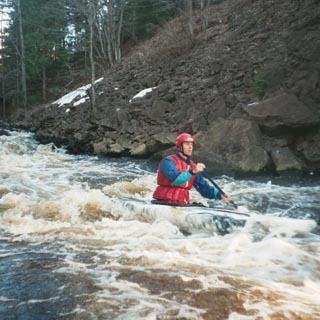
The West Branch of the Montreal is one of those little gems on the South Shore of Lake Superior that has been popular with whitewater paddlers for many years. It was first featured in the AW Journal back in 1981 and is enjoyed each spring by the paddlers from throughout the region. It has also been the site of the US Wildwater Championships.
American Whitewater and the Wisconsin Hoofers Outing Club, with assistance from the Rivers & Trails Program of the National Park Service, are working to identify the range of preferred whitewater boating flows on West Branch Montreal River. Xcel Energy manages Gile Flowage which provides water to their Saxon Falls Hydroelectric Project and Montreal Hydroelectric Project downstream. Gile Flowage is a storage impoundment and not a licensed project, but paddlers are interested in obtaining more accurate information on preferred flows with the goal of determining the potential for a scheduled flow release.
We have developed this preliminary survey to determine current knowledge of flows on the West Branch of the Montreal and interest in this river. Our goal is to utilize information from the survey to help us identify a flow preference curve for whitewater boating, which will identify minimum, acceptable, and optimum flows. Alternatively this survey will identify information gaps in our knowledge of flows on this reach and help us develop future survey goals. Within the next month we will introduce a revised survey that paddlers can fill out immediately following a trip down the West Branch of the Montreal.