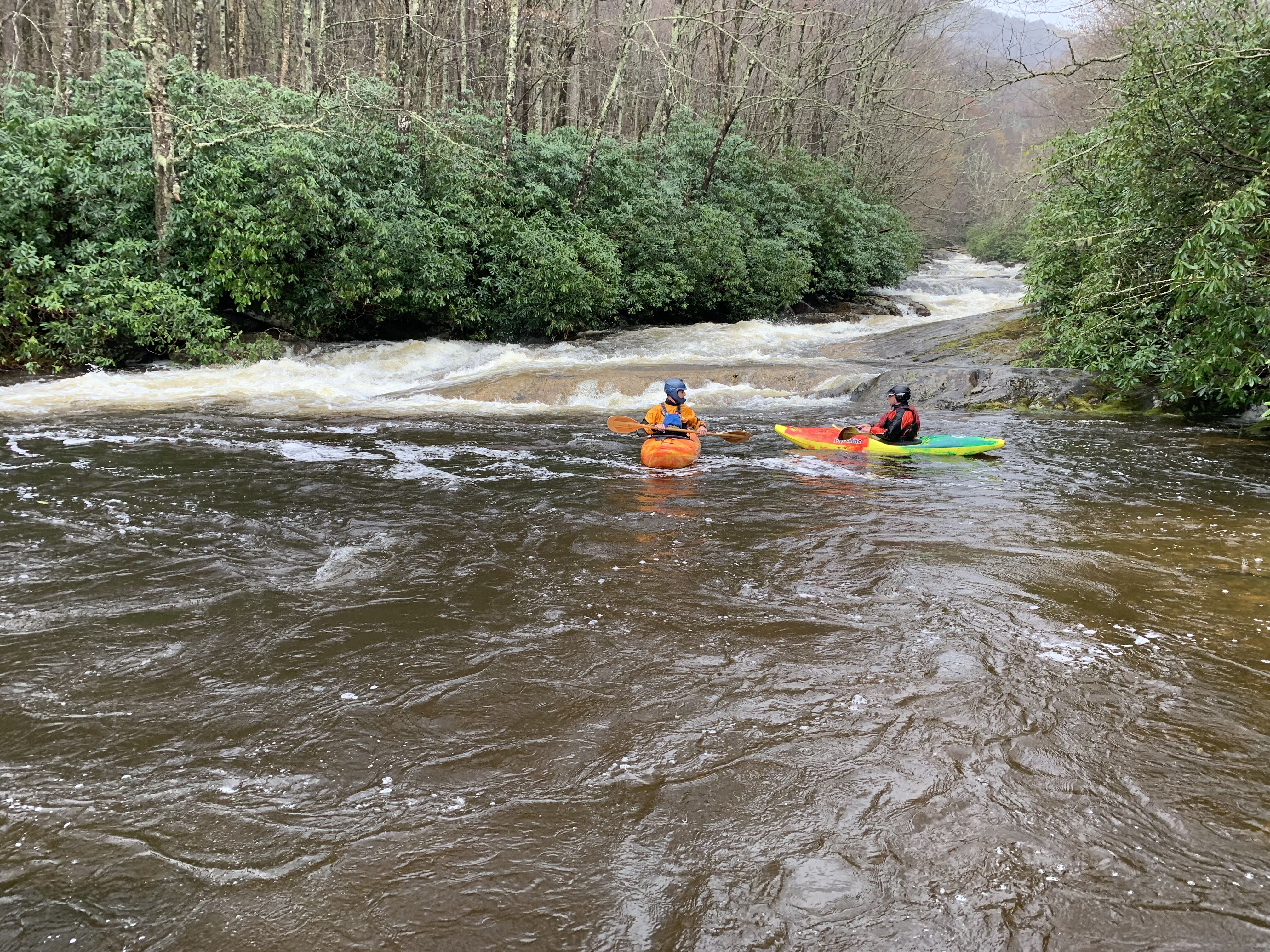
Western North Carolina is home to the highest mountains in the eastern US, abundant rainfall, globally significant biodiversity, and large tracts of federal lands. In combination these things add up to an incredible array of whitewater rivers and streams that have long been paddling classics. While many communities rely on these headwater streams for drinking water and recreational benefits, most streams are inadequately protected from threats that will only grow with time.
Western North Carolina has almost 400 dams, with over 250 miles of large rivers under large reservoirs plus at least that many miles still flowing but severely impacted by dams. And yet, the region has only three Wild and Scenic Rivers: Wilson Creek, the Horsepasture River, and the Chattooga River, totaling 35 miles. In addition to these three designated streams the Forest Service extends interim protection to an additional 10 streams that they feel are “eligible” for Wild and Scenic designation. While the Wild and Scenic Rivers Act was envisioned as a way of balancing the nation’s dam building policy with conservation, in Western North Carolina that vision has yet to be realized. American Whitewater has proposed to change that by building grassroots community support for protecting a suite of the region’s most spectacular and valuable streams.
To accomplish this goal American Whitewater deeply engaged in the Forest Planning Process for the Pisgah and Nantahala national forests from 2014 through 2023. Based on conversations with our members and partner organizations, we recommended that the Forest Service consider adding over 20 new streams to their roster of Wild and Scenic eligible streams, and worked closely with a collaborative group called the Nantahala Pisgah Forest Partnership to build support and understanding of river conservation needs. Also through the National Forest planning process, we worked to improve management that will benefit outdoor recreation and special places across the Forest.
On February 17, 2023, the US Forest Service released their long awaited new management plan for the 1.1 million acre Nantahala Pisgah National Forest, which set the course of federal management of the area for the next two decades or longer. The Nantahala Pisgah Forest Partnership (the Partnership), a collaborative group of which American Whitewater is an active member, spent the past decade developing recommendations for the Plan to improve the management of the Forest. The Plan has both reasons for celebration and reasons for concern when it comes to the future of these special lands and the rivers that flow through them.
Wild and Scenic River Wins: A very bright spot in the new plan is the addition of nine outstanding rivers and streams that are newly protected in the plan based on fresh findings that they are eligible for Wild and Scenic designation. New protections total 46 stream miles and 14,720 acres of river corridors. This outcome doubles the number of eligible streams in the Forest Plan, and was a major goal of American Whitewater. American Whitewater and the Partnership filed objections to the draft plan seeking additional streams, and were successful in securing new protections for the North Fork of the French Broad river through the objection process. Sadly the streams in Panthertown Valley were not found eligible. The newly eligible streams are: The North Fork French Broad River, Thompson River, Whitewater River, West Fork Pigeon River, Flat Laurel Creek, South Toe River, Fires Creek, Santeetlah Creek, and the Cullasaja River. Paddlers will recognize these streams as some of the finest whitewater paddling and most beautiful streams in the southern Applachians. A big thanks to all the paddlers and partners that helped earn protection for these streams!
Other Conservation Highlights: The plan includes a total of 49,000 acres of new recommended Wilderness. While a portion of that acreage is already under Congressional protection, roughly 34,000 acres are gaining new protected status. The Plan also recognizes the special scenic and recreational values of the Craggy and Big Ivy area, albeit less acreage of that area than the public requested.
Consensus Approach Not Adopted: The Nantahala Pisgah Forest Partnership pitched the Forest Service an innovative set of recommendations that would have led to more interests being met on the Forest more quickly with less conflict. These recommendations included which lands should be open to active management like logging versus set aside for more passive management, how old growth and biodiversity can be best protected and restored, how to move multiple interests forward at a similar pace, and how recreation should be managed to be both inviting and sustainable. The Forest Service at best cherry-picked these recommendations, which is a disappointing response to such an intensive collaborative effort.
Recreation Results Mixed, Chattooga Limits Remain: The new plan does better on trail management, and offers trail users some opportunities for improvements. However, the Forest Service chose to ignore significant recreational opportunities like easing the limits on paddling on the Upper Chattooga and improving rock climbing management guidelines. We would like to thank the many diverse groups on the Partnership for their universal support in easing Chattooga limits. It is profoundly disappointing that the Forest Service ignored this broad public support for easing the boating limits, especially considering that 11 years of monitoring data show no need for the paddling limits to be kept in place. Agency staff chose to avoid the issue entirely in their analysis, yet included the old limits in the new plan.
The Future: American Whitewater is in the early stages of testing support for designating some of the eligible streams as Wild and Scenic Rivers through an act of Congress, a step that would offer permanent protection from dams and other impacts while allowing recreational uses to continue. We will be working with many local communities, organizations, businesses, and paddlers to move this concept forward!
Watch a PBS show on the Forest Planning process here: http://www.thisamericanland.org/news/revising-forest-plans#.Wl4SQa3Mz-a
How You can help:
-
Take and share compelling and approachable videos and photographs of rivers and streams on Forest Service lands in WNC, especially streams that are either eligible or recommended for eligibility by AW. Add photos to the AW photo database so the Forest Service and AW staff can see them. Share online videos with AW staff.